National Weather Service United States Department of Commerce
Complex of late night thunderstorms sweep across the Caprock
25-26 June 2017
 
On the afternoon of Sunday, June 25th, thunderstorms develop across northeast New Mexico, northwest Texas, and the western Oklahoma Panhandle. These storms gradually merged, forming a thunderstorm complex, or mesoscale convective system (MCS). The below imagery shows the mass of showers and thunderstorms over the region Sunday evening.
 
Visible satellite imagery of thunderstorm activity across New Mexico and West Texas at 8:32 pm on June 25, 2017. GOES-16 data are considered preliminary and non-operational. Click on the image for a larger version.


The MCS moved south-southeast Sunday night across most of the Caprock, bringing strong winds and heavy rain. The storm was most intense across Bailey County, where it produced a wind gust of 82 mph at the West Texas Mesonet site near Muleshoe at 11:25 pm. An inch and a half of rain also fell in less than a half hour. The below radar animation shows the developing stages of the large batch of showers and thunderstorms Sunday evening before it plunged southeastward across the South Plains.
 
 
Regional radar animation valid from 7:38 pm to 8:48 pm on Sunday, 25 June 2017.


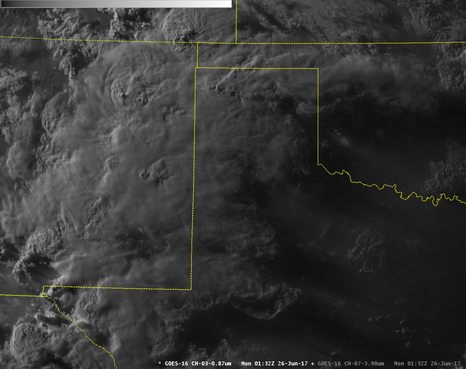
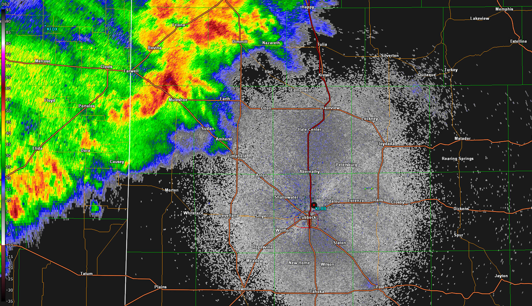
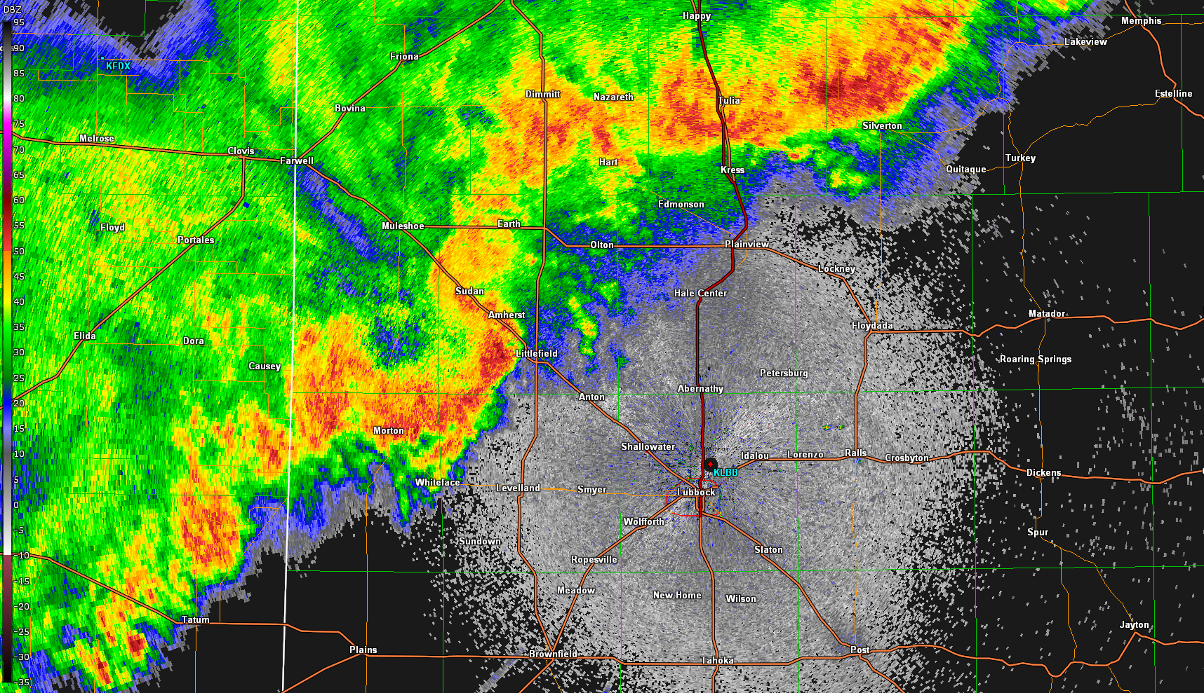
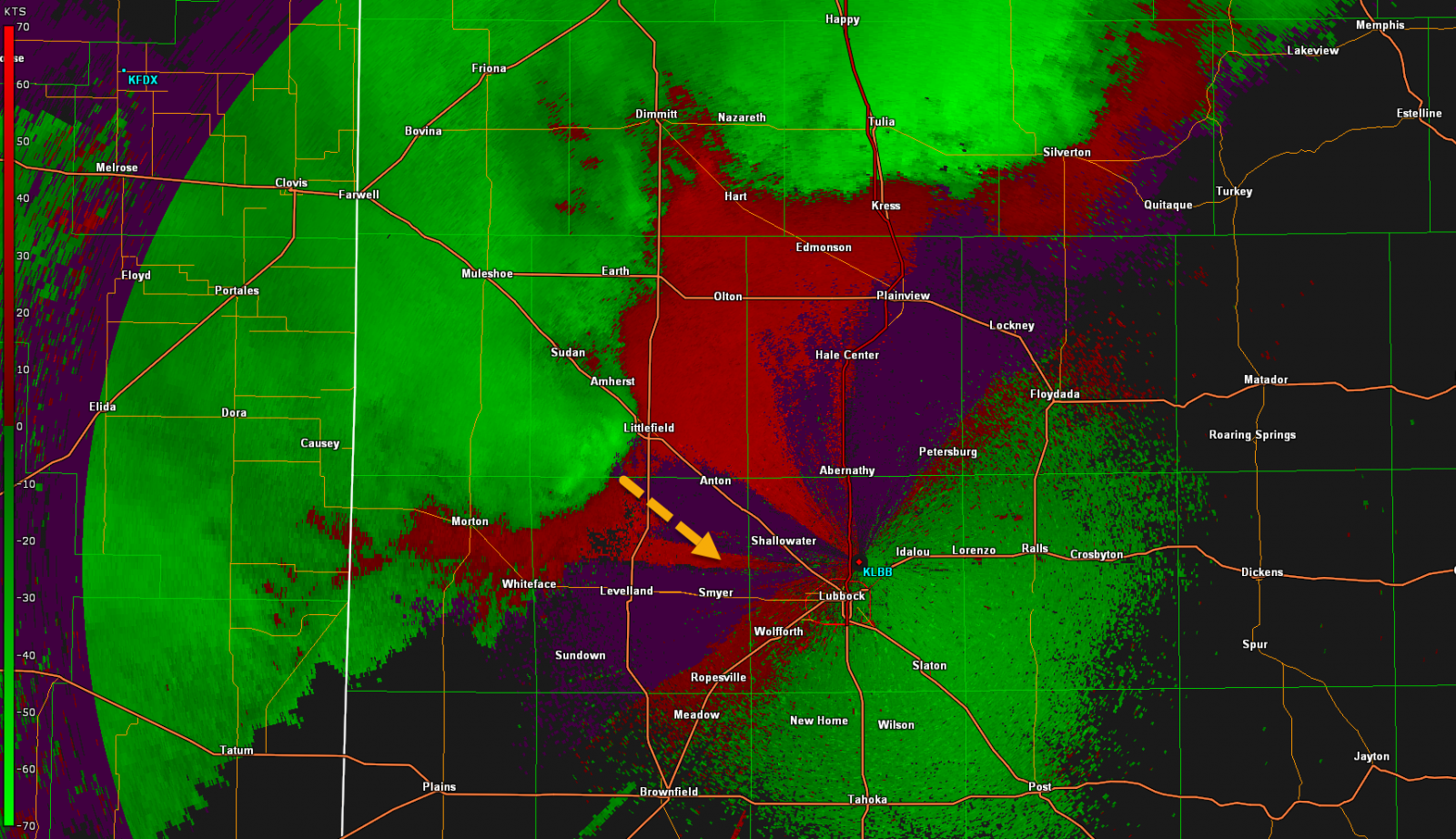
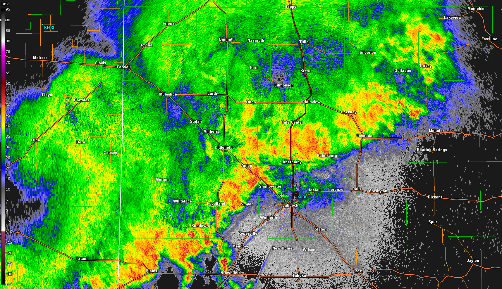
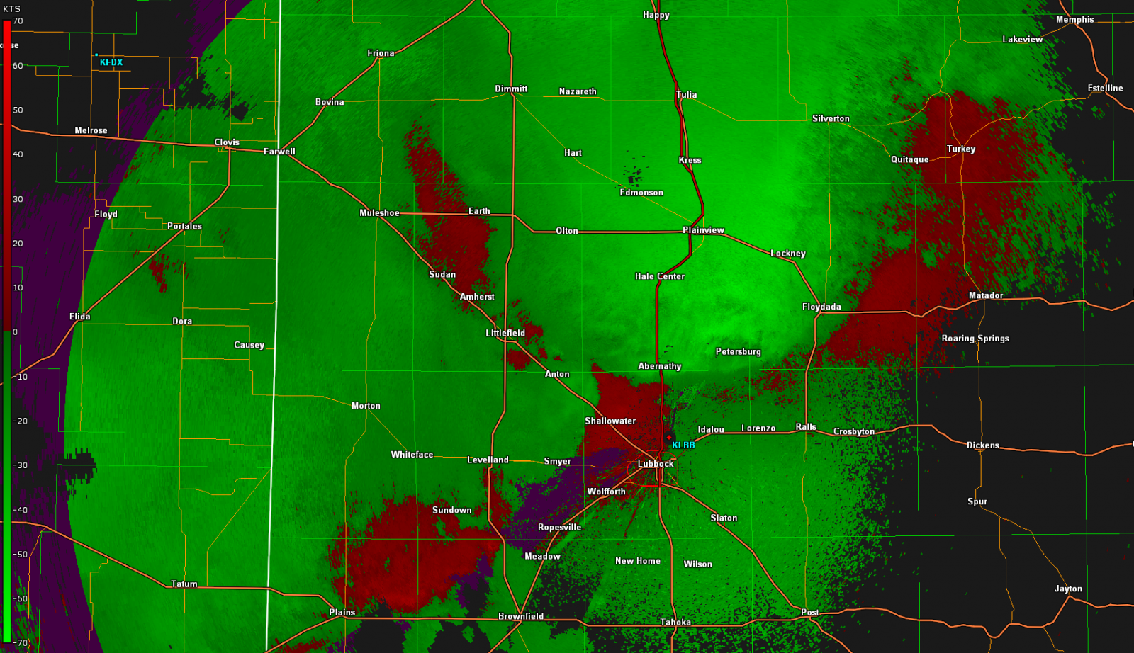
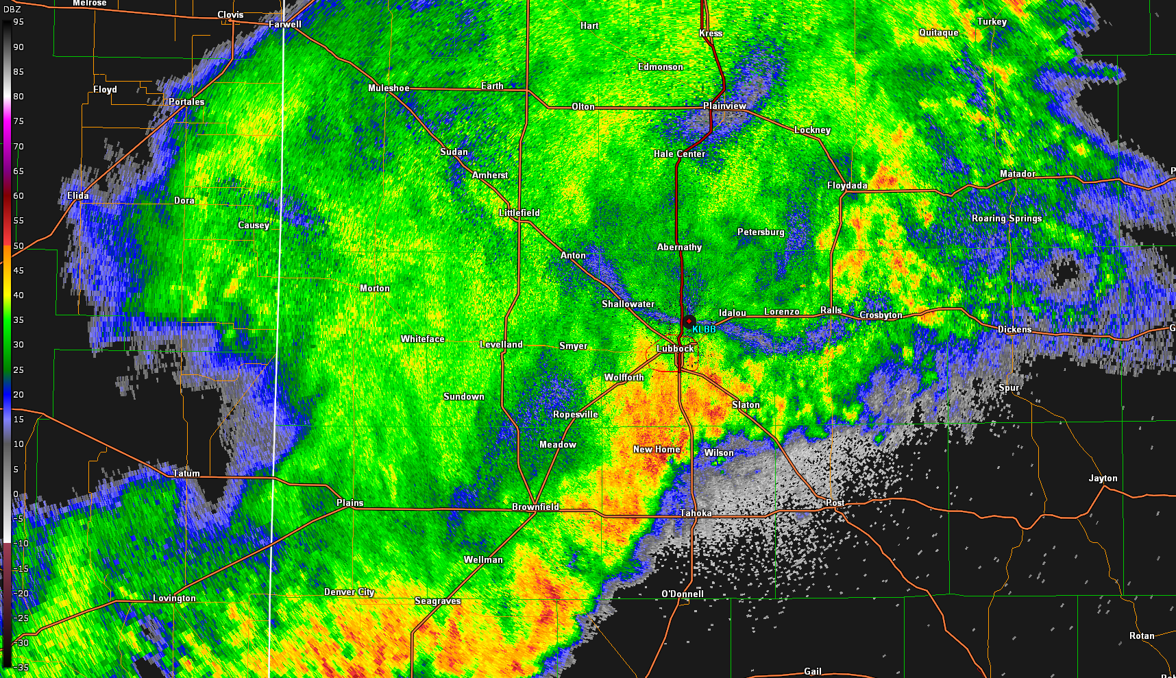
As the storm moved into the Lubbock area a little after 1 am, it had lost some of its strength. However, it still produced severe wind gusts of 60-70 mph across Lubbock and Terry Counties, causing some tree limbs to be broken off. The storm continued on through the central and southern South Plains before finally moving off and gradually decaying in the Permian Basin. Below are radar reflectivity and velocity images from 11 pm to 3 am.


Reflectivity data from the Lubbock WSR-88D radar Sunday night at 11 pm. Velocity data from the Lubbock WSR-88D radar 11 pm Sunday evening.
Reflectivity data from the Lubbock WSR-88D radar midnight early Monday morning. Velocity data from the Lubbock WSR-88D radar at midnight early Monday morning.
Reflectivity data from the Lubbock WSR-88D radar 1 am Monday morning. Velocity data from the Lubbock WSR-88D radar 1 am Monday morning.
Reflectivity data from the Lubbock WSR-88D radar 2 am Monday morning. Velocity data from the Lubbock WSR-88D radar 2 am Monday morning.
Reflectivity (left) and velocity (right) data from the Lubbock WSR-88D radar Sunday night and early Monday (25-26 June). From top to bottom they are from 11 pm, midnight, 1 am and 2 am. 


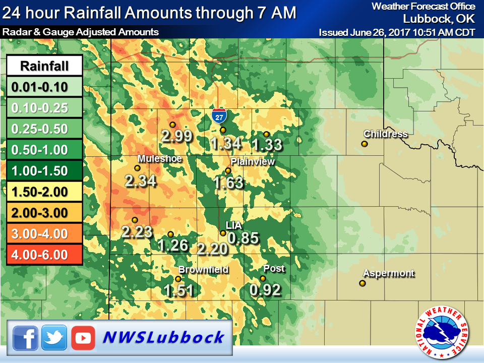
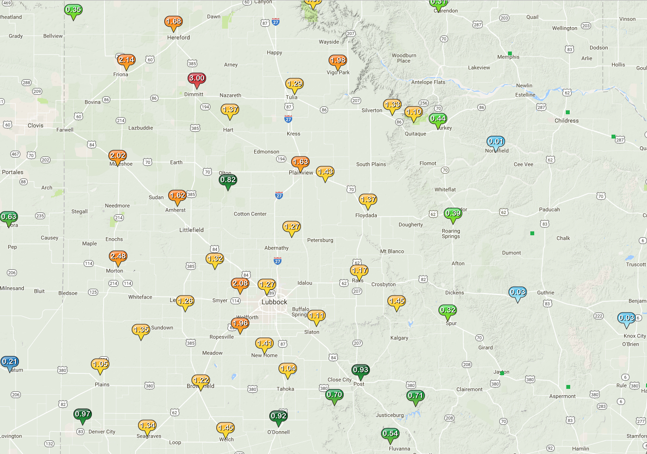
The complex produced heavy rainfall, which caused some flooding across the area. Below is a map of radar-derived rain totals along with some of the observed rainfall amounts. Rain totals of 1 to 2 inches were common across much of the Caprock with 2 to 3 inch totals over parts of the southwest Texas Panhandle into the western South Plains.


Radar-estimated and bias-corrected 24 hours rain totals ending at 7 am on Monday, 25 June 2017. Also plotted are select West Texas Mesonet and NWS observations. Click on the image to enlarge it.


The image below shows specific rainfall amounts measured by stations of the West Texas Mesonet. Unfortunately the welcome rain for the Caprock largely missed points further east. Portions of the southeast Texas Panhandle into the northern Rolling Plains did received beneficial rains a couple days earlier, but a good share of the central and southern Rolling Plains continue to miss out on the good rains. 


Measured 48-hour rainfall across the area from June 25 through June 26, 2017. The data are courtesy of the Texas Tech West Texas Mesonet.


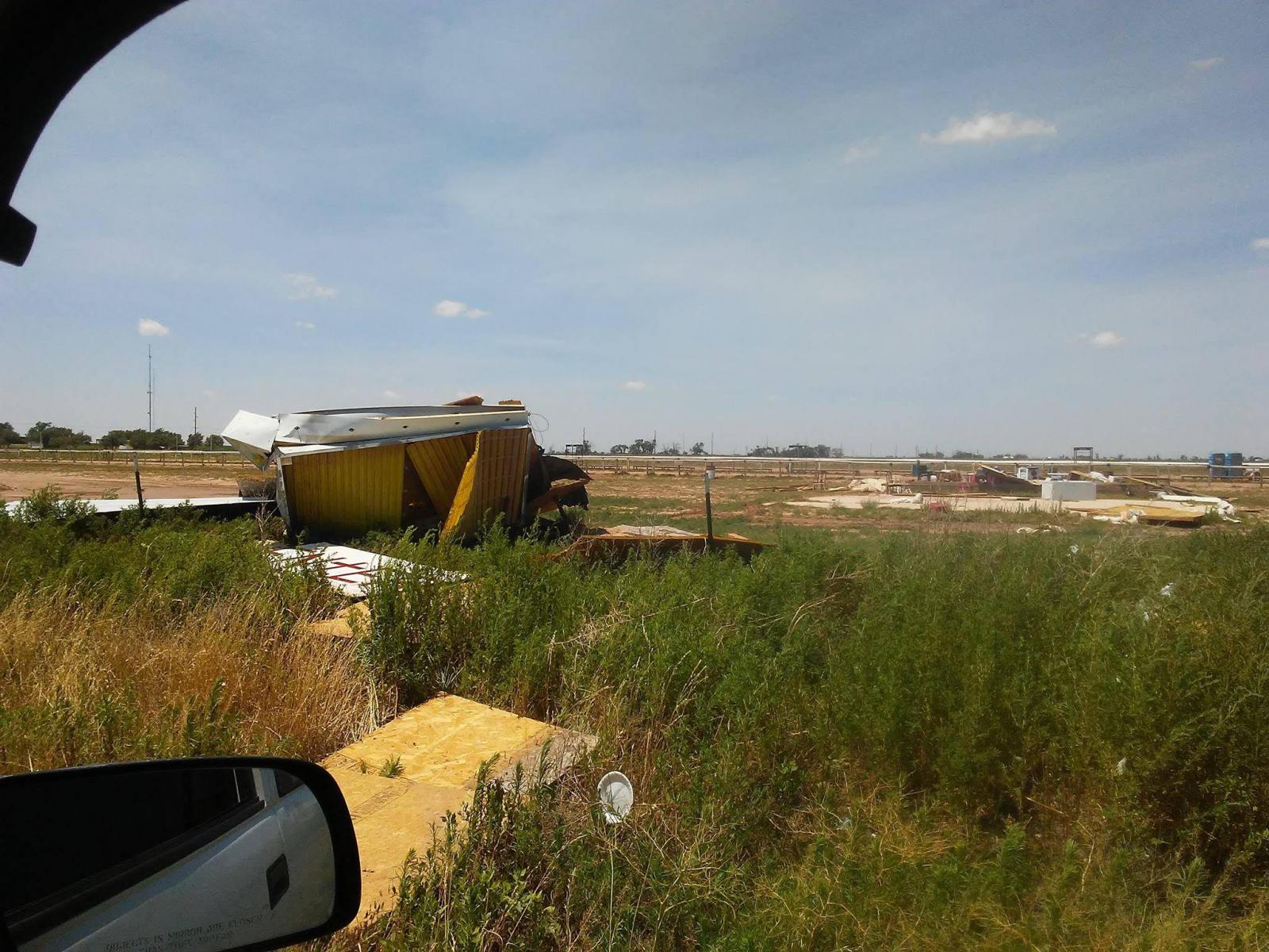
Here are the maximum wind gusts reported by the West Texas Mesonet on Monday, June 26th (after midnight). Before midnight many spots across the southeast Texas Panhandle into the northwest South Plains recorded wind gusts of 40 to 55 mph. A particularly strong cell also brought the brief by intense 82 mph wind gust to the West Texas Mesonet station located just south of Muleshoe. 


A map of maximum wind gusts, as measured by the West Texas Mesonet, on June 26, 2017. The strongest winds gusts across the southwest Texas Panhandle and northwest South Plains occurred before midnight and are not displayed here. Click on the image for a larger version.


The severe winds that visited the Muleshoe area did cause damage, including the destroyed structures below. Trees also suffered significant damage in spots.


Damage that occurred near Muleshoe the evening of June 25th. The picture is courtesy of Ray Rice. Click on the image for a larger version.


A listing of the preliminary storm reports for the overnight event can be found below.


Local Storm Reports for June 26th


PRELIMINARY LOCAL STORM REPORT...SUMMARY
NATIONAL WEATHER SERVICE LUBBOCK TX
651 AM CDT MON JUN 26 2017

..TIME...   ...EVENT...      ...CITY LOCATION...     ...LAT.LON...
..DATE...   ....MAG....      ..COUNTY LOCATION..ST.. ...SOURCE....
            ..REMARKS..

1120 PM     TSTM WND GST     2 SSW MULESHOE          34.21N 102.74W
06/25/2017  M72 MPH          BAILEY             TX   MESONET

1125 PM     TSTM WND GST     2 SSW MULESHOE          34.21N 102.74W
06/25/2017  M82 MPH          BAILEY             TX   MESONET

0125 AM     TSTM WND GST     6 NNE LUBBOCK           33.67N 101.82W
06/26/2017  M60 MPH          LUBBOCK            TX   ASOS

0140 AM     TSTM WND GST     2 S BROWNFIELD          33.15N 102.27W
06/26/2017  M66 MPH          TERRY              TX   MESONET

0212 AM     FLOOD            LUBBOCK                 33.58N 101.88W
06/26/2017                   LUBBOCK            TX   FIRE DEPT

            FIRE DEPARTMENT REPORTS FLOODING AT 4TH AND FRANKFORD.

0235 AM     TSTM WND GST     1 N O`DONNELL           32.98N 101.83W
06/26/2017  M61 MPH          LYNN               TX   MESONET

0250 AM     TSTM WND GST     5 SSW GRAHAM            33.08N 101.52W
06/26/2017  M59 MPH          GARZA              TX   MESONET