Late June and early July brought several rounds of thunderstorms to West Texas. This activity was complete with damaging winds, large hail and heavy rain. The storms the first couple of days of July were primarily during the overnight hours, as it took time for them to move from where they developed over the higher terrain of New Mexico into the South Plains. To view a more detailed account of the storms from June 30th through July 2nd LOOK HERE. The storms the July 3rd and 4th developed a little closer to home and thus moved into the region earlier, during the late afternoon and evening hours.
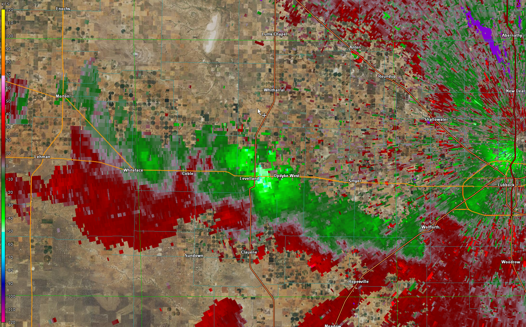
The above radar animation show thunderstorms over parts of the Permian Basin as well as moving into the northwestern South Plains. The northern storms developed into a line as they plunged southeastward toward Lubbock. This line dropped hail as large as quarters in Levelland and sporadically produced wind gusts of 55 to 60 mph, with a few stronger gusts. The Dimmitt West Texas Mesonet located on the northeast side of town recorded a peak gust of 70 mph with a storm early on in the event.

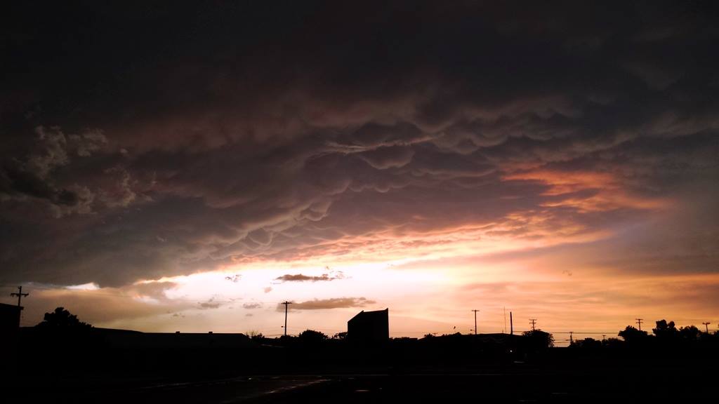
As the thunderstorms moved southeastward they organized into a line with a photogenic shelf cloud preceding the rain. The outflow winds also picked up copious amounts of dust, forming a haboob (wall of dust) that marched over the central South Plains. Some locations saw the visibility fall to zero for a short time as the haboob moved through. After the initial shot of wind and dust, moderate to heavy rain did move in and clear the skies of the dust and wet the ground.
 |
 |
| View of the line of storms as they moved in to Lubbock Monday evening. The pictures are courtesy of Erin Shaw. | |
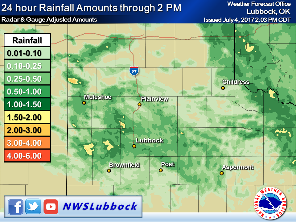
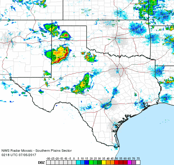
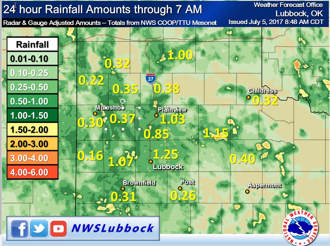
The thunderstorms persisted, but gradually weakened, as they moved out into the Rolling Plains during the late evening and overnight hours of the 3rd. Many locations were fortunate enough to record more measurable rainfall. A quarter of an inch to an inch totals were fairly common, with a few spots picking up over an inch across the central South Plains, as well as in parts of Parmer County.
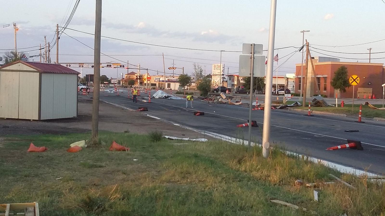
The bulk of the rainfall came to an end by the early morning hours of July 4th. However a few showers and isolated thunderstorms did persist in the predawn hours of the 4th. This activity didn't produce much additional rainfall, but one weakening shower did generate damaging winds as it moved across the north side of Levelland between 3 and 4 am.

The West Texas Mesonet Station located 4 miles south of Levelland recorded a peak wind gust of 56 mph (and no rain) as the weakening shower moved over at 4:15 am, though stronger winds likely occurred on the north side of Levelland before that. The strong winds caused considerable damage to several building, power poles and trees, primarily on the north side of Levelland. One person was also injured by the damaging winds.
 |
 |
 |
 |
 |
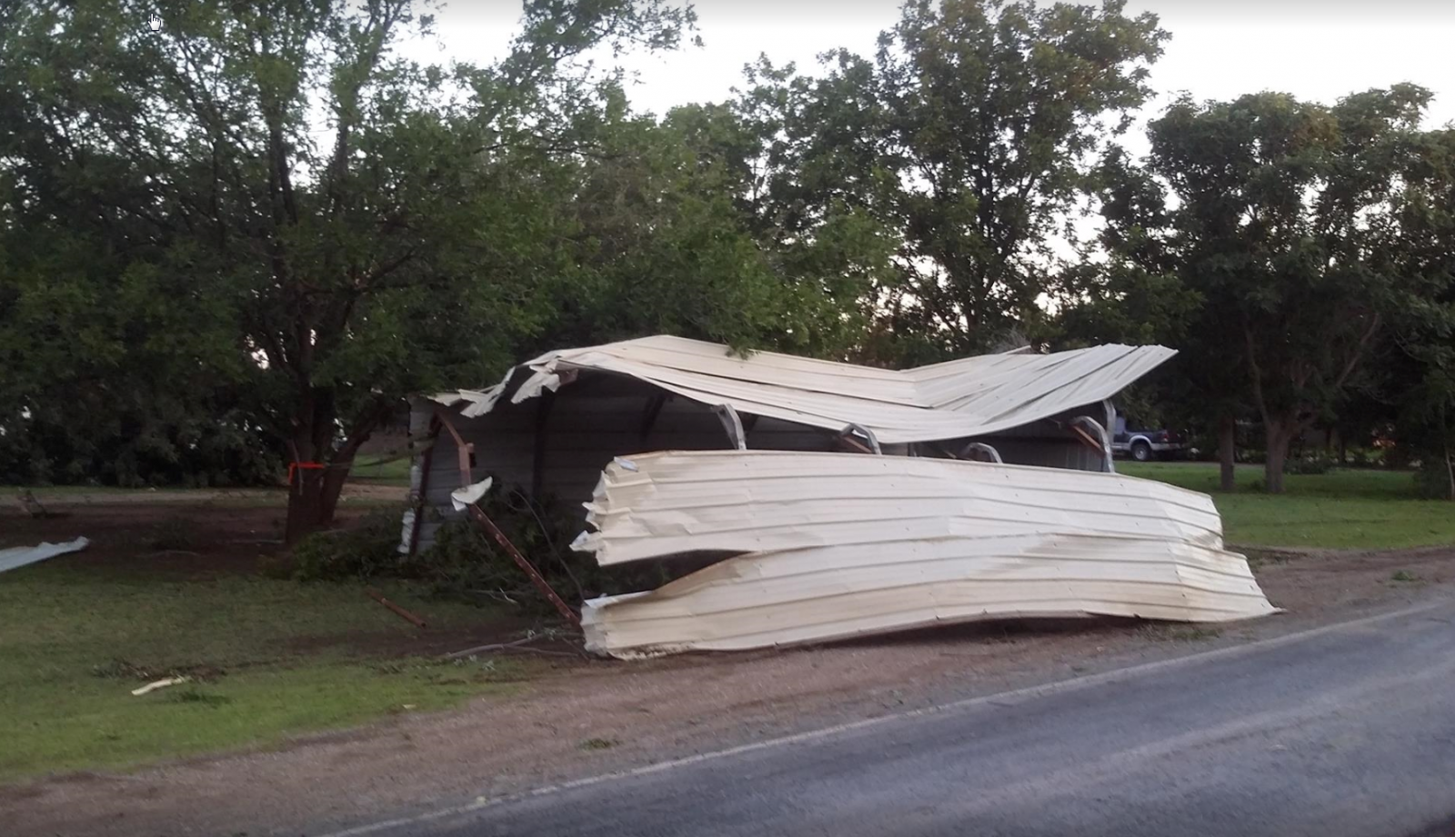 |
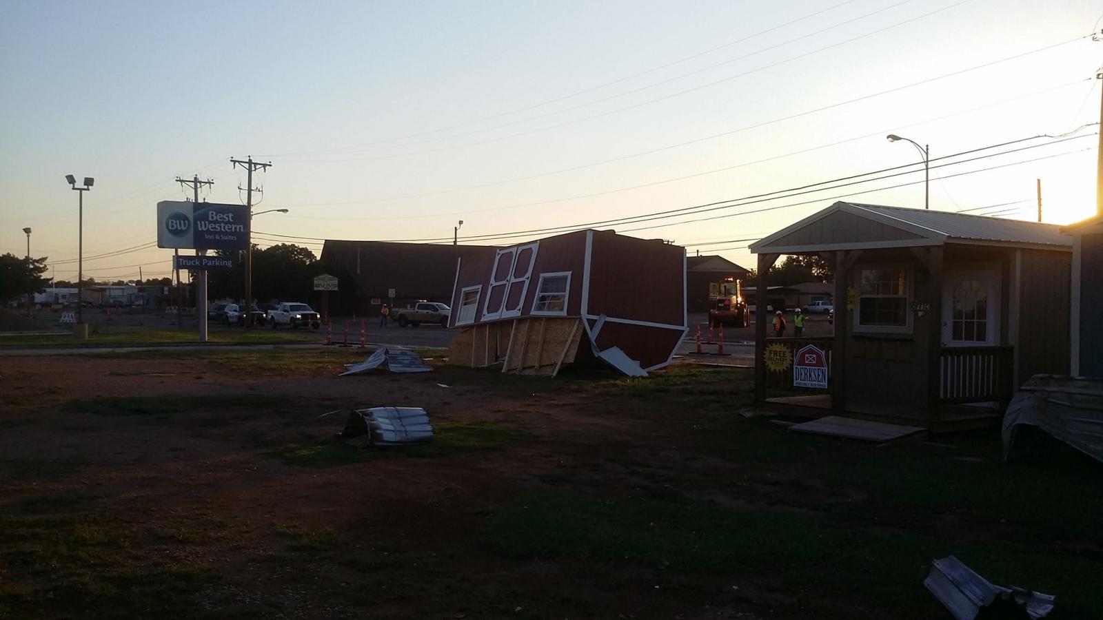
| Pictures of damage that occurred across the north side of Levelland early on the morning of the 4th of July. The pictures are courtesy of the Levelland Fire Department. | |
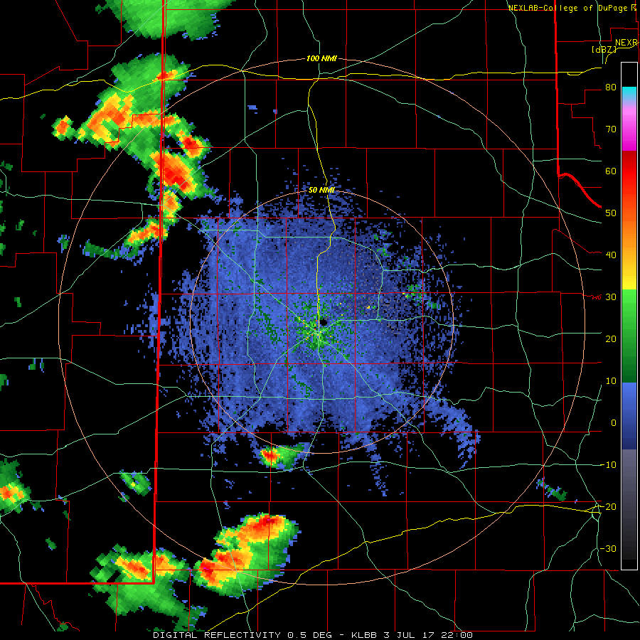
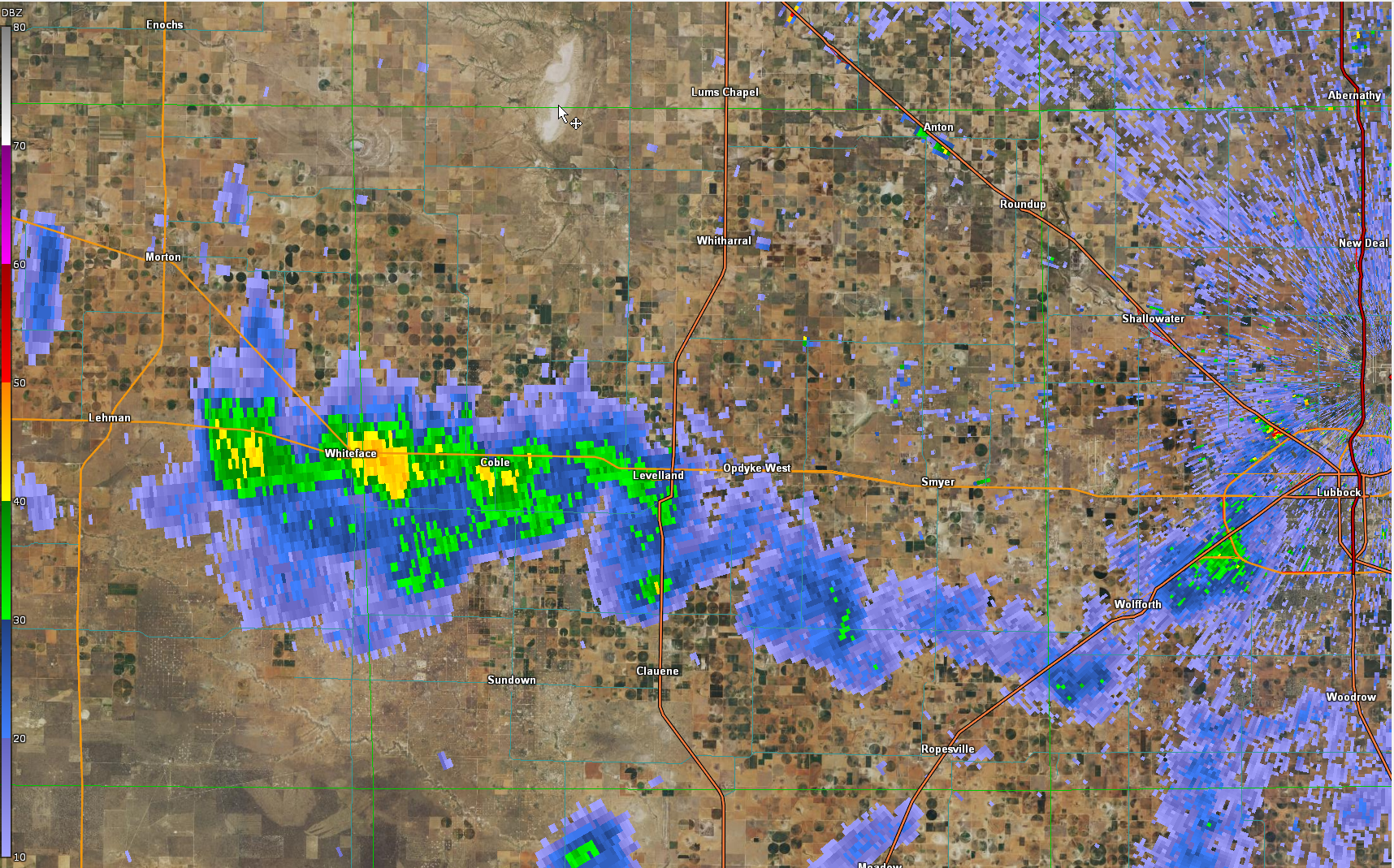
The below imagery shows what the radar looked like around the time of the damaging winds in Levelland. The reflectivity data look fairly innocuous, consistent with a small area of light precipitation (little of which was likely reaching the ground). The velocity data does show fairly strong inbound though where it was sensing air flowing out of the collapsing showers. At this time of night it is nearly impossible to tell if these stronger winds are reaching ground level (they often do not), but in this case they did.
 |
 |
| Lubbock WSR-88D radar reflectivity (left) and velocity (right) at 3:39 am on July 4th, around the time of the damaging winds in Littlefield. | |
The damaging winds in and around Levelland were associated with a heat burst (or series of heat bursts), as the below graphic shows. Temperatures rose from near 70 degrees to above 80 degrees while the dewpoint also dropped from near 60 into the 40s as the stronger winds came to the surface. These type of events occasionally occur in the middle of the night during the summer when rain falling from the middle of the atmosphere evaporates as it encounters much drier and warmer/hotter air below cloud level. Occasionally the downward momentum is enough to push all the way to ground level resulting in strong/severe winds, along with anomalous warming and drying in the middle of the night.

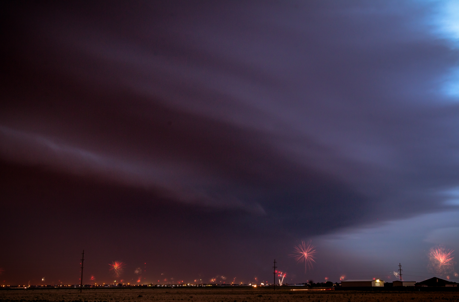
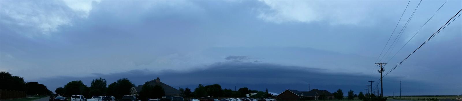
The weather had one more show for the region during the late afternoon and evening of July 4th. Another complex of thunderstorms developed and then plunged southeastward across the South Plains, bring wind, dust and heavy rain as it moved through. The complex did provide its own fireworks, but unfortunately the time was not great and ended up causing the cancellation of the fireworks display in Lubbock, disappointing many people.

If you could get over the disappointment of the quick end to the window for fireworks, nature did provide nice sights, including another formidable shelf cloud that rolled over the region.
The shelf cloud enveloped the whole sky with plenty of wind and blowing dust in its wake as it passed. Many wind gusts from 55 to 65 mph were recorded behind the gust front as the line moved through.
The complex of storms brought final round of good rain to much of the region Tuesday night before a drier weather pattern developed over the region. Many locations on the Caprock into the central Rolling Plains recorded an additional third of an inch to an inch during the evening and overnight hours.
The preliminary storm reports for the 3rd and 4th of July can be viewed below:
PRELIMINARY LOCAL STORM REPORT...SUMMARY
NATIONAL WEATHER SERVICE LUBBOCK TX
1243 PM CDT TUE JUL 04 2017

..TIME...   ...EVENT...      ...CITY LOCATION...     ...LAT.LON...
..DATE...   ....MAG....      ..COUNTY LOCATION..ST.. ...SOURCE....
            ..REMARKS..

0610 PM     TSTM WND GST     2 NE DIMMITT            34.57N 102.29W
07/03/2017  M70 MPH          CASTRO             TX   MESONET

            MEASURED BY THE TEXAS TECH UNIVERSITY WEST TEXAS
            MESONET

0746 PM     TSTM WND GST     6 NNE LUBBOCK           33.67N 101.82W
07/03/2017  M58 MPH          LUBBOCK            TX   ASOS

0750 PM     TSTM WND GST     2 NNE FLOYDADA          34.00N 101.33W
07/03/2017  M62 MPH          FLOYD              TX   MESONET

            MEASURED BY THE TEXAS TECH UNIVERSITY WEST TEXAS
            MESONET

0755 PM     HAIL             1 E LEVELLAND           33.58N 102.35W
07/03/2017  E1.00 INCH       HOCKLEY            TX   TRAINED SPOTTER

0830 PM     NON-TSTM WND GST 7 ESE SILVERTON         34.45N 101.19W
07/03/2017  M58 MPH          BRISCOE            TX   MESONET

            MEASURED BY THE TEXAS TECH UNIVERSITY WEST TEXAS
            MESONET. LASTED FROM 830-835 CDT.

0850 PM     TSTM WND GST     6 NW WHITE RIVER LAKE   33.53N 101.17W
07/03/2017  M59 MPH          CROSBY             TX   MESONET

            MEASURED BY THE TEXAS TECH UNIVERSITY WEST TEXAS
            MESONET

0915 PM     TSTM WND GST     1 W SPUR                33.48N 100.88W
07/03/2017  M64 MPH          DICKENS            TX   MESONET

            MEASURED BY THE TEXAS TECH UNIVERSITY WEST TEXAS
            MESONET. MEASURED FROM 915-925 CDT.

1005 PM     NON-TSTM WND GST 2 WSW TURKEY            34.38N 100.93W
07/03/2017  M58 MPH          HALL               TX   MESONET

            MEASURED BY THE TEXAS TECH UNIVERSITY WEST TEXAS
            MESONET

0220 AM     TSTM WND GST     2 NE SLATON             33.46N 101.62W
07/04/2017  M60 MPH          LUBBOCK            TX   MESONET

            WEST TEXAS MESONET REPORT. GUST ASSOCIATED WITH A HEAT
            BURST.

0340 AM     TSTM WND DMG     1 N LEVELLAND           33.59N 102.36W
07/04/2017                   HOCKLEY            TX   LAW ENFORCEMENT

            *** 1 INJ *** WIDESPREAD WIND DAMAGE FROM WEAK
            THUNDERSTORM MACROBURST

