| Widespread mid-August Rainfall 11-12 August 2017 |
|
 |
|
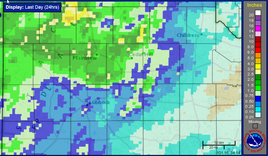
| 24 hour rain totals ending at 3 pm on Saturday, 12 August 2017. Similar radar estimated and bias-correct rainfall totals can be found at: South Plains region and Larger West Texas Region. | |
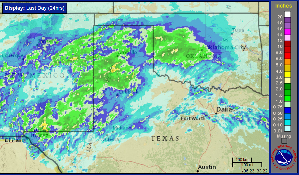
| A potent upper level disturbance embedded in the monsoon flow took advantage of plentiful amounts of mid-August moisture to bring widespread showers and thunderstorms late Friday evening into Saturday morning (11-12 August). The bulk of the activity developed over New Mexico Friday afternoon and evening before spreading slowly eastward into West Texas early Saturday. The strongest thunderstorms and heaviest rain were directed across the southwestern Texas Panhandle and northern South Plains, where many spots saw 1 to 2+ inches of rain. | |
 |
|
| Regional radar animation valid from 8:18 pm to 9:28 pm on Friday, 11 August 2012. | |
| Additional clouds and moderate to heavy rain then spread across much of the remainder of the South Plains and southeastern Texas Panhandle Saturday morning. Although this round of rain contained little lightning it still produced fairly efficient rainfall rates. | |
 |
|
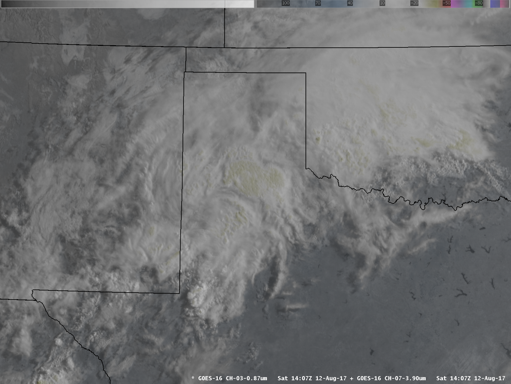
| Infrared and visible combination satellite image captured at 9:07 am on Saturday, 12 August 2017. | |
| The large batch of rain gradually weakened through the late morning hours as it shifted into the Rolling Plains, while Oklahoma saw another round of moderate to heavy rain (adding to several rounds of heavy rain experienced over the recent days there). | |
 |
|
|
|
| The light to moderate rain lingered over parts of the Rolling Plains well into the afternoon hours before finally shifting east of the area by early evening. | |
 |
|
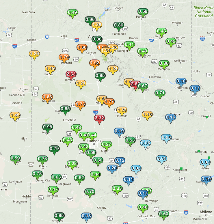
| West Texas Mesonet 24-hour rain totals ending at 3 pm on Saturday, 12 August 2017. | |
| The big winner for this event was the West Texas Mesonet site located 6 miles east-northeast of Abernathy where a total of 3.32 inches was recorded. Even south of the heaviest corridor of rain, much of the central and southern South Plains received a quarter to three quarters of an inch. Unfortunately, the southern Rolling Plains largely missed out with totals generally under a tenth of an inch. |

