On Sunday evening, August 13, 2017, an intense slow-moving supercell thunderstorm developed over northern Briscoe County. This storm moved slowly southeastward passing over the community of Turkey before weakening and being absorbed by a large line of storms racing southward out of the Texas Panhandle. The lead rotating storm likely dropped large hail over rural portions of Briscoe and western Hall Counties before weakening. In addition, it generated intense damaging microburst winds as it moved past Turkey. Unfortunately, the intense winds, estimated to reach 100 to 120 mph, did cause significant damage in and around the town of Turkey. The West Texas Mesonet site located 2 miles west-southwest of town recorded a peak gust of 68 mph as the storm moved by. Torrential rainfall accompanied this storm and others that moved across Briscoe and Hall Counties, producing flooding along highway 86 and in rural areas in the northern portions of the counties.
 |
 |
|
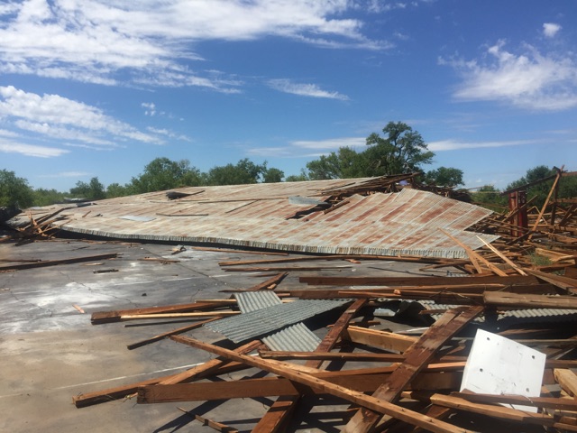
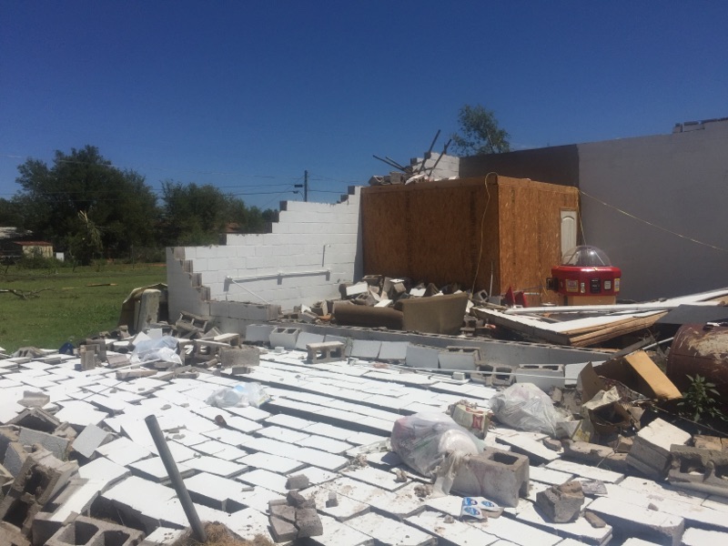
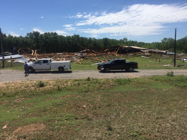
A couple of pictures of the damage incurred in Turkey, Texas. The damage occurred Sunday evening (13 August 2017) and the pictures were taken on Monday the 14th.
|
|
The above and below pictures show the significant damage that occurred to several structures in Turkey. Thankfully there were no injuries or deaths, though extensive and costly property damage did occur.
 |
 |
|
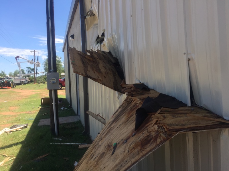
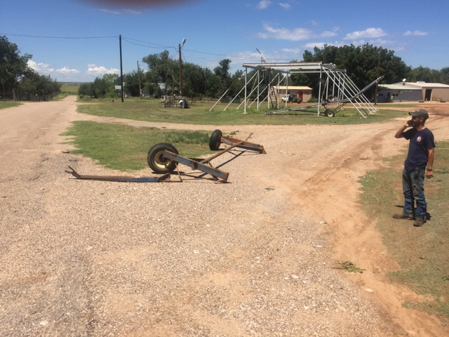
Additional pictures of the damage incurred in Turkey, Texas. The damage occurred Sunday evening (13 August 2017) and the pictures were taken on Monday the 14th.
|
|
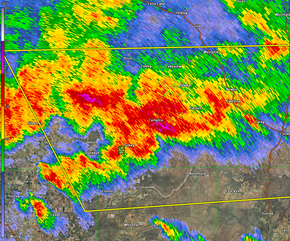
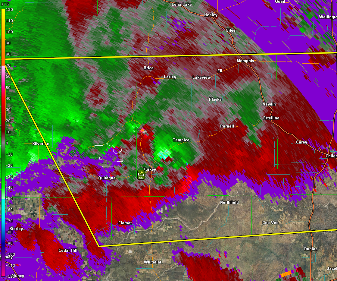
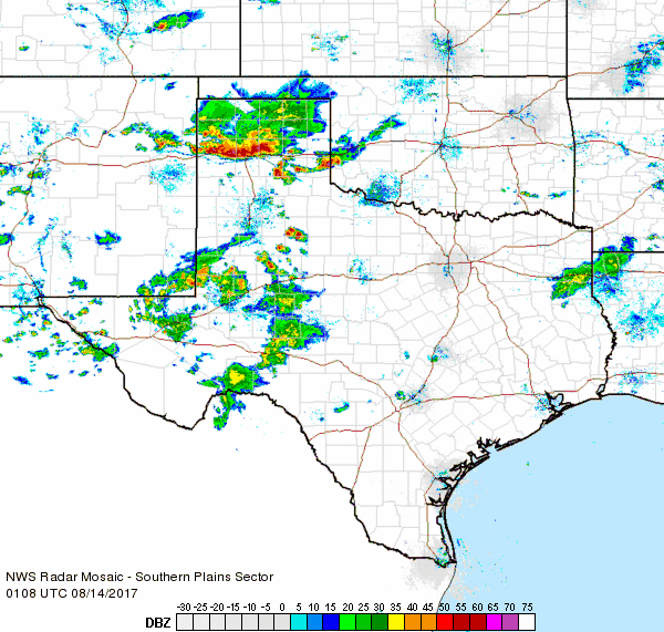
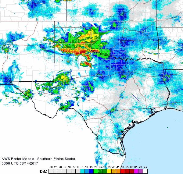
The radar images below show the presentation of the thunderstorms around the time the intense winds and extensive damage was taking place. Several areas of rotation did pass north and east of Turkey, with strong downburst winds raking the city as another cluster of storms merged into the parent storm from the southwest.
 |
 |
|
Lubbock radar imagery captured around the time of the peak winds in Turkey, Texas. The left image is the 0.5 degree reflectivity data and the right is the 0.5 degree velocity data. The images are from 9:47 pm on Sunday, 13 August 2017. The radar beam is approximately 7,000 feet above ground level.
|
|
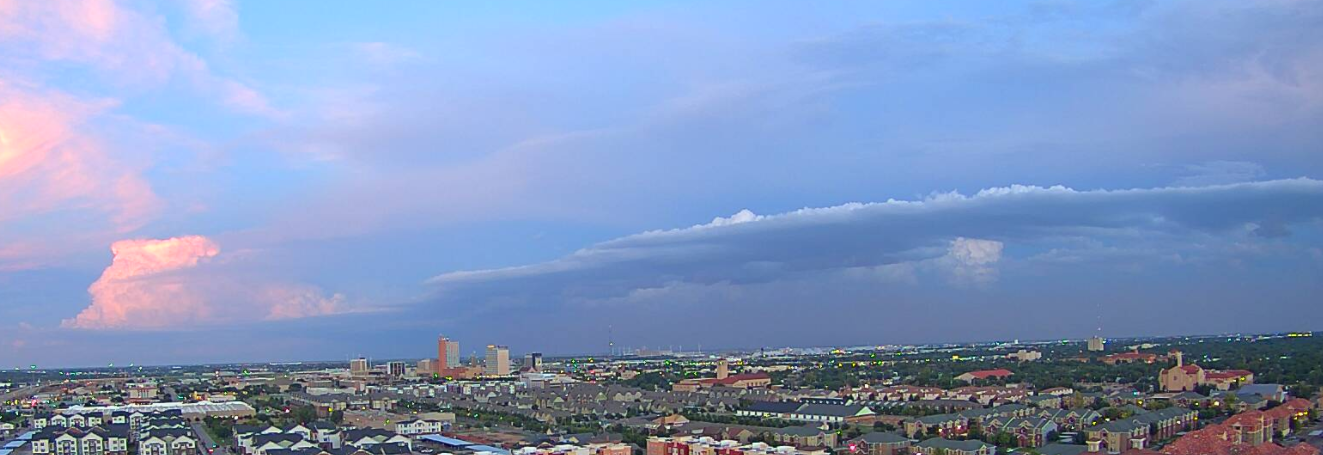
Further south, around Lubbock, the skies were much calmer, though isolated thunderstorms and dusty outflows were visible shortly before the sun went down.
 |
|
|
Pretty sunset with thunderstorms in the distance and an outflow boundary moving through Lubbock Sunday evening.
|
In addition to the destructive winds in and around Turkey, the thunderstorms dropped torrential rainfall, particularly where they lingered across portions of the southeast Texas Panhandle into the northern Rolling Plains. Although the storm intensity quickly waned late Sunday evening, heavy rain persisted into early Monday morning as the complex of storms moved south and southeastward.

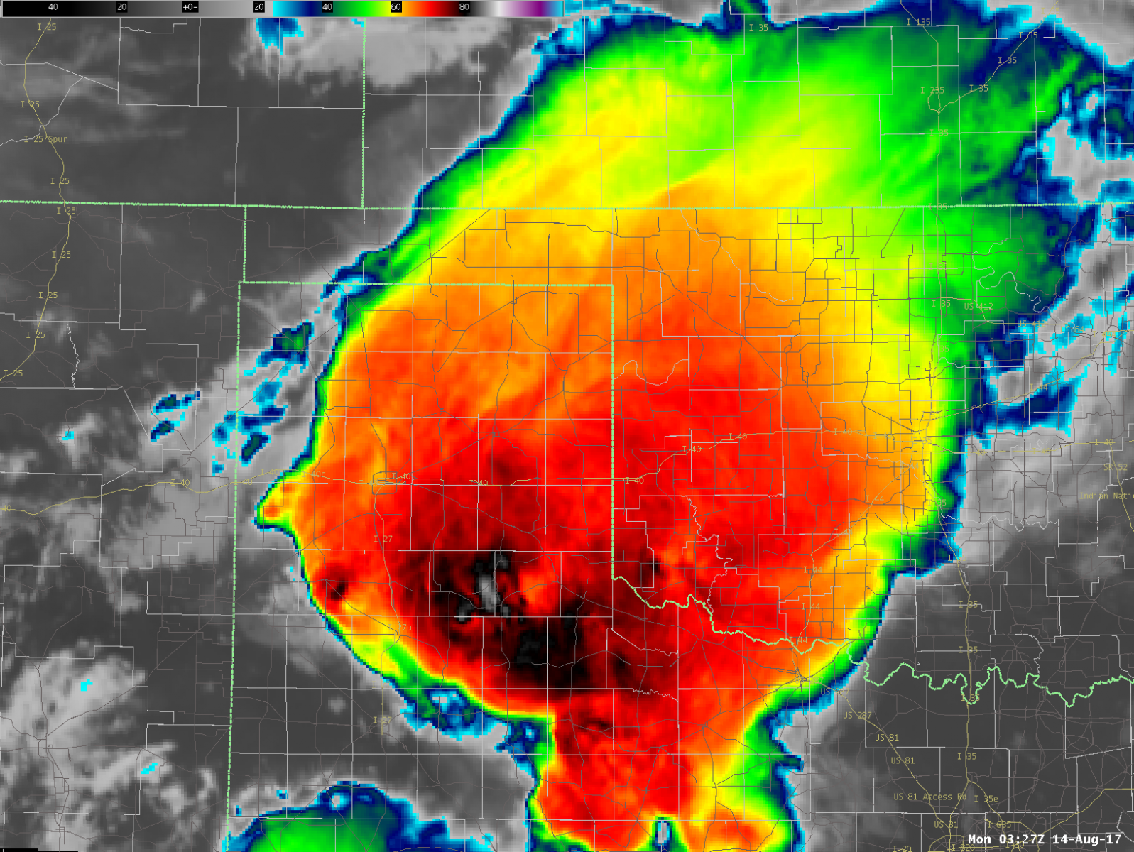
The image below is a snapshot of the high-resolution GOES-16 imagery of the large thunderstorm complex late Sunday evening. The dark reds and whites are indicative of very cold, tall cloud tops associated with a mature thunderstorm complex.
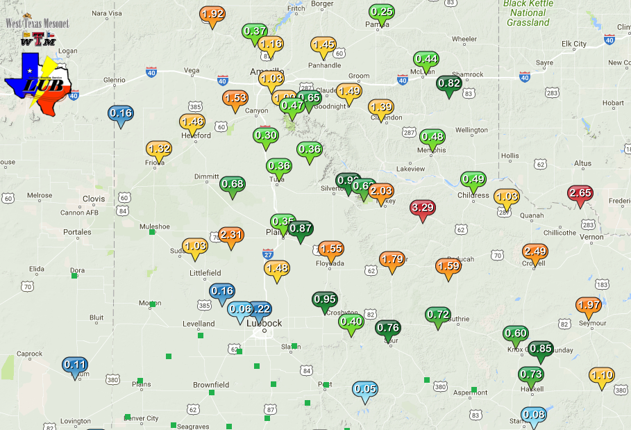
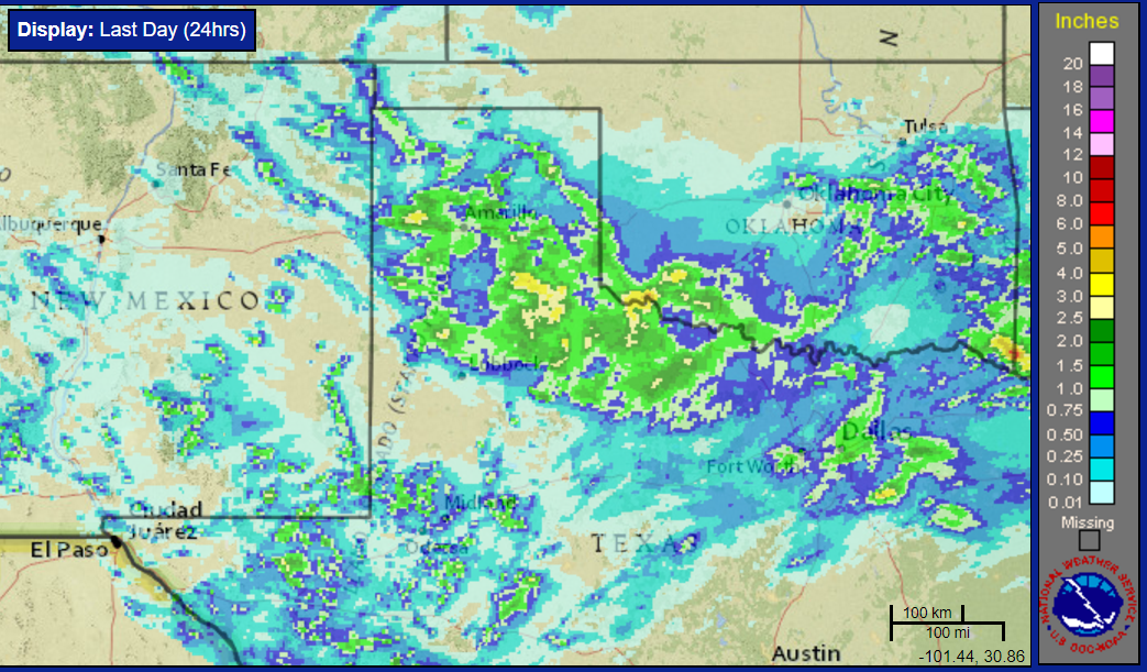
Very heavy rain, as much as 2 to 4 inches, fell over the course of an hour or two from northeast Briscoe County through central and southern Hall County as well as northern Motley County. Our Cooperative Observer in Turkey measured an impressive 3.06 inches, with the Northfield West Texas Mesonet site recording 3.29 inches. This much rain falling that fast did also create areas of flooding. Even outside the heaviest swaths, a large chunk of the southern Texas Panhandle into the northeast South Plains and the northern and central Rolling Plains did receive an inch or more.
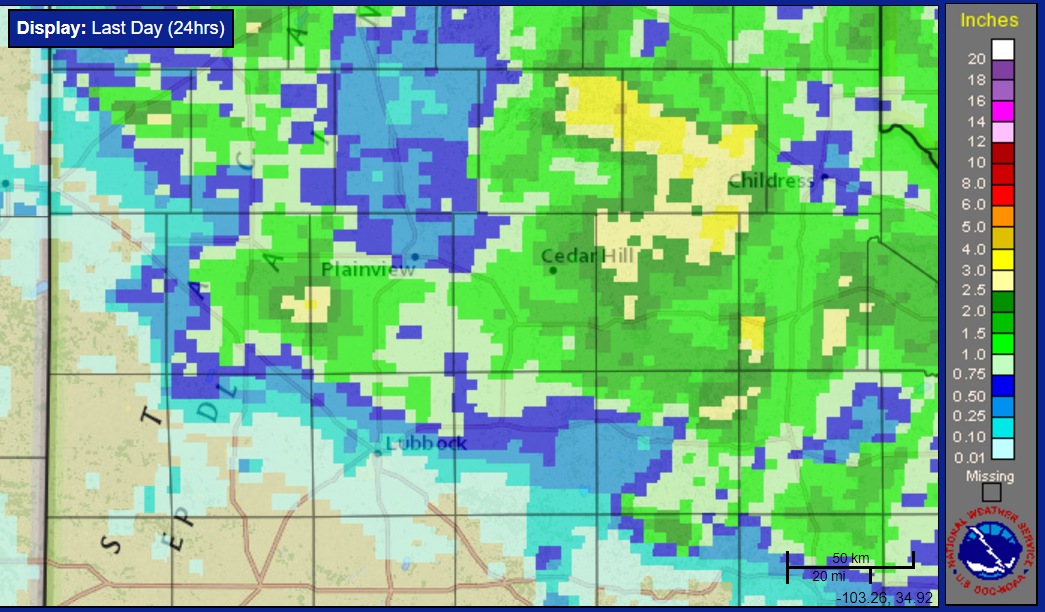
The below image shows the rain totals observed by the West Texas Mesonet for this event. Officially, the Lubbock Airport recorded 0.31 inches while the Childress Airport tallied 0.81 inches. Thankfully, even the northern Rolling Plains, where they have had a tendency to miss out of the rains more often than not this summer, did see welcome moisture. Only the southern and western South Plains missed out on the rain altogether.
The NWS office in Lubbock conducted a damage survey in and around the town of Turkey on Monday, August 14th. The results are contained in a Public Information Statement shown below, along with the preliminary storm reports from the event.
PUBLIC INFORMATION STATEMENT
NATIONAL WEATHER SERVICE LUBBOCK TX
433 PM CDT Wed Aug 16 2017

...NWS Damage Survey for 08/13/2017 Thunderstorm Wind Event at
Turkey Texas...

.Turkey Wet Microburst Wind Event...

Peak wind: 100-120 MPH
Fatalities:0
Injuries:0

Start date: 08_13_2017
Start time: 09:30 PM CDT
Start location: Turkey, Texas

End date:       08_13_2017
End time:       09:45 PM CDT
End location:   Turkey, Texas

Meteorologists with the National Weather Service in Lubbock
conducted a ground and aerial damage survey at Turkey, Texas on
August 14, 2017. Significant damage occurred in Turkey on the
evening of August 13, 2017 in association with widespread severe
thunderstorm activity.

Several homes and businesses suffered damage. The Turkey Compress
was totally destroyed, and at least 2 homes suffered major damage
and are uninhabitable. Numerous large trees and power poles
snapped, building and car windows were broken, garage doors
collapsed and other extensive damage occurred to car ports and
canopies. Despite a large amount of flying debris that moved
through the city from north to south, no fatalities nor injuries
occurred. No large hail was reported by Turkey residents.

Peak wind speeds during this event are estimated to be in the
100-120 mph range based on observed damage. The lower speed bound
is supported by snapped trees, power poles, collapsed garage
doors and various roof damage. The upper speed bound is estimated
from the destroyed compress building and the two homes that
suffered major roof and wall damage. It is important to note that
the most severely damaged buildings were quite old. One of the
homes that suffered major damage was built in 1927.

The majority of evidence suggests that this damage was the result
of a wet microburst that moved generally from north to south
across the community of Turkey. This determination is based on the
type and location of damage and distribution of debris, weather
radar data, and eyewitness accounts. Turkey officials reported
that high winds were observed for a period of about 15 minutes and
the Texas Tech West Texas Mesonet station 2 miles SSW of Turkey
reported severe wind gusts as high as 68 mph for a period of 15
minutes between 9:35 and 9:50 PM CDT. The damaging wind was
immediately followed by heavy rainfall, which totaled 2-3 inches.
This event occurred after dark and there were no reports of a
tornado or funnel cloud in or near Turkey around the time the
damage occurred.

Representatives from Turkey as well as Hall County Sheriff and
Hall County Emergency Management provided outstanding assistance
and guidance through the duration of the survey.

