| Widespread rain falls on West Texas 23 - 28 September 2017 |
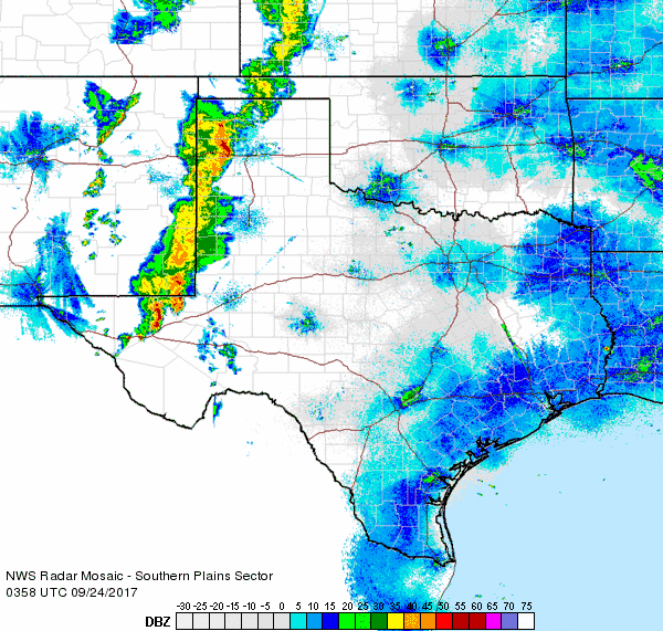 |
| Regional radar animation valid from 10:58 pm 23 September to 12:08 am 24 September 2017 (Saturday night into early Sunday). |
| The end of September brought a number of rounds of showers and thunderstorms over the course of several days, with widespread rain falling all of the southern High Plains. This occurred as a nearly stationary storm system across the western United States helped draw moisture northward from the Gulf at the lower levels and from the eastern Pacific at the middle and upper levels (including moisture from Tropical Storm Pilar). This moisture interacted with disturbances moving through southwest flow aloft in advance of the western storm system to squeeze out round after round of rain. A cold front moving from north to south across the South Plains early Tuesday also helped focus more intense showers and thunderstorms along and behind it. |
 |
| 5-day radar-estimated and bias-correct rainfall totals ending at 5 am on Thursday, 28 September 2017. A regional view of the same graphic can be FOUND HERE. |
| Early on in the event, a few of the thunderstorms did become strong at times, producing gusty winds and small hail, but their primary impact was to drop locally heavy rainfall. As temperatures cooled behind the cold front Tuesday, the event turned to periods of light to moderate rain. Over the course of four to five days, most of the South Plains, Rolling Plains and southern Texas Panhandle recorded 1 to 3 inches of rain, with pockets of 3 to 5 inches. This amount of rain did cause some minor flooding at times, though it was spread out in time enough to prevent more serious flooding concerns. |
 |
| Regional radar animation valid from 3:58 pm 5:08 am 26 September 2017 (Tuesday). |
| Officially the Lubbock Airport recorded 2.04 inches between September 24th and 27th, while Childress recorded 2.77 inches over that same stretch. After a mostly warm and dry month, the late September rains quickly boosted rain totals above monthly averages. |
 |
| West Texas Mesonet 96-hour (4-day) rain totals ending at 6 am on 27 September 2017. |
| In addition to the widespread rainfall, a cold front combined with relentless cloud cover to drop temperatures well below average. After seeing highs in the 80s and 90s most of the month, they were stuck in the lower to middle 60s by the 26th and 27th. Below is a plot of the high temperatures recorded by the West Texas Mesonet on the 27th. |
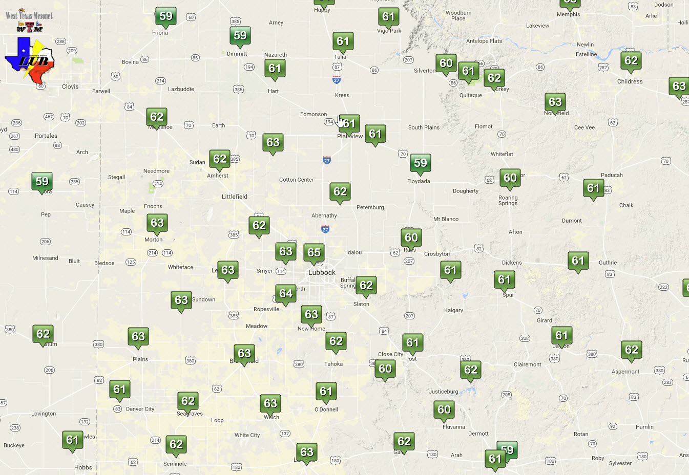 |
| West Texas Mesonet observed high temperatures on Wednesday, 27 September 2017. |

