
A storm and trailing cold front will continue to slowly move through the Gulf Coast and Southeast U.S. through this weekend with widespread rain showers and isolated thunderstorms. A fast-moving clipper storm may bring several inches of snow to the north-central Plains, Midwest, eastern Great Lakes, and Northeast regions this weekend. Read More >
Situation Overview: Rivers above or near flood stage will continue to mostly recede over the weekend as cooler temperatures have reduced snowmelt runoff and remaining snowpack between 9000 and 11,000 feet has been significantly depleted over the last several days. Outflows from some area reservoirs will remain very high leading to downstream rivers running near or above flood stage for the next several days.
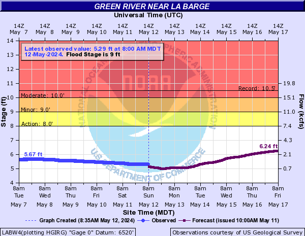
Green River Basin Flooding: A Flood Warning is in effect along the Green River from near the confluence with the New Fork River near Big Piney to Fontenelle Reservoir. The Green River at La Barge was steady near 10 feet Saturday evening, and is forecast to recede to near its flood stage of 9.0 feet by mid-week. The river crested at 10.2 feet on June 11th at this location. The record crest is 10.5 feet on June 9, 1986.
Any kind of recreation on the Green River and New Fork River is not advised. Minor low-land flooding is likely.
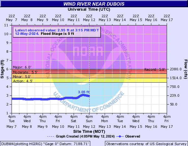
Wind River and Little Wind River near Riverton: No flood warnings remained in effect. The Big Wind and Little Wind River near Riverton continue to recede significantly and are expected to fall below flood stage early Sunday morning.
Big Horn River: No flood warnings remain in effect. The Bighorn River will continue to run high for the next several days due to high release rates from Boysen Reservoir. The Bighorn River at Worland is expected to continue fluctuating between 11.2 and 11.5 feet. Partial flooding of Riverside Park in Worland will continue. Moderate flooding begins above 11.5 feet.
Do not attempt to cross streams during these times as the swift and cold water will easily carry you downstream! Please stay away from flood waters!

River Gauge Stages and Forecasts (AHPS)
|
|
||||
|
above Hudson near Lander |
near Mortimore Lane Bridge - Lander |
at Fort Washakie |
||
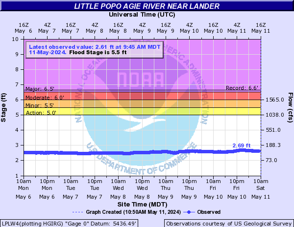 |
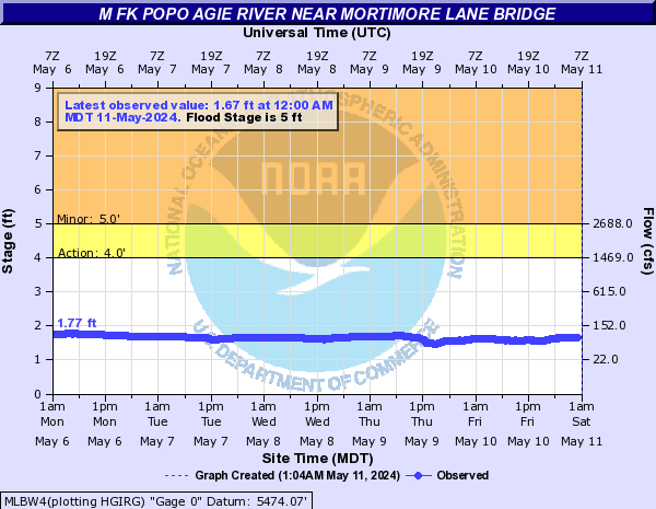 |
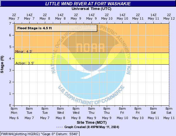 |
||
|
near Riverton |
at Riverton |
near Dubois |
||
 |
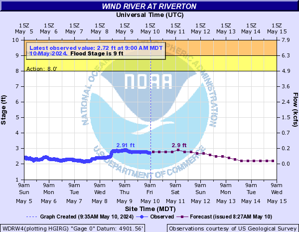 |
 |
||
|
|
||||
|
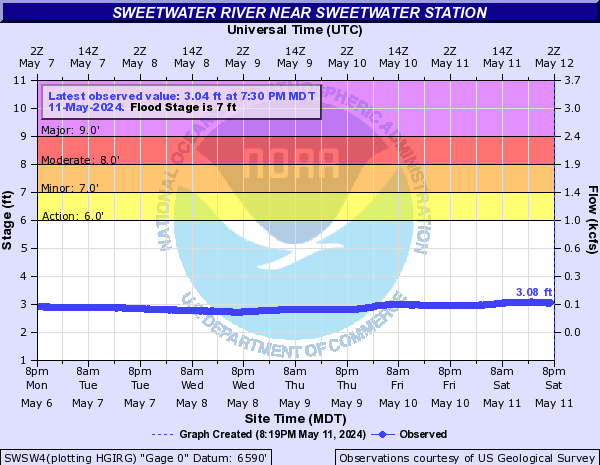
near Sweetwater Station |
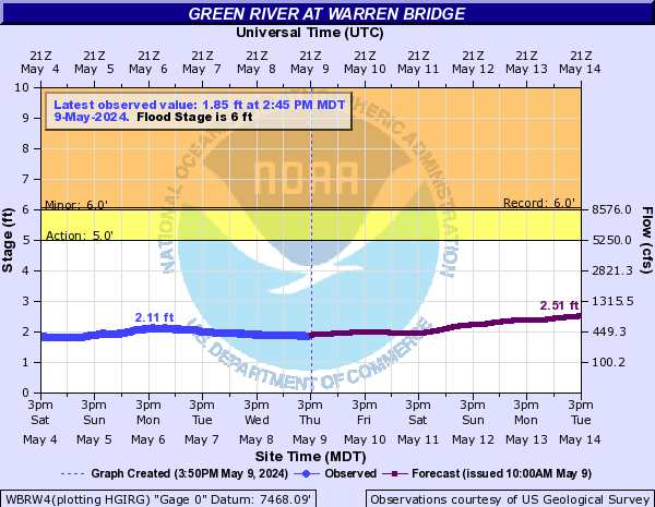
at Warren Bridge |
near La Barge |
||
 |
 |
 |
||
|
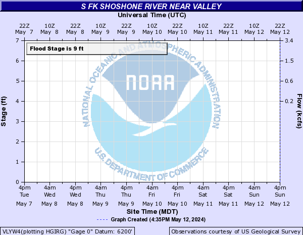
near Valley |
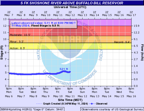
South Fork of the Shoshone River above Buffalo Bill Reservoir |
at Worland |
 |
 |
 |