National Weather Service United States Department of Commerce


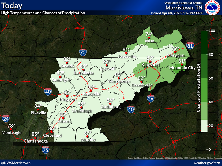
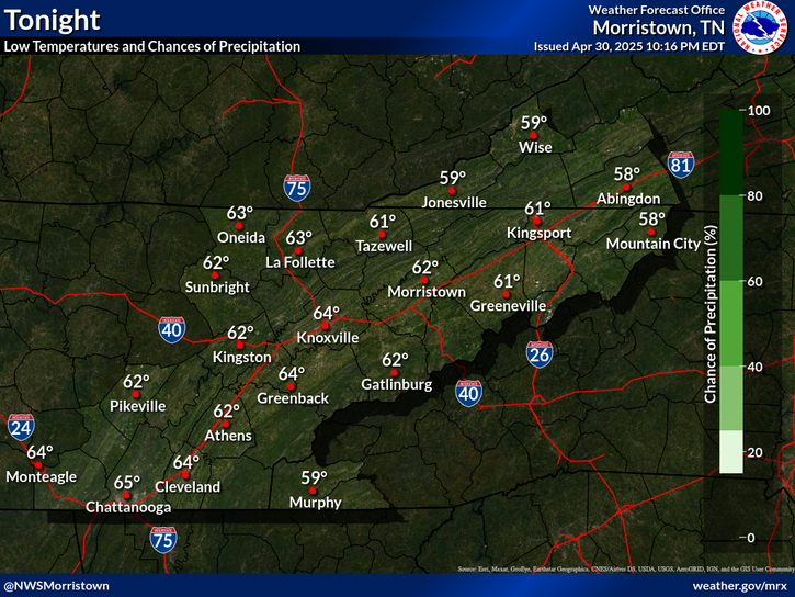
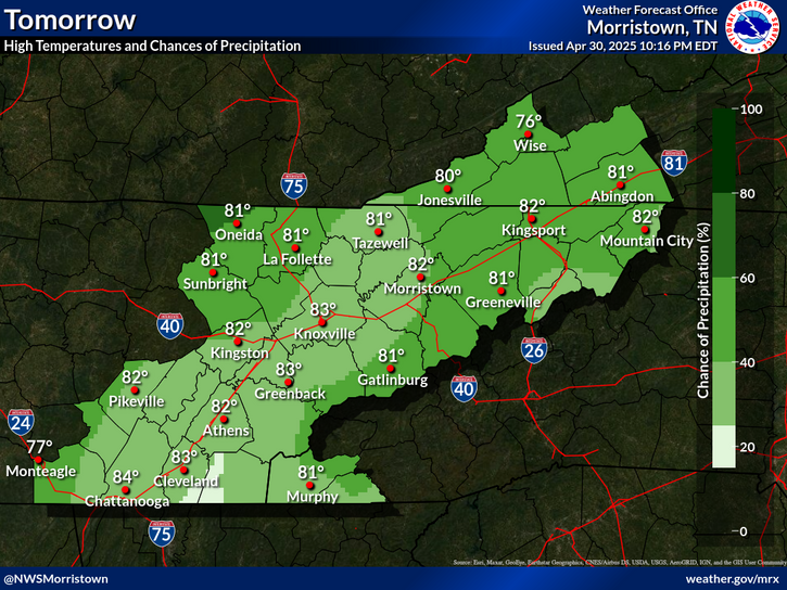
Rain showers will move in mainly north and central this afternoon, but will start as snow or quickly change to snow over the higher elevations. All areas will transition to snow before the precipitation ends late tonight. Most areas will see little or no accumulation, but accumulations of 2 to 4 inches will be possible mainly over the higher elevations of Southwest Virginia and the mountains of East Tennessee. Up to 6 inches possible over the highest peaks.
Another cold front will pass through the area late Friday, bringing a chance of light snow accumulations mainly north and higher elevations and a drop in temperatures Saturday. Gusty winds can be expected over the higher elevations as well Friday night into early Saturday. A warming trend is expected by early next week.
Each observation point is apart of our COOP program (Cooperative Observer Program). Each site has a 24 hour observation period that ends and begins at 8 am local time. Each site records temperature, precipitation, and snowfall data. More information about the COOP program can be found here www.nws.noaa.gov/om/coop/ Data began being collected at: Cades Cover on 01/01/1999 || Mount LeConte on 07/01/1987 || Newfound Gap on 01/01/1991 || Sugarlands Visitor Center on 12/01/1921

 Current Weather Observations...
Location Time
(EST)
Weather Vsby.
(SM)
Temp.
(ºF)
Dewpt.
(ºF)
Hum.
(%)
Wind
(mph)
Wind Chill / Heat Index
(ºF)
Pres.
(in)
Abingdon VA11:3510282379SSW 1316 [WC]29.74
Andrews-Murphy NC12:40Partly Cloudy10463052CALM-29.80
Chattanooga TN12:53Mostly Clear10543243SW 7-29.81
Crossville TN12:53Overcast10463360W 16G2639 [WC]29.76
Dalton GA11:35Clear10432856SE 539 [WC]29.90
Knoxville TN (McGhee-Tyson)12:53Mostly Cloudy10443159SW 1636 [WC]29.76
Middlesboro KY12:55Mostly Cloudy10392965SSE 9G1633 [WC]29.73
Monroe Cnty TN12:55Mostly Clear10443260SW 10G1838 [WC]29.77
Morristown TN12:55Mostly Clear10413375WSW 7G1436 [WC]29.73
Oak Ridge TN12:53Mostly Clear10452851VRB 741 [WC]29.78
Tazewell Cnty VA11:35Overcast10262386WSW 5G1720 [WC]29.69
Tri-Cities TN12:531 Inches Of Snow On Ground10362769WSW 1227 [WC]29.74
Wise VA11:35Overcast10302686SW 14G2219 [WC]29.68
Greeneville, TN12:55Overcast10373074VRB 731 [WC]29.74


Local Weather History For February 6th...
Tornado tracked 10 miles across Bradley, Polk and McMinn Co in 1986. 5 injured.


Briefing Hydrology Past Weather Events Graphical Hazardous Weather Outlook for East Tennessee East Tennessee Observations
Decision Support Hydrology Past Weather Events GHWO Observations Gridded Forecast
Daily Climate for Middle Tennessee Local East Tennessee Climate Tornado Database Tropical Weather Information NOAA Weather Radio
IDSS Point Forecasts Daily Climate Local Climate Tornado Database Tropical Weather Radio
Daily Climate for Middle Tennessee Probabilistic Data for East Tennessee Virtual Tour of the NWS Morristown Office Skywarn Spotter Training for East Tennessee  
Being Prepared Estar Perparado Probabilistic Virtual Tour Spotter Training