
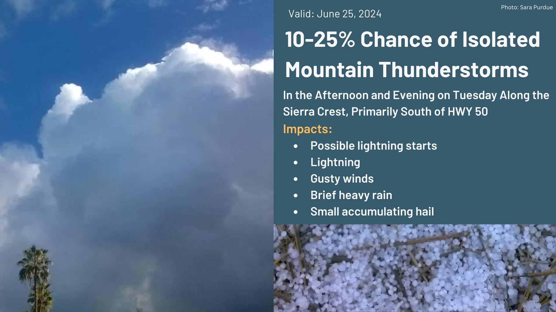
Heat expands across the Desert Southwest, Plains, Mississippi Valley and Midwest into Monday. Fire weather concerns continue for portions of the Intermountain West. Active monsoonal moisture fuels thunderstorms over the Southwest with possible flash flooding. Tropical cyclone Fausto in the Pacific, should weaken as it approaches Hawaii; Dangerous surf, swells and rip currents are expected. Read More >
Last Map Update: Sun, Jul 26, 2026 at 4:12:41 pm PDT
|
Text Product Selector (Selected product opens in current window)
|
|


 Social Media Feeds
 Sacramento Radar
 Beale Radar
 Satellite
 Graphical Forecasts - Local
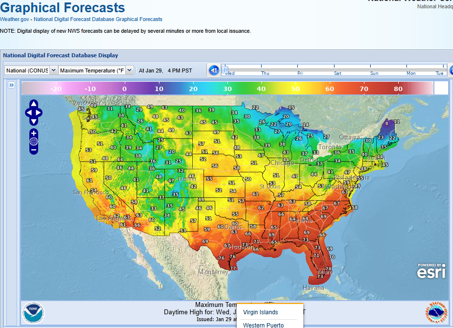 Graphical Forecasts - U.S.
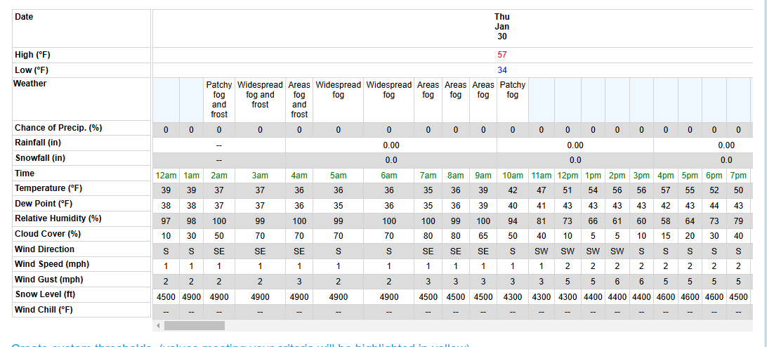 Forecast Weather Tables
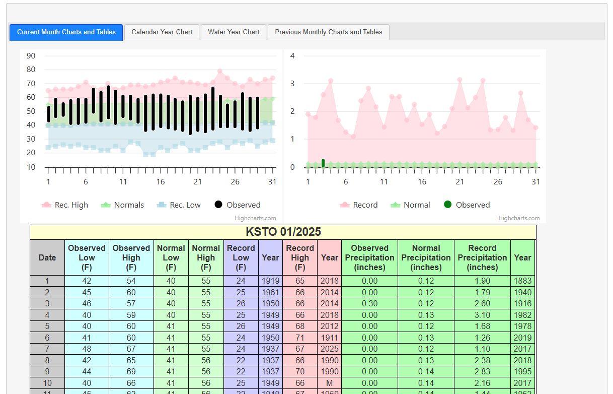 Recent STO Temperatures
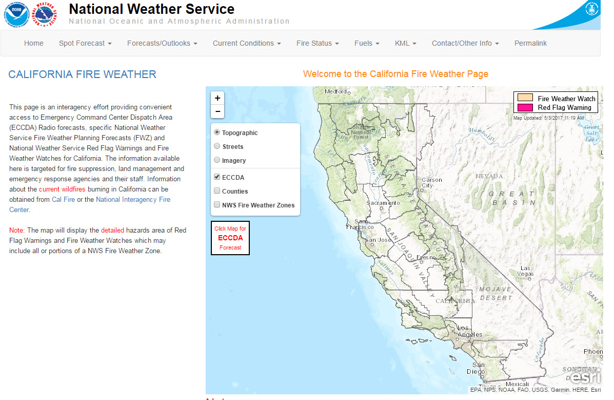 California Fire Weather Page
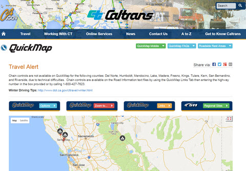 Caltrans QuickMap
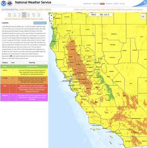 Heat Risk Link
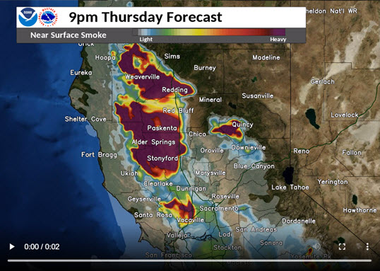 Experimental Smoke Forecast
 Weather Stats