
Wildfire smoke continues to impact air quality from the Great Lakes region into New England and the Mid-Atlantic today with widespread Air Quality Alerts in effect. Severe thunderstorms are expected across portions of the Ohio Valley and Lower Great Lakes into the Mid-Atlantic and Northeast, this afternoon into the evening. Monsoonal thunderstorms may bring areas of flooding to the Southwest. Read More >
Overview
|
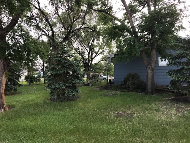
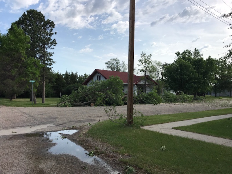
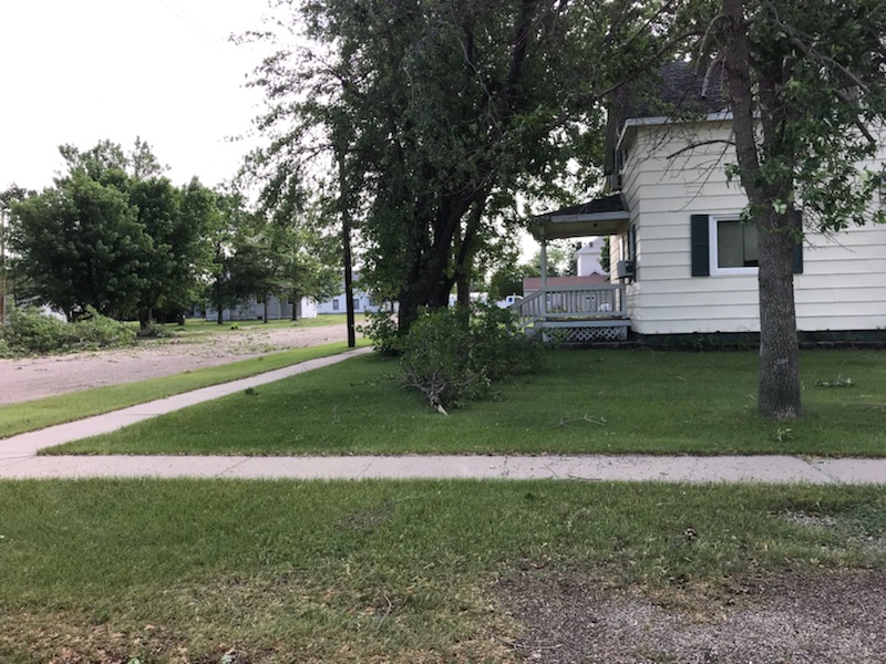
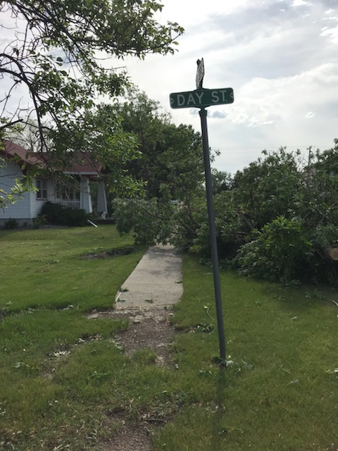
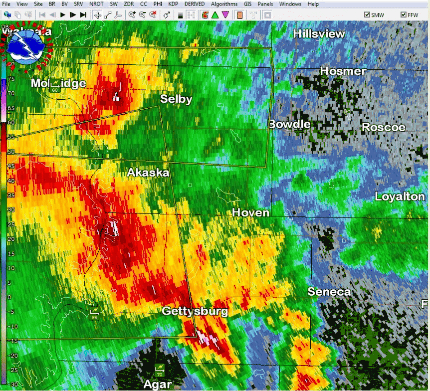
Like the area saw just a few days ago (June 1, 2018 Summary), the interaction between a warm airmass over South Dakota and a cold front led to the development of severe thunderstorms that moved east across northern South Dakota. Thunderstorms developed in western South Dakota during the evening hours of June 5th, 2018 and moved into north central SD. These initial thunderstorms produced hail up to 2.5” in diameter and winds of 60-75 mph between Rapid City and the North Dakota border. As the storms continued east into north central SD, it produced hail to the size of golf balls in western Corson County. But the main impact was the severe winds. These winds were supported by environmental conditions that were favorable for strong thunderstorm winds (very warm temperatures along with dry air in the lower and middle levels of the atmosphere). The core of the strongest winds occurred along and to the south of U.S. Highway 12 from Walworth County east into Minnesota. This led to several outbuildings being partially or totally destroyed, damage to grain bins and silos, broken power poles, and numerous areas with tree damage. The highest reported wind gusts were measured to the east-southeast of Lowry, with measured gusts of 97 and 100 mph. |
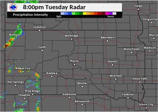 Radar loop of severe thunderstorms overnight June 5, 2018 |
 |
 |
 |
|
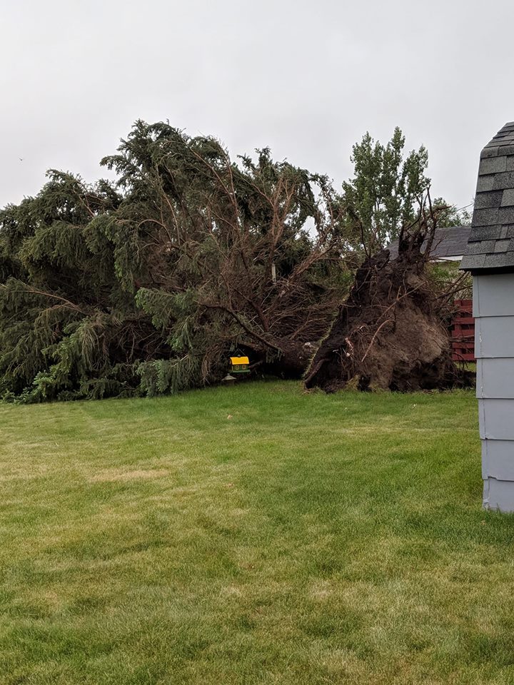
Hoven Photo courtesy of Sara Johnson |
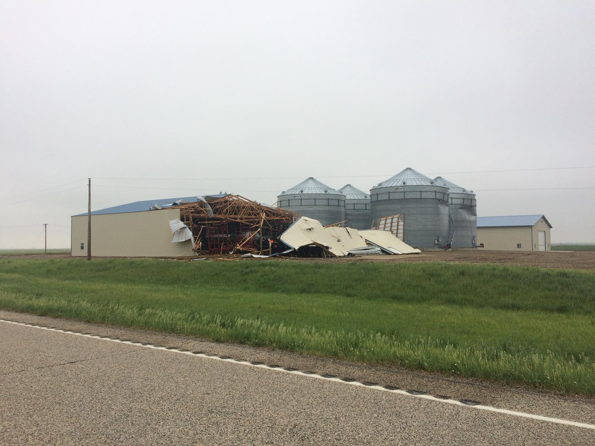
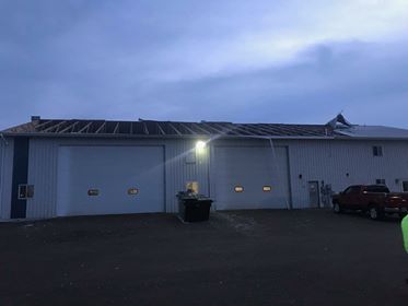
Partially destroyed machine shop north of Faulkton Photo courtesy of the SD Highway Patrol |
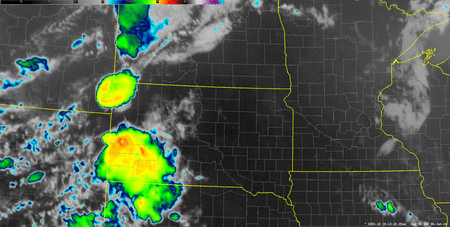
GOES-East IR Imagery Loop |
Wind Damage:
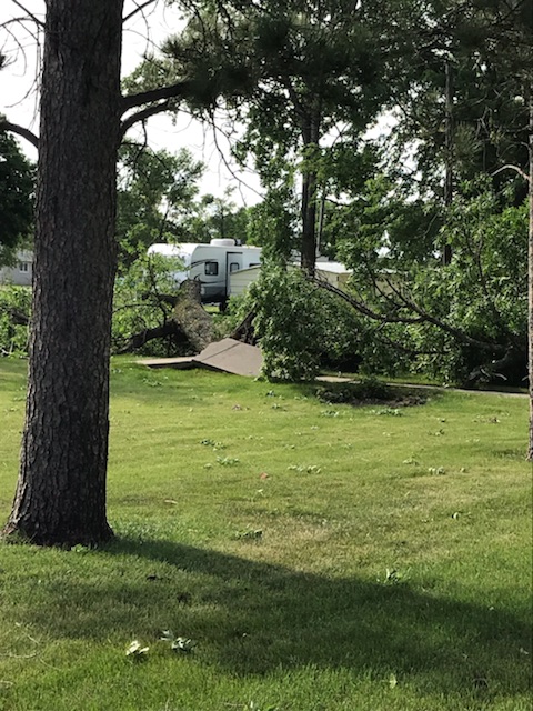
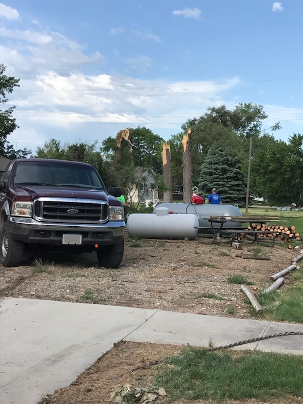
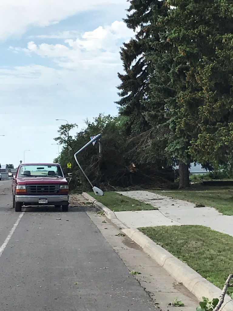
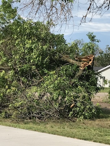
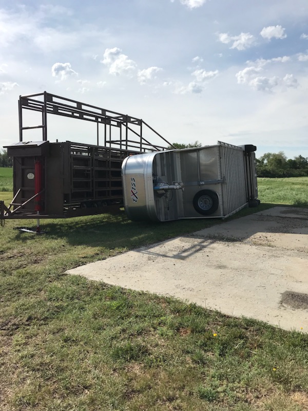
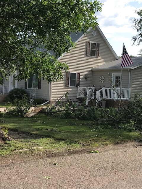
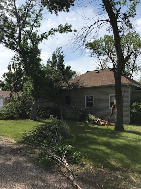
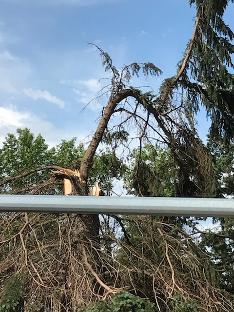
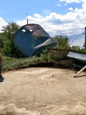
Very strong winds with gusts up to 100 mph resulted in downed trees, damaged machine sheds, broken power poles, tipped trailers, and a tipped mobile home.
Hoven Storm Damage
Photos courtesy of Audrey Beitelspacher
 |
 |
 |
 |
 |
 |
 |
 |
 |
 |
 |
 |
 |
|||
| Radar Reflectivity from 11:30-11:50 pm, as storms passed through Hoven. 100 mph wind gusts were reported in the area. |
Additional Storm Damage Photos
 |
.jpg) |
 |
|
|
Agtegra buildings in Bristol Photo courtesy of Kim Danielson-Huwe |
Tipped grain bin in Glencross Photo courtesy of Grady Kraft |
Tipped grain bin in Glencross Photo courtesy of Grady Kraft |
Partially destroyed machine shop north of Faulkton Photo courtesy of the SD Highway Patrol |
PRELIMINARY LOCAL STORM REPORT...SUMMARY
NATIONAL WEATHER SERVICE ABERDEEN SD
1250 PM CDT WED JUN 6 2018

..TIME...   ...EVENT...      ...CITY LOCATION...     ...LAT.LON...
..DATE...   ....MAG....      ..COUNTY LOCATION..ST.. ...SOURCE....
            ..REMARKS..

0945 PM     TSTM WND DMG     1 NE EAGLE BUTTE        45.01N 101.23W
06/05/2018                   DEWEY              SD   PUBLIC

            MOBILE HOME TIPPED OVER.

0206 AM     TSTM WND GST     2 NW TWIN BROOKS        45.22N 96.81W
06/06/2018  E60 MPH          GRANT              SD   PUBLIC

            RADAR ESTIMATED TIME.

0150 AM     TSTM WND GST     4 W WAUBAY              45.33N 97.39W
06/06/2018  M70 MPH          DAY                SD   MESONET

            WAUBAY RWIS.

0135 AM     TSTM WND GST     WEBSTER                 45.34N 97.52W
06/06/2018  E63 MPH          DAY                SD   MESONET


0133 AM     TSTM WND GST     5 S GARDEN CITY         44.88N 97.59W
06/06/2018  E60 MPH          CLARK              SD   MESONET


1241 AM     TSTM WND GST     CRAVENS CORNER          45.45N 98.93W
06/06/2018  E79 MPH          EDMUNDS            SD   MESONET


1240 AM     TSTM WND GST     WARNER                  45.32N 98.50W
06/06/2018  E60 MPH          BROWN              SD   LAW ENFORCEMENT

            RADAR ESTIMATED TIME. SEVERAL MODERATE TO
            LARGE SIZE TREE BRANCHES DOWN AND POWER IS
            STILL OUT AS OF 620 AM CDT.

1221 AM     TSTM WND GST     5 S MIRANDA             44.90N 98.96W
06/06/2018  M65 MPH          FAULK              SD   MESONET

            MIRANDA RWIS.

1209 AM     TSTM WND DMG     4 E NORBECK             45.19N 99.13W
06/06/2018                   FAULK              SD   LAW ENFORCEMENT

            MACHINE SHED PARTIALLY DESTROYED ALONG WITH
            SOME DAMAGED GRAIN BINS. RADAR ESTIMATED
            TIME.

1206 AM     TSTM WND DMG     4 E ONAKA               45.18N 99.38W
06/06/2018                   FAULK              SD   EMERGENCY MNGR

            CONCRETE SILO KNOCKED OVER, POLE BARN
            TOTALLED, AND TREE DAMAGE.

1206 AM     TSTM WND DMG     6 S BOWDLE              45.36N 99.66W
06/06/2018                   EDMUNDS            SD   EMERGENCY MNGR

            10 POWER POLES BROKEN AND TREES BLOWN DOWN.

1205 AM     TSTM WND GST     16 W POLO               44.82N 99.44W
06/06/2018  E60 MPH          HYDE               SD   PUBLIC


1205 AM     TSTM WND GST     BRENTWOOD COLONY        45.12N 99.31W
06/06/2018  E70 MPH          FAULK              SD   MESONET


1203 AM     TSTM WND GST     1 E ONAKA               45.19N 99.44W
06/06/2018  E60 MPH          FAULK              SD   MESONET


1159 PM     TSTM WND GST     17 W POLO               44.78N 99.46W
06/05/2018  M60 MPH          HYDE               SD   MESONET

            JCT SD-26/SD-47 RWIS.

1146 PM     TSTM WND GST     PIERRE                  44.38N 100.32W
06/05/2018  E71 MPH          HUGHES             SD   ASOS


1145 PM     TSTM WND GST     3 ESE LOWRY             45.30N 99.91W
06/05/2018  M100 MPH         WALWORTH           SD   TRAINED SPOTTER


1145 PM     TSTM WND GST     1 ESE LOWRY             45.31N 99.95W
06/05/2018  M97 MPH          WALWORTH           SD   PUBLIC


1143 PM     TSTM WND GST     3 ESE AKASKA            45.32N 100.06W
06/05/2018  M65 MPH          WALWORTH           SD   PUBLIC

            LOWRY RWIS.

1130 PM     TSTM WND GST     GETTYSBURG              45.00N 99.96W
06/05/2018  M68 MPH          POTTER             SD   MESONET


1123 PM     TSTM WND GST     3 N AGAR                44.88N 100.07W
06/05/2018  M72 MPH          SULLY              SD   MESONET

            AGAR RWIS.

1113 PM     TSTM WND GST     MOBRIDGE                45.54N 100.44W
06/05/2018  M64 MPH          WALWORTH           SD   ASOS


1113 PM     TSTM WND GST     3 SSW WHITLOCKS BAY REC 45.01N 100.29W
06/05/2018  M69 MPH          POTTER             SD   MESONET

            FOREST CITY BRIDGE RWIS.

1051 PM     TSTM WND GST     1 NE RIDGEVIEW          45.09N 100.79W
06/05/2018  M62 MPH          DEWEY              SD   MESONET

            RIDGEVIEW RWIS.

1051 PM     TSTM WND GST     4 W TRAIL CITY          45.47N 100.81W
06/05/2018  M60 MPH          DEWEY              SD   MESONET

            TRAIL CITY RWIS.

1035 PM     HAIL             EAGLE BUTTE             45.00N 101.24W
06/05/2018  E1.25 INCH       DEWEY              SD   LAW ENFORCEMENT


1030 PM     TSTM WND GST     LITTLE EAGLE            45.68N 100.80W
06/05/2018  E60 MPH          CORSON             SD   PUBLIC


1026 PM     TSTM WND GST     EAGLE BUTTE             45.00N 101.24W
06/05/2018  E60 MPH          DEWEY              SD   TRAINED SPOTTER


1026 PM     HAIL             EAGLE BUTTE             45.00N 101.24W
06/05/2018  M1.00 INCH       DEWEY              SD   TRAINED SPOTTER


1013 PM     TSTM WND GST     3 NNW LANTRY            45.06N 101.44W
06/05/2018  M73 MPH          DEWEY              SD   MESONET


1006 PM     HAIL             7 S WATAUGA             45.82N 101.54W
06/05/2018  M1.75 INCH       CORSON             SD   EMERGENCY MNGR


1005 AM     HEAVY RAIN       5 WNW SELBY             45.53N 100.13W
06/06/2018  M1.18 INCH       WALWORTH           SD   COCORAHS


0700 AM     HEAVY RAIN       17 N HOLABIRD           44.77N 99.59W
06/06/2018  M0.81 INCH       HYDE               SD   COCORAHS
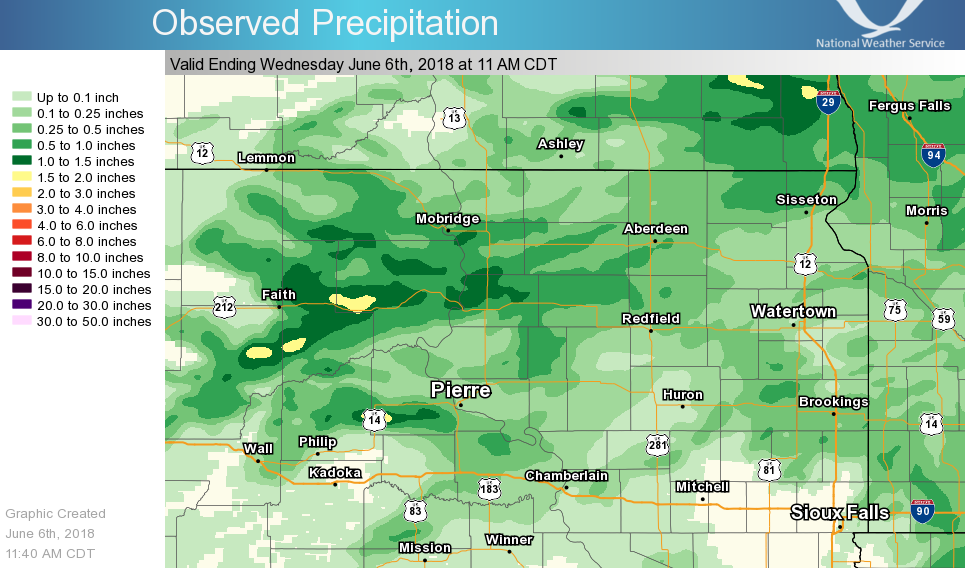
Rain Reports
 |
Media use of NWS Web News Stories is encouraged! Please acknowledge the NWS as the source of any news information accessed from this site. |
|

