Overview
|
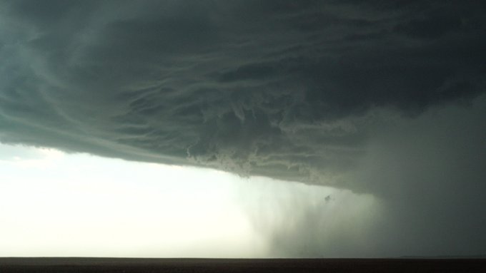
A low pressure system and attached cold front triggered storms in a ripe environment across southern North Dakota during the mid-afternoon, and these storms quickly became strong to severe. Through the remainder of the afternoon and evening, these storms maintained their strong to severe intensity and even became destructive in some areas as they drifted southeast across the border into South Dakota. Extensive crop and property damage resulted from up to 80 mph wind gusts and/or large hail to baseball sized plus across portions of Corson, Dewey, Walworth, Potter, Sully, Hughes and Lyman Counties. Two rounds of severe storms about an hour apart affected those roughly from Blunt to Lower Brule to Iona. As storms continued south of the NWS Aberdeen forecast area into Gregory county in south central South Dakota, a tornado rapidly developed in the town of Burke. This EF-1 tornado produced significant damage to portions of the city center. For more information, visit this summary page from NWS Sioux Falls. |
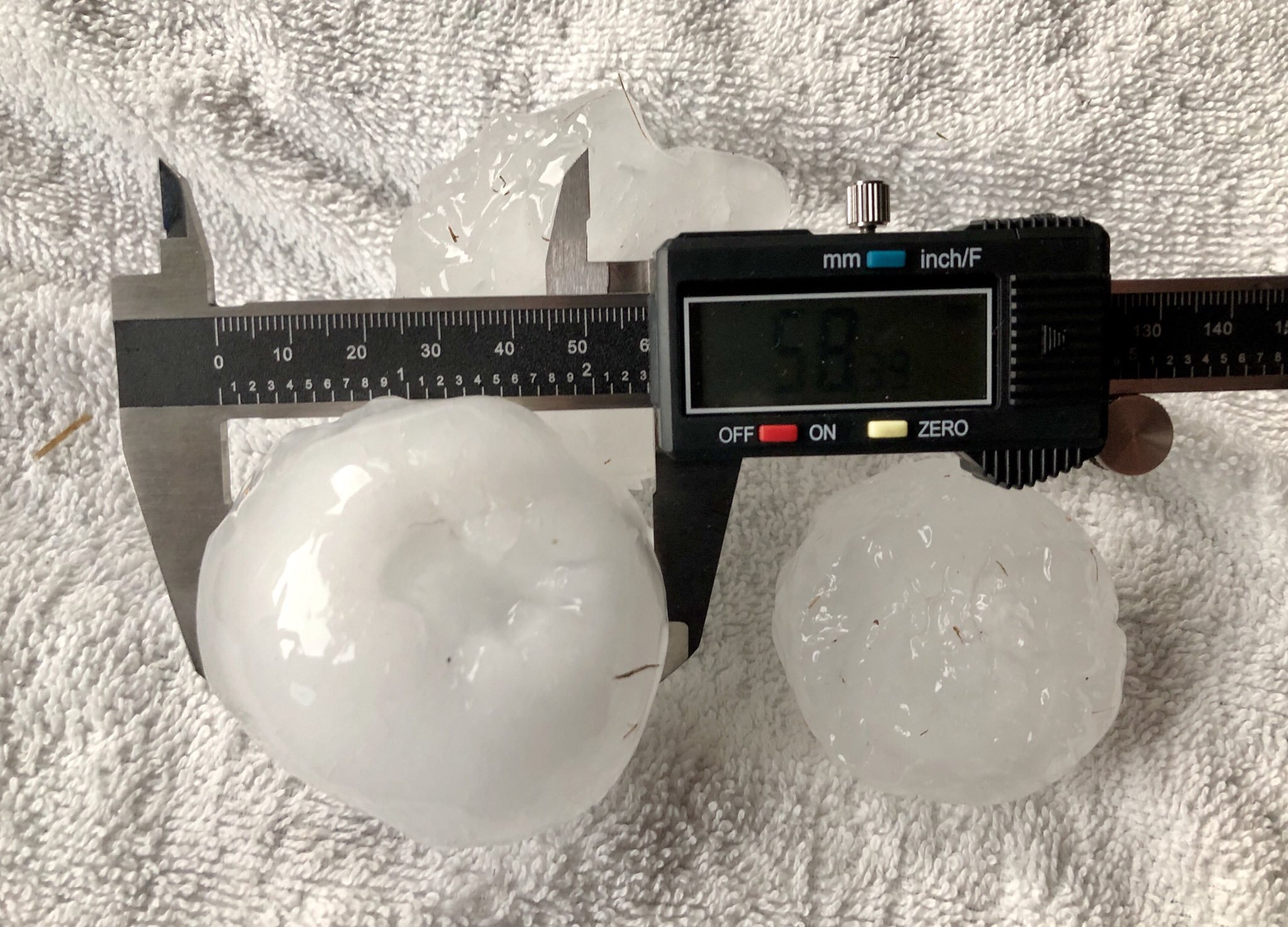 2.3" Hail one mile west of Blunt, SD (Credit Derek Thompson) |
Photos & Video
 |
 |
 |
 |
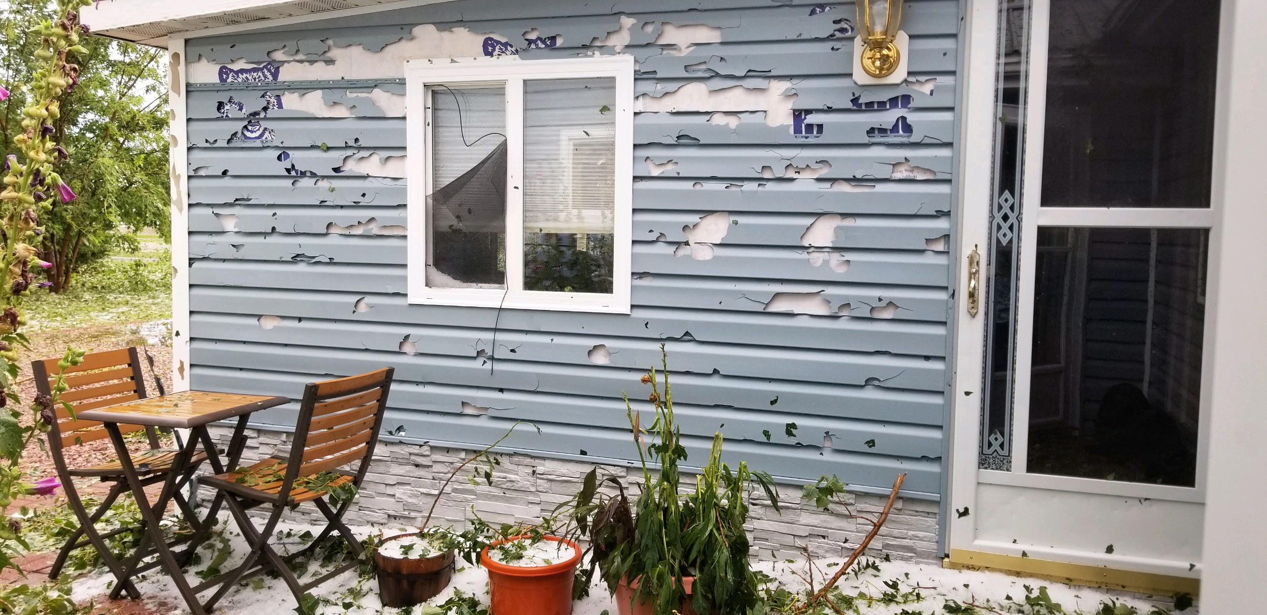
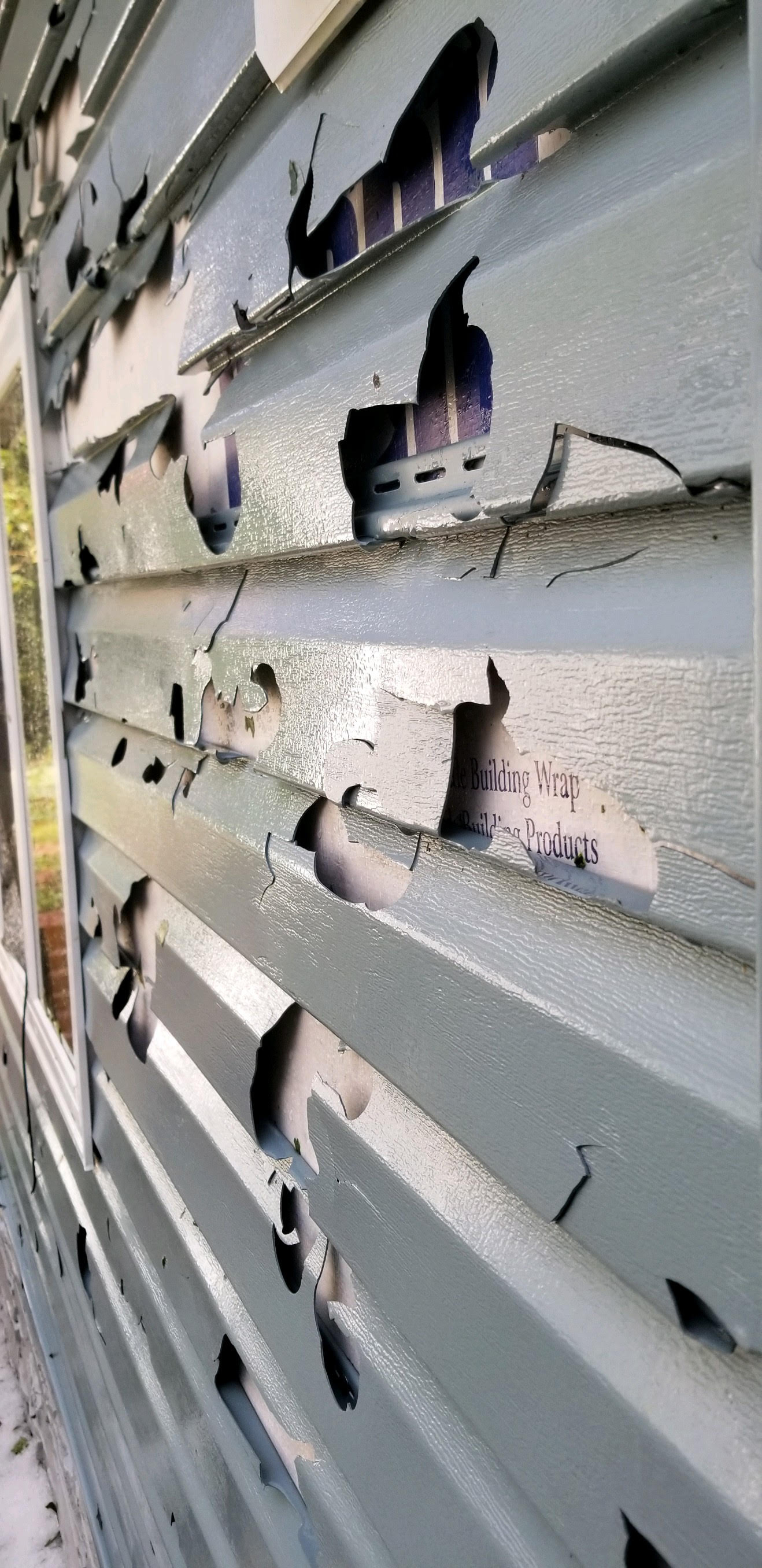
| Whitlock Bay area - Hail damaged the siding of a house (Credit - Beaty Hanson) |
Whitlock Bay area - Hail damaged the siding of a house (Credit - Beaty Hanson) |
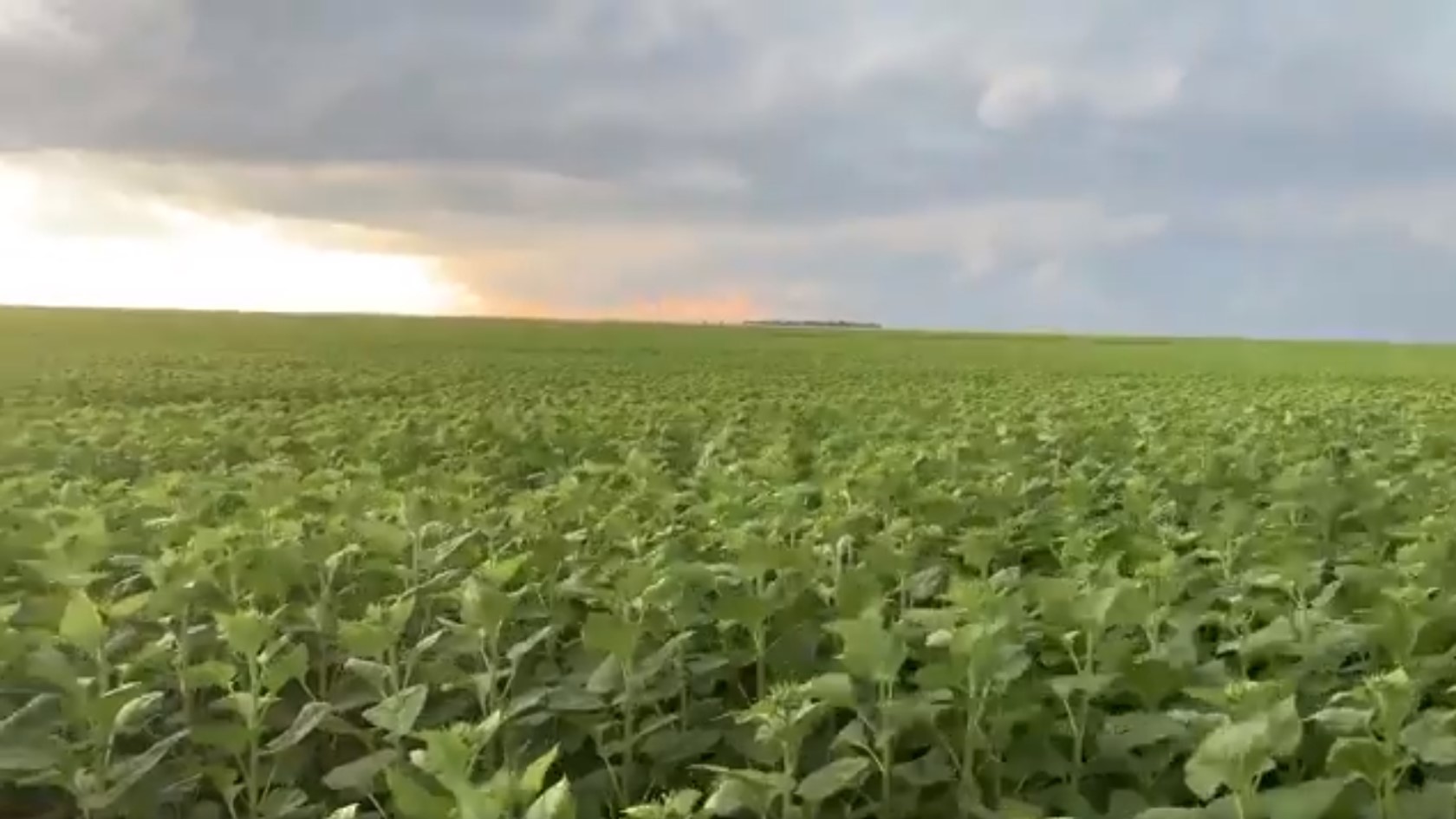
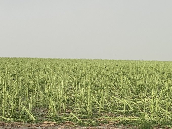
Sunflower field before the storm hit - northwest of Agar, SD (Credit - Todd Yackley) |
The same sunflower field (northwest of Agar, SD) after the storm moved through (Credit - Todd Yackley) |
 |
 |
 |
 |
| Damaged soybeans 8 miles south of Pollock on Highway 1804 (Credit Brent Odde) |
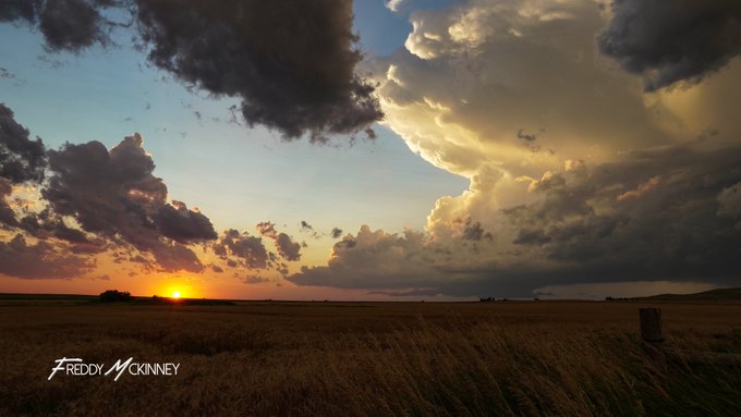
3" Hail near Stephan, SD (Credit - Freddy McKinney) |
Baseball sized hail near Blunt, SD (Credit - Valerie Marso) |
Hail from southeast of Blunt, SD (Credit - Penny Norris) |
 |
 |
 |
 |
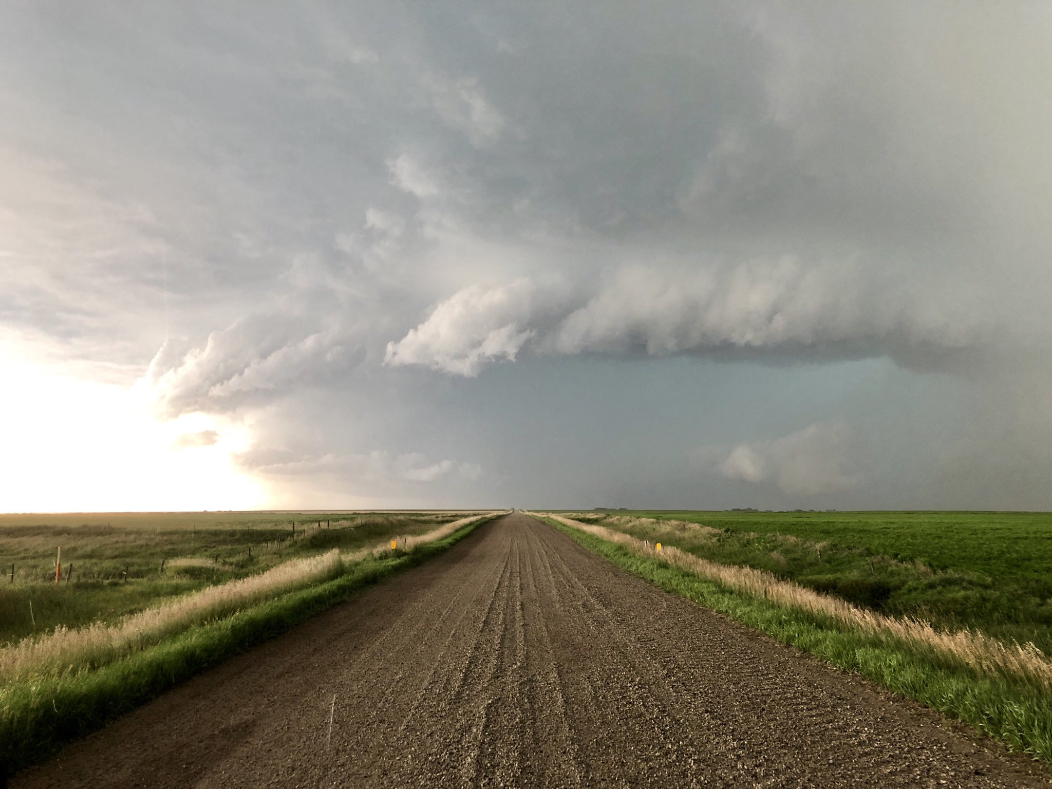
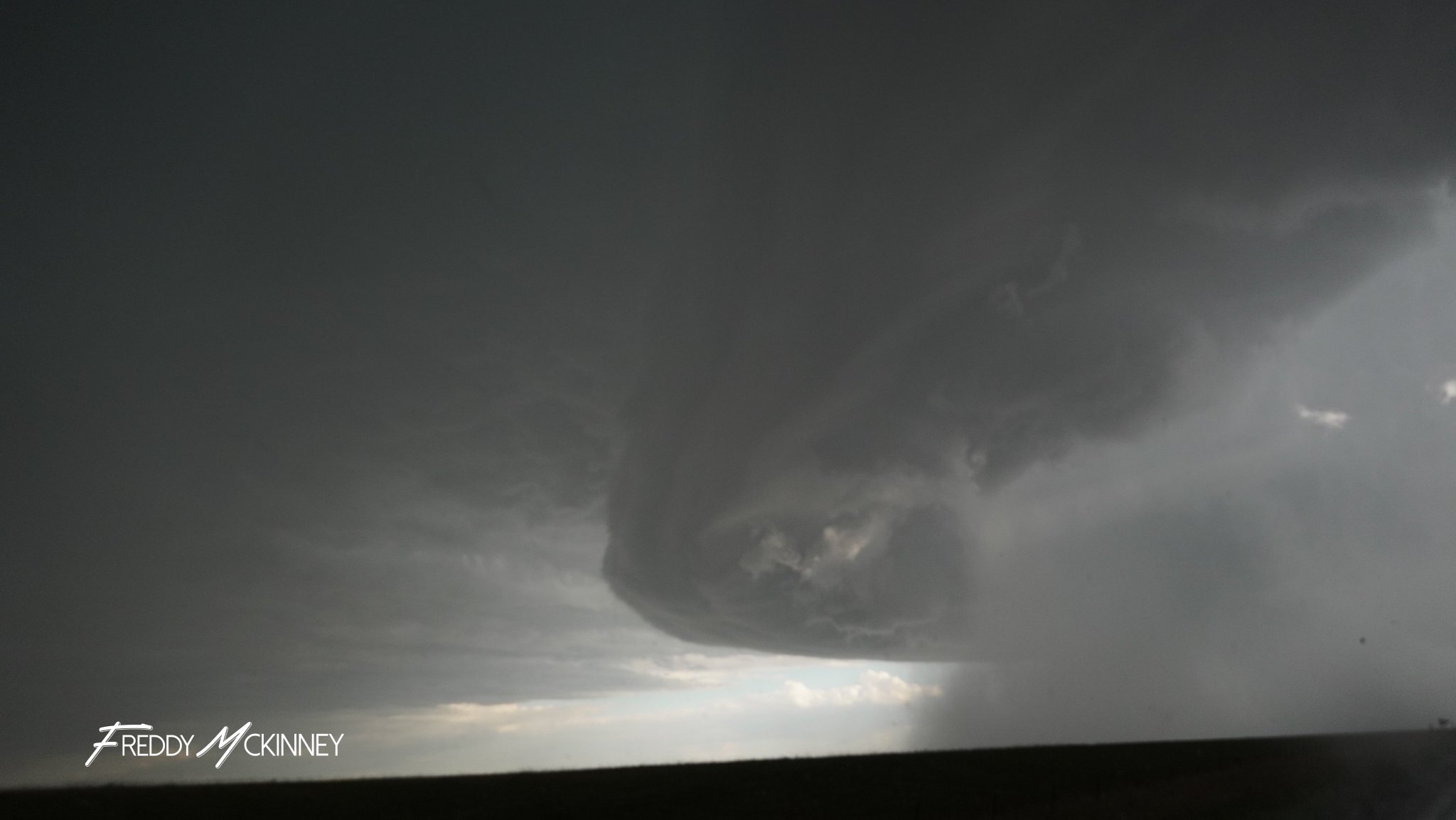
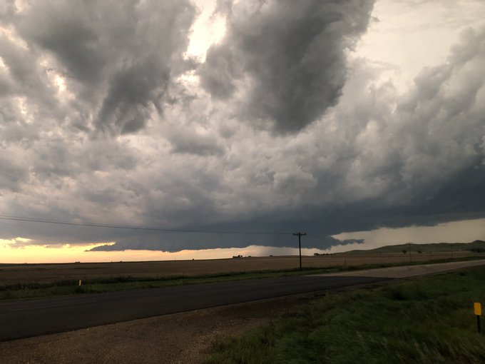
| Windshield damage from 2.4" diameter hail 1W of Blunt. Courtesy of Derek Thompson | Supercell thunderstorm 10SW of Gettysburg. Courtesy of Derek Thompson | Supercell thunderstorm near Stephan. Courtesy of Freddy McKinney | Supercell thunderstorm near Stephan. Courtesy of Freddy McKinney |
 |
 |
 |
 |
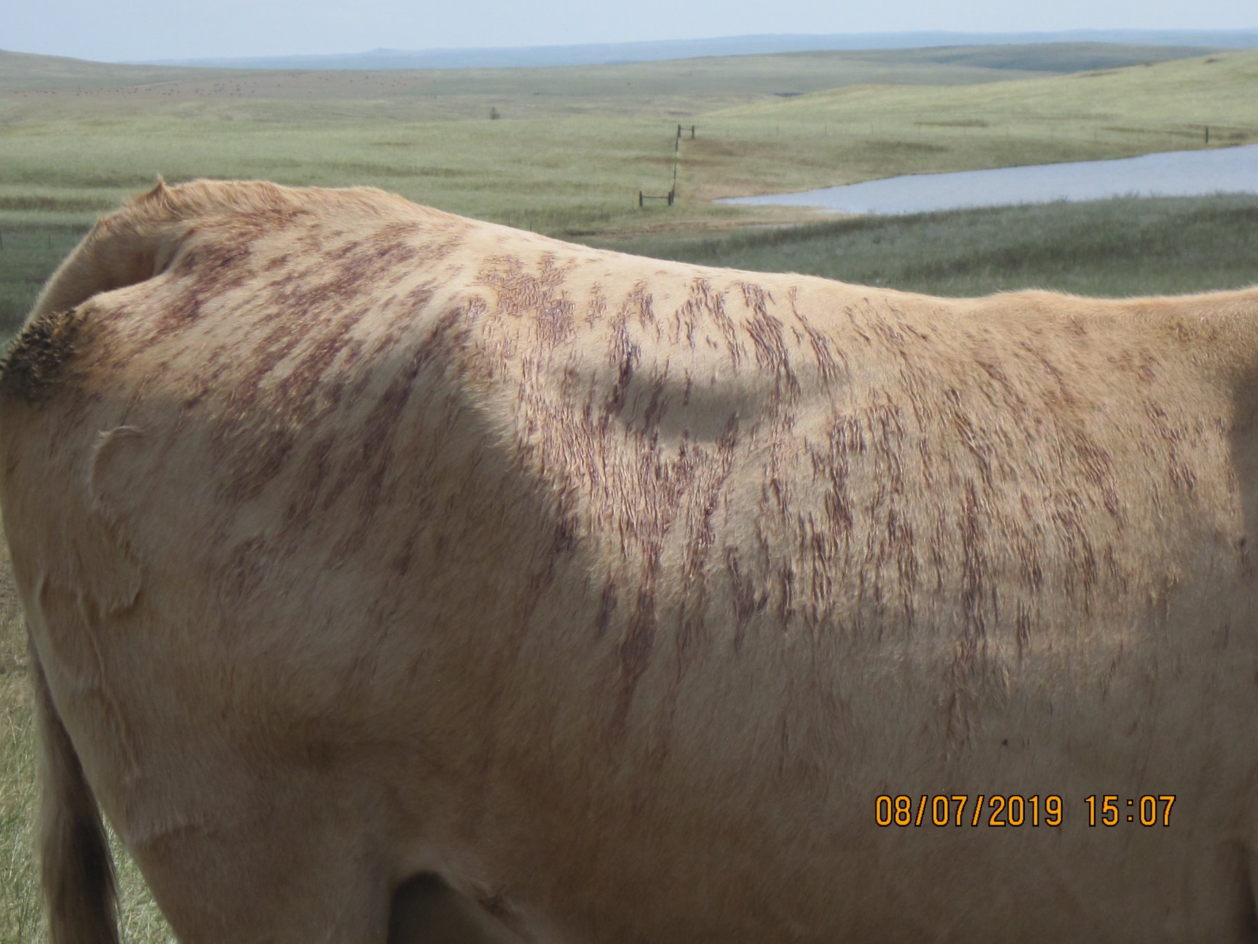
| Cattle southwest of Mobridge were bruised after enduring the hail storm. Photo Courtesy of Mark Landis. | Cattle southwest of Mobridge were bruised after enduring the hail storm. Photo Courtesy of Mark Landis. | Cattle southwest of Mobridge were bruised after enduring the hail storm. Photo Courtesy of Mark Landis. | Cattle southwest of Mobridge were bruised after enduring the hail storm. Photo Courtesy of Mark Landis. |
 |
.jpg) |
 |
 |
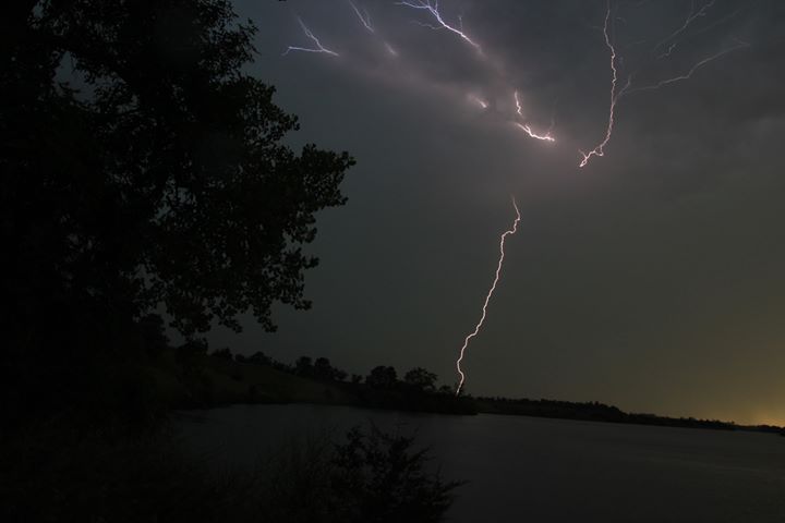
| Cloud-to-ground lightning strike as seen from Richmond Lake. Courtesy of Mike Scott | Mammatus clouds at sunset as seen from Richmond Lake. Courtesy of Mike Scott | Supercell thunderstorm near Stephan. Courtesy of Freddy McKinney | Supercell thunderstorm near Stephan. Courtesy of Freddy McKinney |
Radar & Satellite
 |
|
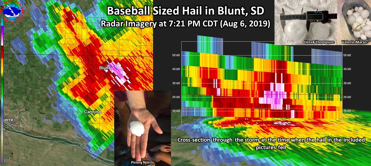
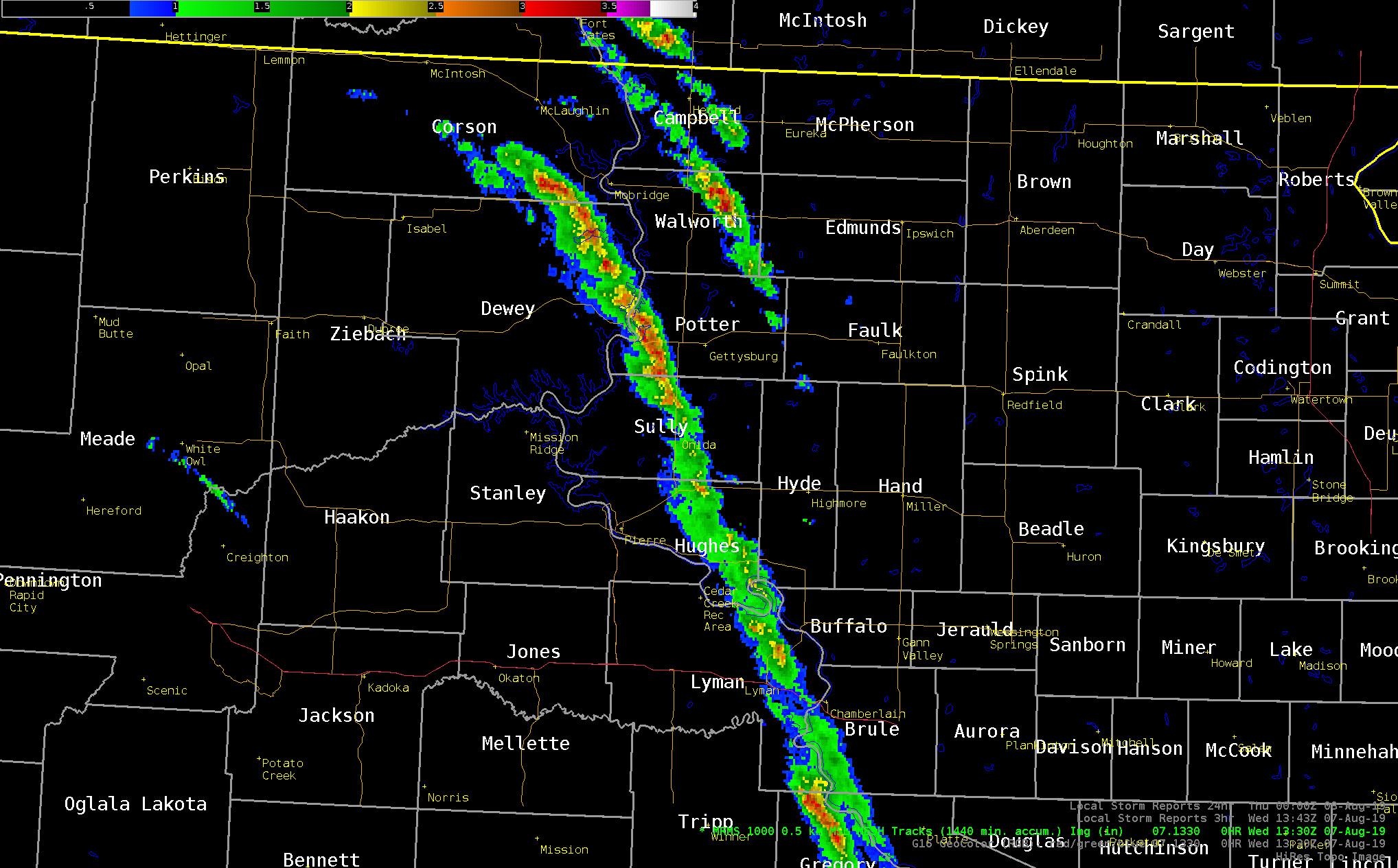
| Radar loop of the event, running from 2:21 PM to 11:00 PM CDT on August 6th, 2019. | Radar imagery and cross-section of the storm when it moved through Blunt, SD (7:21 PM CDT - August 6, 2019). At that time, hail to the size of baseballs fell and the storm was over 50,000 feet tall. |
| 1 Minute GOES-East satellite loop of the event, running from 2:30 PM to 10:30 PM CDT on August 6th, 2019. This "Sandwich" product combines visible and infrared satellite imagery to allow forecasters to see the increased storm details from the visible imagery with temperature information from the top of the storm in the infrared imagery. |
| GOES-East Visible Imagery of Severe Thunderstorms in South Dakota on August 6, 2019. The loop runs from 2:15 PM to 9:15 PM CDT. |
Storm Reports
 |
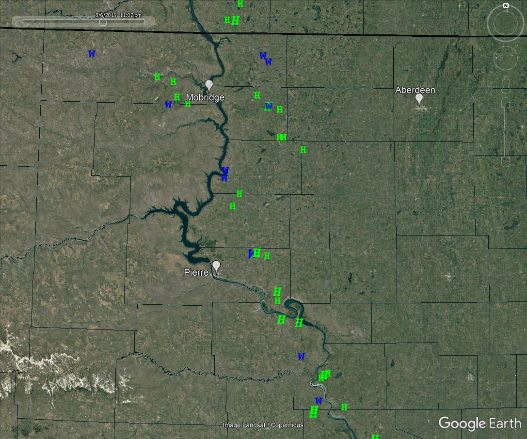 |
| The "Radar Hail Tracks" portion of this graphic shows the areas that saw roughly from 1" to 3" diameter hail across central South Dakota. This, combined with high winds, left a scar on vegetation which dried out and died in as little as 2 days following the storm, as seen on Visible Satellite from space. Click to enlarge. | Map of the hail and wind reports listed below. Click to enlarge. Find an interactive map version of reports here. |
LSRABR

PRELIMINARY LOCAL STORM REPORT...SUMMARY
NATIONAL WEATHER SERVICE ABERDEEN SD
207 PM CDT WED AUG 7 2019

..TIME...   ...EVENT...      ...CITY LOCATION...     ...LAT.LON...
..DATE...   ....MAG....      ..COUNTY LOCATION..ST.. ...SOURCE....
            ..REMARKS..

0720 PM     TSTM WND GST     1 WSW BLUNT             44.51N 100.01W
08/06/2019  M78 MPH          HUGHES             SD   STORM CHASER

            ALSO MEASURED 2.4 INCH HAIL 20 MINUTES AFTER
            IT FELL.

0623 PM     TSTM WND GST     WHITLOCKS BAY REC AREA  45.05N 100.27W
08/06/2019  M70 MPH          POTTER             SD   PUBLIC

            1.75 INCH HAIL ALSO REPORTED.

0845 PM     TSTM WND GST     3 SE RELIANCE           43.85N 99.56W
08/06/2019  M64 MPH          LYMAN              SD   MESONET

            DOT RWIS.

0915 PM     TSTM WND GST     LOWER BRULE             44.07N 99.58W
08/06/2019  E60 MPH          LYMAN              SD   FIRE DEPT/RESCUE


0733 PM     TSTM WND GST     2 S JAVA                45.47N 99.88W
08/06/2019  E60 MPH          WALWORTH           SD   EMERGENCY MNGR


0635 PM     TSTM WND GST     7 ESE HERREID           45.80N 99.94W
08/06/2019  E60 MPH          CAMPBELL           SD   PUBLIC

            3 INCH DIAMETER BRANCH DOWN. A FEW QUARTER
            SIZE HAIL, BUT MOSTLY DIME TO NICKEL SIZE.

0400 PM     TSTM WND GST     9 S WATAUGA             45.79N 101.54W
08/06/2019  E60 MPH          CORSON             SD   PUBLIC

            BRIEF HAIL BETWEEN NICKEL AND QUARTER SIZE.

0504 PM     TSTM WND GST     4 W TRAIL CITY          45.47N 100.81W
08/06/2019  M59 MPH          DEWEY              SD   MESONET


0625 PM     TSTM WND GST     2 N HERREID             45.87N 100.08W
08/06/2019  M57 MPH          CAMPBELL           SD   MESONET


0748 PM     HAIL             8 NNW WEST BEND REC ARE 44.27N 99.78W
08/06/2019  M3.00 INCH       HUGHES             SD   STORM CHASER

            MANY HAIL STONES EXCEEDING 3 INCHES IN SIZE.

0915 PM     HAIL             LOWER BRULE             44.07N 99.58W
08/06/2019  E2.75 INCH       LYMAN              SD   FIRE DEPT/RESCUE

            TENNIS BALL TO BASEBALL SIZE HAIL. WINDOW
            DAMAGE TO VEHICLES AND HOMES.

0805 PM     HAIL             5 SE JOE CREEK REC AREA 44.09N 99.74W
08/06/2019  E2.75 INCH       LYMAN              SD   TRAINED SPOTTER

            MOSTLY GOLF BALL SIZE HAIL WITH A FEW
            BASEBALL SIZE.

0730 PM     HAIL             2 S JAVA                45.47N 99.88W
08/06/2019  E2.75 INCH       WALWORTH           SD   TRAINED SPOTTER

            MOSTLY GOLF BALL SIZE HAIL. VEHICLE WINDOWS
            SHATTERED.

0721 PM     HAIL             1 E BLUNT               44.52N 99.97W
08/06/2019  M2.75 INCH       HUGHES             SD   TRAINED SPOTTER

            GOLF BALL TO BASEBALL SIZED HAIL FELL FROM 1
            MILE WEST TO 1 MILE EAST OF BLUNT. SEVERAL
            REPORTS OF WINDOWS AND SIDING BROKEN. TREE
            LIMBS DOWN. WINDS ESTIMATED 60 TO 65 MPH.

1004 PM     HAIL             3 SSW IONA              43.50N 99.44W
08/06/2019  U2.00 INCH       LYMAN              SD   PUBLIC

            HAIL SIZE IS UNKNOWN, BUT IT WAS LARGE
            ENOUGH TO DAMAGE SIDING, BREAK WINDOWS, AND
            SEVERELY DAMAGE CROPS. RADAR ESTIMATED TIME.

0820 PM     HAIL             1 E BLUNT               44.52N 99.97W
08/06/2019  M1.75 INCH       HUGHES             SD   TRAINED SPOTTER


0643 PM     HAIL             6 W AGAR                44.82N 100.20W
08/06/2019  M1.75 INCH       SULLY              SD   TRAINED SPOTTER

            18 INCH DIAMETER TREE DOWN ON POWER LINES.

0639 PM     HAIL             4 WSW GORMAN            44.90N 100.14W
08/06/2019  M1.75 INCH       SULLY              SD   TRAINED SPOTTER

            ALL WINDOWS ON NORTH SIDE OF HOUSE BROKEN
            OUT.

0828 PM     HAIL             5 ESE BLUNT             44.50N 99.88W
08/06/2019  E1.25 INCH       HUGHES             SD   PUBLIC

            QUARTER TO HALF DOLLAR SIZE. NO APPARENT
            DAMAGE NOTICEABLE.

0750 PM     HAIL             3 NE HOVEN              45.27N 99.74W
08/06/2019  E1.25 INCH       WALWORTH           SD   PUBLIC

            MOSTLY QUARTER SIZE HAIL, SOME HALF DOLLAR
            SIZE. SOME GARDEN CROP DAMAGE.

0905 PM     HAIL             4 NW WEST BEND REC AREA 44.21N 99.78W
08/06/2019  E1.00 INCH       HUGHES             SD   PUBLIC


0810 PM     HAIL             3 ESE TOLSTOY           45.19N 99.56W
08/06/2019  M1.00 INCH       FAULK              SD   PUBLIC


0747 PM     HAIL             2 N HOVEN               45.27N 99.78W
08/06/2019  E1.00 INCH       WALWORTH           SD   PUBLIC


0740 PM     HAIL             6 W BOWDLE              45.45N 99.78W
08/06/2019  M1.00 INCH       WALWORTH           SD   EMERGENCY MNGR

            TIME ESTIMATED FROM RADAR.

0728 PM     HAIL             2 S JAVA                45.47N 99.88W
08/06/2019  E1.00 INCH       WALWORTH           SD   EMERGENCY MNGR

            MOSTLY DIME TO NICKEL SIZE HAIL WITH SOME
            QUARTER SIZE.

0718 PM     HAIL             3 NE SELBY              45.54N 99.99W
08/06/2019  M1.00 INCH       WALWORTH           SD   TRAINED SPOTTER

            OVER 60 MPH ESTIMATED AS WELL.

0524 PM     HAIL             5 E TRAIL CITY          45.48N 100.63W
08/06/2019  E1.00 INCH       CORSON             SD   PUBLIC

            40 MPH WIND ESTIMATE. CORN CROP WAS
            STRIPPED.

0500 PM     HAIL             3 N TRAIL CITY          45.52N 100.73W
08/06/2019  M1.00 INCH       CORSON             SD   PUBLIC

            DEPTH OF HAIL WAS 5 INCHES. CORN CROP WAS
            STRIPPED.

0445 PM     HAIL             5 SSE LITTLE EAGLE      45.62N 100.77W
08/06/2019  M1.00 INCH       CORSON             SD   PUBLIC

            GROUND BECAME WHITE WITH HAIL.

0425 PM     HAIL             6 WSW LITTLE EAGLE      45.65N 100.92W
08/06/2019  E1.00 INCH       CORSON             SD   PUBLIC

            MOST HAILSTONES BETWEEN NICKEL AND QUARTER
            SIZE.

0804 PM     HAIL             3 NNW TOLSTOY           45.25N 99.64W
08/06/2019  E0.88 INCH       EDMUNDS            SD   NWS EMPLOYEE


0502 PM     HAIL             10 N TIMBER LAKE        45.58N 101.04W
08/06/2019  M0.50 INCH       CORSON             SD   PUBLIC


0957 PM     TSTM WND DMG     2 NE IONA               43.56N 99.40W
08/06/2019                   LYMAN              SD   PUBLIC

            TREES DOWN, SHINGLES OFF HOMEOWNERS ROOF.
            RADAR ESTIMATED TIME.

0715 PM     FUNNEL CLOUD     4 SSE BLUNT             44.47N 99.97W
08/06/2019                   HUGHES             SD   STORM CHASER


0643 PM     TSTM WND DMG     9 ENE MOUND CITY        45.76N 99.89W
08/06/2019                   CAMPBELL           SD   PUBLIC

            GARDEN CROPS DAMAGED AND SOME FLATTENED.

0625 PM     TSTM WND DMG     3 SSW WHITLOCKS BAY REC 45.00N 100.28W
08/06/2019                   POTTER             SD   PUBLIC

            WINDS ESTIMATED AT AT LEAST 80 MPH. HAIL AS
            LARGE AS TENNIS BALLS, ALTHOUGH MOST WERE
            SMALLER. HAIL ACCUMULATED IN DRIFTS THAT
            WERE 7 TO 8 INCHES DEEP. WIND DRIVEN HAIL
            SHREDDED SIDING, MANY WINDOWS BROKEN. TREES
            WERE BOTH UPROOTED AND BROKEN AT THE TRUNK
            AND MANY VERY LARGE BRANCHES ARE DOWN. THE
            ROOF OF A NEARBY STORAGE UNIT WAS PARTIALLY
            TORN OFF.
 |
Media use of NWS Web News Stories is encouraged! Please acknowledge the NWS as the source of any news information accessed from this site. |
|

