
Widespread life-threatening flash and urban flooding continues in south-central Texas, with considerable flooding impacts possible across central Texas. Wildfire smoke is impacting air quality across much of the Great Lakes region into southern New England and the Mid-Atlantic. Monsoonal thunderstorms may produce isolated to scattered flash flooding across the Southwest into the Great Basin. Read More >
Thunderstorms developed across northwestern South Dakota around 4 pm on Friday, July 31st and then spread and developed further south and east through the evening across much of central South Dakota and into western portions of the James River Valley. Even though not all the typical ingredients for severe thunderstorms were in place, relatively dry air in the lower levels of the atmosphere promoted the development of strong to severe wind gusts of 50-80 mph. Often times, these winds were associated with thunderstorm outflow boundaries, which can race well out ahead of the parent thunderstorm. Thus, even though the sky doesn't darken and rain/lightning isn't present, damaging winds can still occur. Find more information below.
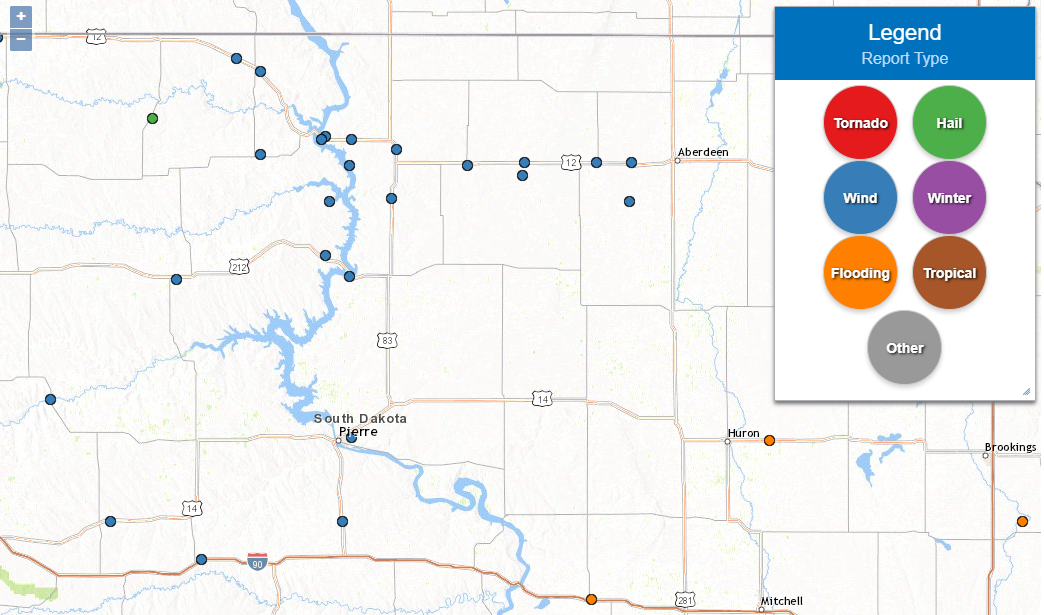
Latest storm reports map, from https://t.co/ehBn2PHvPz
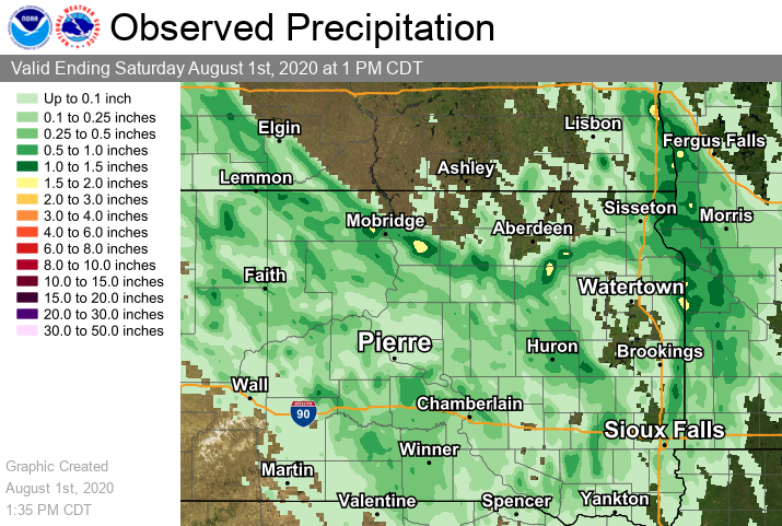
Observed rainfall (radar-estimated)
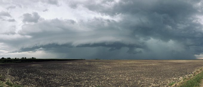
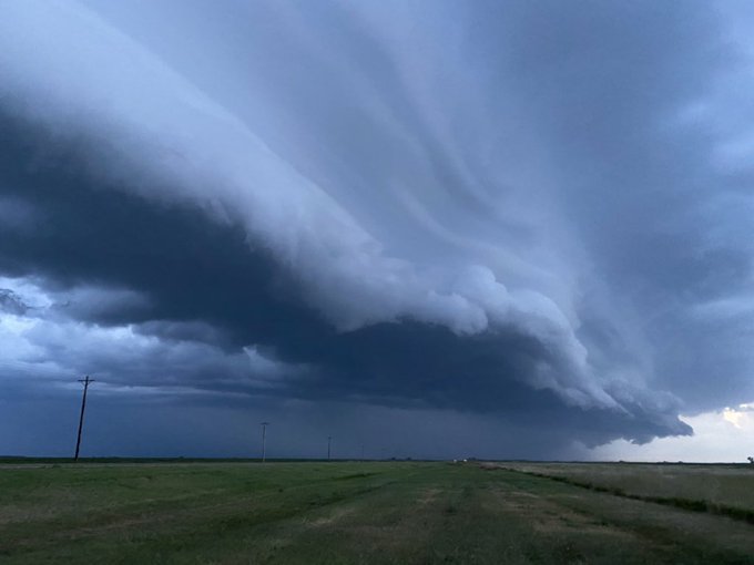
Photos from Redfield at 8:30 pm courtesy of Derek Thompson (left) and from just north of Doland courtesy of Alex Resel (right)
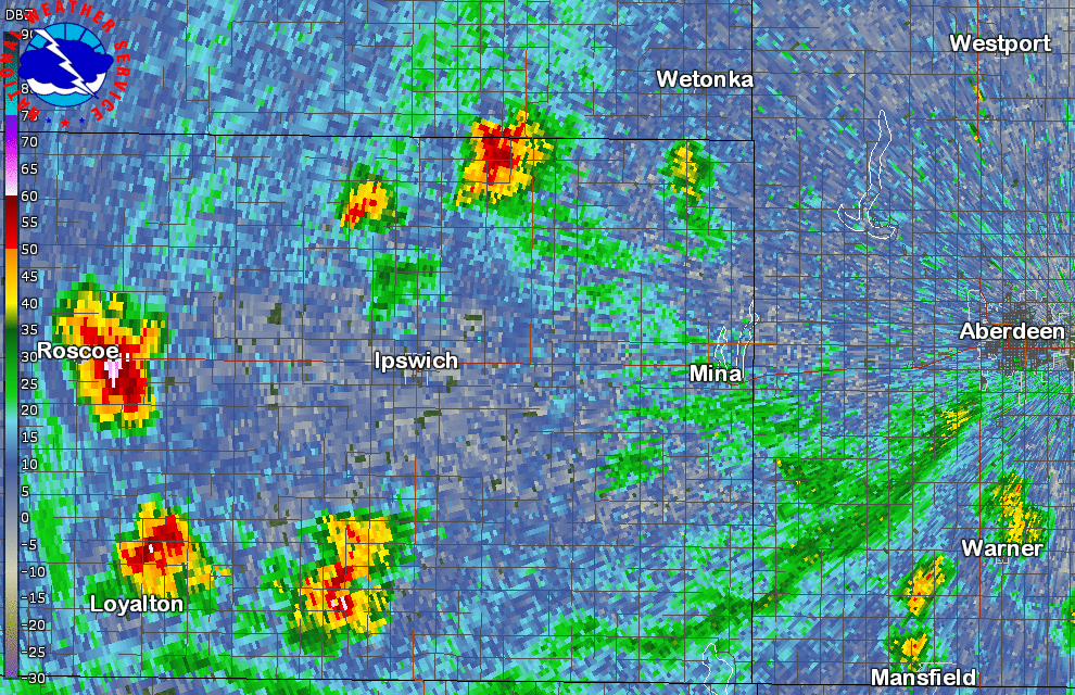
Radar reflectivity loop (7:11 to 7:51 pm CDT) of the storm that produced a measured 78 mph wind gust at Craven's Corner at 7:39 pm CDT. Outflow boundaries (fine lines coming out from this storm and others further west) are clearly visible, and indicate the leading edge of strong winds.
Listing of storm reports below
..TIME... ...EVENT... ...CITY LOCATION... ...LAT.LON...
..DATE... ....MAG.... ..COUNTY LOCATION..ST.. ...SOURCE....
..REMARKS..
0700 PM Tstm Wnd Gst Selby 45.50N 100.03W
07/31/2020 E70 MPH Walworth SD Law Enforcement
0630 PM Tstm Wnd Gst 1 WNW Glenham 45.54N 100.28W
07/31/2020 E65 MPH Walworth SD Law Enforcement
0624 PM Tstm Wnd Gst 4 ESE Akaska 45.31N 100.06W
07/31/2020 M59 MPH Walworth SD Mesonet
Mesonet station 209 Lowry (SDDOT).
0616 PM Tstm Wnd Gst 1 NE Mobridge 45.55N 100.42W
07/31/2020 M68 MPH Walworth SD ASOS
ASOS station KMBG Mobridge Muni AP.
0612 PM Tstm Wnd Gst 7 S Glenham 45.44N 100.29W
07/31/2020 E60 MPH Walworth SD NWS Employee
Winds over 60 mph.
0604 PM Tstm Wnd Dmg Mobridge 45.54N 100.44W
07/31/2020 Walworth SD Public
Power lines down. Time estimated by radar and Mobridge Airport wind gust.
0620 PM Tstm Wnd Gst 3 SSW Whitlocks Bay Rec 45.01N 100.29W
07/31/2020 M55 MPH Potter SD Mesonet
Mesonet station 157 Forest City (SDDOT).
0724 PM Tstm Wnd Gst 9 NNW Vivian 44.05N 100.33W
07/31/2020 M58 MPH Lyman SD Mesonet
Mesonet station 13 Vivian (SDDOT).
0657 PM Tstm Wnd Gst 2 ENE Pierre 44.38N 100.28W
07/31/2020 M69 MPH Hughes SD ASOS
ASOS station KPIR Pierre Muni AP.
0830 PM Tstm Wnd Gst 9 N Chelsea 45.30N 98.75W
07/31/2020 E60 MPH Edmunds SD Trained Spotter
Tree limbs down.
0825 PM Tstm Wnd Gst 1 NE Mina 45.45N 98.74W
07/31/2020 M56 MPH Edmunds SD Mesonet
0739 PM Tstm Wnd Gst Cravens Corner 45.45N 98.93W
07/31/2020 M78 MPH Edmunds SD Mesonet
Mesonet station 173 Craven (SDDOT).
0730 PM Tstm Wnd Gst Roscoe 45.45N 99.33W
07/31/2020 M56 MPH Edmunds SD Emergency Mngr
0714 PM Tstm Wnd Gst 1 ESE Bowdle 45.44N 99.64W
07/31/2020 M59 MPH Edmunds SD Mesonet
Mesonet station 216 Bowdle (SDDOT).
0710 PM Tstm Wnd Gst 3 S Roscoe 45.40N 99.34W
07/31/2020 E70 MPH Edmunds SD Trained Spotter
70 plus mph wind gusts from the outflow of a thunderstorm just northeast of this
location. Radar estimated time.
0602 PM Tstm Wnd Gst 8 WNW Whitlocks Bay Rec 45.09N 100.42W
07/31/2020 E60 MPH Dewey SD Public
Radar estimated time.
0557 PM Tstm Wnd Gst 7 W Swan Creek Rec Area 45.30N 100.40W
07/31/2020 M56 MPH Dewey SD Public
Radar estimated time.
0530 PM Tstm Wnd Gst Eagle Butte 45.00N 101.24W
07/31/2020 E55 MPH Dewey SD Public
0550 PM Tstm Wnd Gst 2 SE Mclaughlin 45.80N 100.78W
07/31/2020 M56 MPH Corson SD Mesonet
Mesonet station MHTS2 McLaughlin 2 SE (SD Mesonet).
0544 PM Tstm Wnd Gst 5 WNW Mclaughlin 45.85N 100.91W
07/31/2020 M71 MPH Corson SD Mesonet
Mesonet station 205 McLaughlin (SDDOT).
0525 PM Tstm Wnd Gst 2 WNW Trail City 45.48N 100.78W
07/31/2020 E65 MPH Corson SD Public
Estimated 60-70 mph winds along with pea to quarter sized hail. Radar estimated time.
0452 PM Hail 3 SSW Klein Ranch 45.62N 101.37W
07/31/2020 E1.75 inch Corson SD Public

