Weather History - February 12th
Local and Regional Events:
February 12, 1905:
On this date in weather history, record low temperatures occurred across northeast South Dakota and west-central Minnesota, with lows in the 30s below zero. Sisseton, Aberdeen, and Watertown all had record lows. Sisseton fell to 31 degrees below zero, Watertown saw 35 degrees below zero, and Aberdeen dropped to 36 degrees below zero in 1905. In central South Dakota, Kennebec fell to 34 degrees below zero.
U.S.A and Global Events for February 12th:
1784: Ice floes were spotted in the Gulf of America after passing out the Mississippi River in February 1784. Ice blocked the river in New Orleans, Louisiana. The ice in New Orleans is one of two times that this occurred during the Great Arctic Outbreak of 1899. The eruption of Laki in Iceland from June 8, 1783, through February 7, 1784, is the likely cause for the severe winter of 1783 - 1784. Click HERE for more information from the Ultimate History Project.
 T
T
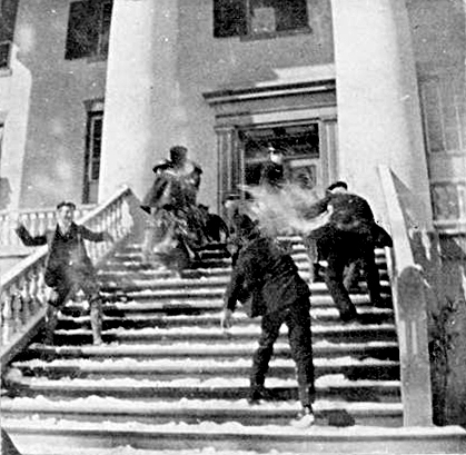
1899: The bitter cold outbreak of February 1899 continued across the southern Plains, Texas, and the Deep South. The mercury dipped to 8 degrees below zero at Fort Worth, Texas, and 22 degrees below zero at Kansas City, Missouri. Nebraska’s temperature at Camp Clarke plunged to 47 degrees below zero to establish a state record. The all-time record low for Oklahoma City was set when the temperature fell to a frigid 17 degrees below zero, breaking the previous record low of 12 below zero, set on the previous day. Washington D.C. hit 15 degrees below zero, while Charleston, SC, received a record four inches of snow. Snow was also reported in Fort Myers, Tampa, and Tallahassee in Florida. Click the links for additional information from the National Centers for Environmental Information and Florida Memory.
]
The image above is a snowball fight on the steps of the Florida Capitol building.
1958: Snow blanketed northern Florida, with Tallahassee reporting a record 2.8 inches. A ship in the Gulf of America, 25 miles south of Fort Morgan, Alabama, reported zero visibility in heavy snow on the afternoon of the 12th.

2017: There was an imminent failure of the auxiliary spillway on the Oroville Dam in California.
6:08pm: #OrovilleDam itself is not compromised at current time. Failure would be on auxiliary spillway. See graphic for details. pic.twitter.com/LSxCwsthxC
— NWS Sacramento (@NWSSacramento) February 13, 2017
Click HERE for more This Day in Weather History from the Southeast Regional Climate Center.