
Dangerous heat will expand from the Gulf Coast into the Southern Plains and Desert Southwest through week's end. Additional extreme heat impacting the Pacific Northwest will shift to the northern Plains by the weekend. Tropical Storm Bertha is expected to continue to impact portions of the northern Gulf Coast from the western Florida Panhandle to southeastern Louisiana through tonight. Read More >
|
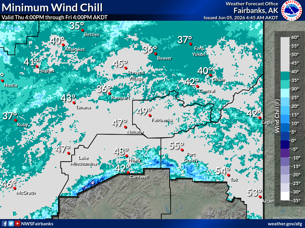
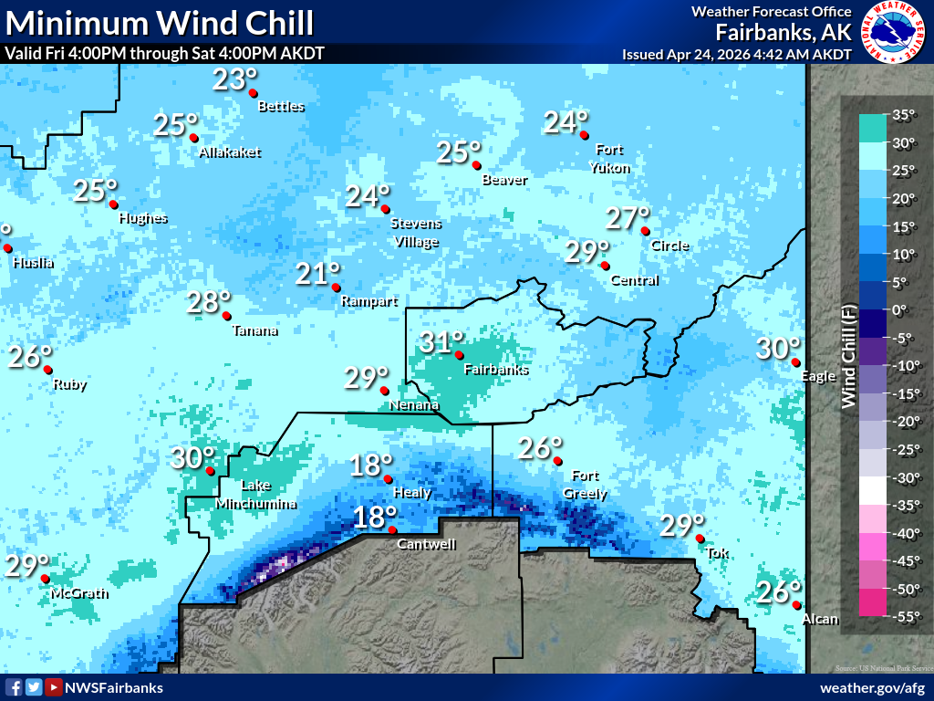
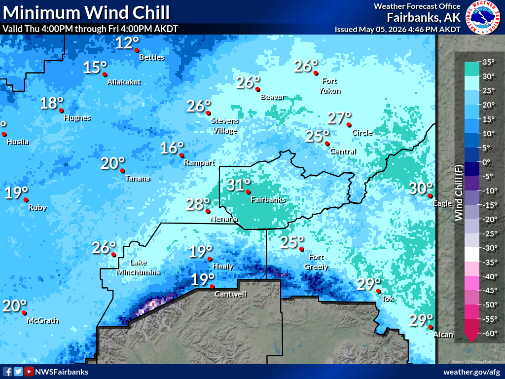
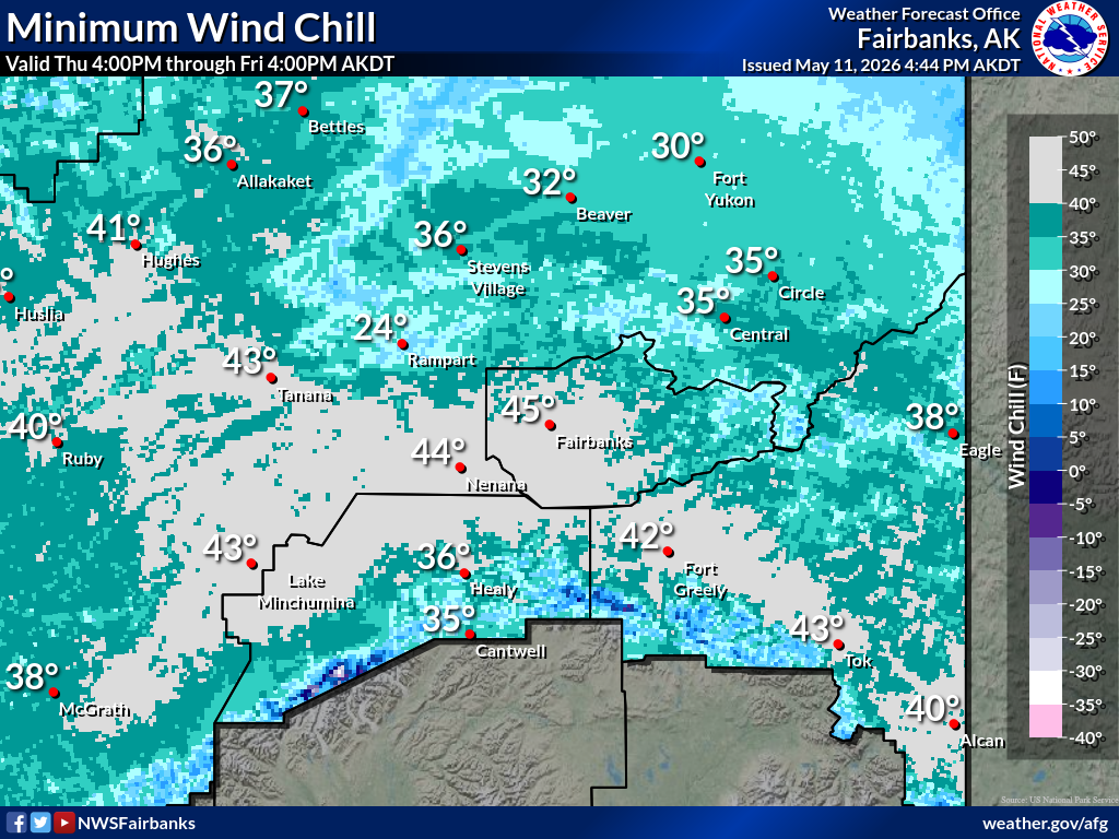
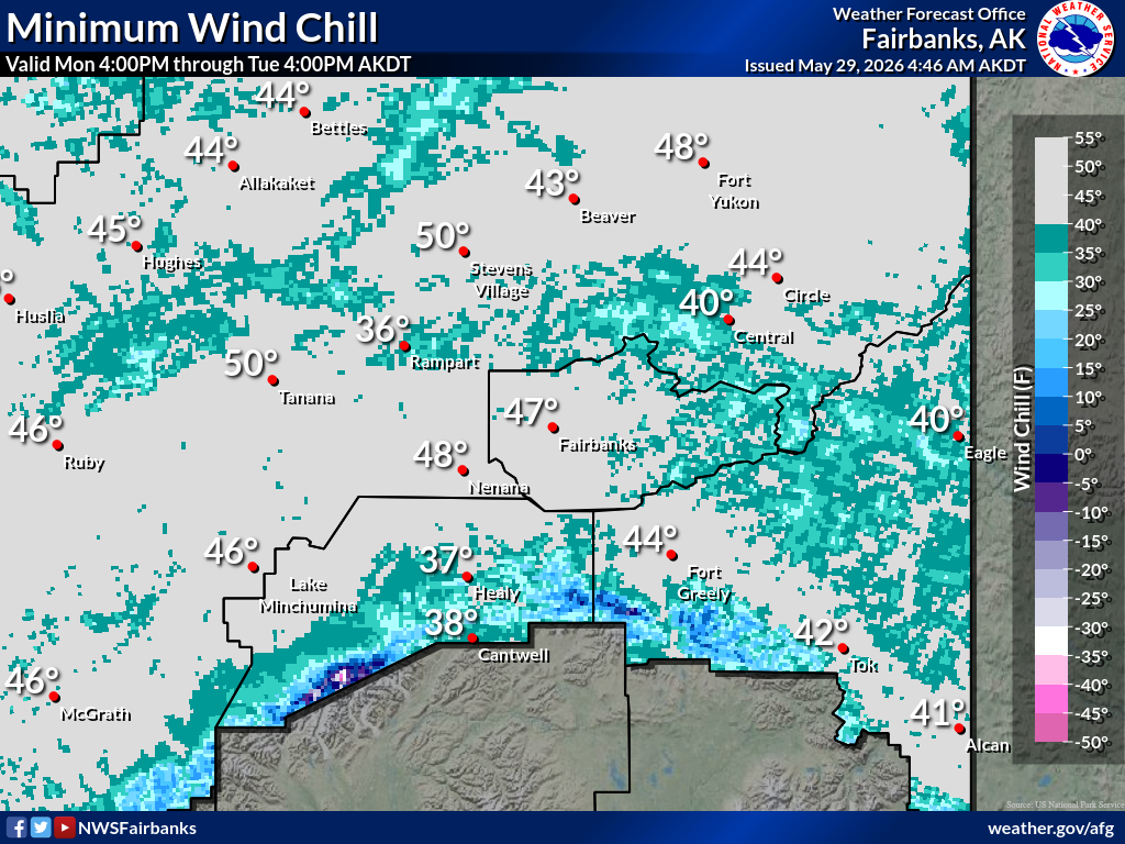
Min |
 |
|
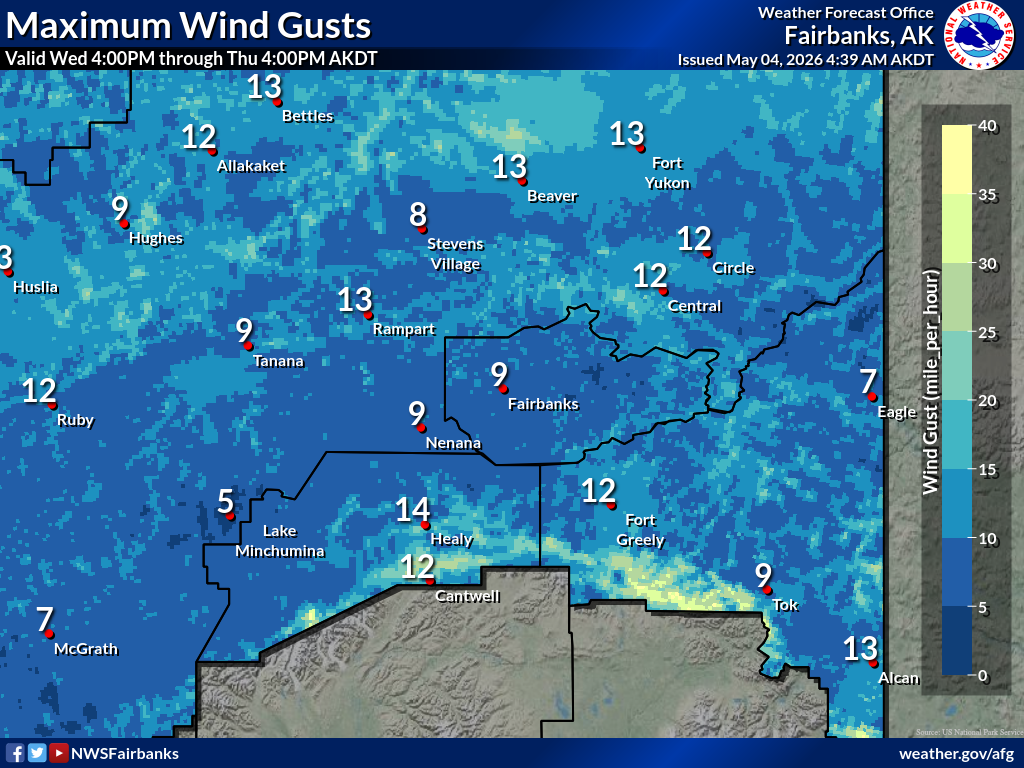
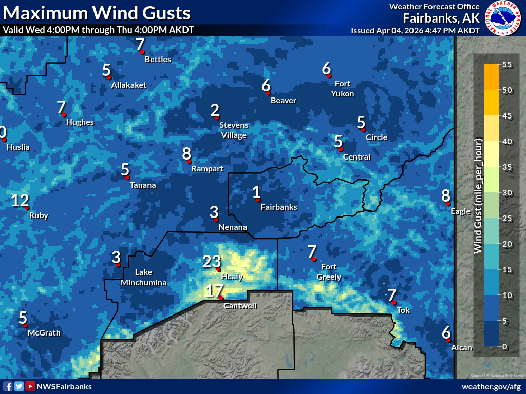
Maximuum
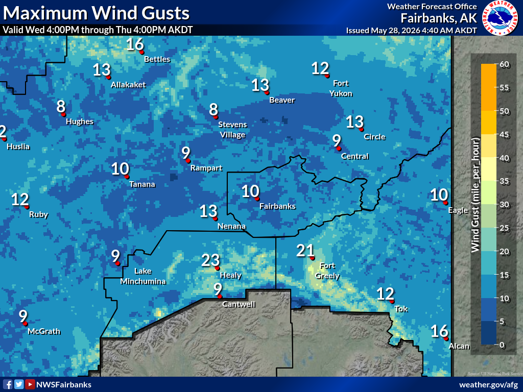
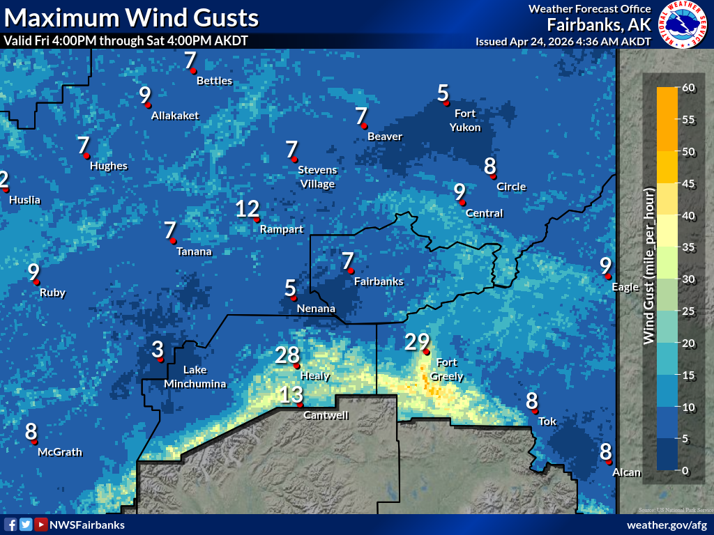
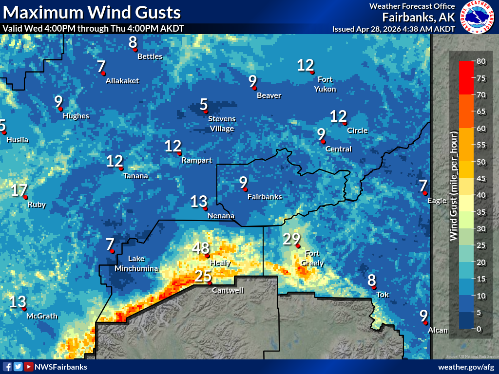
Maximum |
 |
|
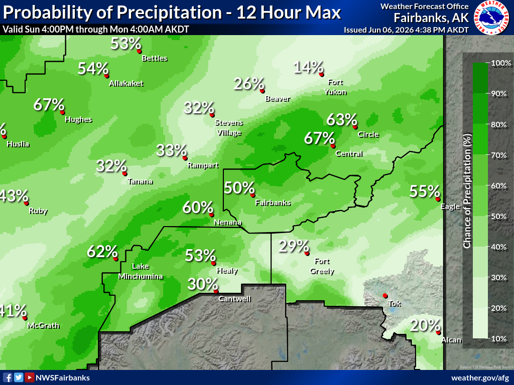
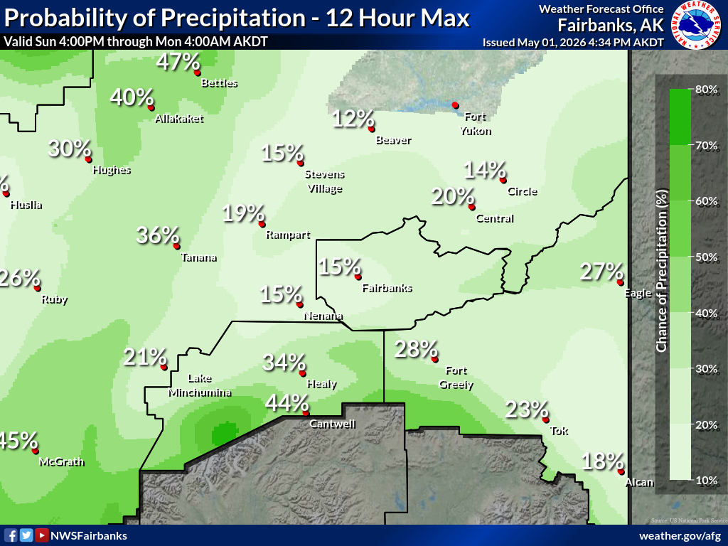
Precipitation
Precipitation |
 |
|
Probability |
 |
|
Snowfall
Snowfall |
 |
|
Ice Accum
Ice Accum |
 |
|
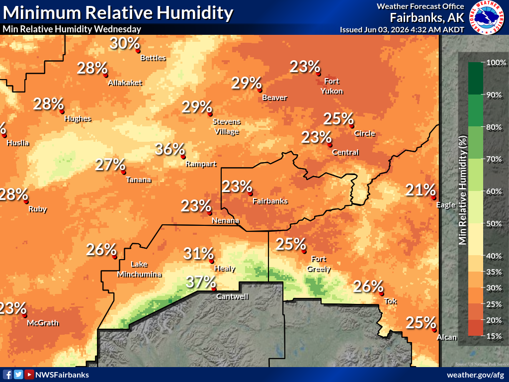
Min RH |
 |
|
Maximuum
Maximum |
|
|
Radar Current Current Current |
 |
|
Radar Current Current Current |
 |
|
Satellite.... |
 |
|
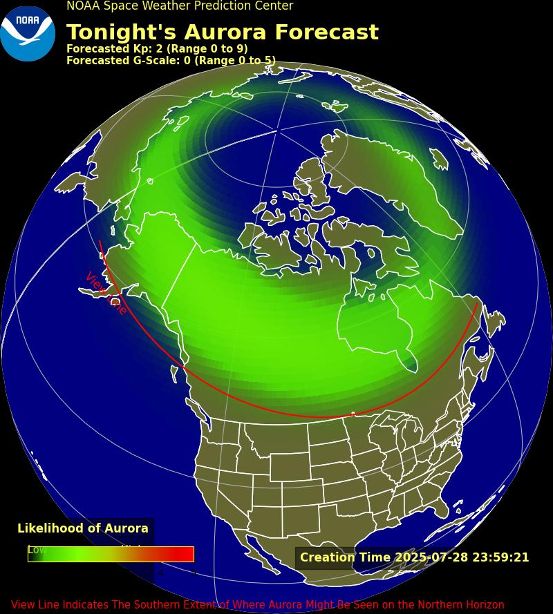
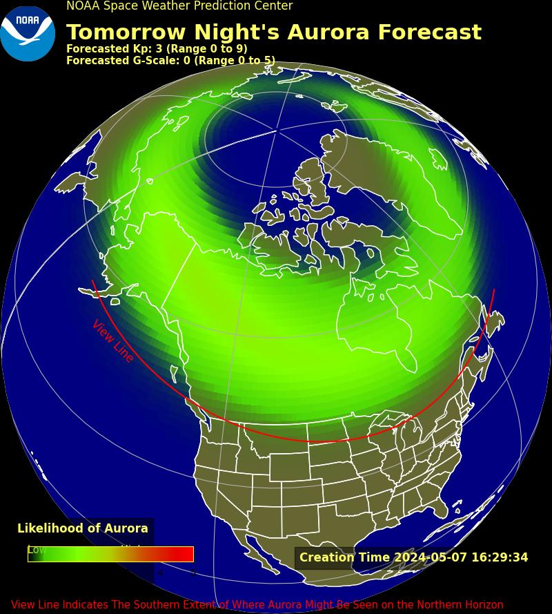
Aurora 30 Minute 3 Day 27 Day Planetary UAF Aurora |
 |
|
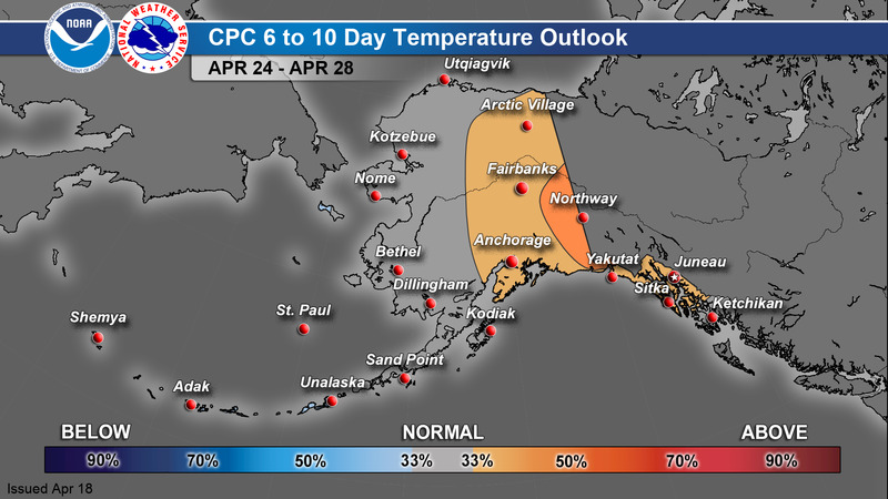
6-10 Day
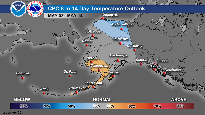
8-14 Day
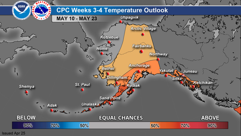
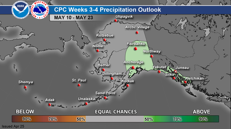
Weeks 3-4
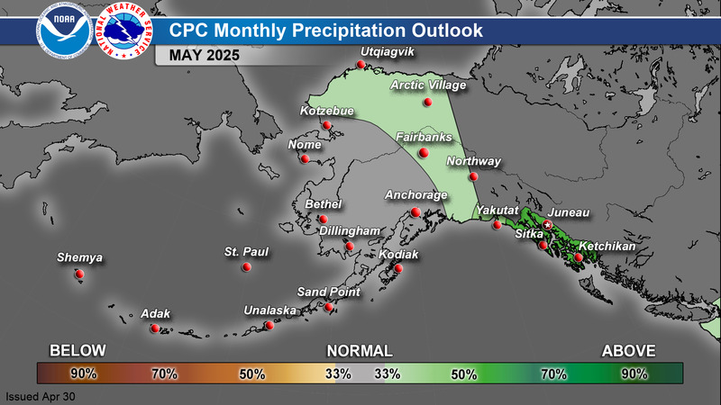
Monthly
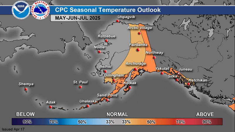
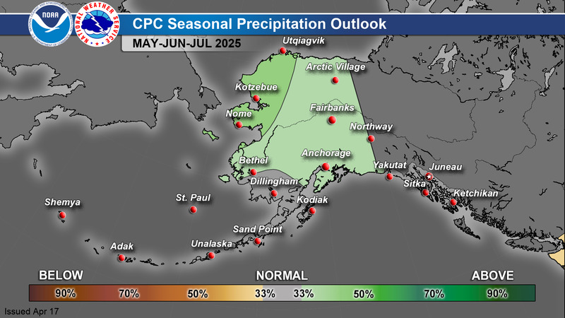
Season |
 |
Current Conditions - Map
Current Conditions - Table
Current Snow Depth
Alaska Interagency Coordination Center - Fire Weather
GOES-West Satellite Imagery
Space Weather Prediction Center - Aurora Dashboard
Alaska Sea Ice Program (ASIP)
Alaska River Gauge - Map
Alaska Earthquake Center
Alaska Volcano Observatory
National Tsunami Warning Center
Climate Prediction Center

