
Numerous severe thunderstorms are expected across a broad region from the Ohio Valley to the Mid-Atlantic and Northeast States today into tonight. Swaths of damaging wind gusts are expected and some tornadoes are possible. Bertha is expected to bring tropical storm conditions to portions of the Gulf Coast from the Florida Panhandle westward to southeastern Louisiana later today and Wednesday. Read More >
|
Min |
 |
|
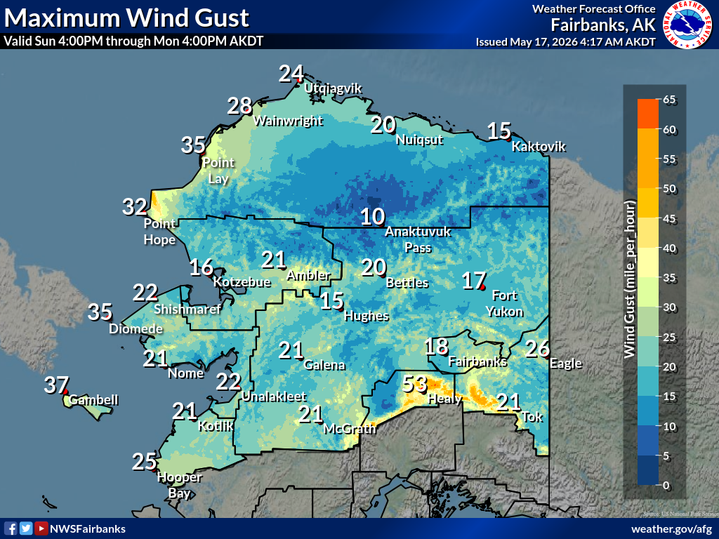
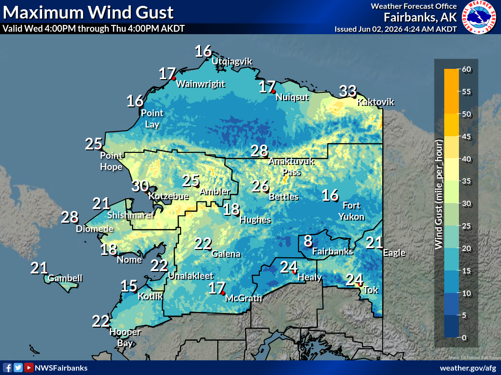
Maximuum
Maximum |
 |
|
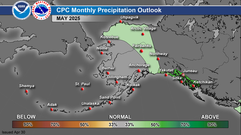
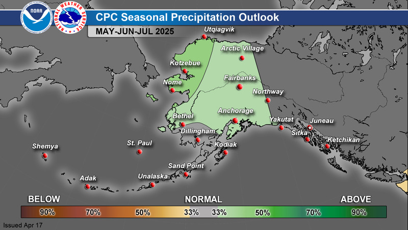
Precipitation
Precipitation |
 |
|
Probability |
 |
|
Snowfall
Snowfall |
 |
|
Ice Accum
Ice Accum |
 |
|
Min RH |
 |
|
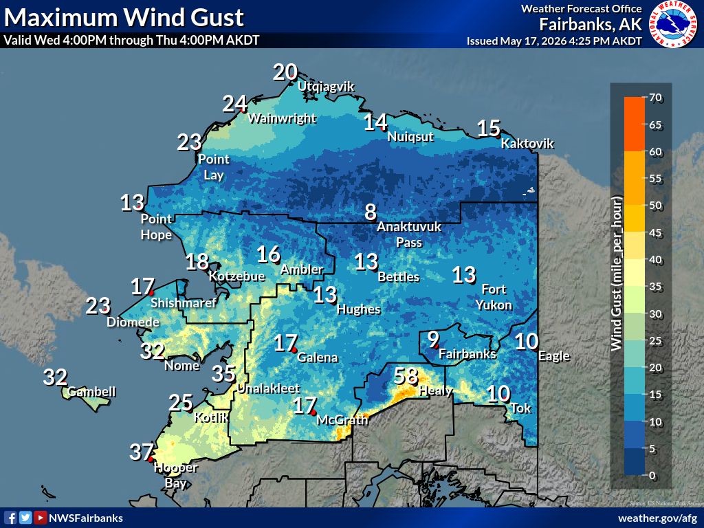
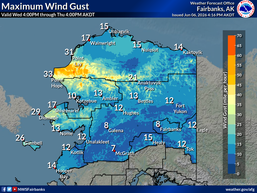
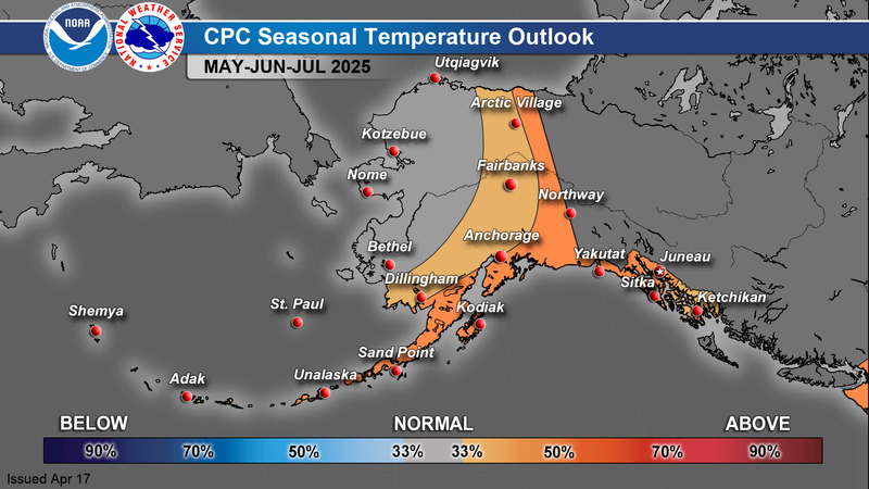
Maximuum
Maximum |
|
|
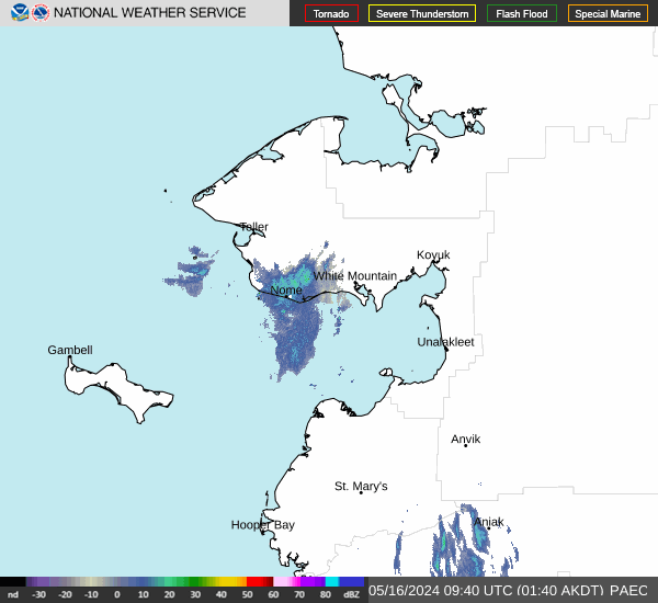
Radar Current Current Current |
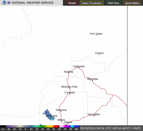 |
|
Radar Current Current Current |
 |
|
Satellite.... |
 |
|
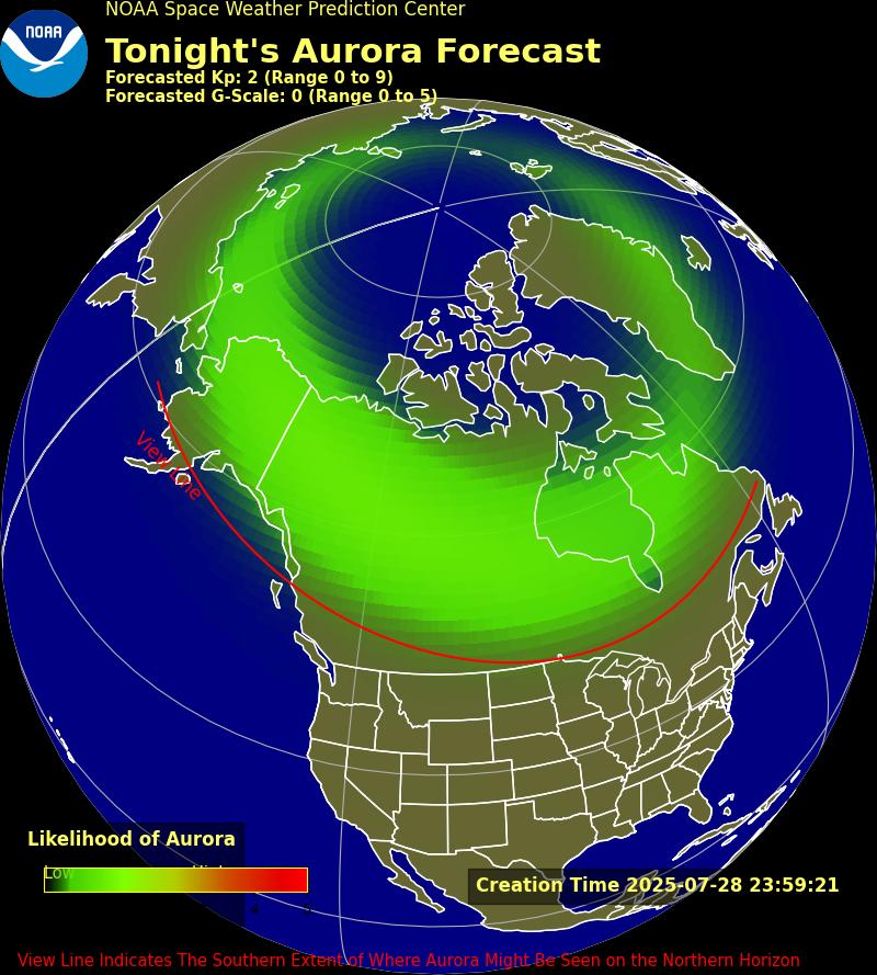
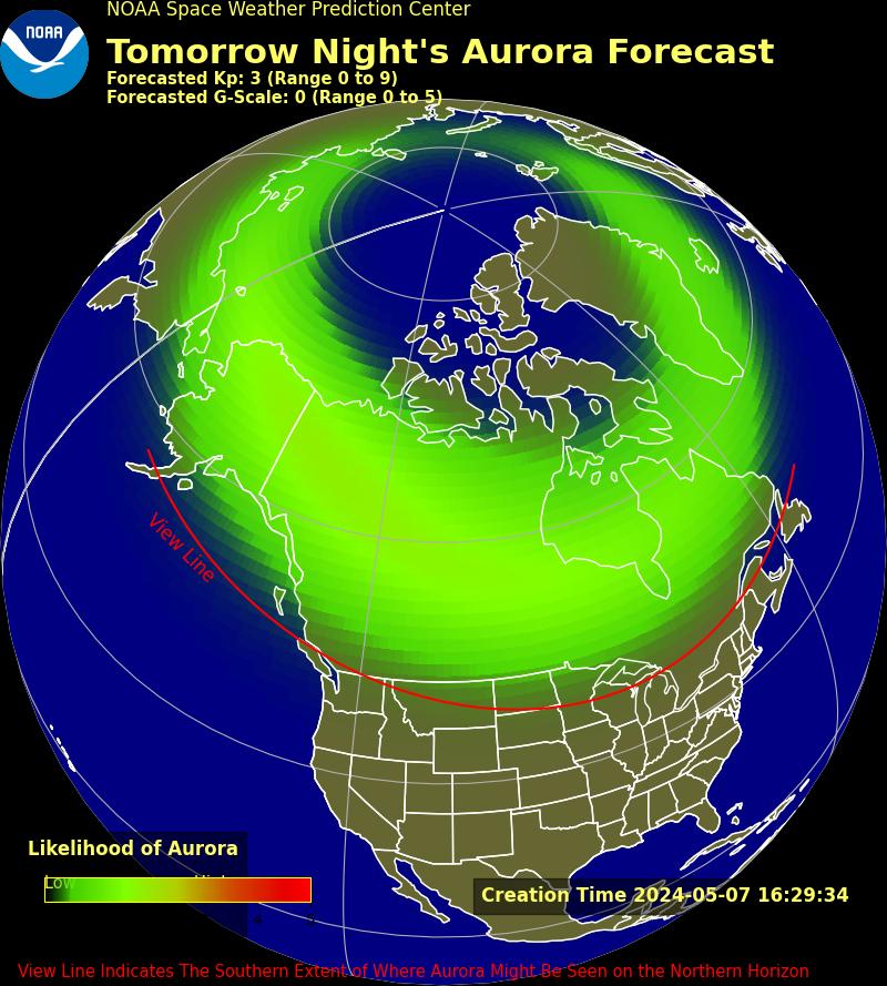
Aurora 30 Minute 3 Day 27 Day Planetary UAF Aurora |
 |
|
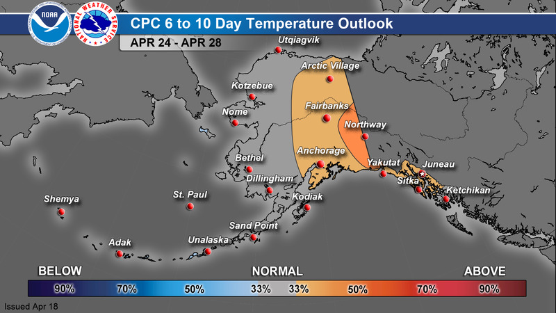
6-10 Day
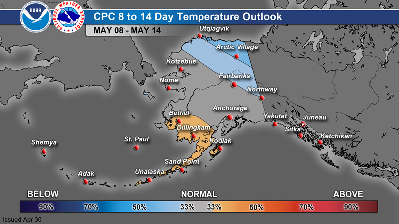
8-14 Day
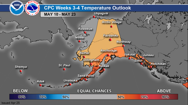
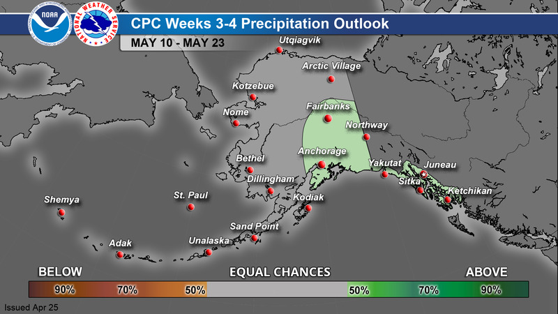
Weeks 3-4
Monthly
Season |
 |
Current Conditions - Map
Current Conditions - Table
Current Snow Depth
Alaska Interagency Coordination Center - Fire Weather
GOES-West Satellite Imagery
Space Weather Prediction Center - Aurora Dashboard
Alaska Sea Ice Program (ASIP)
Alaska River Gauge - Map
Alaska Earthquake Center
Alaska Volcano Observatory
National Tsunami Warning Center
Climate Prediction Center

