Overview
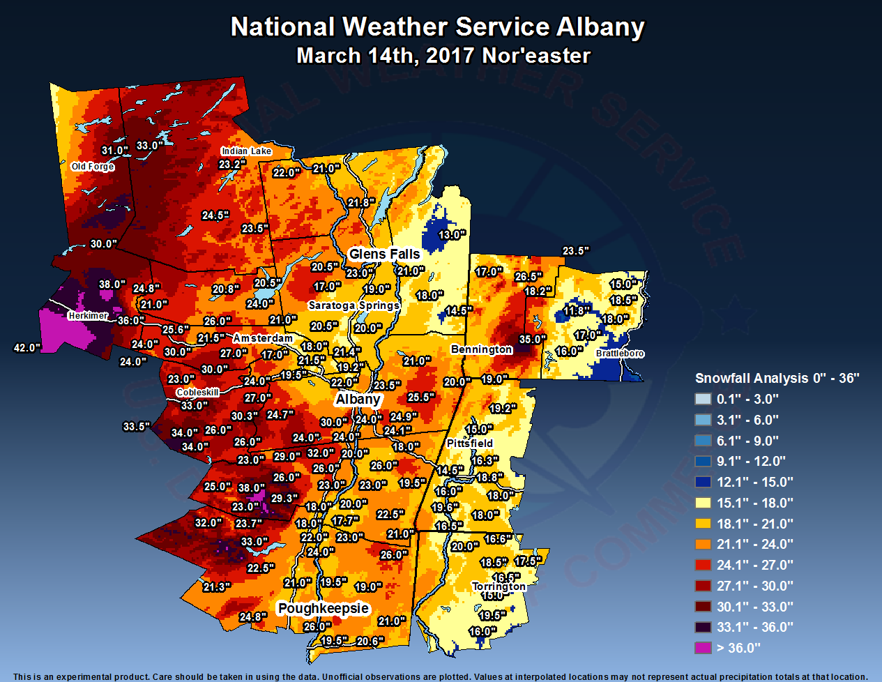
The March 14th Nor'easter, Pi Day Blizzard, was a significant storm that dumped 1 to 3 feet of snow across
the local area with some portions picking up an amazing 36 to 42 inches. The snow fell at 1 to 4 inches per hour
for much of the day. A particularly heavy band of snow rotated northward across the region during the late morning
into the early afternoon and stalled out over portions of the Mohawk Valley, resulting in an incredible report
of 11.5 inches in 2 hours in Herkimer County.

There was a widespread extreme public impact, with many roads severely impacted and schools closed for 2 days.
A state of emergency was issued for all New York Counties, and tractor-trailers were banned on most area interstates.
Numerous counties issued travel bans on county roads. The governor of Connecticut issued a statewide travel ban on
state roads. Travel restrictions were issued for the Massachusetts Turnpike. Much of the train service across the
region was cancelled, and all flights were grounded at Albany International Airport.  In addition to the snowfall,
gusty winds up to 40 to 50 mph resulted in near-zero visibility and blizzard conditions across the Mid-Hudson Valley,
Catskills, Capital District, Taconics, Lake George-Saratoga Region, Berkshires, Litchfield Hills and much of southern
Vermont. At higher elevations across the Berkshires, winds gusted as high as 74 mph. The winds brought considerable
blowing and drifting of snow.
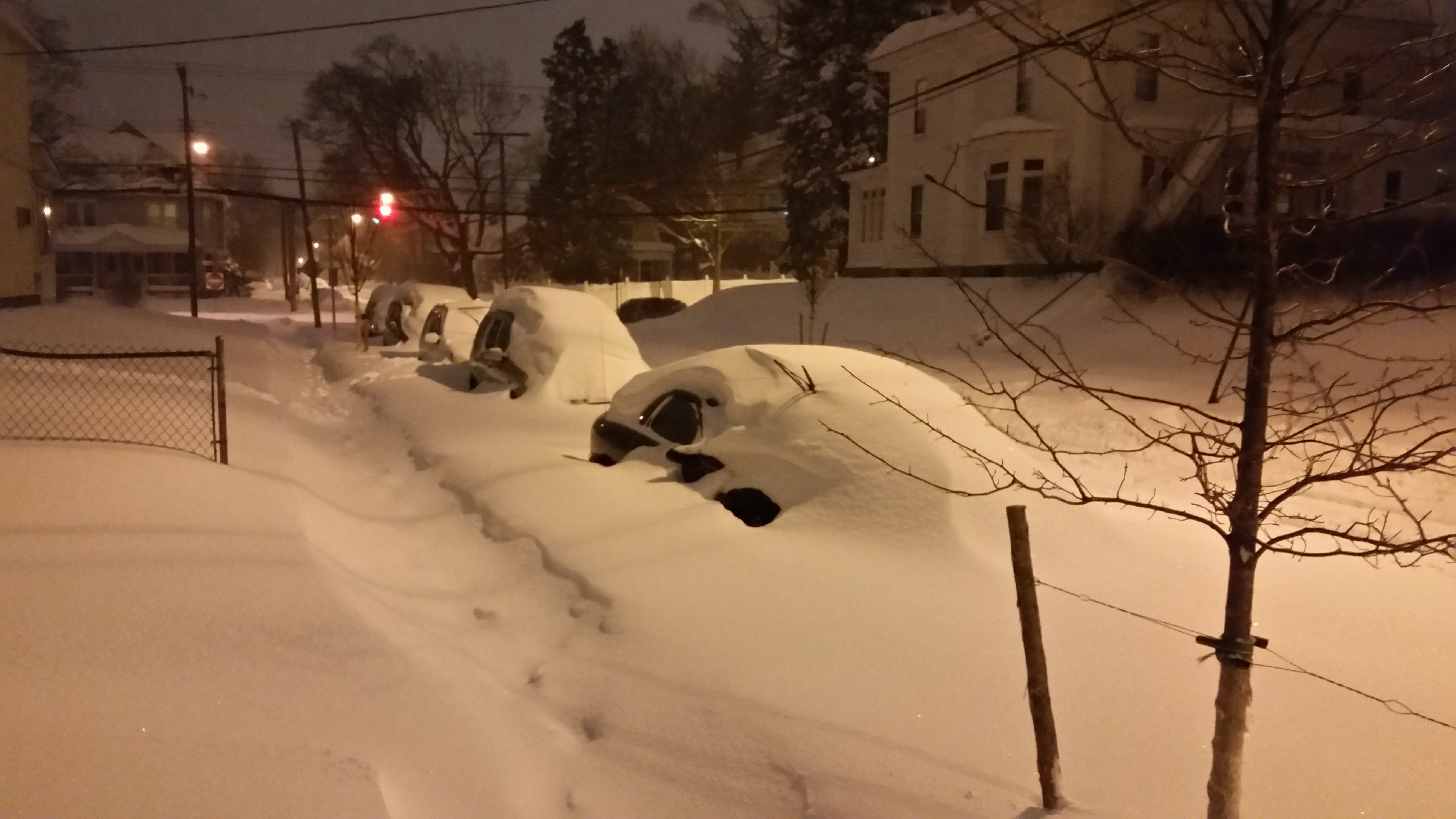 |
| March 14, 2017 Albany, NY Photo: Dan Thompson |
Snow Reports
PUBLIC INFORMATION STATEMENT
SPOTTER REPORTS
NATIONAL WEATHER SERVICE ALBANY NY
222 PM EDT WED MAR 15 2017

THE FOLLOWING ARE UNOFFICIAL OBSERVATIONS TAKEN DURING THE PAST 33
HOURS FOR THE STORM THAT HAS BEEN AFFECTING OUR REGION. APPRECIATION
IS EXTENDED TO HIGHWAY DEPARTMENTS...COOPERATIVE OBSERVERS...SKYWARN
SPOTTERS AND MEDIA FOR THESE REPORTS. THIS SUMMARY IS ALSO AVAILABLE
ON OUR HOME PAGE AT WEATHER.GOV/ALBANY

********************STORM TOTAL SNOWFALL********************

LOCATION          STORM TOTAL     TIME/DATE   COMMENTS
                     SNOWFALL           OF
                     /INCHES/   MEASUREMENT

CONNECTICUT

...LITCHFIELD COUNTY...
   NORFOLK               20.0   916 PM  3/14  PUBLIC
   1 N THOMASTON         19.5   906 AM  3/15  COCORAHS
   WINSTED               18.5   756 AM  3/15  TRAINED SPOTTER
   NEW HARTFORD          17.5   645 PM  3/14  TRAINED SPOTTER
   PLEASANT VALLEY       17.0   130 PM  3/14  PUBLIC
   1 NE COLEBROOK        16.6   700 AM  3/15  COCORAHS
   TACONIC               16.5  1230 PM  3/14  FACEBOOK
   3 SW NEW HARTFORD CE  16.5   700 AM  3/15  COCORAHS
   BAKERSVILLE           16.5   700 AM  3/15  CO-OP OBSERVER
   1 S WATERTOWN         16.0   715 AM  3/15  COCORAHS
   HARWINTON             15.0   627 AM  3/15  TRAINED SPOTTER
   THOMASTON DAM         13.0   700 AM  3/15  CO-OP OBSERVER

MASSACHUSETTS

...BERKSHIRE COUNTY...
   GREAT BARRINGTON      19.6   729 AM  3/15  TRAINED SPOTTER
   SAVOY                 19.2  1059 PM  3/14  WEATHERNET6
   WILLIAMSTOWN          19.0   619 PM  3/14  FACEBOOK
   6 SSW BECKET          18.8   700 AM  3/15  COCORAHS
   OTIS                  18.0   506 PM  3/14  BROADCAST MEDIA
   NEW MARLBOROUGH       18.0   520 AM  3/15  WEATHERNET6
   LENOX DALE            16.3   800 AM  3/15  CO-OP OBSERVER
   3 N GREAT BARRINGTON  16.0   700 AM  3/15  COCORAHS
   2 NNW PITTSFIELD      15.0   700 AM  3/15  COCORAHS
   NNE STOCKBRIDGE       14.5   600 AM  3/15  COCORAHS

NEW YORK

...ALBANY COUNTY...
   3 SW GLENMONT         30.0   700 AM  3/15  COCORAHS
   2 NNW RENSSELAERVILL  24.7   700 AM  3/15  COCORAHS
   KNOX                  24.0  1201 AM  3/15  WEATHERNET6
   RAVENA                24.0   503 PM  3/14  WEATHERNET6
   ALCOVE DAM            24.0   740 AM  3/15  CO-OP OBSERVER
   WATERVLIET            23.5   858 AM  3/15  TRAINED SPOTTER
   1 SW ALBANY           23.2   700 AM  3/15  COCORAHS
   1 S WESTMERE          23.0  1203 AM  3/15  METEOROLOGIST
   LATHAM                22.0   130 AM  3/15  FACEBOOK
   SLINGERLANDS          22.0   900 PM  3/14  PUBLIC
   1 SW SLINGERLANDS     21.2   830 PM  3/14  TRAINED SPOTTER
   1 W ALBANY            21.0   700 AM  3/15  NWS EMPLOYEE
   1 E NORTH BETHLEHEM   20.5  1230 AM  3/15  NWS EMPLOYEE
   6 SSW SCHENECTADY     20.5   700 AM  3/15  COCORAHS
   COHOES                20.5  1205 PM  3/15  WEATHERNET6
   DELMAR                20.0   557 PM  3/14  WEATHERNET6
   1 SW GUILDERLAND      19.5   900 AM  3/15  NWS EMPLOYEE
   1 WNW ALBANY          19.3   830 AM  3/15  NWS EMPLOYEE
   BOGHT CORNERS         19.2  1000 PM  3/14  NWS EMPLOYEE
   COLONIE               19.0  1015 PM  3/14  WEATHERNET6
   MCKOWNVILLE           18.7  1100 PM  3/14  METEOROLOGIST
   3 NW GUILDERLAND      18.5   933 AM  3/15  NWS EMPLOYEE
   1 ENE MCKOWNVILLE     17.8   800 AM  3/15  NWS ALBANY
   1 NE SHAKERS          17.0   800 AM  3/15  ASOS

...COLUMBIA COUNTY...
   AUSTERLITZ            26.0   957 PM  3/14  WEATHERNET6
   NORTH CHATHAM         24.1   603 PM  3/14  TRAINED SPOTTER
   CLAVERACK             23.0   915 PM  3/14  WNYT
   TAGHKANIC             22.5   950 AM  3/15  WEATHERNET6
   ANCRAMDALE            21.0   601 PM  3/14  WEATHERNET6
   KINDERHOOK            20.0   716 PM  3/14  TRAINED SPOTTER
   LIVINGSTON            20.0  1150 AM  3/15  WEATHERNET6
   HARLEMVILLE           19.5   442 PM  3/14  TRAINED SPOTTER
   CHATHAM CENTER        18.0   513 PM  3/14  WEATHERNET6
   GERMANTOWN            18.0   444 PM  3/14  WEATHERNET6
   1 SSW LIVINGSTON      17.7   735 AM  3/15  COCORAHS

...DUTCHESS COUNTY...
   1 S RED OAKS MILL     26.0   257 PM  3/14  TRAINED SPOTTER
   PINE PLAINS           26.0   315 PM  3/14  FACEBOOK
   RED OAKS MILL         26.0   255 PM  3/14  FACEBOOK
   RHINECLIFF            24.0   523 PM  3/14  TRAINED SPOTTER
   RED HOOK              23.0  1030 AM  3/15  TRAINED SPOTTER
   2 SE TIVOLI           22.0   300 PM  3/14  TRAINED SPOTTER
   LA GRANGE             22.0   715 PM  3/14  METEOROLOGIST
   RHINEBECK             21.5   959 PM  3/14  METEOROLOGIST
   HOPEWELL JUNCTION     21.5   530 PM  3/14  TWITTER
   1 SW RED OAKS MILL    21.4  1230 AM  3/15  TRAINED SPOTTER
   4 SSE POUGHKEEPSIE    21.4   500 AM  3/15  COCORAHS
   POUGHQUAG             21.0   745 PM  3/14  TRAINED SPOTTER
   2 SSE HOPEWELL JUNCT  20.6   700 AM  3/15  COCORAHS
   3 NE LAGRANGEVILLE    20.3   700 AM  3/15  COCORAHS
   2 ESE WAPPINGERS FAL  19.5   700 AM  3/15  COCORAHS
   HYDE PARK             19.5   955 PM  3/14  TRAINED SPOTTER
   SALT POINT            19.0   240 PM  3/14  TRAINED SPOTTER
   1 SSE RHINEBECK       18.5   300 PM  3/14  TRAINED SPOTTER
   ANNANDALE-ON-HUDSON   17.5   330 PM  3/14  TRAINED SPOTTER

...FULTON COUNTY...
   BROADALBIN            24.0   720 AM  3/15  WEATHERNET6
   PERTH                 21.0   727 AM  3/15  WEATHERNET6
   7 NW GLOVERSVILLE     20.8   800 AM  3/15  CO-OP OBSERVER
   FISHHOUSE             20.5   635 AM  3/15  WEATHERNET6

...GREENE COUNTY...
   HUNTER                38.0   706 AM  3/15  FACEBOOK
   1 E GREENVILLE        32.0   540 AM  3/15  COCORAHS
   EAST JEWETT           29.3   700 AM  3/15  CO-OP OBSERVER
   GREENVILLE CENTER     29.0   504 AM  3/15  WEATHERNET6
   NORTON HILL           27.0   558 PM  3/14  WEATHERNET6
   3 E FREEHOLD          26.0   530 AM  3/15  COCORAHS
   PURLING               26.0   425 PM  3/14  WEATHERNET6
   CATSKILL              25.0   559 AM  3/15  WEATHERNET6
   HALCOTT CENTER        25.0   751 PM  3/14  WEATHERNET6
   CAIRO                 24.0   417 PM  3/14  WEATHERNET6
   1 ESE FREEHOLD        23.5   815 PM  3/14  TRAINED SPOTTER
   EARLTON               23.0   335 PM  3/14  WEATHERNET6
   DURHAM                23.0   553 PM  3/14  WEATHERNET6
   WEST KILL             23.0   729 PM  3/14  WEATHERNET6
   2 SE FREEHOLD         22.0   445 PM  3/14  TRAINED SPOTTER

...HAMILTON COUNTY...
   2 NNE INLET           33.0   523 AM  3/15  TRAINED SPOTTER
   2 ENE EAGLE BAY       31.0   847 PM  3/14  TRAINED SPOTTER
   10 SSW SPECULATOR     24.5   700 AM  3/15  COCORAHS
   WELLS                 23.5  1000 AM  3/15  TRAINED SPOTTER
   2 SW INDIAN LAKE      23.2   820 AM  3/15  CO-OP OBSERVER

...HERKIMER COUNTY...
   WEST WINFIELD         42.0   700 AM  3/15  TRAINED SPOTTER
   FAIRFIELD             38.0  1022 AM  3/15  TRAINED SPOTTER
   LITTLE FALLS          36.0   730 AM  3/15  TRAINED SPOTTER
   ILION                 36.0  1135 PM  3/14  TRAINED SPOTTER
   OHIO                  30.0   630 AM  3/15  TRAINED SPOTTER
   2 NW DOLGEVILLE       24.8   700 AM  3/15  COCORAHS
   1 SSE DOLGEVILLE      21.0   845 PM  3/14  TRAINED SPOTTER

...MONTGOMERY COUNTY...
   CANAJOHARIE           30.0  1040 PM  3/14  FACEBOOK
   ROOT CENTER           30.0  1113 PM  3/14  FACEBOOK REPORT
   GLEN                  27.0   734 AM  3/15  WEATHERNET6
   AMSTERDAM             26.8   611 AM  3/15  WEATHERNET6
   FONDA                 26.0  1018 PM  3/14  WEATHERNET6
   SE FORT PLAIN         25.6   700 AM  3/15  COCORAHS
   2 WSW HESSVILLE       24.0   830 AM  3/15  COCORAHS
   HESSVILLE             24.0   829 AM  3/15  WEATHERNET6
   5 W FONDA             21.5   900 AM  3/15  COCORAHS
   PALATINE BRIDGE       18.5   503 PM  3/14  WEATHERNET6

...RENSSELAER COUNTY...
   AVERILL PARK          25.5   726 AM  3/15  METEOROLOGIST
   EAST SCHODACK         24.9  1029 AM  3/15  TRAINED SPOTTER
   1 WNW AVERILL PARK    24.5   800 AM  3/15  COCORAHS
   EAST GREENBUSH        24.0  1201 AM  3/15  TRAINED SPOTTER
   SPEIGLETOWN           22.0   714 AM  3/15  WEATHERNET6
   BRUNSWICK             21.1   600 AM  3/15  CO-OP OBSERVER
   7 NE TROY             21.0   700 AM  3/15  COCORAHS
   EAST NASSAU           21.0  1052 AM  3/15  TRAINED SPOTTER
   1 E TROY              20.1   700 AM  3/15  COCORAHS
   3 SSW SAND LAKE       20.0   730 AM  3/15  TRAINED SPOTTER
   CASTLETON-ON-HUDSON   20.0  1046 AM  3/15  PUBLIC
   CENTER BRUNSWICK      20.0  1055 PM  3/14  WEATHERNET6
   BERLIN                20.0   618 AM  3/15  WEATHERNET6
   TROY                  20.0  1202 PM  3/15  WEATHERNET6


...SARATOGA COUNTY...
   LAKE DESOLATION       27.2   618 AM  3/15  WEATHERNET6
   CORINTH               23.0  1204 PM  3/15  WEATHERNET6
   2 S CLIFTON PARK CEN  21.4   934 AM  3/15  RETIRED NWS EMP.
   CHARLTON              20.5  1053 PM  3/14  WEATHERNET6
   MALTA                 20.0  1203 PM  3/15  WEATHERNET6
   1 S SARATOGA SPRINGS  19.9   600 AM  3/15  COCORAHS
   WILTON                19.0   645 AM  3/15  TRAINED SPOTTER
   SARATOGA SPRINGS      19.0   541 AM  3/15  WEATHERNET6
   EDDY CORNERS          19.0   541 AM  3/15  TRAINED SPOTTER
   MILTON                18.5   443 AM  3/15  WEATHERNET6
   3 S CLIFTON PARK      18.1   600 AM  3/15  COCORAHS
   1 NE BURNT HILLS      18.0  1116 PM  3/14  FACEBOOK
   2 W GREENFIELD CENTE  17.0   745 AM  3/15  COCORAHS
   JONESVILLE            17.0   737 AM  3/15  METEOROLOGIST
   3 ESE BALLSTON SPA    16.0   800 AM  3/15  COCORAHS

...SCHENECTADY COUNTY...
   DELANSON              24.0   507 AM  3/15  WEATHERNET6
   DUANESBURG            24.0  1059 PM  3/14  WEATHERNET6
   1 SSW AQUEDUCT        21.5   700 AM  3/15  NWS EMPLOYEE
   ROTTERDAM             21.0   700 PM  3/14  TRAINED SPOTTER
   SCHENECTADY           19.5  1059 PM  3/14  WEATHERNET6
   SCHENECTADY-GE PLOT   18.1  1031 PM  3/14  NWS EMPLOYEE
   NISKAYUNA             18.0   700 AM  3/15  CO-OP OBSERVER
   PATTERSONVILLE        17.0   420 PM  3/14  TRAINED SPOTTER
   1 NNE HAWTHORNE HILL  16.7  1020 PM  3/14  NWS EMPLOYEE
   GLENVILLE             16.2   603 PM  3/14  FACEBOOK
   SOUTH SCHENECTADY     16.1   710 PM  3/14  NWS EMPLOYEE
   CARMAN                14.0   840 PM  3/14  FACEBOOK

...SCHOHARIE COUNTY...
   RUTH                  34.0   553 AM  3/15  WEATHERNET6
   JEFFERSON             34.0   855 AM  3/15  WEATHERNET6
   CHARLOTTEVILLE        33.5  1120 AM  3/15  WEATHERNET6
   RICHMONDVILLE         33.0   353 AM  3/15  WEATHERNET6
   MIDDLEBURGH           30.3   430 AM  3/15  WEATHERNET6
   2 ESE COBLESKILL      29.0   735 AM  3/15  CO-OP OBSERVER
   SCHOHARIE             27.0  1030 PM  3/14  WEATHERNET6
   GILBOA                26.0  1217 PM  3/15  WEATHERNET6
   NORTH BLENHEIM        26.0   708 PM  3/14  TRAINED SPOTTER
   1 NNW SUMMIT          25.0   700 AM  3/15  COCORAHS
   SEWARD                23.0  1057 PM  3/14  WEATHERNET6

...ULSTER COUNTY...
   WEST SHOKAN           33.0   452 AM  3/15  WEATHERNET6
   HIGHMOUNT             32.0   759 AM  3/15  WEATHERNET6
   1 SW GALEVILLE        24.8   500 PM  3/14  TWITTER
   PINE HILL             24.0  1014 AM  3/15  TRAINED SPOTTER
   PLATTEKILL            24.0  1025 PM  3/14  FACEBOOK
   PHOENICIA             23.7   742 AM  3/15  WEATHERNET6
   3 S KINGSTON          23.0   800 AM  3/15  TRAINED SPOTTER
   LOMONTVILLE           22.5   520 PM  3/14  FACEBOOK
   KINGSTON              22.0   200 PM  3/14  FACEBOOK
   ULSTER HEIGHTS        21.3   114 PM  3/14  PUBLIC
   COTTEKILL             21.0   759 AM  3/15  TRAINED SPOTTER
   NEW PALTZ             20.0   115 PM  3/14  AMATEUR RADIO
   1 ENE PLATTEKILL      19.0   840 PM  3/14  TRAINED SPOTTER
   ULSTER PARK           18.2   854 PM  3/14  WEATHERNET6
   SAUGERTIES            18.0  1028 PM  3/14  WEATHERNET6

...WARREN COUNTY...
   4 WSW NORTH RIVER     22.0   915 AM  3/15  1772 FT  ELEVATION
   2 WNW WARRENSBURG     21.8  1200 AM  3/15  TRAINED SPOTTER
   QUEENSBURY            21.5   700 AM  3/15  WEATHERNET6
   5 SE NORTH CREEK      21.0   700 AM  3/15  CO-OP OBSERVER
   LAKE LUZERNE          20.5   600 AM  3/15  CO-OP OBSERVER
   GLENS FALLS           19.3  1145 AM  3/15  TRAINED SPOTTER
   2 SW CHRISTIAN HILL   19.0   730 PM  3/14  TRAINED SPOTTER

...WASHINGTON COUNTY...
   FORT EDWARD           21.0   940 AM  3/15  TRAINED SPOTTER
   GREENWICH             18.0  1200 AM  3/15  FACEBOOK
   CAMBRIDGE             14.5   924 AM  3/15  TRAINED SPOTTER
   HUDSON FALLS          13.2   539 AM  3/15  WEATHERNET6
   HARTFORD              13.0   700 PM  3/14  TWITTER

VERMONT

...BENNINGTON COUNTY...
   WOODFORD              35.0  1229 PM  3/15  WEATHERNET6
   MANCHESTER            26.5   507 AM  3/15  WEATHERNET6
   LANDGROVE             23.5   636 AM  3/15  WEATHERNET6
   MANCHESTER CENTER     18.2   906 AM  3/15  WEATHERNET6
   3 ENE MANCHESTER      18.2   700 AM  3/15  COCORAHS
   1 WNW SOUTH DORSET    17.0   700 AM  3/15  TRAINED SPOTTER

...WINDHAM COUNTY...
   1 E WESTMINSTER WEST  18.5   900 AM  3/15  COCORAHS
   2 WNW PUTNEY          18.0   700 AM  3/15  COCORAHS
   2 N EAST DOVER        17.0   730 AM  3/15  COCORAHS
   WILMINGTON            16.0   622 AM  3/15  WEATHERNET6
   1 NNE ROCKINGHAM      15.0   700 AM  3/15  COCORAHS
   3 SW WARDSBORO        11.8   920 AM  3/15  COCORAHS

&&
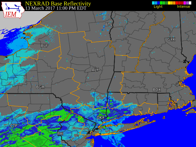
Radar Loop & Snowfall Maps
 |
 |
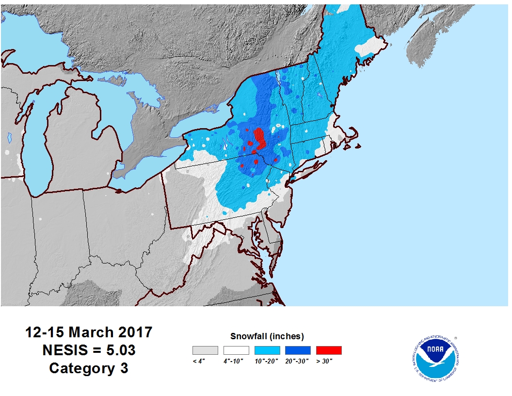 |
| March 14, 2017 | Snowfall Map: March 14, 2017 | Regional Snowfall: March 12-15, 2017 Northeast Snowfall Impact Scale |
Environment
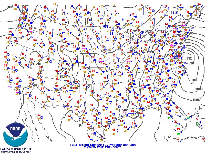
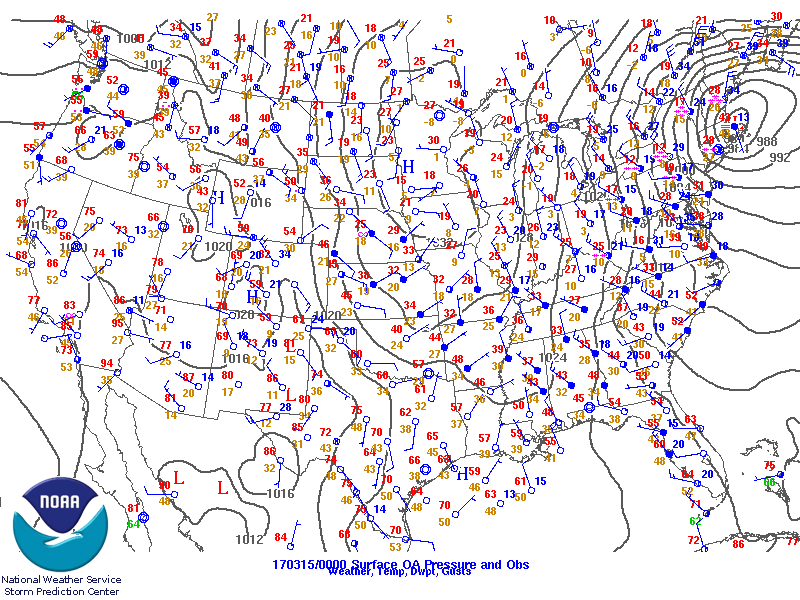
Surface Maps
 |
 |
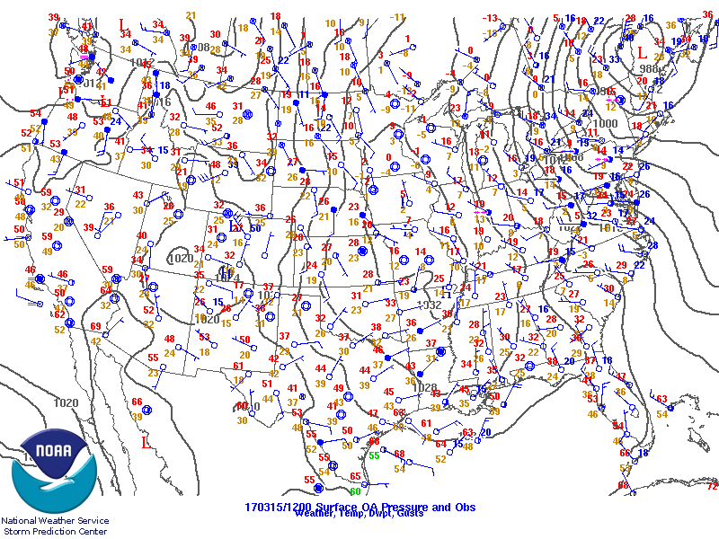 |
| March 14, 2017 - 7 am EST | March 14, 2017 - 7 PM EST | March 15, 2017 - 7 am EST |
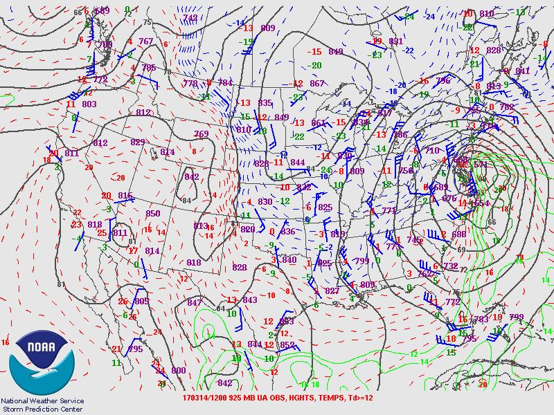
925 mb Maps
 |
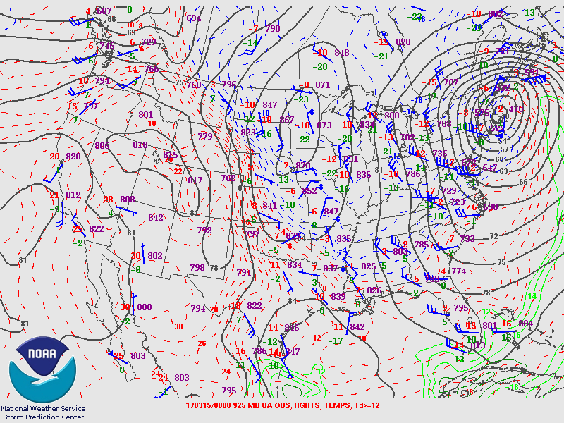 |
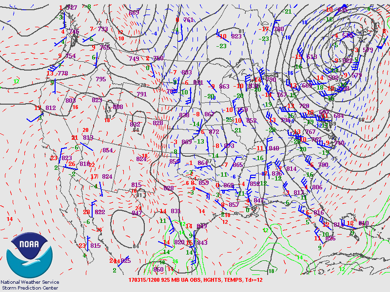 |
| March 14, 2017 - 7 am EST | March 14, 2017 - 7 PM EST | March 15, 2017 - 7 am EST |
850 mb Maps
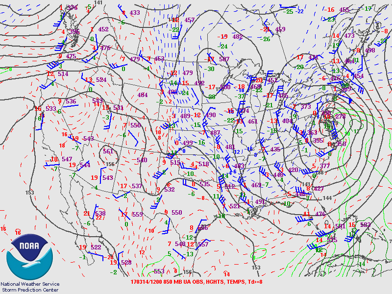 |
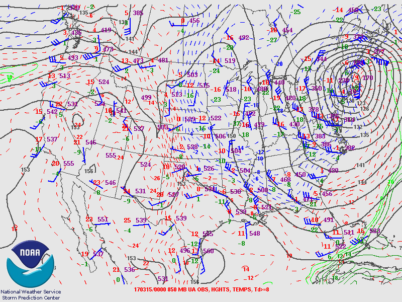 |
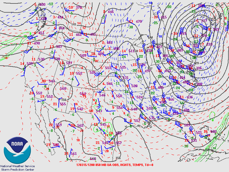 |
| March 14, 2017 - 7 am EST | March 14, 2017 - 7 PM EST | March 15, 2017 - 7 am EST |
500 mb Maps
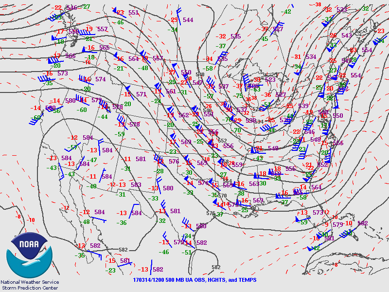 |
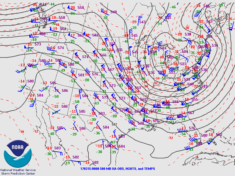 |
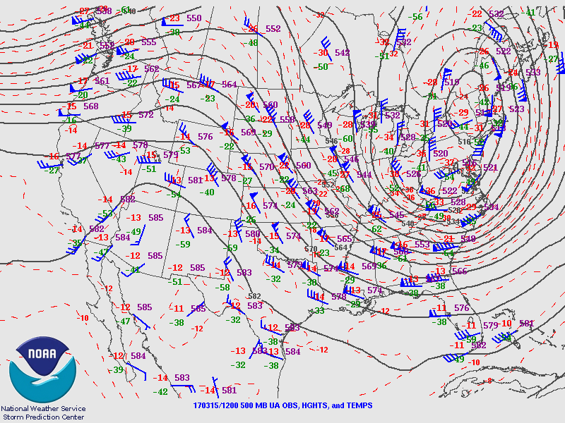 |
| March 14, 2017 - 7 am EST | March 14, 2017 - 7 PM EST | March 15, 2017 - 7 am EST |
250 mb Maps
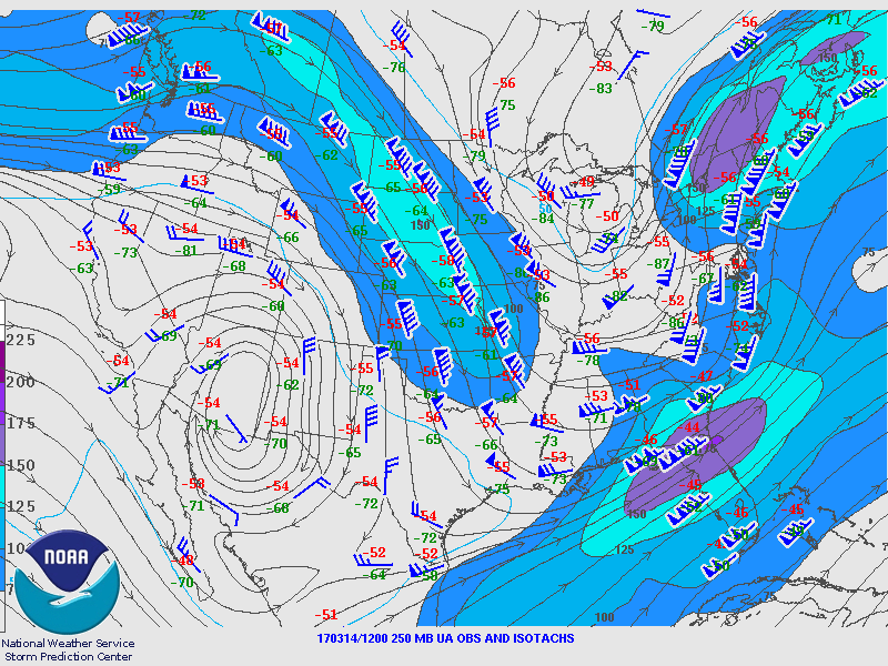 |
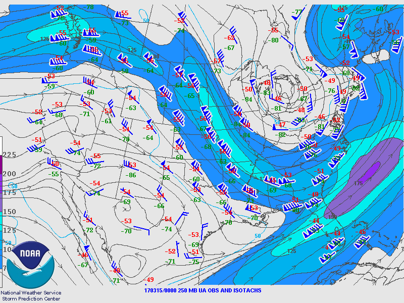 |
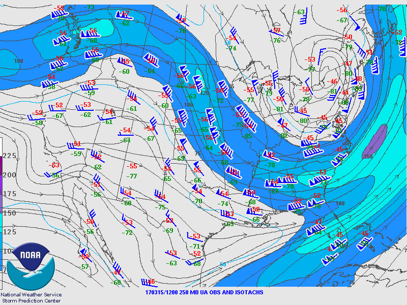 |
| March 14, 2017 - 7 am EST | March 14, 2017 - 7 PM EST | March 15, 2017 - 7 am EST |
 |
Media use of NWS Web News Stories is encouraged! Please acknowledge the NWS as the source of any news information accessed from this site. |
|

