Overview
A coastal low pressure system developed off the Carolina Coast on March 13 and slowly tracked northward up the East Coast into March 14 before then moving eastward out to sea on March 15. Light precipitation started on March 13 associated with a weak disturbance from the west. Thermal profiles led to mainly light rain showers across the valley areas and snow or a rain/snow mix across the higher elevations. By the evening and overnight hours on March 13 into March 14, all precipitation changed over to snow and began to fall moderate to heavy at times as the coastal low approached, near and just off the coast of Long Island and New England. Snow continued to fall throughout the daytime hours on March 14. The heaviest snow during this time occurred across portions of Warren, Hamilton, Fulton, Montgomery, Schoharie, Greene and Ulster counties as a pivoting snow band set up across these areas much of the day. Snowfall rates of 1 to 2 inches per hour likely occurred within this band. In addition, heavy upslope snowfall continued across the southern Green Mountains in Vermont and Berkshires in Massachusetts. Elsewhere, light to occasionally moderate snow fell through the day, though additional accumulations were limited in some valley areas as the high sun angle and reduced intensity of the snowfall melted most falling snowflakes once they reached the surface and also slowly compacted the newly fallen snow. By the early evening hours on March 14, the pivoting snow band shifted back eastward into the Hudson Valley. Northerly winds down the Hudson Valley and northwesterly winds down the Mohawk Valley resulted in an enhancement of this band over the region (Mohawk-Hudson Valley Convergence) bringing snowfall rates of around 1 inch per hour once again. This, combined with the lowering sun angle and sun setting, brought additional light accumulations with roads becoming snow covered and/or slushy/slippery toward the end of the evening commute. From the late evening into the overnight hours, snow begin to gradually taper off in most areas with just some lingering light to moderate snow showers and flurries across some higher elevation areas through the morning hours on March 15 before ending.
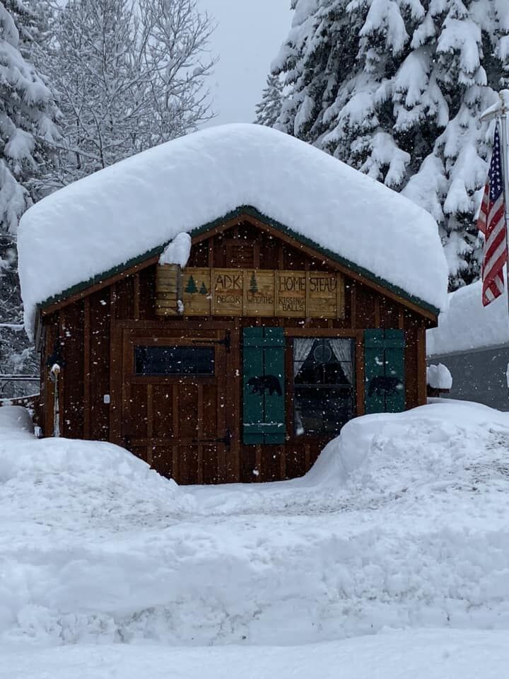
Snowfall totals varied greatly based on location and elevation and was due to differences in the snow-to-liquid ratios (lower in the valleys and higher in the higher elevations). Most higher elevation areas received between 15 and 30 inches of snow. Portions of the southern Greens, Berkshires, southeastern Adirondacks and eastern Catskills received in excess of 30 inches with a few locations in the southern Greens even topping 40 inches. Valley locations received mostly 7 to 15 inches of snow. A few areas across the western Mohawk Valley and the mid-Hudson Valley received less than 6 inches of snow as they by and large were missed by the heavier snow bands. Liquid equivalent precipitation equaled 1 inch to 2.50 inches.
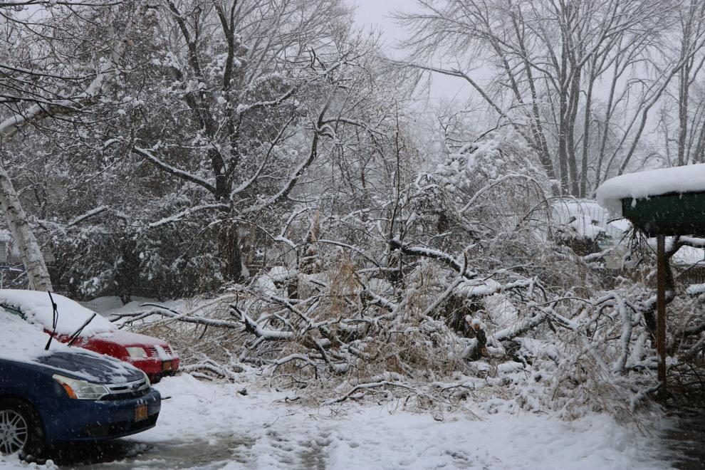
This was a heavy, wet snow for most areas and the weight and amount of the snow led to numerous downed trees and power lines resulting in widespread power outages. According to the National Grid, approximately 141,000 customers lost power within the state of New York with most of these outages occurring within our county warning area. Numerous outages also occurred within southern Vermont, western Massachusetts and northwestern Connecticut. Some locations were without power for at least 1 or 2 days. Several warming stations opened to assist those without power.
This event led to the closing of many school districts and resulted in the issuance of chain up laws and bans of empty tractor trailers and/or tandems on some area interstates. Several jurisdictions issued a State of Emergency as a result of the storm.
Snow
-SnowfallAnalysisPublic1.png)
Public Information Statement
Spotter Reports
National Weather Service Albany NY
230 PM EDT Wed Mar 15 2023

The following are unofficial observations taken during the past 33
hours for the storm that has been affecting our region. Appreciation
is extended to highway departments, cooperative observers, Skywarn
spotters and media for these reports. This summary also is available
on our home page at weather.gov/albany

********************STORM TOTAL SNOWFALL********************

LOCATION                TOTAL      TIME/DATE  COMMENTS
                     SNOWFALL       MEASURED
                     (inches)

CONNECTICUT

...Litchfield County...
  Norfolk                19.7   800 AM  3/15  Co-Op Observer
  4 ESE Canaan           16.0   700 AM  3/15  CoCoRaHS
  2 WNW Warren           14.0   700 AM  3/15  CoCoRaHS
  New Hartford           14.0   817 AM  3/15  Trained Spotter
  Winsted                12.1   800 AM  3/15  Trained Spotter
  2 NNW Bakersville      11.5   509 PM  3/14  Trained Spotter
  Torrington             11.5   820 PM  3/14  Twitter
  1 SE Winsted           11.3   916 PM  3/14  Trained Spotter
  3 SW New Hartford Ce    8.6   700 AM  3/15  CoCoRaHS
  Bakersville             8.6   700 AM  3/15  Co-Op Observer
  2 NNE Litchfield        6.0   700 AM  3/15  CoCoRaHS
  5 ESE Litchfield        5.1   816 AM  3/15  CoCoRaHS
  3 N Watertown           5.0   845 AM  3/15  CoCoRaHS
  2 SSW Woodbury Cente    2.0   700 AM  3/15  CoCoRaHS
  3 WNW New Milford       1.8   700 AM  3/15  CoCoRaHS
  5 SSW New Milford       1.0   800 AM  3/15  CoCoRaHS

MASSACHUSETTS

...Berkshire County...
  Windsor                32.0   740 AM  3/15  Twitter
  Hancock                27.0  1136 PM  3/14  WeatherNet6
  2 ENE Pittsfield       26.7   715 AM  3/15  Elevation 1194 Feet
  Clarksburg             26.0  1200 PM  3/15  Twitter
  Becket                 26.0   722 AM  3/15  WeatherNet6
  6 SSW Becket           24.8   640 AM  3/15  CoCoRaHS
  3 S Sandisfield        24.1  1002 AM  3/15  Trained Spotter
  Pittsfield             23.0   727 AM  3/15  WeatherNet6
  2 NNE Pittsfield       22.5   948 PM  3/14  1194 ft elevation
  1 NNW Cheshire         21.4   700 AM  3/15  CoCoRaHS
  Lenoxdale              20.5   700 AM  3/15  Co-Op Observer
  Adams                  20.0   849 PM  3/14  Trained Spotter
  3 S New Ashford        19.0   700 PM  3/14  Town of Lanesborough
  1 E Lenox              18.2  1000 PM  3/14  Trained Spotter
  Lanesborough           16.0  1059 PM  3/14  WeatherNet6
  3 N Great Barrington   14.5   700 AM  3/15  CoCoRaHS
  Stockbridge            14.0   555 AM  3/15  WeatherNet6
  Cheshire               13.0   700 PM  3/14  Amateur Radio
  Williamstown           13.0   700 PM  3/14  Amateur Radio
  North Adams            11.0   635 AM  3/15  Amateur Radio
  N Great Barrington     10.9  1159 PM  3/14  CoCoRaHS

NEW YORK

...Albany County...
  2 NNW Rensselaervill   25.4   700 AM  3/15  CoCoRaHS
  Knox                   24.5  1120 PM  3/14  WeatherNet6
  4 NW Altamont          15.5   700 AM  3/15  CoCoRaHS
  Albany                 13.0   800 PM  3/14  Trained Spotter
  3 SSW Altamont         11.9   655 AM  3/15  CoCoRaHS
  2 W Delmar             10.5   751 AM  3/15  Trained Spotter
  Albany Intl AP         10.1   800 AM  3/15  Storm total
  2 SW Voorheesville      9.5   755 AM  3/15  Amateur Radio
  1 SW Albany             9.2   700 AM  3/15  CoCoRaHS
  2 W Albany              9.2  1000 PM  3/14  Retired NWS Emp.
  3 NW Guilderland        9.1   905 AM  3/15  NWS Employee
  3 SW Glenmont           9.0   700 AM  3/15  CoCoRaHS
  Delmar                  9.0  1127 PM  3/14  WeatherNet6
  Boght Corners           8.8   945 PM  3/14  NWS Employee
  Colonie                 8.6   846 PM  3/14  Trained Spotter
  1 NNW Colonie           8.4   745 PM  3/14  Trained Spotter
  1 SSE Albany            8.3   700 AM  3/15  CoCoRaHS
  2 ESE Westmere          7.5  1025 PM  3/14  NWS Employee
  NWS Albany              7.3   800 AM  3/15  CoCoRaHS
  1 W Albany              6.8  1000 PM  3/14  NWS Employee

...Columbia County...
  3 N Austerlitz         31.0   725 AM  3/15  Elevation 1750 Feet
  Austerlitz             20.5  1101 PM  3/14  WeatherNet6
  4 NNW Hillsdale        20.3   659 PM  3/14  Trained Spotter
  Canaan                 18.0   630 PM  3/14  Facebook
  1 SW Chatham           14.5   700 AM  3/15  CoCoRaHS
  Taghkanic              13.2   846 AM  3/15  WeatherNet6
  N Ancramdale           13.0   700 AM  3/15  CoCoRaHS
  3 N Valatie            11.0   700 AM  3/15  CoCoRaHS
  1 S Valatie             9.0   700 AM  3/15  CoCoRaHS
  1 E Germantown          4.2   700 AM  3/15  CoCoRaHS

...Dutchess County...
  3 NE Millbrook         13.0   600 AM  3/15  CoCoRaHS
  3 SE Millbrook         12.4   700 AM  3/15  CoCoRaHS
  Beekman                12.0   915 PM  3/14  Trained Spotter
  Millbrook              11.0   730 PM  3/14  Facebook
  3 NE Lagrangeville     10.8   700 AM  3/15  CoCoRaHS
  3 NE Hopewell Juncti   10.6   600 AM  3/15  CoCoRaHS
  E Fishkill             10.5   839 AM  3/15  Twitter
  Lagrange               10.0   540 PM  3/14  Social Media
  Poughkeepsie            7.5   830 PM  3/14  Trained Spotter
  Hopewell Junction       7.5   830 PM  3/14  Trained Spotter
  Red Oaks Mill           6.3  1100 PM  3/14  Trained Spotter
  2 S Pleasant Valley     5.5  1200 AM  3/15  CoCoRaHS

...Fulton County...
  Gloversville 7nw       14.9   700 AM  3/15  Co-Op Observer
  1 NE Northville         9.5   710 AM  3/15  CoCoRaHS
  1 N Northville          6.1  1135 AM  3/15  CoCoRaHS
  5 ESE Broadalbin        6.0   900 AM  3/15  CoCoRaHS

...Greene County...
  4 SW Palenville        36.0   621 PM  3/14  Elevation 2100 Feet
  Hunter                 32.3   731 AM  3/15  Trained Spotter
  West Kill              32.0   801 AM  3/15  WeatherNet6
  East Jewett            28.0   500 PM  3/14  Trained Spotter
  3 E Freehold           25.5   530 AM  3/15  CoCoRaHS
  Halcott Center         22.0   932 AM  3/15  WeatherNet6
  2 N Lexington          20.0   700 AM  3/15  CoCoRaHS
  1 E Greenville         18.0   630 AM  3/15  CoCoRaHS
  Greenville Center      18.0   624 AM  3/15  WeatherNet6
  Cairo                   9.0   749 AM  3/15  WeatherNet6
  Catskill                5.5  1128 PM  3/14  WeatherNet6
  WNW Athens              3.4   700 AM  3/15  CoCoRaHS

...Hamilton County...
  Indian Lake            32.3   830 AM  3/15  Co-Op Observer
  2 WSW Lake Pleasant    30.1   655 AM  3/15  CoCoRaHS
  Piseco                 27.0   729 AM  3/15  WeatherNet6
  1 N Long Lake          16.6   700 AM  3/15  CoCoRaHS
  Inlet                  13.0   600 PM  3/14  Trained Spotter

...Herkimer County...
  2 NW Salisbury Cente   15.5   700 AM  3/15  CoCoRaHS
  2 E West Winfield      12.0   200 PM  3/15  Public
  3 NE Schuyler          11.0   700 AM  3/15  CoCoRaHS
  Dolgeville              6.0   115 AM  3/15  Trained Spotter
  Stillwater Reservoir    6.0   800 AM  3/15  Co-Op Observer
  Herkimer                5.0   800 AM  3/15  CoCoRaHS

...Montgomery County...
  Glen                   17.0   629 PM  3/14  WeatherNet6
  2 WSW Hessville        12.4   800 AM  3/15  CoCoRaHS
  Fonda                   8.0   759 AM  3/15  WeatherNet6
  Amsterdam               7.9  1149 PM  3/14  WeatherNet6
  1 NNW Amsterdam         7.9   747 AM  3/15  CoCoRaHS

...Rensselaer County...
  Petersburgh            31.0  1028 AM  3/15  Facebook
  Berlin                 26.0   630 AM  3/15  Facebook
  1 WNW Averill Park     26.0   800 AM  3/15  CoCoRaHS
  Poestenkill            25.3  1145 PM  3/14  Trained Spotter
  2 NNW Averill Park     23.0   740 PM  3/14  Trained Spotter
  7 NE Troy              20.9   700 AM  3/15  CoCoRaHS
  1 E Troy               20.4   700 AM  3/15  CoCoRaHS
  Valley Falls           19.5  1100 PM  3/14  Trained Spotter
  West Sand Lake         19.5   900 PM  3/14  Trained Spotter
  Speigletown            18.0   700 AM  3/15  Facebook
  North Greenbush        18.0  1030 PM  3/14  Facebook
  2 NNE Troy             17.2   800 AM  3/15  CoCoRaHS
  1 N Sycaway            17.2  1045 AM  3/15  NWS Employee
  East Greenbush         17.0   855 PM  3/14  Trained Spotter
  Troy                   16.0   715 AM  3/15  Trained Spotter
  1 SW Valley Falls      15.7   750 PM  3/14  Trained Spotter
  Buskirk                15.0   820 AM  3/15  Trained Spotter
  Hoosick Falls          14.5   744 AM  3/15  WeatherNet6
  1 S Troy               13.5   700 PM  3/14  Amateur Radio
  East Schodack          13.5   810 AM  3/15  Twitter
  Schaghticoke           13.0   712 PM  3/14  WeatherNet6
  2 WNW Wyantskill       12.0   800 AM  3/15  Amateur Radio

...Saratoga County...
  Lake Desolation        26.0  1141 PM  3/14  WeatherNet6
  4 WNW Rock City Fall   22.2   710 AM  3/15  CoCoRaHS
  Corinth                16.0  1144 PM  3/14  WeatherNet6
  1 S Saratoga Springs   14.3   530 AM  3/15  CoCoRaHS
  Sacandaga Lake         14.0   800 AM  3/15  Co-Op Observer
  Galway                 13.6  1054 PM  3/14  WeatherNet6
  2 ESE Clifton Park     12.5   910 PM  3/14  NWS Employee
  Clifton Park           11.8  1000 PM  3/14  CoCoRaHS
  Halfmoon               11.5   713 PM  3/14  Fire Dept/Rescue
  3 ESE Ballston Spa     11.0   800 AM  3/15  CoCoRaHS
  2 W Greenfield Cente    9.5   800 AM  3/15  CoCoRaHS
  Saratoga Lake           9.3   920 PM  3/14  Trained Spotter
  Saratoga Springs        9.3  1020 PM  3/14  WeatherNet6

...Schenectady County...
  Delanson 2ne           16.0   700 AM  3/15  Co-Op Observer
  1 SSW Aqueduct          9.5   930 PM  3/14  NWS Employee
  3 SSE Niskayuna         8.6   700 AM  3/15  CoCoRaHS
  2 ENE Schenectady       8.0   700 AM  3/15  CoCoRaHS

...Schoharie County...
  Middleburgh            30.0   644 AM  3/15  WeatherNet6
  Jefferson              28.0   101 PM  3/15  WeatherNet6
  S Jefferson            24.0   700 AM  3/15  CoCoRaHS
  Richmondville          24.0   437 AM  3/15  WeatherNet6
  1 SE Gilboa            23.0   900 PM  3/14  Town of Conesville
  Schoharie              21.0  1142 PM  3/14  WeatherNet6
  Charlotteville         16.0   838 PM  3/14  WeatherNet6

...Ulster County...
  4 S Halcott Center     20.0   826 AM  3/15  Trained Spotter
  1 NNW Ulster Park       5.5   730 AM  3/14  CoCoRaHS
  SW Highland             4.9   700 AM  3/15  CoCoRaHS
  4 N Kerhonkson          4.3   700 AM  3/14  CoCoRaHS
  West Shokan             4.0   852 AM  3/15  Public
  2 S Hurley              3.9   700 AM  3/14  CoCoRaHS
  2 WNW Rosendale Vill    3.8   815 AM  3/14  CoCoRaHS
  5 NW Saugerties         0.1   900 AM  3/14  CoCoRaHS

...Warren County...
  Stony Creek            36.0   943 PM  3/14  1500 feet elevation.
  2 ENE Brant Lake       31.0   700 AM  3/15  Storm total
  2 WNW Warrensburg      17.1   800 AM  3/15  CoCoRaHS
  Lake Luzerne           15.5   633 AM  3/15  WeatherNet6
  1 N Lake George        13.8   700 AM  3/15  CoCoRaHS
  5 ESE Lake George      12.0   700 AM  3/15  CoCoRaHS
  Glens Falls             9.5   730 PM  3/14  Trained Spotter

...Washington County...
  Granville              24.0   751 AM  3/15  WeatherNet6
  Hartford               22.5   930 AM  3/15  Twitter
  Hebron                 18.0   737 AM  3/15  WeatherNet6
  2 SSE Salem            15.5   600 AM  3/15  CoCoRaHS
  Pilot Knob             11.5   830 AM  3/15  Trained Spotter

VERMONT

...Bennington County...
  5 NW Readsboro         42.1   221 PM  3/15  Meteorologist
  Landgrove              41.0  1240 PM  3/15  WeatherNet6
  1 NNE Landgrove        40.0   630 AM  3/15  CoCoRaHS
  Peru                   31.9   700 AM  3/15  Co-Op Observer
  3 ENE Manchester       31.8   700 AM  3/15  CoCoRaHS
  1 ESE Arlington        30.4   825 AM  3/15  Trained Spotter
  Shaftsbury             23.5   619 AM  3/15  Facebook
  West Arlington         11.0   657 AM  3/15  WeatherNet6

...Windham County...
  6 W West Brattleboro   41.6   800 AM  3/15  Co-Op Observer
  Wilmington             36.0   613 AM  3/15  Park/Forest Srvc
  1 WNW Wilmington       36.0   558 AM  3/15  CoCoRaHS
  Marlboro               36.0   830 PM  3/14  Facebook
  2 N East Dover         30.0   722 AM  3/15  CoCoRaHS
  Brattleboro            26.0   838 AM  3/15  Facebook
  Athens                 25.0  1109 AM  3/15  Twitter
  1 NNE Rockingham       19.4   700 AM  3/15  CoCoRaHS
  1 NE Putney            17.2   730 AM  3/15  CoCoRaHS
  1 S Brattleboro        16.2   700 AM  3/15  CoCoRaHS
Photos
 |
 |
 |
 |
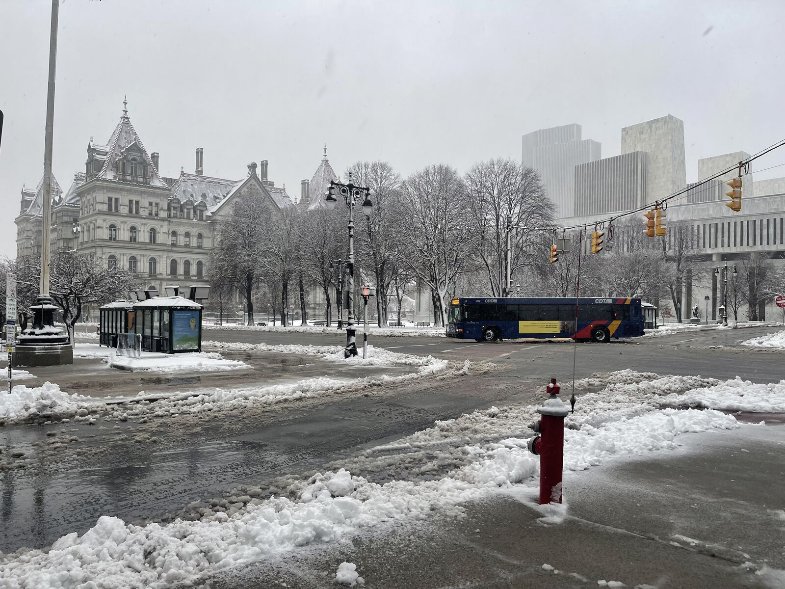
| Slushy but otherwise wet streets in Albany on March 14, 2023 (CBS6 Photo) |
Berlin, Rensselaer County on March 14, 2023 (Photo by Brianna Brann courtesy of CBS6) |
Clifton Park, Saratoga County on March 14, 2023 (Steve LaPointe/CBS6) |
Cobleskill, Schoharie County on March 14, 2023 (Photo by Linda Borowsky courtesy of CBS6) |
 |
 |
 |
 |
| Indian Lake, Hamilton County (Photo by Linda Thivierge McInerney courtesy of CBS6) |
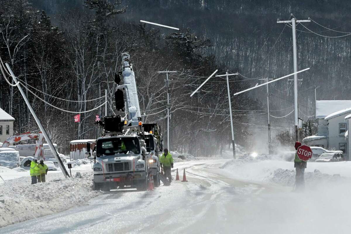
National Grid crews repair a utility pole on Route 443 near Meadow Brook Farms Dairy in Clarksville, NY (Will Waldron/Times Union) |
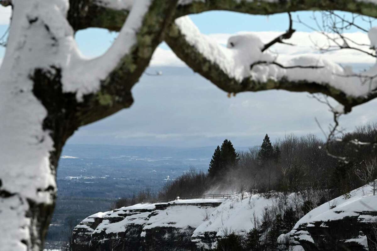
Snow-laden branches decorate the overlook at John Boyd Thacher State Park on March 15, 2023 in New Scotland, NY (Will Waldron/Times Union) |
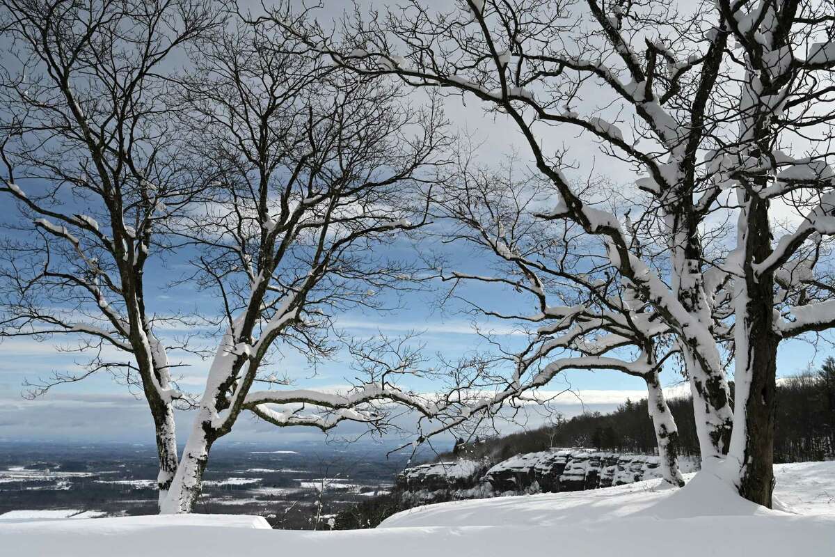
Snow-laden trees decorate the overlook at John Boyd Thacher State Park on March 15, 2023 in New Scotland, NY (Will Waldron/Times Union) |
 |
 |
 |
 |
| Snow is whipped up by strong winds at the John Boyd Thacher State Park overlook on March 15, 2023 in New Scotland, NY (Will Waldron/Times Union) |
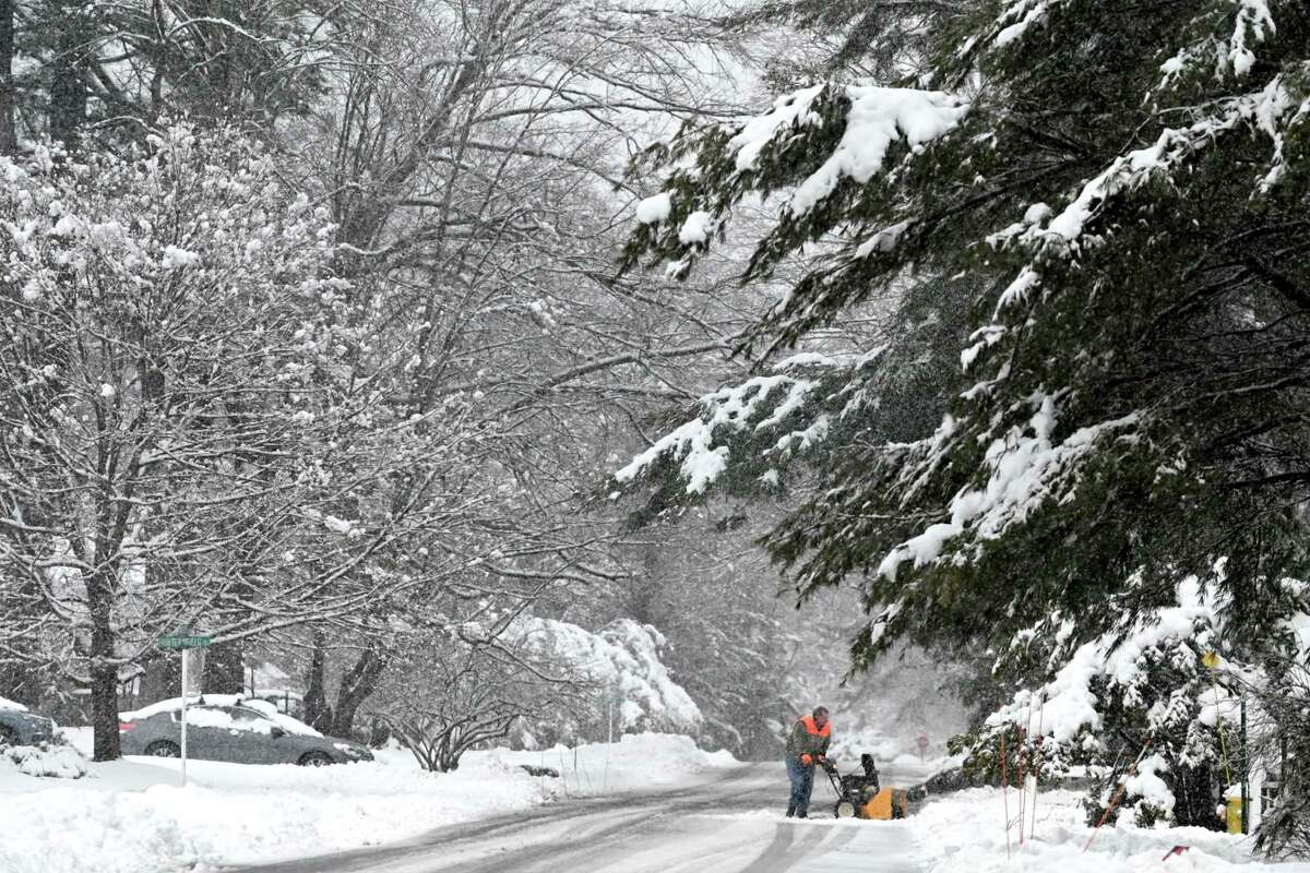
Snow is cleared from a driveway in Delmar, NY on March 14, 2023 (Will Waldron/Times Union) |
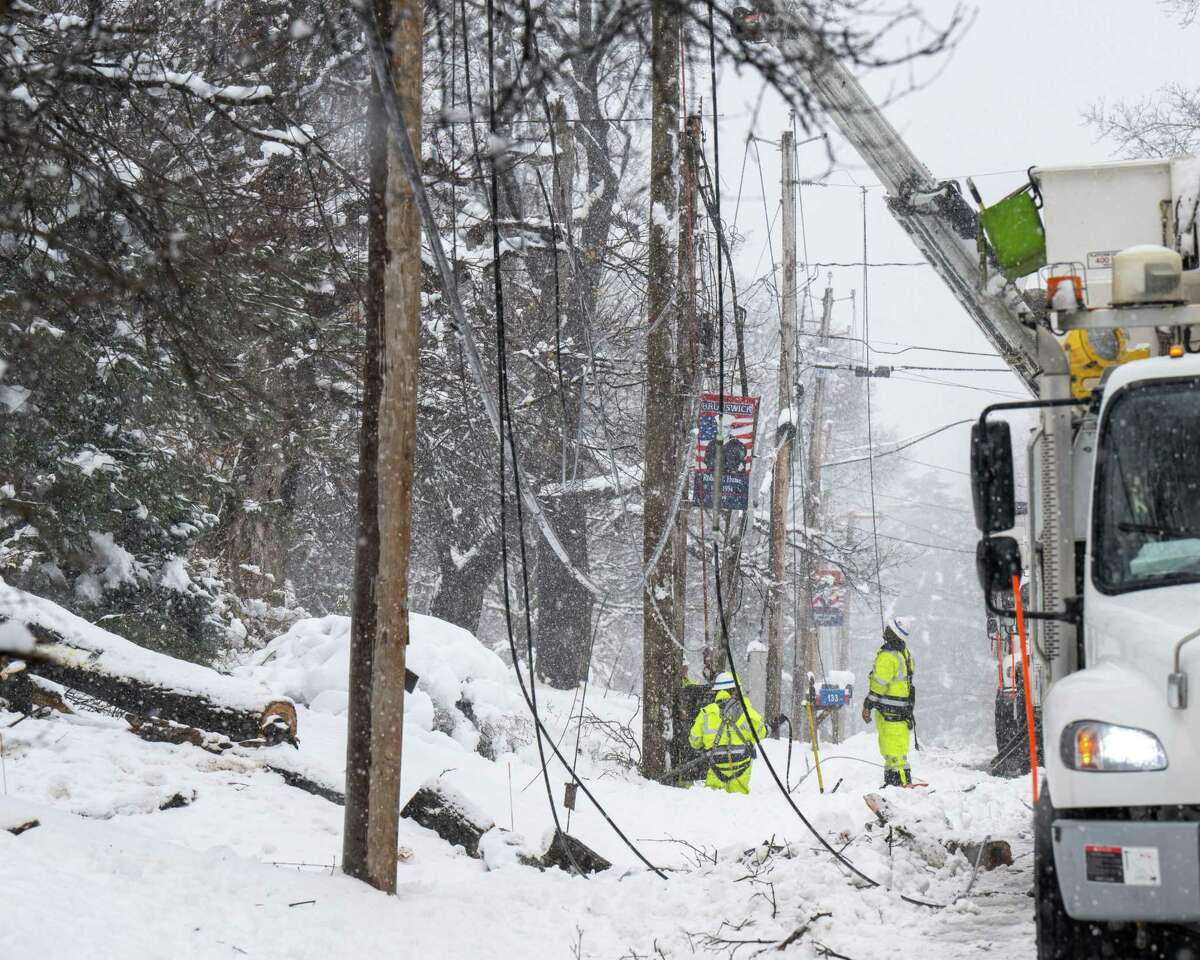
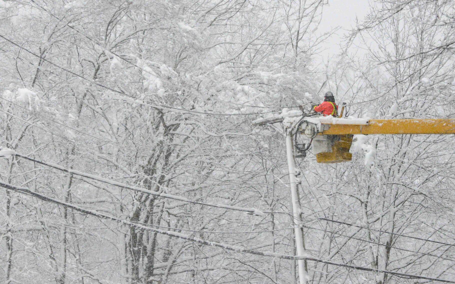
A crew from National Grid repairs downed wires along Route 2 in Brunswick, NY on March 14, 2023 (Jim Franco/Times Union) |
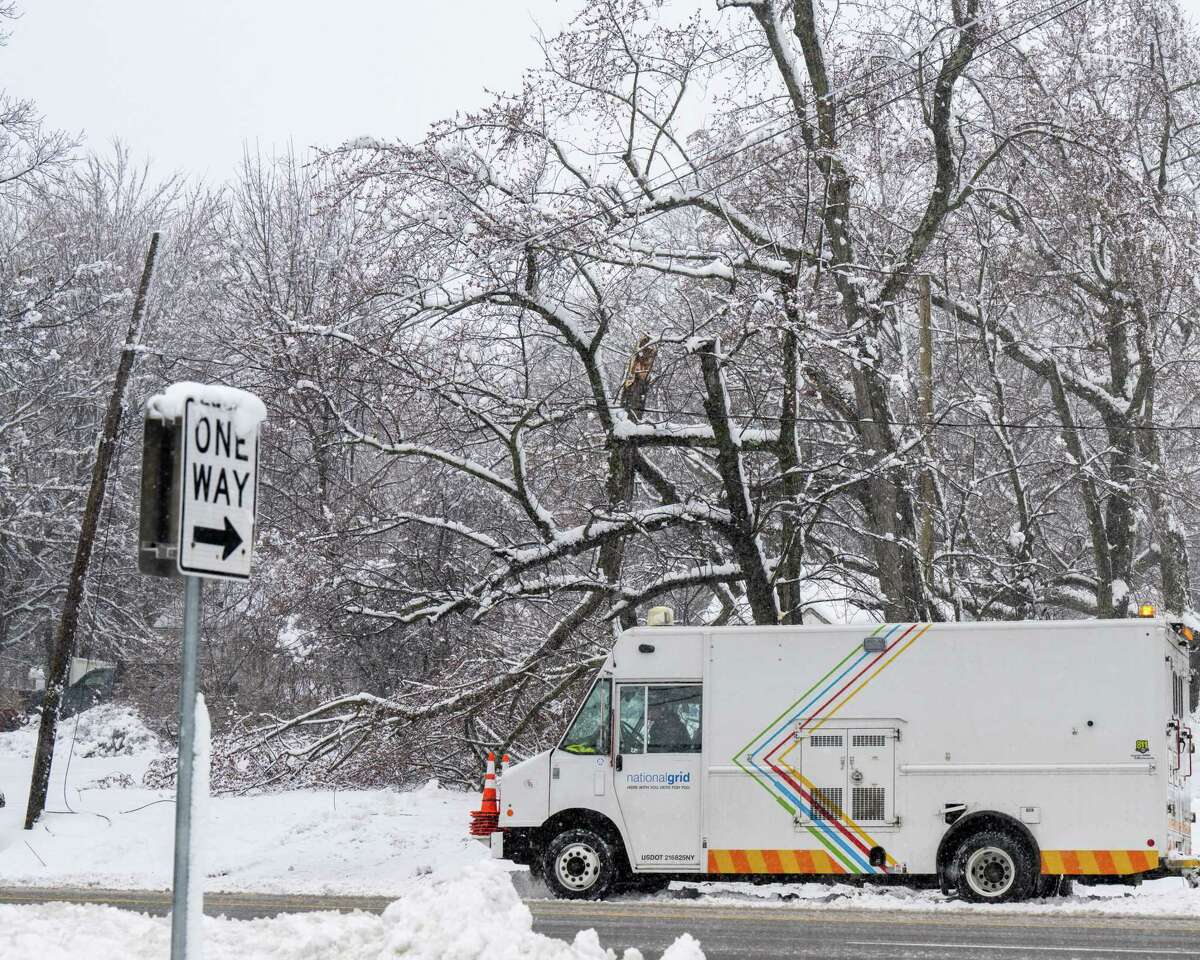
National Gird is near a large branch that fell on a wire along Route 9 in Colonie, NY on March 14, 2023 (Jim Franco/Times Union) |
 |
 |
 |
 |
| Heavy snow and wind brought a tree down in Hudson Falls, NY (Nick Friedman/Post-Star) |
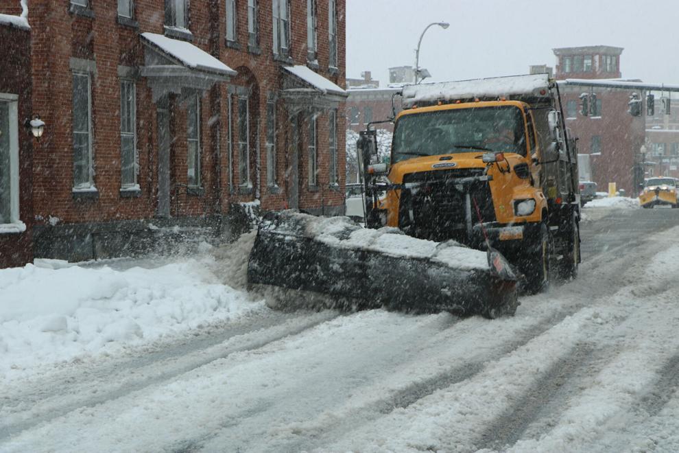
A plow truck cleans up the streets of Glens Falls, NY on March 14, 2023 (Nick Friedman/Post-Star) |
A large branch broke from the weight of heavy snow on March 14, 2023 near The Hyde Collection in Glens Falls, NY (Nick Friedman/Post-Star) |
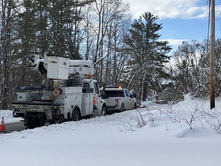
Power crews work to repair a downed electric line in Pownal, VT on March 16, 2023 (Tory Rich/Manchester Journal) |
 |
 |
||
| Green Mountain Energy fixes a power line on Guilford Road in Brattleboro, VT on March 14, 2023 (Kristopher Radder/Brattleboro Reformer) |
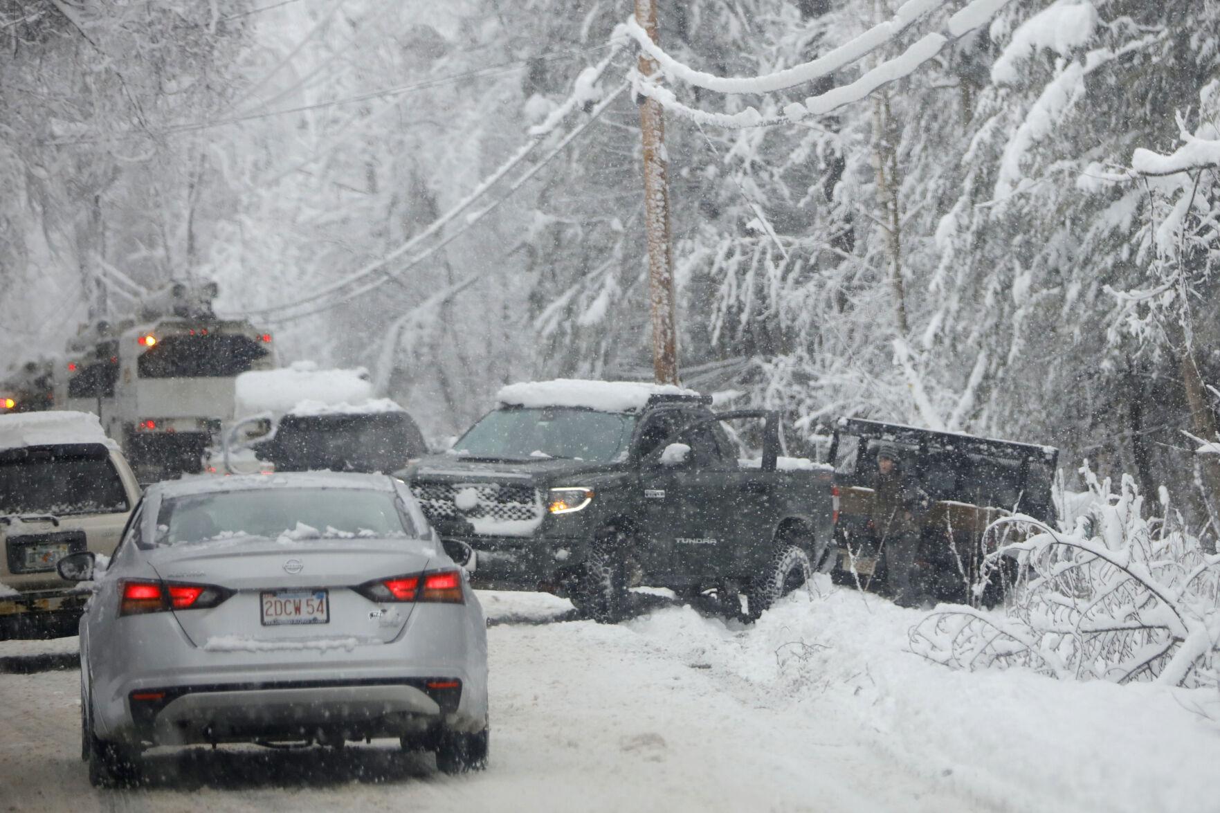
Cars and trucks drive tightly around a pickup truck as it attempts to pull another truck from the snowy embankment on Tamarack Road in Pittsfield, MA on March 14, 2023 (Stephanie Zollshan/Berkshire Eagle) |
Radar
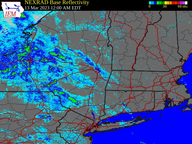 |
| Regional Radar Loop valid 12:00 am March 13 to 12:00 pm March 15, 2023 |
Environment
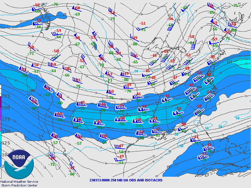
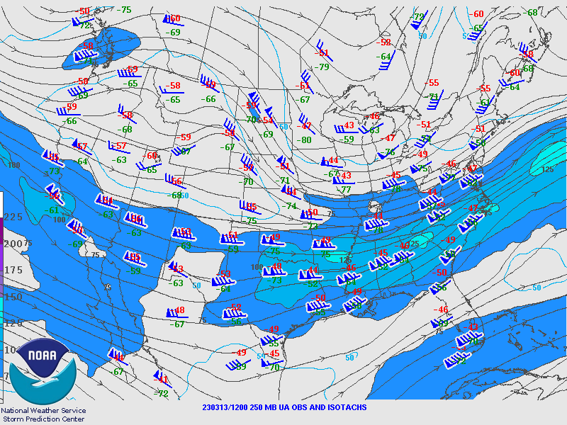
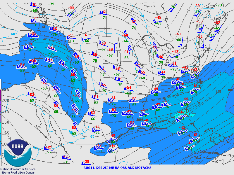
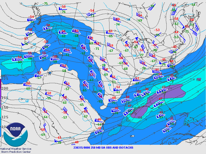
250 hPa Analysis
 |
 |
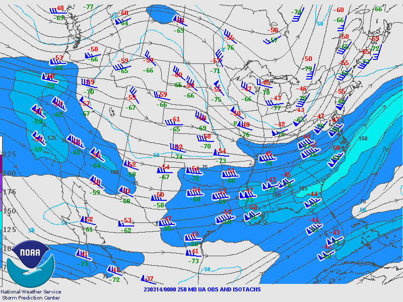 |
| Valid 00z March 13, 2023 | Valid 12z March 13, 2023 | Valid 00z March 14, 2023 |
 |
 |
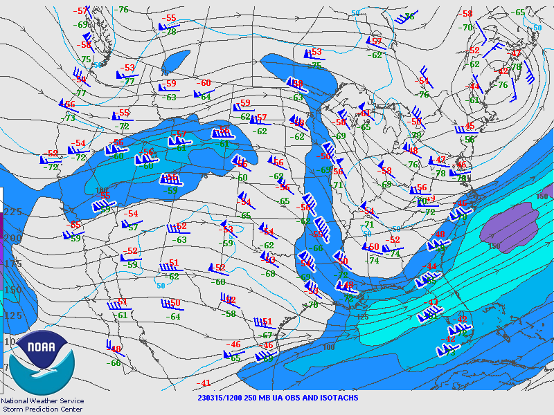 |
| Valid 12z March 14, 2023 | Valid 00z March 15, 2023 | Valid 12z March 15, 2023 |
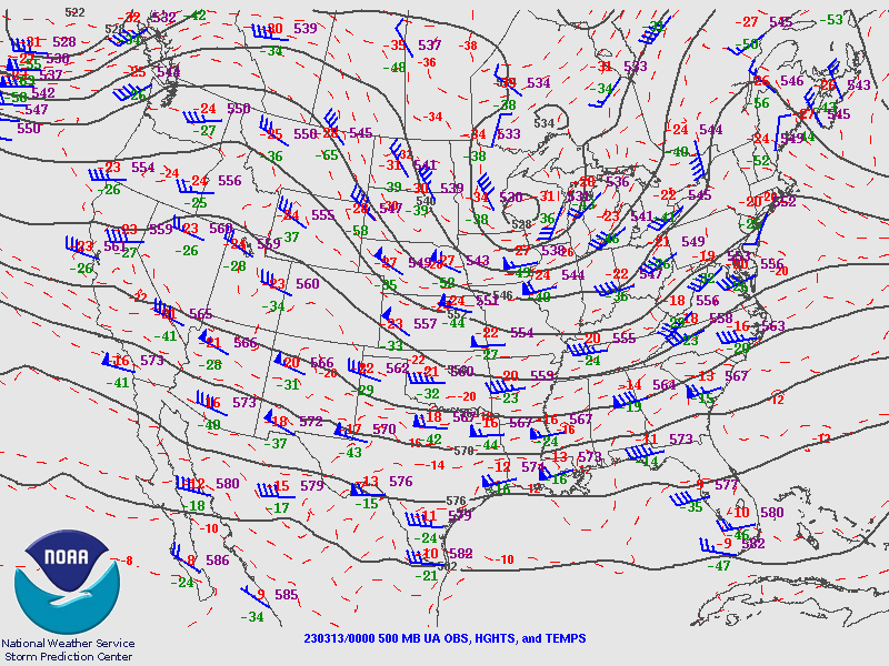
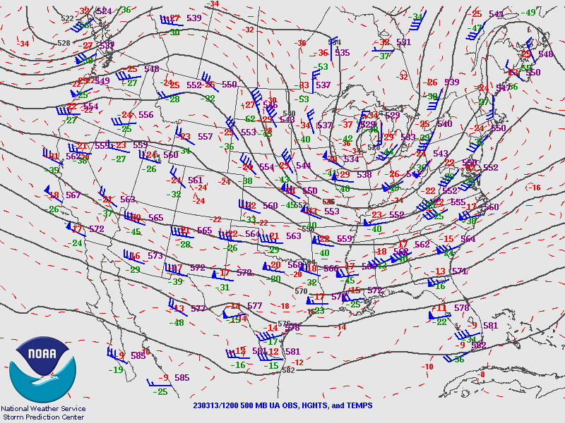
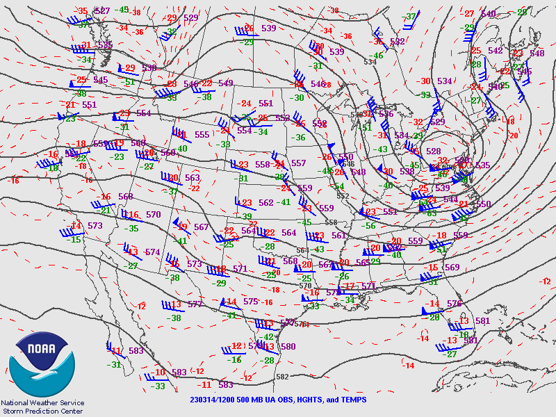
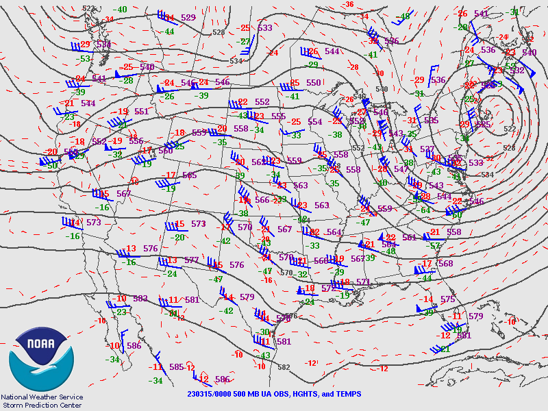
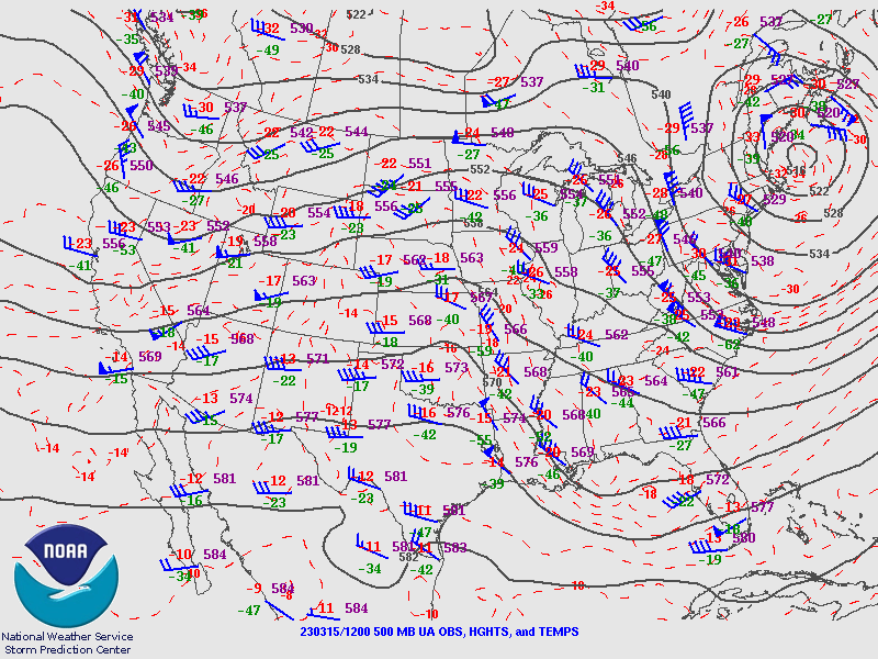
500 hPa Analysis
 |
 |
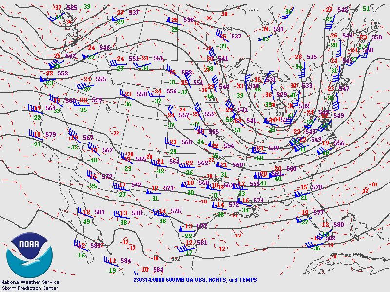 |
| Valid 00z March 13, 2023 | Valid 12z March 13, 2023 | Valid 00z March 14, 2023 |
 |
 |
 |
| Valid 12z March 14, 2023 | Valid 00z March 15, 2023 | Valid 12z March 15, 2023 |
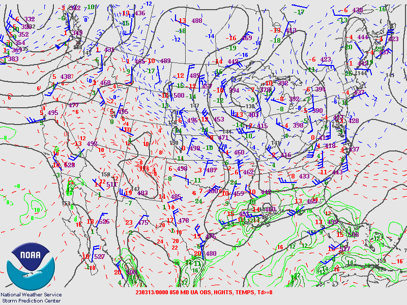
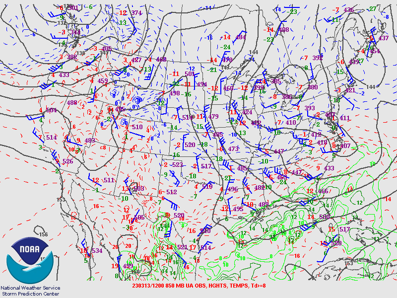
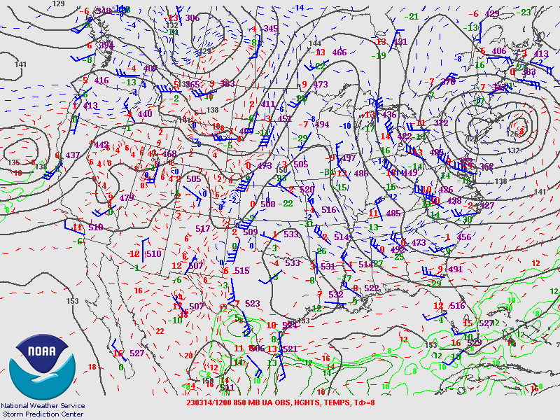
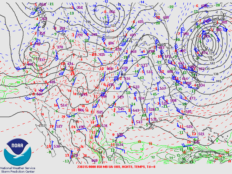
850 hPa Analysis
 |
 |
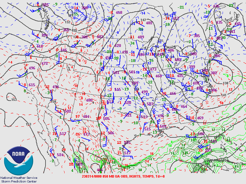 |
| Valid 00z March 13, 2023 | Valid 12z March 13, 2023 | Valid 00z March 14, 2023 |
 |
 |
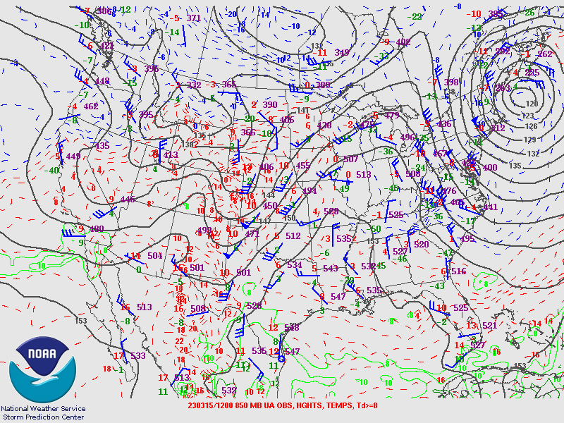 |
| Valid 12z March 14, 2023 | Valid 00z March 15, 2023 | Valid 12z March 15, 2023 |
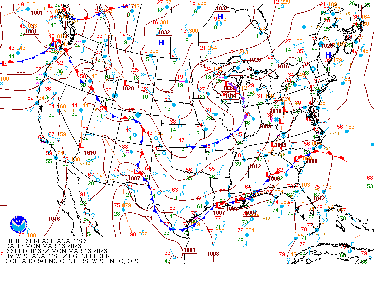
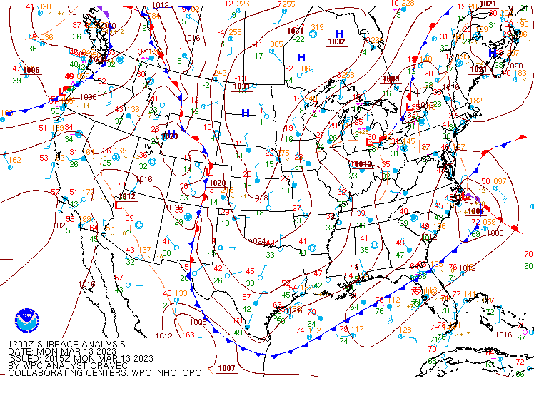
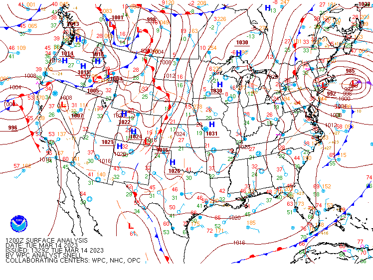
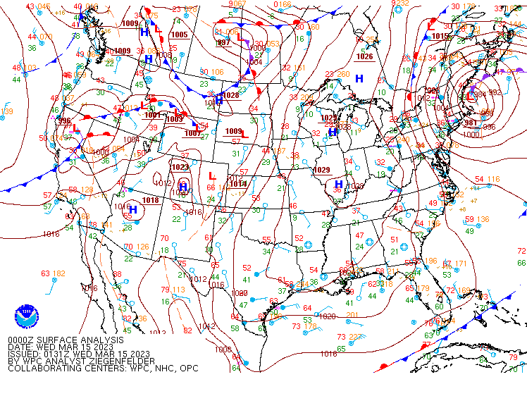
Surface Analysis
 |
 |
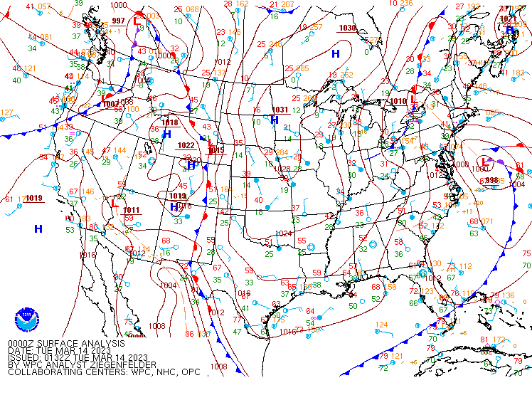 |
| Valid 00z March 13, 2023 | Valid 12z March 13, 2023 | Valid 00z March 14, 2023 |
 |
 |
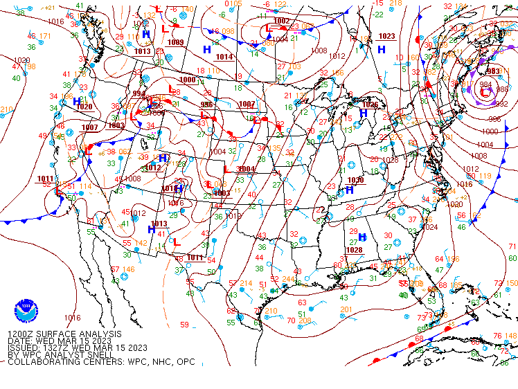 |
| Valid 12z March 14, 2023 | Valid 00z March 15, 2023 | Valid 12z March 15, 2023 |
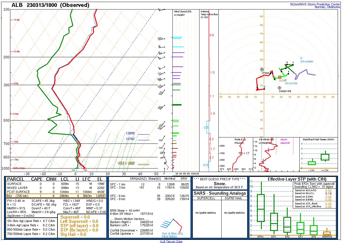
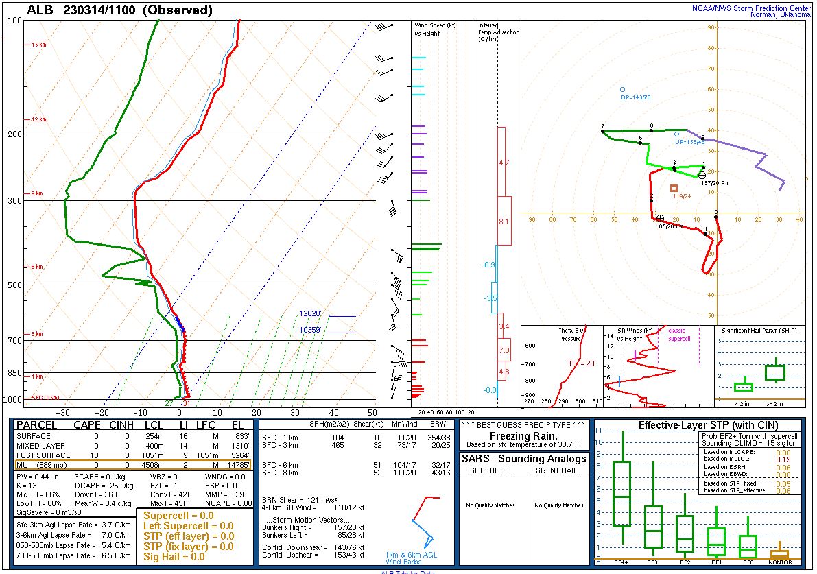
Forecast Soundings from the University at Albany/NYS Mesonet
 |
 |
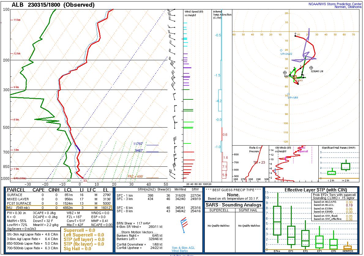 |
| 18z March 13, 2023 | 11z March 14, 2023 | 18z March 15, 2023 |
 |
Media use of NWS Web News Stories is encouraged! Please acknowledge the NWS as the source of any news information accessed from this site. |
|

