Flood Outlook
Current Conditions
|
|
|
|
|
Current Vis/IR Loop (click for loop)
|
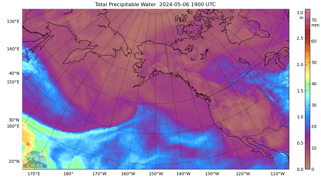
Total Precipitable Water Loop
|
|
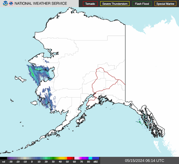
Alaska Mosaic Radar Loop
|
|
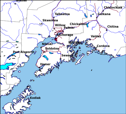
Kenai Radar Loop
|
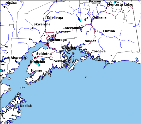
Middleton Radar Loop
|
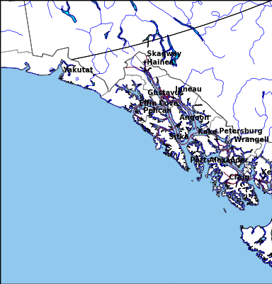
Sitka Radar Radar Loop
|
|
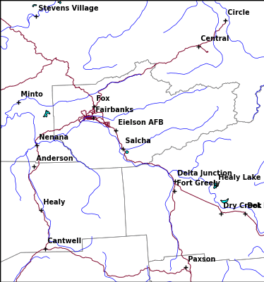
Fairbanks Radar Loop
|
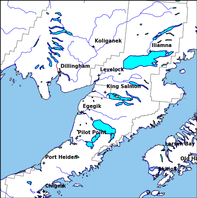
King Salmon Radar Loop
|
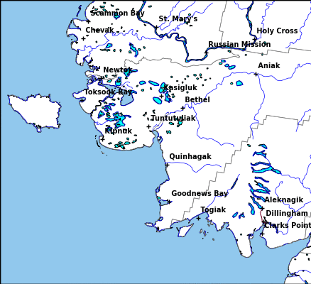
Bethel Radar Loop
|
|
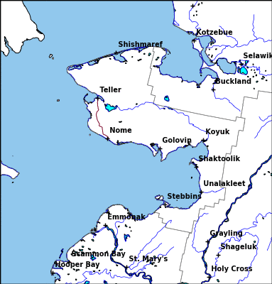
Nome Radar Loop
|
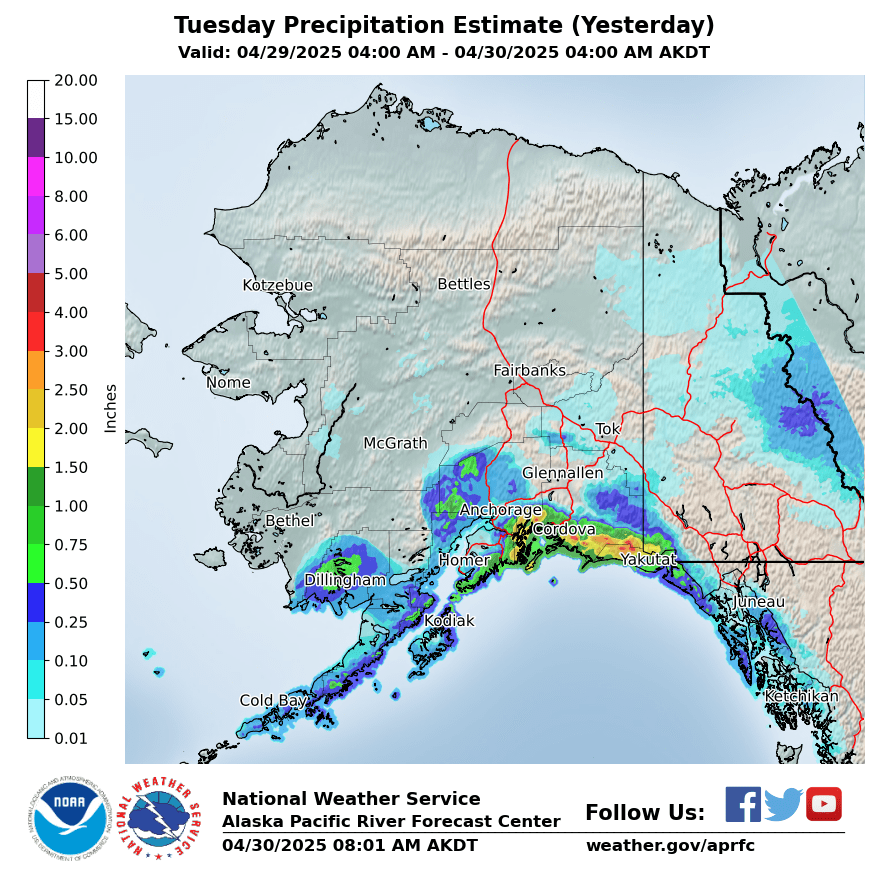
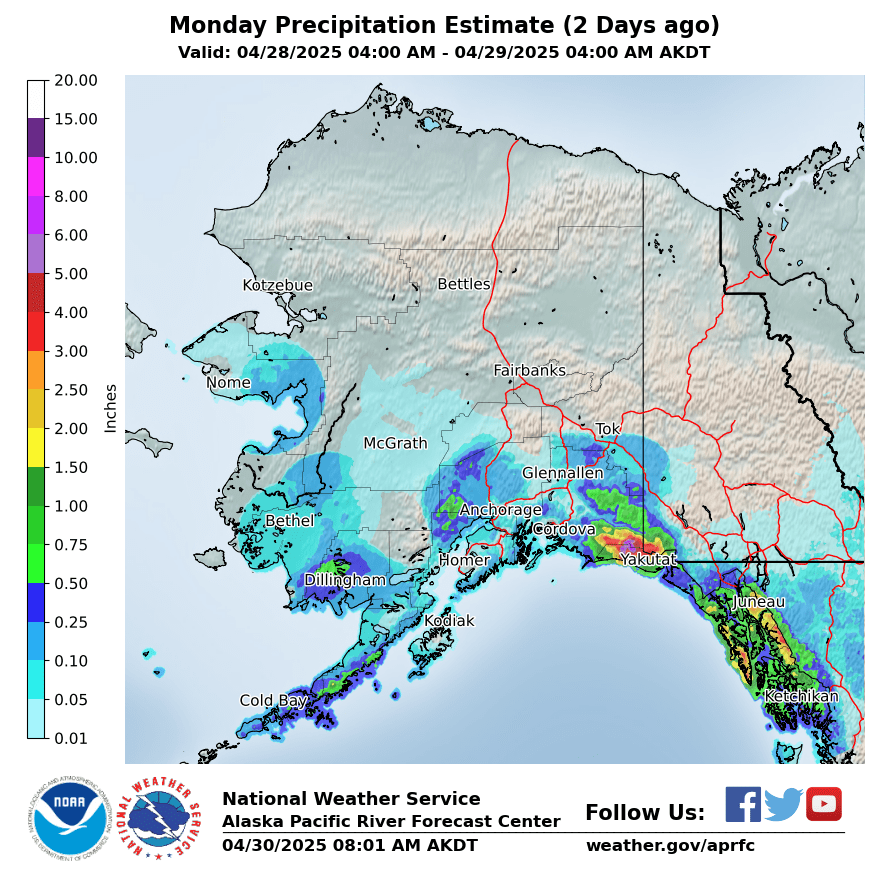
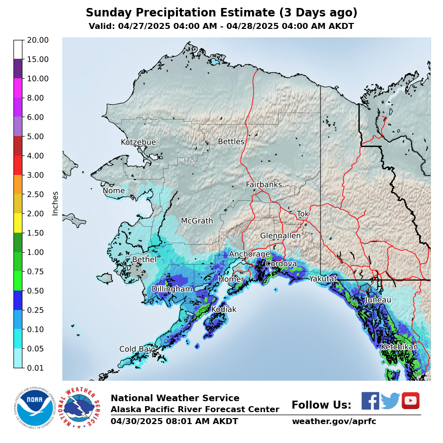
Observed Precipitation
|
Yesterday
|
2 Days Ago
|
3 Days Ago
|
|
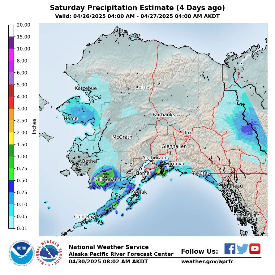
4 Days Ago
|
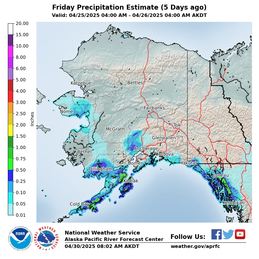
5 Days Ago
|
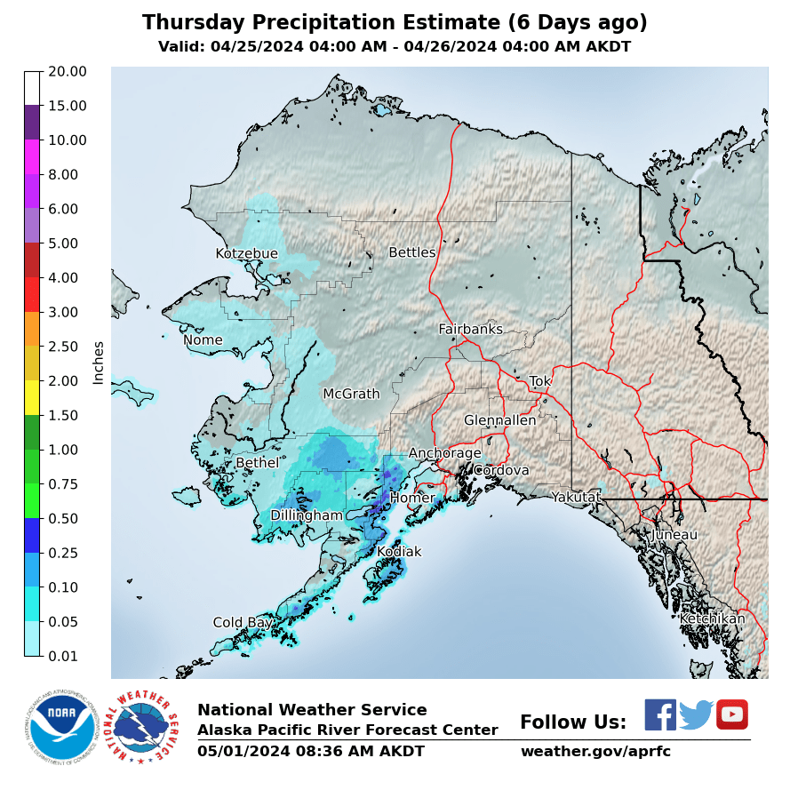
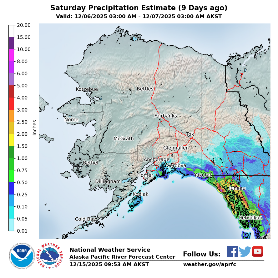
6 Days Ago
|
|
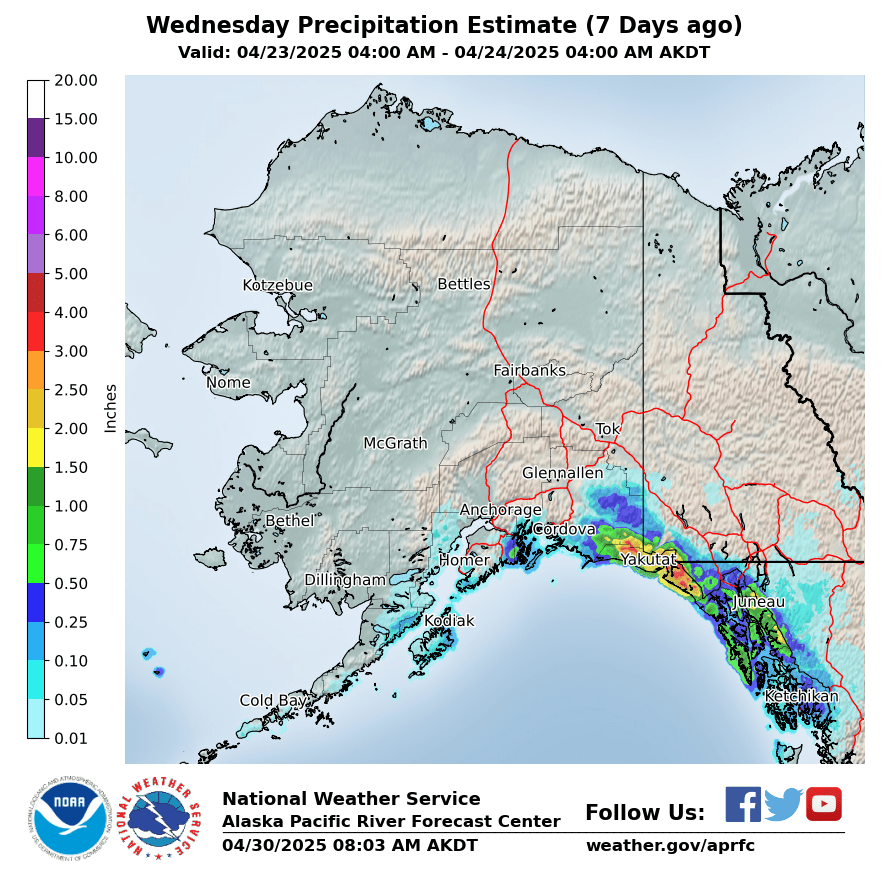
7 Days Ago
|
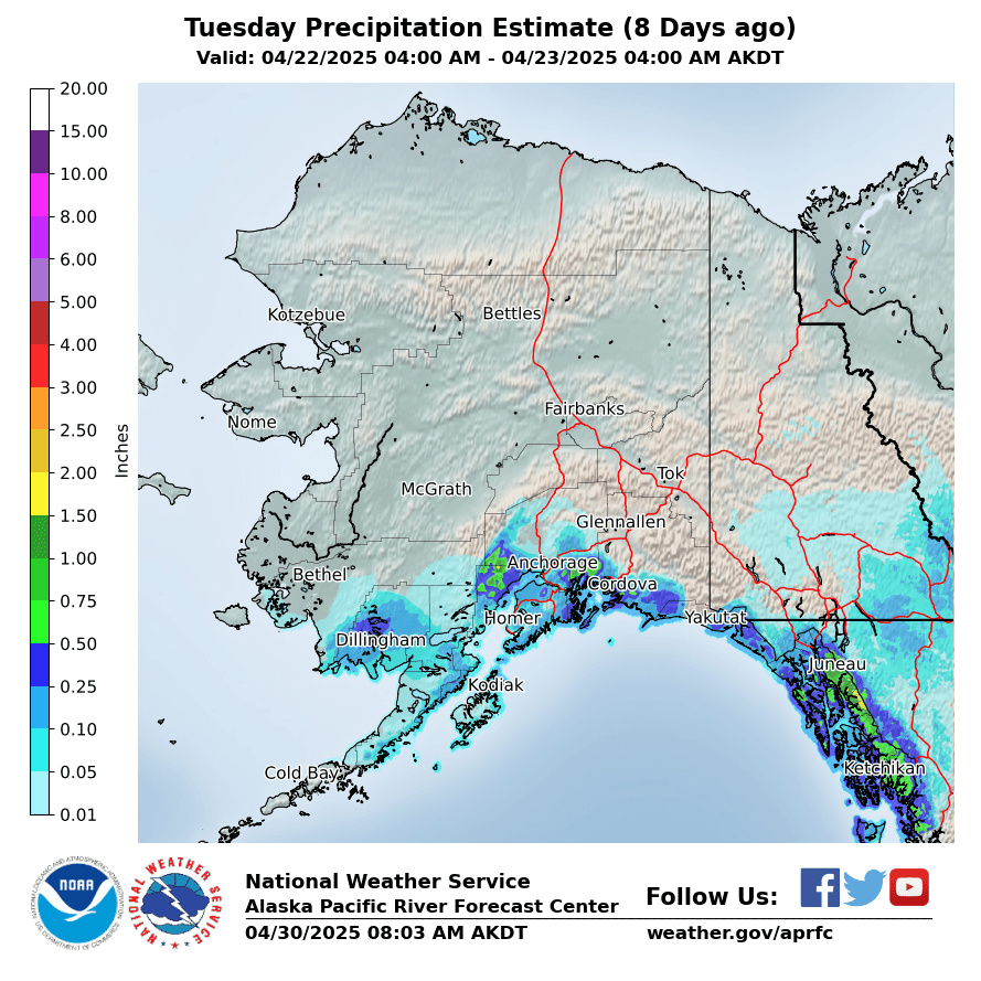
8 Days Ago
|
9 Days Ago
|
|
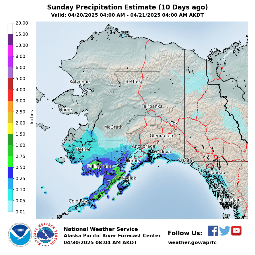
10 Days Ago
|
Forecasted Precipitation
|
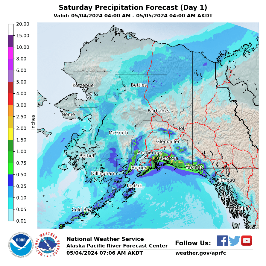
Day 1
|
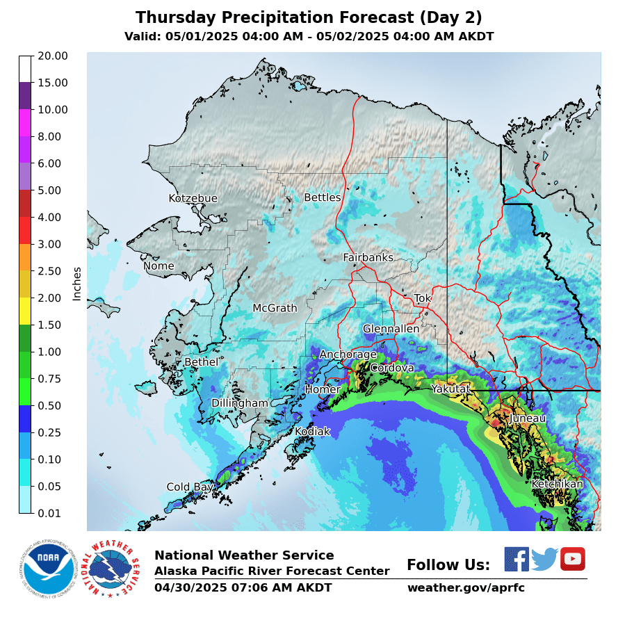
Day 2
|
Day 3
|
|
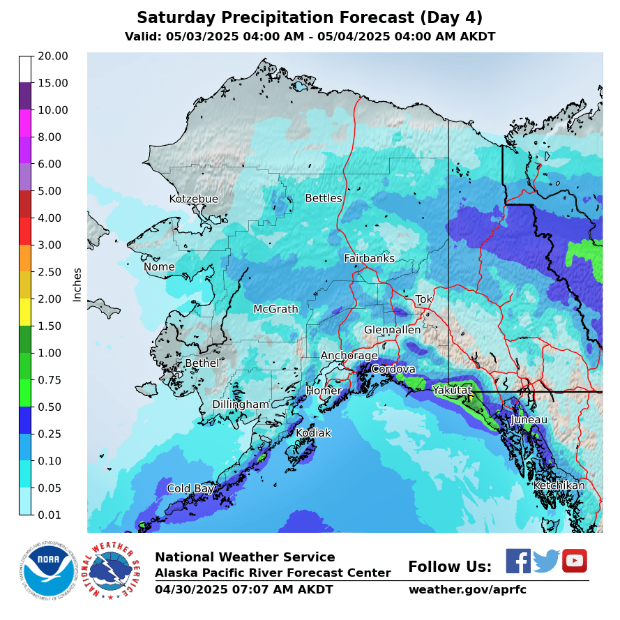
Day 4
|
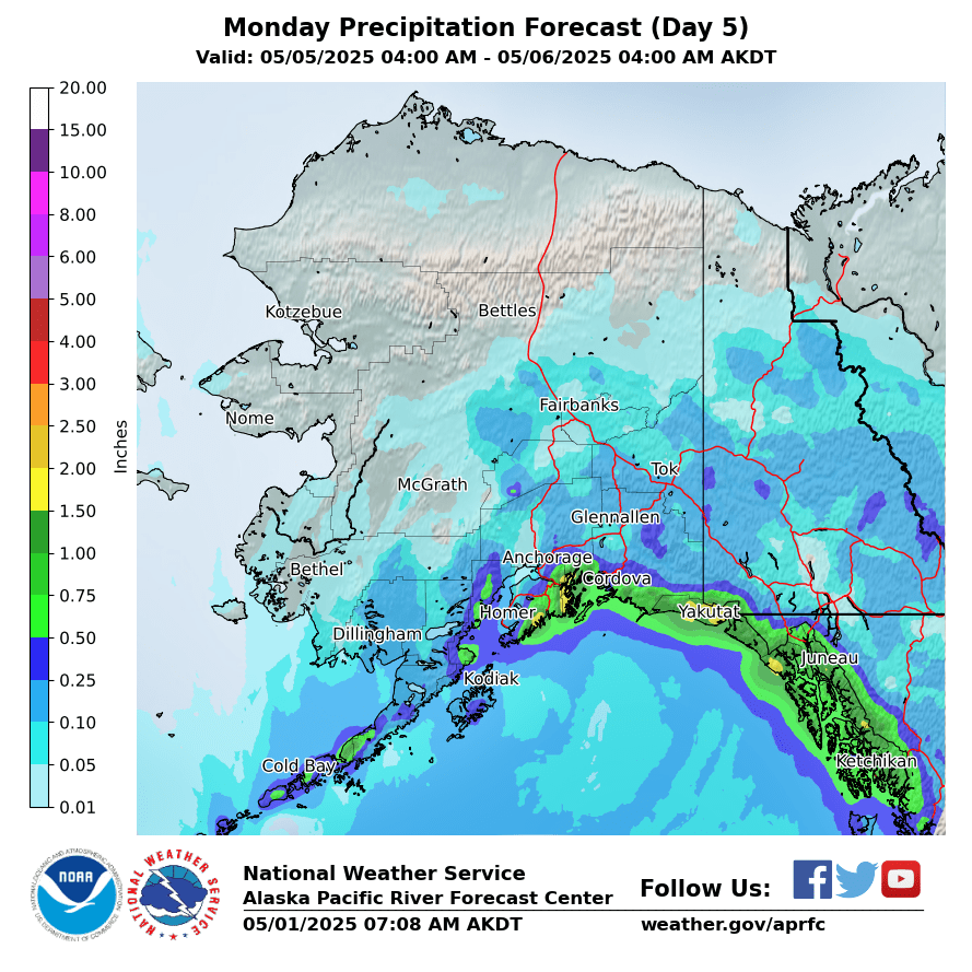
Day 5
|
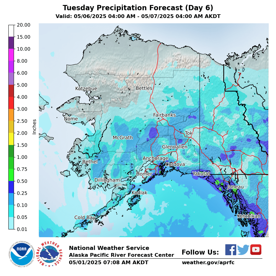
Day 6
|
|
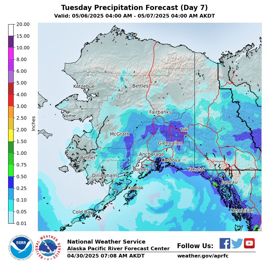
Day 7
|
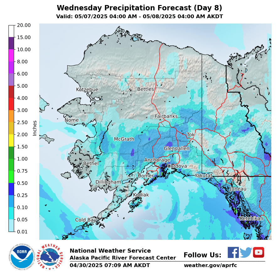
Day 8
|
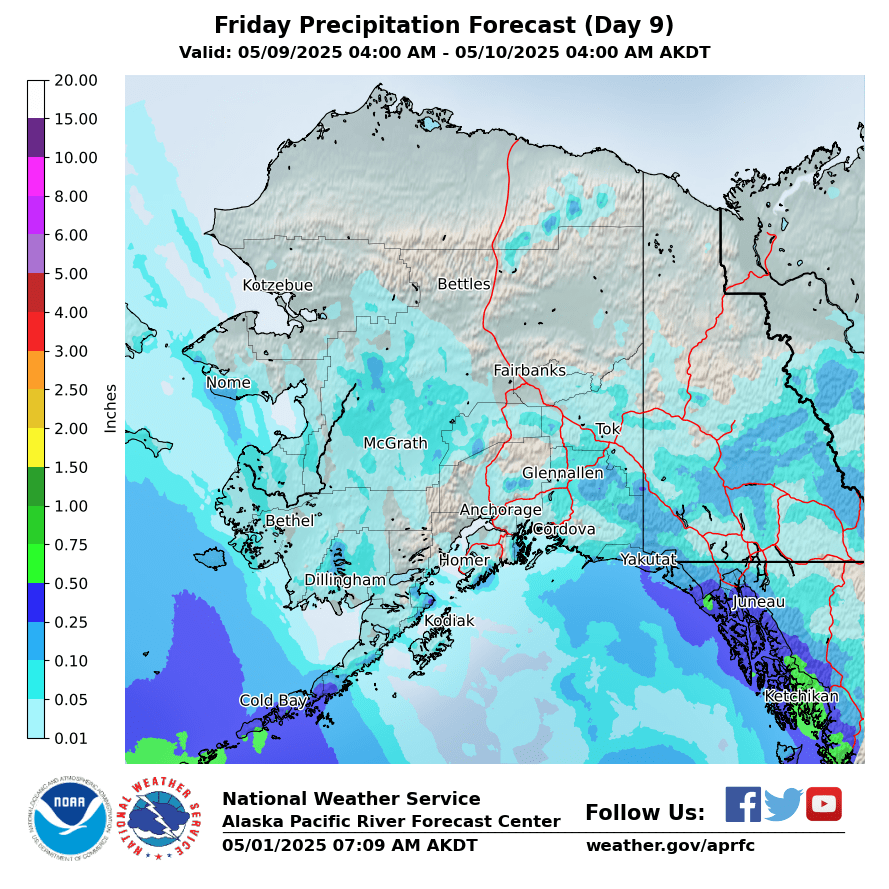
Day 9
|
|
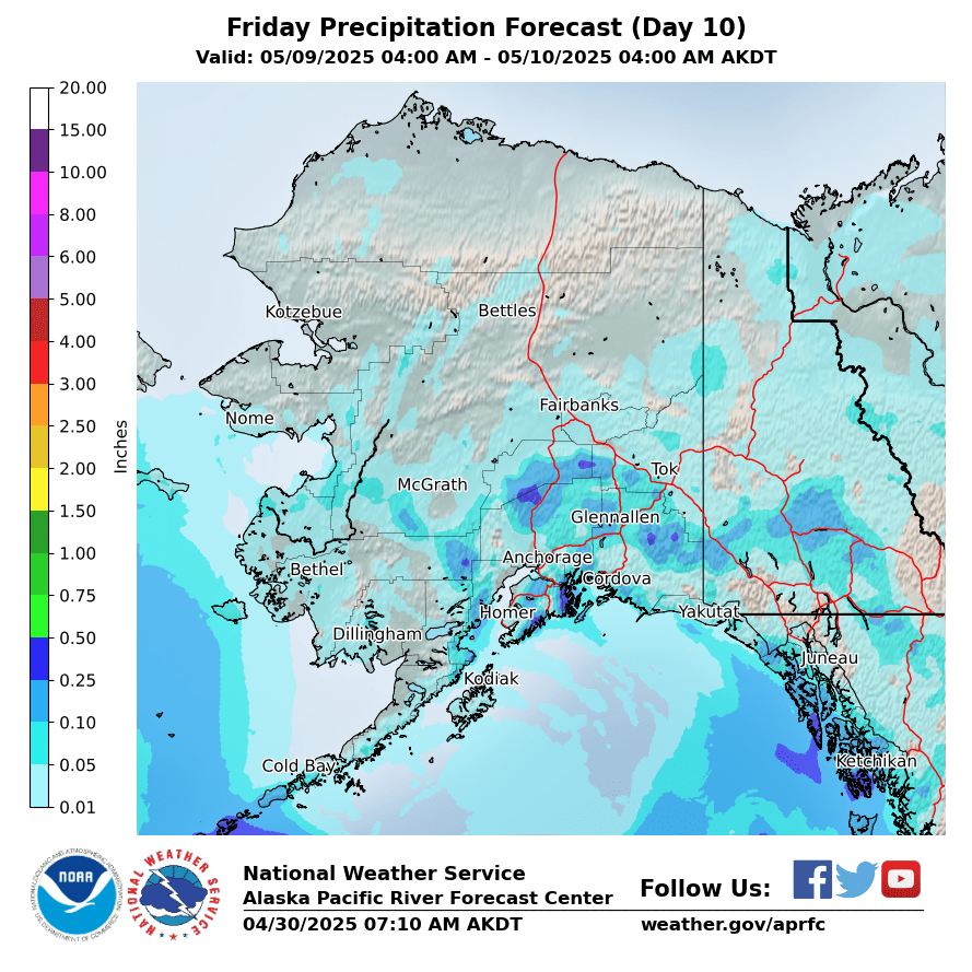
Day 10
|
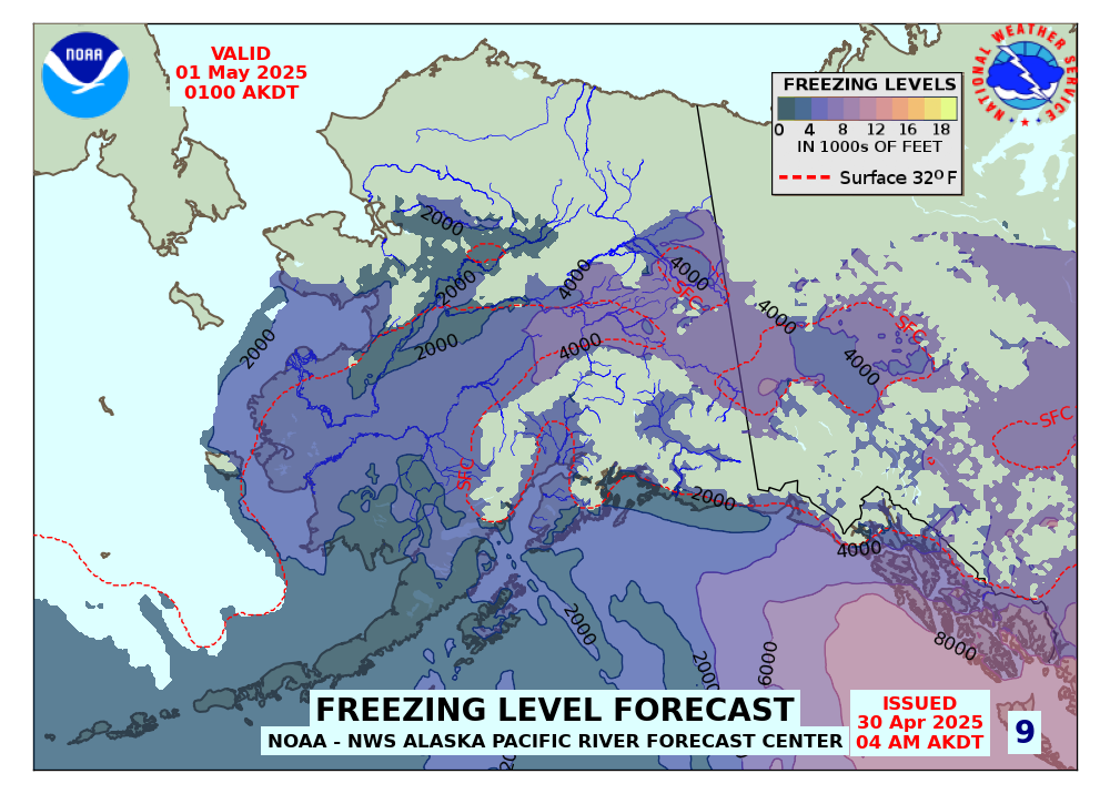
Forecasted Freezing Levels (click for Loop)
|
|
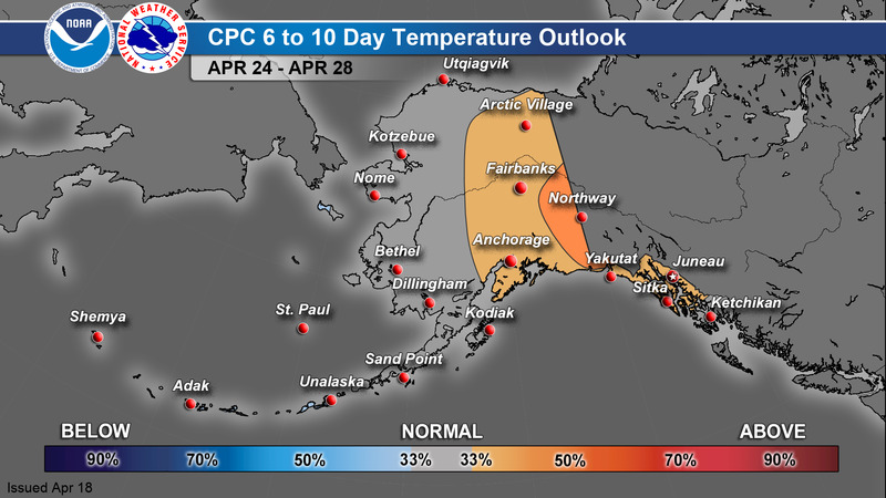
CPC 6-10 Day Outlook
|
Temperature
|
Precipitation
|
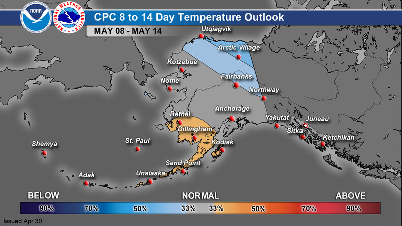
CPC 8-14 Day Outlook
|
Temperature
|
Precipitation
|
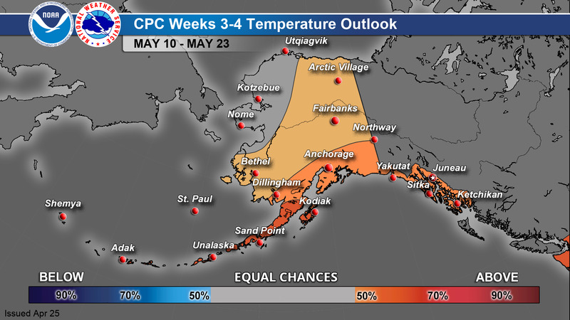
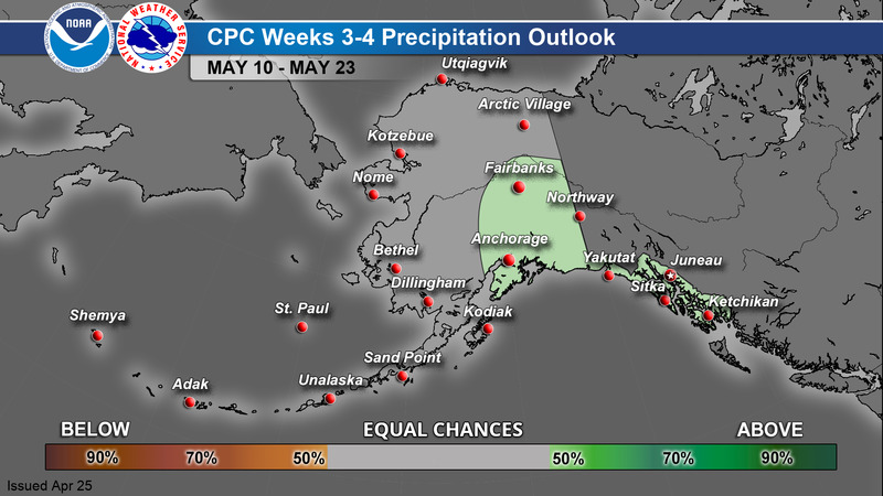
CPC Week 3-4 Outlook
|
Temperature
|
Precipitation
|
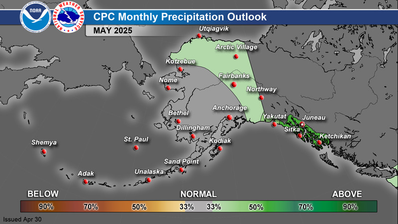
CPC 1 Month Outlook
|
Temperature
|
Precipitation
|
>
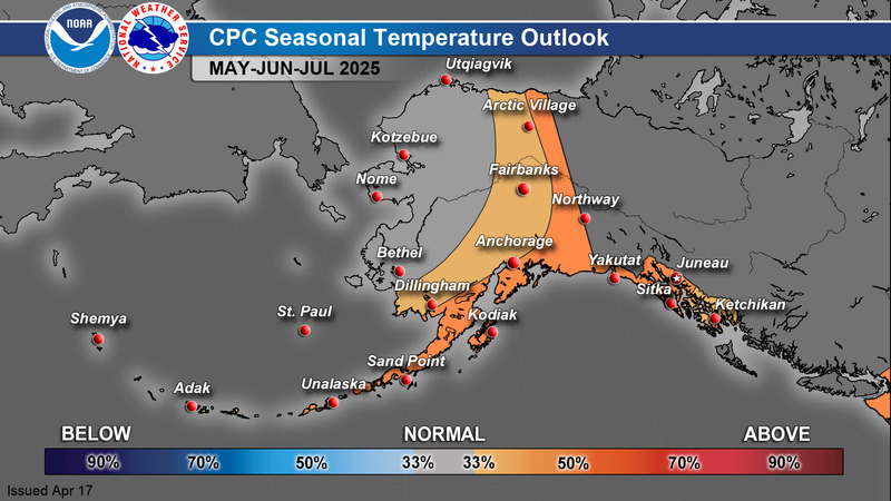
CPC 3 Month Outlook
|
Temperature
|
Precipitation
|
For additional climate outlook data, see: https://www.cpc.ncep.noaa.gov/
A Guide to Interpreting CPC Products: https://www.weather.gov/afc/GuideToInterpretCPCProducts
Alaska Drought Monitor
|
|
955
FXAK68 PAFC 281254
AFDAFC
Southcentral and Southwest Alaska Forecast Discussion
National Weather Service Anchorage AK
454 AM AKDT Tue Jul 28 2026
.SHORT TERM FORECAST SOUTHCENTRAL ALASKA (Days 1 through 3: Today
through Thursday evening)...
Satellite imagery this morning shows a surface low off the
southeast coast of Kodiak Island continuing to move through the
western Gulf toward the North Pacific. Low clouds continue to
rotate around the low; however, these clouds should dissipate in
coverage, at least across interior parts of the island, as the
low exits the region.
Farther north, the upper-level trough that brought widespread
shower activity from Homer to Broad Pass yesterday continues to
elongate and weaken this morning. A surface low near McGrath this
morning will move toward Bristol Bay as an upper-level ridge
begins to drive south from northwest Alaska. Scattered showers
will linger across the Susitna Valley and the Copper River Basin
today, diminishing in coverage as the trough weakens. A weak
easterly wave will move across Southcentral today, getting drawn
southwestward toward Bristol Bay be this evening. This feature
may result in a few isolated thunderstorms over parts of the
Copper River Basin and Susitna Valley this afternoon. While
chances are low (10-20%) for thunderstorm development, any
additional daytime heating from breaks in the clouds will help
increase instability.
The upper-level ridge axis then moves to the Alaska Range by
Wednesday and over the Southern Mainland for Thursday and Friday.
This pattern will result in a return to more summer-like
conditions with generally clear skies and temperatures pushing
into the upper 60 to lower 70s for coastal locations and will into
the 70s for interior locations. A period of gusty winds is likely
(70-80%) to develop for Seward and Whittier as the ridge builds in
from the north. One caveat to this forecast will be the extent of
lingering low clouds and fog over the Gulf of Alaska as the ridge
builds in. There is some indication that some low clouds or fog
may advect toward the immediate coast, and perhaps into Cook
Inlet, as early as Wednesday morning with a greater chance of
these clouds moving into Prince William Sound by Thursday.
-TM
&&
.SHORT TERM FORECAST SOUTHWEST ALASKA AND THE BERING
SEA/ALEUTIANS (Days 1 through 3: Today through Thursday)...
Morning satellite imagery shows a trough in the Gulf of Alaska, a
weakening front in the eastern Aleutian Chain, and a ridge
building behind the front. Though the front in the Aleutians will
dissipate by early afternoon, rainfall will continue through early
afternoon. Throughout the Bering and into the AKPen and Bristol
Bay, areas of fog persist. Much of Southwest has cleared out after
the trough moved to the Gulf overnight.
With the front having dissipated and the main trough well into
the North Pacific, ridging once again becomes established in the
Bering today and will extend up to Interior Alaska through the
week. Some showers will linger along the western Alaska Range from
King Salmon northward through this evening as upsloping winds
still persist east of the ridge axis. Otherwise, Southwest and
much of the Alaska Peninsula (AKPen) will see warm, clear and dry
conditions through Thursday. While much of Southwest and the
northern AKPen will see highs in the 60s to low 70s, the areas to
watch will be from Bristol Bay north to the Kuskokwim Valley,
where there will likely be a prolonged period of daytime highs
above 70 degrees. The warmest of these days will be Wednesday and
Thursday when the ridge positions directly over Southwest. For
Bristol Bay, conditions like these occur about once a year,
typically towards the end of July. With more people out and about
conducting subsistence activities, it`s a good idea to plan for
these warmer temperatures, especially as several days in a row of
70+ degree temperatures could lead to cumulative heat stress. The
good news is that overnight lows will dip to 45-50 degrees,
providing the opportunity for some cooling down overnight. We`ll
continue to monitor these conditions to see whether warmer
temperatures are more pronounced. For the Bering, Aleutians and
far southern AKPen, the ridge overhead means conditions will
continue to be conducive for areas of low stratus and fog. Areas
of overnight fog may also form in Bristol Bay and along the AKPen
up to King Salmon. Fog will continue to be the most challenging
part of the forecast.
A low from the North Pacific moves towards the western Aleutian
Chain Wednesday afternoon and spreads to the southern Bering on
Thursday while pushing a front through the Aleutians. This will
begin to displace the ridge east, bringing rain and small- craft
winds to the southern Bering and much of the Aleutian Chain
Wednesday afternoon into Thursday. A somewhat strong upper jet and
theta-e ridge will be present with this system, which may allow
conditions to be conducive for isolated marine lightning along the
front. By Thursday evening, the low will be positioned in the
central Bering with its front positioned in the eastern Aleutians.
-PA
&&
.LONG TERM FORECAST (Days 4 through 7: Friday through Monday)...
The trend towards warmer, drier conditions continues through the
long term period as high pressure remains over much of mainland
Alaska and the northern Gulf of Alaska. Broad troughing is
forecast to slide across the southern Bering and Aleutians Friday
through Saturday. While not particularly strong, intermittent rain
chances are likely beneath and downstream of the trough, with the
greatest chance for rain stretching from Unalaska and Saint Paul
to coastal Southwest Alaska through Saturday. By Sunday into early
next week, the low tracks into the North Pacific with its front
remaining well south of the northern Gulf coast.
&&
.AVIATION...
PANC...VFR conditions will persist through this evening. Showers
remain possible early this morning and again later this
afternoon, and may bring ceilings down briefly to MVFR levels;
however, ceilings will recover quickly to VFR for the remainder of
the forecast period. Lingering gusty southeast winds overnight
will quickly shut off by early this morning with a light westerly
wind developing late this morning and continuing through late this
evening.
-CL/TM
&&
$$
101
FXAK69 PAFG 281157
AFDAFG
Northern Alaska Forecast Discussion
National Weather Service Fairbanks AK
357 AM AKDT Tue Jul 28 2026
.SYNOPSIS...
A front which moved into the eastern Tanana Valley and Fortymile
country brought rain showers overnight to areas SE of Fairbanks
and the White Mountains. Through the day on Tuesday, the system
will finally depart northern AK in its entirety, although not
before bringing a few more showers, and perhaps a few rumbles of
thunder, to the fortymile country. Clearer skies are expected
through the interior for much of the day on Tuesday, before a
shortwave approaches the western coast N of the Lisburne Peninsula
by late in the day. Expect chances of rain to return with this
system, although they will stay primarily confined to the Brooks
Range and North Slope through the remainder of the week. Some
isolated showers can`t be ruled out for the remainder of the
western coast through the second half of the week, but otherwise
anticipate generally drier conditions across the interior. A
building ridge over the weekend brings with it widespread 70s, and
even 80s for some locations as warm weather returns.
&&
.KEY WEATHER MESSAGES...
Central and Eastern Interior...
-Lingering chances of isolated showers and thunderstorms for the
forty mile country through Tuesday, with drier weather prevailing
through the remainder of the week.
-Temperatures over the weekend will warm into the 70s and low 80s
as a ridged of high pressure builds over the area.
West Coast and Western Interior...
-Lingering chances of isolated rain showers along the West Coast
through the week.
-Drier and warmer for areas further into the interior.
North Slope and Brooks Range..
-Drier weather on Tuesday begins to change by late in the day as
a system moves in from the NW.
-Chances of rain move from W to E across the North Slope through
Wednesday, with drier weather expected Thursday and Friday.
-Temperatures warm into the upper 60s and lower 70s by Thursday
and Friday.
&&
.SHORT TERM FORECAST DISCUSSION...Through Thursday.
A fairly quiet weather pattern for northern Alaska through the
duration of the short term. The upper level trough over the
eastern interior responsible for the lingering cloud cover from
the White Mountains southward will fully depart through the day on
Tuesday. While a few thunderstorms and rain showers can`t be
ruled out for the fortymile country, the lack of any substantial
CAPE will keep these limited in nature. Across the interior, drier
weather continues. High temperatures will be on a general warming
trend through the remainder of the week, with 850 mb temperatures
reaching back up to +7C by Thursday, and warming further still
through the weekend.
A ridge building over the Bering will begin to move east, moving
into the western coast and western interior through the middle of
the week. As associated high pressure builds overhead, the ridge
will redirect a shortwave trough trying to advance out of the
Chukchi Sea over its northern axis and into the North Slope.
Bands of rain will move across the the Lisburne Peninsula
northward by Tuesday night, and then through the rest of the North
Slope and the Brooks Range on Wednesday. Most of the associated
moisture will be largely wrung out along the Brooks Range, though
the Yukon Flats could see some light rain on Thursday.
&&
.FIRE WEATHER...
A few showers linger in the Eastern Interior and Alaska Range
this morning, otherwise most of the area is dry. Another Arctic
front moves into the North Slope this evening and arrives in the
Brooks Range tomorrow. The front will weaken and drift southeast
Wednesday night/Thursday with a few showers possible in the
Eastern Interior, though the chances for wetting rain remains low.
Temperatures through Thursday will be in the 60s to near 70
across the Interior with min RHs around 30 to 40% in the
Central/Eastern Interior and 35 to 50% in the Western Interior.
Winds will be a bit breezy from the west on Wednesday across the
Interior with gusts around 15 to 25 mph, though no significantly
strong wind is expected. Afterwards, ridging will become more
prominent over the region as it builds in from the southwest. This
is looking more likely to produce an extended period of warmer
and drier weather over much of Northern Alaska. An introduction of
more numerous thunderstorms is also likely, especially heading
into next week.
The exact placement of the ridge will determine how hot/dry it
gets as well as the thunderstorm coverage. This pattern is
conducive for increased fire weather, but the level of intensity
is uncertain at this time due to the complexity of the evolving
pattern. Regardless, much of the Interior looks to get back into
the 70s and possibly the 80s with min RHs in the 20s/30s and
increased lightning activity. We will continue to monitor and
update as necessary.
&&
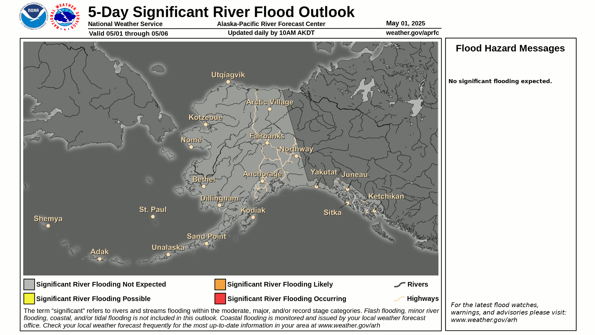
.HYDROLOGY...
No concerns at this time, rivers are returning to near normal
stages.
&&
.LONG TERM FORECAST DISCUSSION...
Beginning the long term on Friday, an upper level ridge will be
in the NPAC with an appendage extending northward over mainland
Alaska. To the west will be a broad longwave trough which extends
from the North Pole to about 35N, south of the Aleutians. In the
middle would be a boundary separating cooler/wetter weather from
warmer and drier weather. This could set up over the West Coast,
allowing for warmer and drier weather to prevail across the
Interior though there is uncertainty with the exact placement of
these features. Nonetheless, the Central/Eastern Interior looks to
be warm with highs well into the 70s and potentially 80s for a
prolonged period of time heading into the weekend and next week.
There will also likely be an uptick in thunderstorm activity for
much if Northern Alaska. Given that the West Coast looks to be the
battle ground, there may be periods of both warm weather and
thunderstorms as well as cool/rainy days. The North Slope looks to
get mild as well since there should be an increase in southerly
flow, but troughing may impede periodically, bringing cool
weather. No significant weather is expected, but fire weather
activity might increase after a pretty tranquil season so far.
Coastal Hazard Potential Days 3 and 4...None
&&
.AFG WATCHES/WARNINGS/ADVISORIES...
AK...None.
PK...Small Craft Advisory for PKZ806-807-856.
Small Craft Advisory for PKZ810.
Small Craft Advisory for PKZ811.
Small Craft Advisory for PKZ812.
Small Craft Advisory for PKZ854.
Small Craft Advisory for PKZ857.
Small Craft Advisory for PKZ858.
&&
$$
618
FXAK67 PAJK 281800
AFDAJK
Southeast Alaska Forecast Discussion
National Weather Service Juneau AK
1000 AM AKDT Tue Jul 28 2026
.UPDATE...
18z Aviation update
Issues resulting from a METAR outage Monday continue to persist
across our area, with sites slowly coming online. Engineers
continue to work to correct the problem.
Tuesday morning most areas in the north were VFR, with the
exception of a handful of sheltered locations, reporting IFR to
LIFR FG, which was in the process of lifting/breaking as of 0800-0900
AKDT. As you move south of Frederick, MVFR conditions were more
prevalent, with -RA BR and CIGS in a mixed bag of BKN to OVC AoB
2000 ft. Winds were relatively light, below 10 knots, for most of
the region outside of PAHN. Through the remainder of Tuesday, a
low will continue to move north into the central Panhandle,
bringing MVFR rain showers with a non-zero chances for a few
strikes of lighting to the central and southern region. Primary
impact from these showers is your VFR CIGS reduced to MVFR, VSBY
down to below 3-5SM from heavier rounds of rain, along with 15
mph gusty winds. Southerly winds continue to build in the
southern region (Clarence Strait, PoW, Ketchikan) Wednesday
morning.
For folks along and north of the Icy Strait Corridor, VFR
prevails until later this evening as rain expands across the
north, bringing MVFR by early Wednesday.
&&
.PREV DISCUSSION......ISSUED AT 339 AM AKDT Tue Jul 28 2026...
SYNOPSIS...
Key Messages:
- Troughing out in the Gulf will send multiple waves of rain from
south to north through SE AK this week.
- A low and front approaching the southern panhandle is bringing
steadier rain into the southern panhandle Tuesday, then
spreading further north through Wednesday.
- Lighter winds will generally prevail, with occasionally breezy
winds for southern panhandle and near Skagway.
SHORT TERM.../through Wednesday night/...Clearing across
northern SE AK has allowed for patchy fog/low stratus development
this morning. A Dense Fog Advisory is in effect for Yakutat until
7am. An upper-level low within a broad area of troughing over the
Gulf will bring active weather into SE AK. The first in a series
of surface lows is approaching the southern panhandle this
morning. This low and attendant front will drift north and west
through the panhandle. Steadier rain is pushing into the southern
panhandle this morning and will slowly push into central panhandle
this afternoon. Positive vorticity advection, along with weak
instability due to colder temps aloft, could bring pockets of
heavier showers and isolated thunderstorms across the southern
panhandle and up to near Sitka and Angoon throught this evening.
Even without thunder though, the primary message is these heavier
showers could prove hazardous to those on the water due to quick
drops in visibility as well as gusty erratic winds in the
vicinity. Rain threat will expand into the northern panhandle
tonight as the low and front continue to shift north and west off
the northeast Gulf coast, eventually being absorbed into a larger
surface low pushing into the Gulf on Wednesday. Shower potential
will continue into Wednesday, especially across the southern
panhandle as the next low approaches. Drier easterly flow and
ridging will bring clearing with showers ending across the north
by Wednesday night.
While locations across the southern panhandle will be a couple of
degrees cooler today with highs in the low 60s, clearing across
the northern panhandle will allow for high in the mid 60s to
possibly near 70. Generally lighter winds will continue, with
occasionally breezy winds across the southern panhandle and near
Skagway.
LONG TERM.../Thursday through Saturday/...A generally wetter
pattern remains in place for SE AK through the long term period.
There will be a few drier breaks, especially for the north, but
otherwise rain continues. Thursday morning will start off a little
drier before a low, sends a few rounds of precipitation toward the
panhandle. The highest rain totals will be over the south, but there
is still high variability in the exact totals. Currently the spread
for Thursday, over the southern panhandle in a 24 hour time span, is
around 0.1 inches for the NBM 25th percentile and around 1.5 inches
for the NBM 75th percentile. The mean is around 0.8 inches in 24
hours. The higher amounts will depend on if another low develops
slightly closer to the panhandle, just SW of Prince of Wales Island.
As this same low moves eastward, it will continue to send waves of
precipitation over the area. No impacts are anticipated, but there
are likely to be periods of slightly heavier rain as showers
persist.
Along with rain, near to slightly above average temperatures will
begin across the area as more northerly flow persists and 850 mb
temperatures warm Thursday into the weekend. High temperatures are
likely to reach into high 60s to the low to mid 70s. Warmest
locations look to be across the north where cloud cover will remain
lower.
AVIATION...Flying conditions this morning remain on the better this
side this morning although there are some isolated areas of low
ceilings and visibilities across the panhandle. Currently Angoon and
Yakutat remain LIFR while the rest of the panhandle continues to see
VFR conditions. Rain will continue to work across the southern
panhandle through today before making it as far north as the Sitka
area. This rain is expected to drop ceilings later today towards
MVFR conditions especially headed into the evening and overnight
hours. For the central and northern panhandle, VFR conditions are
expected to dominate although some reduced ceiling heights may be
possible. There is a chance for some fog redevelopment into the
overnight hours tonight but confidence was not high enough to
include in the TAFs.
MARINE...
Outside (Gulf and Coastal Waters): Gentle to moderate breezes have
developed for portions of the Gulf while other locations continue to
report light winds. These winds will continue through today,
especially with the NW flow down the coast in response to the low
near Dixon Entrance. This low will move inland today but winds are
expected to be more northerly closer to the coast. Farther out in
the Gulf, light winds will be expected with a more variable wind
direction. Wave heights are expected to be around 3-6ft
Inside (Inner Channels): Light winds continue for most of the Inner
Channels this morning with the exception of Southern Chatham where
winds are around 15-20 kt. These winds will continue through the
morning before starting to diminish later today. With the low
working inland today, winds will be shifting in response to the low
and could become slightly stronger, especially for the Clarence
Strait area. Inner Channel wave heights are expected to remain at or
below 4ft today.
&&
.AJK WATCHES/WARNINGS/ADVISORIES...
PUBLIC...None.
MARINE...None.
&&
$$
SHORT TERM...DS
LONG TERM...EAB
AVIATION...AP
MARINE...SF
Visit us at http://www.weather.gov/Juneau