Alaska-Pacific RFC
River Forecast Center
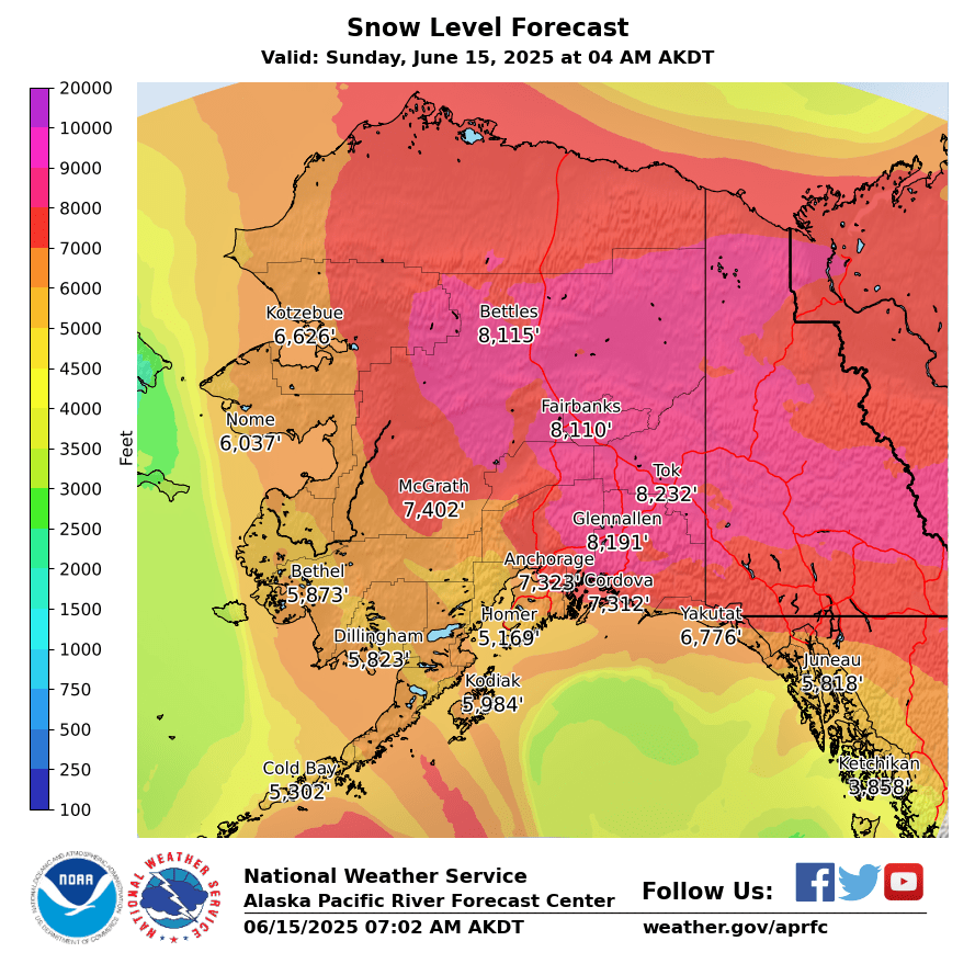
These graphics show the 8-day snow level forecast from the National Blend of Models (NBM). The products are produced once daily from the most recent NBM run.
The NBM snow level is determined from the wet-bulb-zero level, which is the lowest level in a sounding at which the wet-bulb temperature is 0°C. Snow level values are in feet above mean sea level. If the terrain elevation is higher than the forecast snow level, snow level should be interpreted as being at the surface.
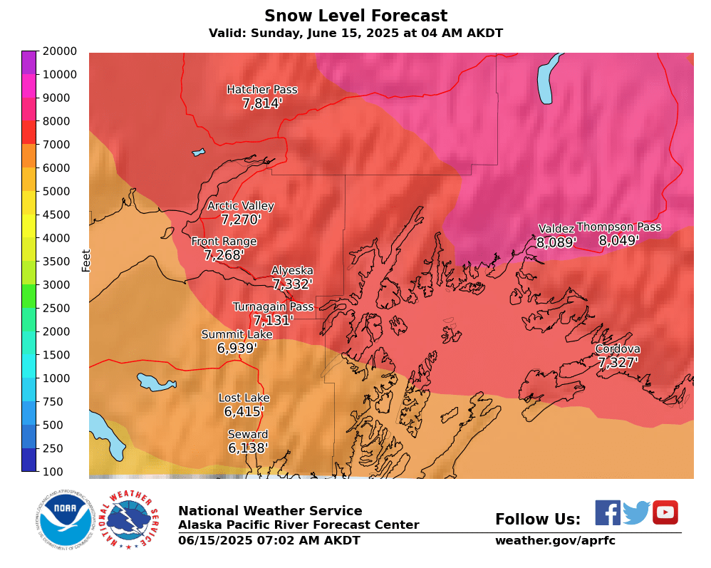
NBM snow level forecasts for selected Southcentral Alaska recreation areas. Click a graphic to view it at full size.


The Southcentral Alaska forecast provides a higher-resolution view of snow levels across the region. Snow level is based on the NBM wet-bulb-zero level and represents the approximate elevation where precipitation transitions from rain to snow.
The annotated plots provide additional point information for popular snow recreation areas. Elevation lines allow users to compare the forecast snow level with local elevations and terrain.

US Dept of Commerce
National Oceanic and Atmospheric Administration
National Weather Service
Alaska-Pacific RFC
Alaska-Pacific River Forecast Center
6930 Sand Lake Road
Anchorage, AK 99502
907-266-5160
Comments? Questions? Please Contact Us.

