Alaska-Pacific RFC
River Forecast Center
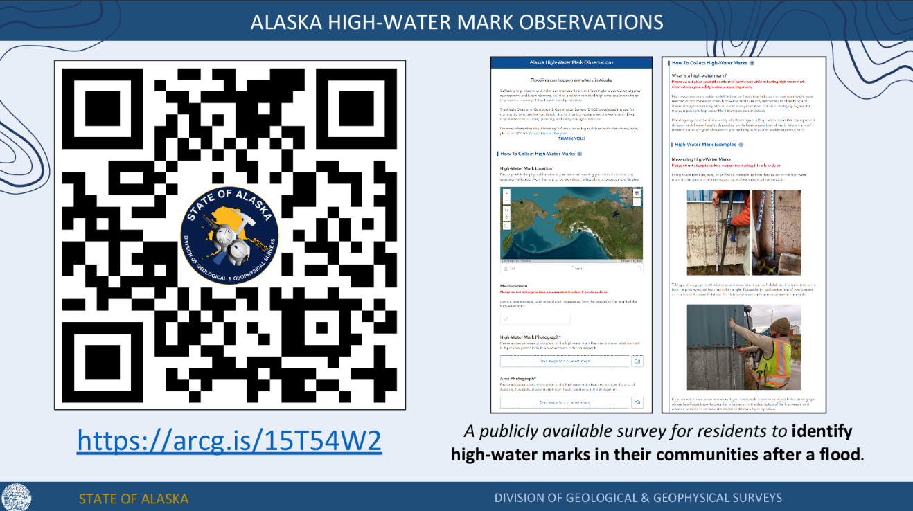
High-water marks (HWMs) are critical indicators left by floods—such as mud lines, debris, or seed lines—that show the peak elevation reached. They are essential for mapping flood inundation, improving hydraulic models, informing future infrastructure design, setting insurance rates, and increasing community awareness of flood risk
Collecting high-water marks helps communities document flooding to assist with emergency management and future planning. Building a reliable record of high-water marks also helps improve the accuracy of flood models and predictions.
The Alaska Division of Geological & Geophysical Surveys (DGGS) has developed a tool for community members to submit high-water mark observations and help improve flood forecasting, planning, and safety throughout Alaska. It is critical to capture high water marks just after a flood. Use the QR code below to help your community!
How to collect High-Water marks: Alaska High-Water Mark Observations Guide
Observation tool link or use the QR code below
US Dept of Commerce
National Oceanic and Atmospheric Administration
National Weather Service
Alaska-Pacific RFC
Alaska-Pacific River Forecast Center
6930 Sand Lake Road
Anchorage, AK 99502
907-266-5160
Comments? Questions? Please Contact Us.

