National Weather Service United States Department of Commerce
Click a location below for detailed forecast.

Last Map Update: Thu, Aug 28, 2025 at 4:30:10 pm CDT

There are no watches, warnings, or advisories at this time.

Below Normal Temperatures This Week Cooler air will remain across the area through the weekend. We will remain below normal for this time of the year. Especially in the mornings. Does This Mean Summer Is Over? Not necessarily. While the upcoming cool down will offer a nice break, temperatures will likely climb again after Labor Day in September.
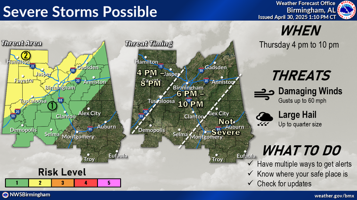
Expect increasing rain across the southwest portion of the area. Activity could potentially move further east later this afternoon. Highs will range from the upper 70s northwest to the mid 80s southeast.
Lingering showers will be likely across the southwest portion of the area with lower chances elsewhere. Lows will range from around 60 north to the upper 60s southeast.
Scattered showers are forecast across all but the far northeast portion of the area on Friday. Highs will range from near 80 far south to readings in the mid 80s northeast.

 
Current Observations ( )
Location Sky/Weather Temp (°F) Dewpt (°F) RH (%) Wind (mph) Pressure (inHg) Remarks
 Alexander City
N/A
N/A
N/A
N/A
N/A
N/A
N/A
 Anniston
N/A
N/A
N/A
N/A
N/A
N/A
N/A
 Auburn
N/A
N/A
N/A
N/A
N/A
N/A
N/A
 Bessemer
N/A
N/A
N/A
N/A
N/A
N/A
N/A
 Birmingham
N/A
N/A
N/A
N/A
N/A
N/A
N/A
 Demopolis
N/A
N/A
N/A
N/A
N/A
N/A
N/A
 Eufaula
N/A
N/A
N/A
N/A
N/A
N/A
N/A
 Gadsden
N/A
N/A
N/A
N/A
N/A
N/A
N/A
 Haleyville
N/A
N/A
N/A
N/A
N/A
N/A
N/A
 Jasper
N/A
N/A
N/A
N/A
N/A
N/A
N/A
 Montgomery
N/A
N/A
N/A
N/A
N/A
N/A
N/A
 Pell City
N/A
N/A
N/A
N/A
N/A
N/A
N/A
 Prattville
N/A
N/A
N/A
N/A
N/A
N/A
N/A
 Selma
N/A
N/A
N/A
N/A
N/A
N/A
N/A
 Shelby Co Airport
N/A
N/A
N/A
N/A
N/A
N/A
N/A
 Sylacauga
N/A
N/A
N/A
N/A
N/A
N/A
N/A
 Talladega
N/A
N/A
N/A
N/A
N/A
N/A
N/A
 Troy
N/A
N/A
N/A
N/A
N/A
N/A
N/A
 Tuscaloosa
N/A
N/A
N/A
N/A
N/A
N/A
N/A
Note: "N/A" or "MISG" will be displayed if values are not available. In the LOCATION column, click on links for a list of recent observations at sites of interest. In the WIND column, VRB is "variable" and G is "gust". In the REMARKS column, HX is "heat index", WCI is "wind chill index", and VSB is "visibility" (if shown).
 
Text Product Selector (Selected product opens in current window)
 
Rainfall Plots Observations Discussion Satellite Climate Storm Reports
 
Hourly Forecast Gridded Forecast Fire Weather Hydrology Aviation Air Quality
 
Tropical Winter SKYWARN GIS Past Events Tornado Database
 
Social Media Videos with ASL   Previsión de 7 Días Conciencia y Preparación Recreational Forecast Wx Radio