Alabama Tornado Database
|
| 2002 Tornado Occurrences (37) () Indicates Total Path Data Multi-State |
| Tornado # of Year |
Year |
Month |
Day |
Time (CST) |
County |
Damage Scale |
Path Length (Miles) |
Maximum Path Width (Yards) |
Fatalities |
Injuries |
Location |
| 37 |
2002 |
12 |
24 |
0645 |
Henry
Event Information
News Article
Moderate Risk
Continued into Georgia |
F1
(F1) |
15.5
(30.5) |
150
(150) |
0
(0) |
8
(10) |
Headland-3 E Haleburg
A tornado touched down in Headland, north of County Road 99 and U.S.Highway 431. The tornado caused extensive roof damage to several homes, businesses, and a school. It damaged six planes and a hanger at the Headland Airport. The tornado raced east-northeast, and destroyed a few barns and damaged a few mobile homes in the Tumbleton/Camp Springs area. The worst damage occurred in Haleburg where several mobile homes and barns were destroyed, with damage to a local church. Eight persons were injured, with six of them hospitalized. The tornado crossed the Chattahoochee River into Georgia.
Start: 31.3600/-85.3300
End: 31.4200/-85.0800
|
| 36 |
2002 |
12 |
24 |
0320 |
Clarke
Event Information
Moderate Risk |
F0 |
0.1 |
20 |
0 |
0 |
Walker Springs
A weak tornado briefly touched down near Walker Springs. Several trees were blown down.
Start: 31.5300/-87.8000
End: 31.5300/-87.8000
|
| 35 |
2002 |
12 |
24 |
0305 |
Washington
Event Information
Moderate Risk |
F0 |
0.1 |
20 |
0 |
0 |
Millry
A weak tornado briefly touched down near Millry. Several trees were blown down and minor roof damage occurred to a building.
Start: 31.6300/-88.3200
End: 31.6300/-88.3200
|
| 34 |
2002 |
12 |
24 |
0240 |
Monroe
Event Information
Moderate Risk |
F0 |
0.1 |
20 |
0 |
0 |
Perdue Hill
A weak tornado briefly touched down near Perdue Hill. Several trees were blown down.
Start: 31.5200/-87.5000
End: 31.5200/-87.5000
|
| 33 |
2002 |
12 |
24 |
0235 |
Washington
Event Information
Moderate Risk |
F0 |
0.1 |
20 |
0 |
0 |
Leroy
A weak tornado briefly touched down near Leroy. A couple of outbuildings were damaged and tin was blown from some of the buildings. Several trees were also blown down.
Start: 31.5000/-87.9800
End: 31.5000/-87.9800
|
| 32 |
2002 |
12 |
23 |
2200 |
Washington
Event Information
Slight Risk |
F0 |
0.1 |
20 |
0 |
0 |
Fruitdale
A weak tornado briefly touched down near Fruitdale. Several trees were blown down.
Start: 31.3300/-88.4200
End: 31.3300/-88.4200
|
| 31 |
2002 |
12 |
19 |
1600 |
Monroe
Event Information
Moderate Risk |
F0 |
0.1 |
20 |
0 |
0 |
Monroeville
A weak tornado briefly touched down just north of Monroeville. Several trees and power lines were blown down.
Start: 31.5200/-87.3300
End: 31.5200/-87.3300
|
| 30 |
2002 |
12 |
19 |
1525 |
Washington
Event Information
Moderate Risk |
F0 |
0.1 |
20 |
0 |
0 |
Malcolm
A weak tornado briefly touched down near Malcolm. Several trees were blown down.
Start: 31.1800/-88.0200
End: 31.1800/-88.0200
|
| 29 |
2002 |
11 |
10 |
2320 |
Cherokee
Storm Survey
Event Summary
Event Information
Service Assessment
High Risk |
F2 |
10.5 |
440 |
1 |
4 |
3.4 SE Centre-12.3 E Centre
The tornado touched down near the Cherokee Country Club. Numerous trees were downed and 88 structures were damaged or destroyed. One fatality occurred in a mobile home. the tornado ended near Weiss Lake.
Start: 34.1200/-85.6300
End: 34.1500/-85.4700
|
| 28 |
2002 |
11 |
10 |
2241 |
St. Clair
Storm Survey
Event Summary
Event Information
Service Assessment
High Risk |
F1 |
3.2 |
50 |
0 |
0 |
3.1 WNW Steele-1.3 N Steele
Several trees were downed and minor structure damage occurred near Chandler Mountain.
Start: 33.9500/-86.2500
End: 33.9500/-86.2000
|
| 27 |
2002 |
11 |
10 |
2222 |
Tuscaloosa-Jefferson
Storm Survey
Event Summary
Event Information
Service Assessment
High Risk |
F2 |
15.2 |
450 |
0 |
3 |
3.2 NW Abernant-1.8 SSW Bessemer
Numerous trees were downed. Several structures were damaged along the path.
Start: 33.3200/-87.2300
End: 33.4000/-86.9700
|
| 26 |
2002 |
11 |
10 |
2222 |
Blount-Etowah
Storm Survey
Event Summary
Event Information
Service Assessment
High Risk |
F1 |
10.6 |
300 |
0 |
0 |
1.4 SW Allgood-7.4 SW Gallant
Numerous trees were downed. Some structures were damaged in Allgood. Several other structures were damaged along the path.
Start: 33.9000/-86.5200
End: 33.9200/-86.3300
|
| 25 |
2002 |
11 |
10 |
2138 |
Walker
Storm Survey
Service Assessment
Event Summary
Event Information
High Risk |
F1 |
4.3 |
300 |
0 |
0 |
3.5 SW Dora-0.8 NE Dora
The tornado touched down along the banks of the Mulberry Fork and moved through parts of Dora. Numerous trees were downed and many structures were damaged.
Start: 33.7000/-87.1500
End: 33.7300/-87.0800
|
| 24 |
2002 |
11 |
10 |
2110 |
Fayette
Storm Survey
Service Assessment
Event Summary
Event Information
High Risk |
F1 |
4.3 |
90 |
0 |
0 |
4.6 ESE Berry-9.0 E Berry
The tornado touched down just west of Boley Springs. Numerous trees were downed, a lumber yard was damaged, and one mobile home was damaged.
Start: 33.6200/-87.5300
End: 33.6500/-87.4500
|
| 23 |
2002 |
11 |
10 |
2015 |
Pickens
Storm Survey
Service Assessment
Event Summary
Event Information
High Risk
Started in Mississippi
Storm Survey2 |
F0
(F1) |
2.0
(9.5) |
40
(400) |
0
(0) |
0
(0) |
4.3 WSW Ethelsville-2.3 WSW Ethelsville
Several trees were downed as the tornado traveled through mostly rural areas.
Start: 33.4000/-88.2800
End: 33.4000/-88.2500
|
| 22 |
2002 |
11 |
10 |
2015 |
Fayette-Walker-Winston-Cullman
Storm Survey
More Storm Info
Service Assessment
Event Summary
Event Information
High Risk |
F3 |
72.6 |
1175 |
7 |
53 |
6.0 NNE Fayette-5.8 W Townley-7.6 SE Arley-1 SE Holly Pond
The most intense damage occurred from US 78/SR 118 to Saragossa. At least 325 structures were damaged or destroyed.
Start: 33.7700/-87.8000
End: 34.1500/-86.6000
|
| 21 |
2002 |
11 |
10 |
1942 |
Pickens
Storm Survey
Service Assessment
Event Summary
Event Information
High Risk
Started in Mississippi
Storm Survey2 |
F1
(F1) |
4.5
(51) |
75
(400) |
0
(1) |
0
(0) |
2.5 NW Stafford-2.9 NE Stafford
The tornado stayed mostly over rural land downing trees, just northwest of Stafford.
Start: 33.4800/-88.2800
End: 33.4800/-88.2200
|
| 20 |
2002 |
11 |
10 |
1931 |
Lamar
Storm Survey
Service Assessment
Event Summary
Event Information
More Lili Information
High Risk
Started in Mississippi
Storm Survey 2 |
F2
(F3) |
7.2
(29.2) |
150
(440) |
0
(0) |
2
(55) |
7.6 WSW Fernbank-1.5 NNW Fernbank
Numerous trees downed. One home was deroofed. Several automobiles were flipped. The damage occurred from near Luxapallila Creek to the Ebenezer Church.
Start: 33.5000/-88.2500
End: 33.5700/-88.1500
|
| 19 |
2002 |
11 |
10 |
1852 |
Fayette-Walker-Winston
Storm Survey
Service Assessment
Event Summary
Event Information
High Risk |
F3 |
44.3 |
1175 |
4 |
38 |
5.6 NNW Fayette-4.5 SW Carbon Hill-2.5 ESE Arley
Numerous trees and power lines were downed. Carbon Hill Elementary School was heavily damaged. All the fatalities occurred along SR 195 in the Rose Hill Community. The injuries were minor to moderate.
Start: 33.7500/-87.8700
End: 34.0500/-87.1800
|
| 18 |
2002 |
11 |
05 |
1735 |
Henry
Event Information
Slight Risk |
F2 |
6.0 |
200 |
1 |
20 |
3 W Abbeville-3 NE Abbeville
The supercell thunderstorm which spawned the tornado in Dale County, produced another tornado which touched down just west of U.S. Highway 431, and tore through the center of Abbeville. It destroyed several single-family homes and mobile homes, and severely damaged numerous other homes and businesses, including the high school. Uprooted trees and power lines littered city streets, with nearly 2,000 residents without electricity. Twenty people were injured, with a half of those hospitalized. A man died when the tornado destroyed his home on Rock Hill Circle.
Start: 31.5700/-85.3000
End: 31.6000/-85.2200
|
| 17 |
2002 |
11 |
05 |
1715 |
Dale
Event Information
Slight Risk |
F1 |
2.0 |
100 |
0 |
3 |
2 N Echo-2 S Bertha
A tornado touched down just north of the intersection of County Road 69 and Highway 27 in northeast Dale County. It damaged several homes, an automobile, and several storage sheds. Three people suffered minor injuries. Two goats were killed by the flying debris. Dale County was declared a state disaster area.
Start: 31.5200/-85.4700
End: 31.5000/-85.4300
|
| 16 |
2002 |
11 |
05 |
1340 |
Baldwin
Event Information
Slight Risk |
F0 |
0.1 |
20 |
0 |
0 |
Barnwell
A weak tornado downed trees and power lines near the Barnwell community. The same storm produced some minor roof damage and downed more trees near Elsanor a few minutes later.
Start: 30.4200/-87.8800
End: 30.4200/-87.8800
|
| 15 |
2002 |
11 |
05 |
1200 |
Butler
Event Information
Slight Risk |
F0 |
0.5 |
50 |
0 |
0 |
Georgiana
A weak tornado resulted in a swath of downed trees in a wooded area between Georgiana and Avant.
Start: 31.6300/-86.7500
End: 31.6300/-86.7500
|
| 14 |
2002 |
11 |
05 |
1130 |
Conecuh
Event Information
Slight Risk |
F0 |
0.1 |
20 |
0 |
0 |
Lenox
A weak tornado briefly touched down near the community, blowing down or uprooting several trees.
Start: 31.3300/-87.1800
End: 31.3300/-87.1800
|
| 13 |
2002 |
11 |
05 |
1040 |
Clarke
Event Information
Slight Risk |
F0 |
0.1 |
20 |
0 |
0 |
Bashi
A weak tornado briefly touched down just east of the community near County Road 48. A few trees were blown down or uprooted by the tornado.
Start: 31.9700/-87.8700
End: 31.9700/-87.8700
|
| 12 |
2002 |
10 |
20 |
1750 |
Covington
Event Information
Small Risk |
F0 |
0.1 |
20 |
0 |
0 |
Libertyville
A weak tornado briefly touched down near the community of Carolina, west of Libertyville. The tornado blew down several trees and also did minor roof damage to several homes. No injuries were reported.
Start: 31.2300/-86.4500
End: 31.2300/-86.4500
|
| 11 |
2002 |
10 |
12 |
1230 |
Madison
Event Information
Small Risk |
F0 |
0.1 |
20 |
0 |
0 |
NW Meridianville
Three golfers reported seeing the funnel come down to the ground and lift some water from the pond. Two or three trees were downed and a trampoline was overturned.
Start: 34.8700/-86.5800
End: 34.8700/-86.5800
|
| 10 |
2002 |
10 |
04 |
1006 |
Cullman
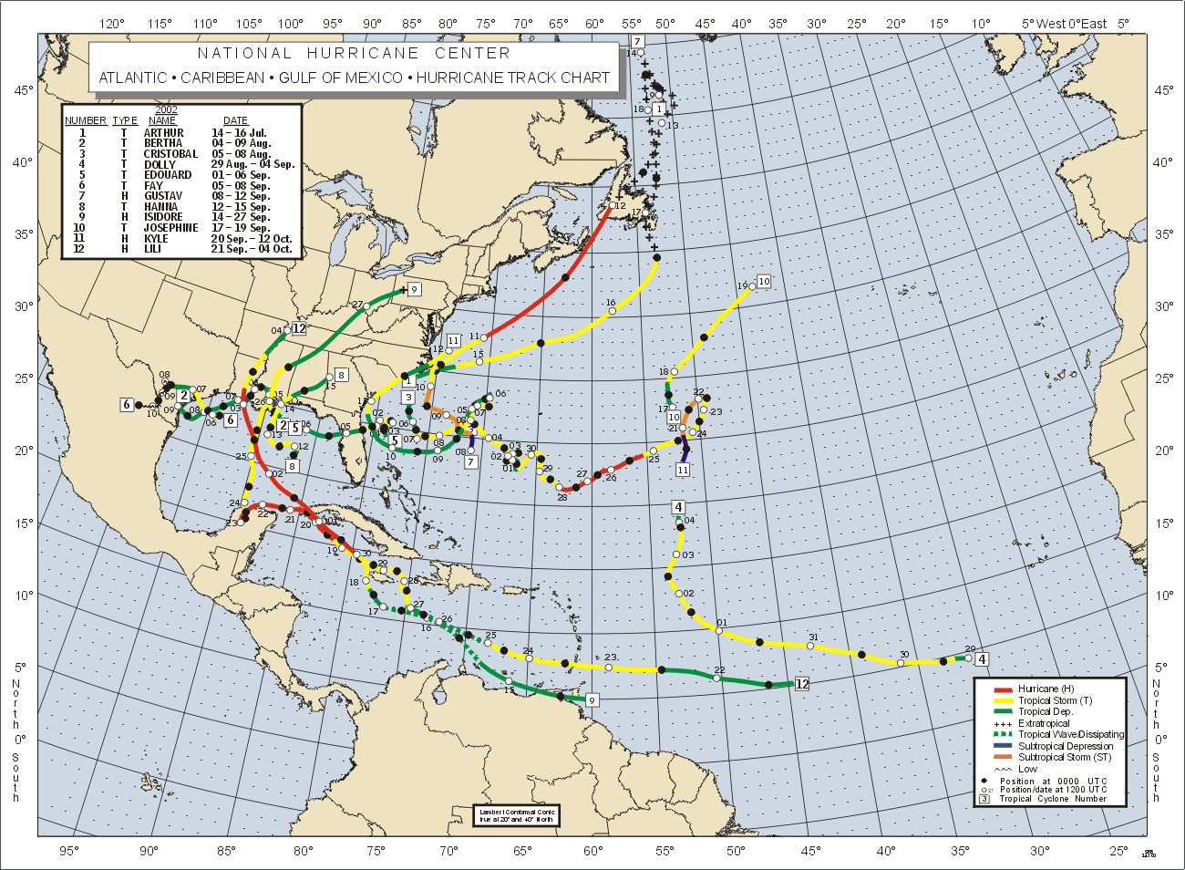
Hurricane Lili
Information
2002 Tropical Map
Event Information
More Lili Information
Slight Risk |
F0 |
1.0 |
100 |
0 |
0 |
Baileyton
Most damage occurred along CR 1693 just south of SR 69. On CR 1693 three homes and four outbuildings received minor damage, one outbuilding was destroyed, and three green houses were damaged. Trees and power lines along CR 1693 were downed. On SR 69, one cabinet shop received moderate damage; a house and another business were damaged and one outbuilding was destroyed. Two witnesses reported seeing the tornado.
Start: 34.2500/-86.6500
End: 34.2500/-86.6500
|
| 9 |
2002 |
9 |
26 |
0530 |
Mobile
Event Information
Hurricane Isadore
Information
More Isidore Information
2002 Tropical Map
Slight Risk |
F0 |
0.1 |
20 |
0 |
0 |
Semmes
A weak tornado blew down several trees and caused some minor roof damage to a home near Semmes. The rapidly moving tornado also damaged a couple of outbuildings near the same location.
Start: 30.7800/-88.2500
End: 30.7800/-88.2500
|
| 8 |
2002 |
9 |
25 |
1906 |
Baldwin
Event Information
Hurricane Isadore
Information
Hurricane Isadore
Information
2002 Tropical Map
Slight Risk |
F0 |
0.1 |
20 |
0 |
0 |
Gulf Shores
A weak tornado damaged a building near the Gulf of America in Gulf Shores. The storm that spawned the tornado moved in from the Gulf. The building suffered minor roof damage and several windows were blown out.
Start: 30.2800/-87.6800
End: 30.2800/-87.6800
|
| 7 |
2002 |
9 |
25 |
1825 |
Baldwin
Event Information
Hurricane Isadore
Information
2002 Tropical Mapbr />
Hurricane Isadore
Information
Slight Risk |
F0 |
0.1 |
20 |
0 |
0 |
Gulf Shores
A weak tornado moved across part of Gulf State Park. The tornado was spawned from a storm that moved in from the Gulf of America. The weak tornado flipped a couple of trailers and also blew down trees and power lines in the Park.
Start: 30.2800/-87.6800
End: 30.2800/-87.6800
|
| 6 |
2002 |
9 |
22 |
1408 |
Mobile |
F0 |
0.1 |
20 |
0 |
0 |
5 W Bates Field
An off duty meteorologist observed a weak tornado just ahead of a squall line that was moving in from the north. The tornado lasted less than a minute and blew down several large tree limbs. He observed the funnel and saw it touchdown before taking cover in his home.
Start: 30.6800/-88.3200
End: 30.6800/-88.3200
|
| 5 |
2002 |
9 |
18 |
1340 |
Madison
Event Information |
F0 |
0.1 |
20 |
0 |
0 |
S Meridianville
A small tornado touched down briefly in a cotton field just southwest of the intersection of Countess Road and US 231 just south of Meridianville. A storm spotter video taped the funnel cloud just prior to the touchdown.
Start: 34.8300/-86.5700
End: 34.8300/-86.5700
|
| 4 |
2002 |
9 |
14 |
0830 |
Mobile
Tropical Storm
Hanna Information
Hurricane Hanna
Information
Event Information
Tropical Storm
Hanna
2002 Tropical Map
Slight Risk |
F0 |
0.1 |
20 |
0 |
0 |
Theodore
A weak tornado briefly touched down near Theodore. Several trees were blown down by the tornado.
Start: 30.5500/-88.1700
End: 30.5500/-88.1700
|
| 3 |
2002 |
7 |
19 |
1522 |
St. Clair
Event Information
Small Risk |
F0 |
0.4 |
50 |
0 |
0 |
7.9 ESE Springville-8.3 ESE Springville
Scattered trees and power lines down. The tornado touched down just west of US 411 and remained mainly in open fields.
Start: 33.7200/-86.3300
End: 33.7200/-86.3300
|
| 2 |
2002 |
4 |
30 |
1557 |
Barbour
Event Information
Moderate Risk |
F0 |
1.5 |
25 |
0 |
0 |
3.1 NNE Texasville-3.3 NE Texasville
Several trees blown down just north of SR 131 and just west of CR 67. The tornado touched down in open countryside.
Start: 31.7500/-85.4200
End: 31.7500/-85.4000
|
| 1 |
2002 |
3 |
29 |
2320 |
Marshall
Event Information
Moderate Risk |
F1 |
8.7 |
500 |
0 |
0 |
W Red Hill-WSW Albertville
A tornado first touched down at a cemetary just west of Red Hill. The F1 tornado travelled on a near due east path crossing CR 14 (Warrenton Road), a small ridge and SR 79. The tornado then climbed another ridge downing trees. Once on top of the ridge, the tornado paralleled Section Line Road (CR 166) downing trees and power lines and causing damage especially to out buildings, farm buildings, chicken houses, and other weak structures. Most substantial structures affected by the tornado had minimal damage as identified from visual inspection. The tornado ended at CR 152 (Oneonta Cut Off Road). Red Cross officials identified 3 structures with major damage and 18 with minor damage.
Start: 34.2500/-86.4500
End: 34.2500/-86.2800
|

