Duluth, MN
Weather Forecast Office
50th Anniversary of the
March 2nd-5th, 1966 Blizzard
Fifty years ago a strong winter storm moved through the Northern Plains and Upper Midwest. This brought widespread blizzard conditions to the region. The brunt of the impacts were felt in the Dakotas, but parts of Minnesota saw snowfall for 3 straight days.
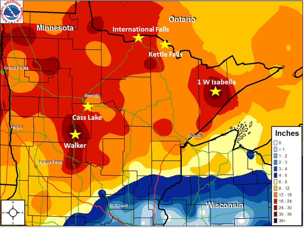
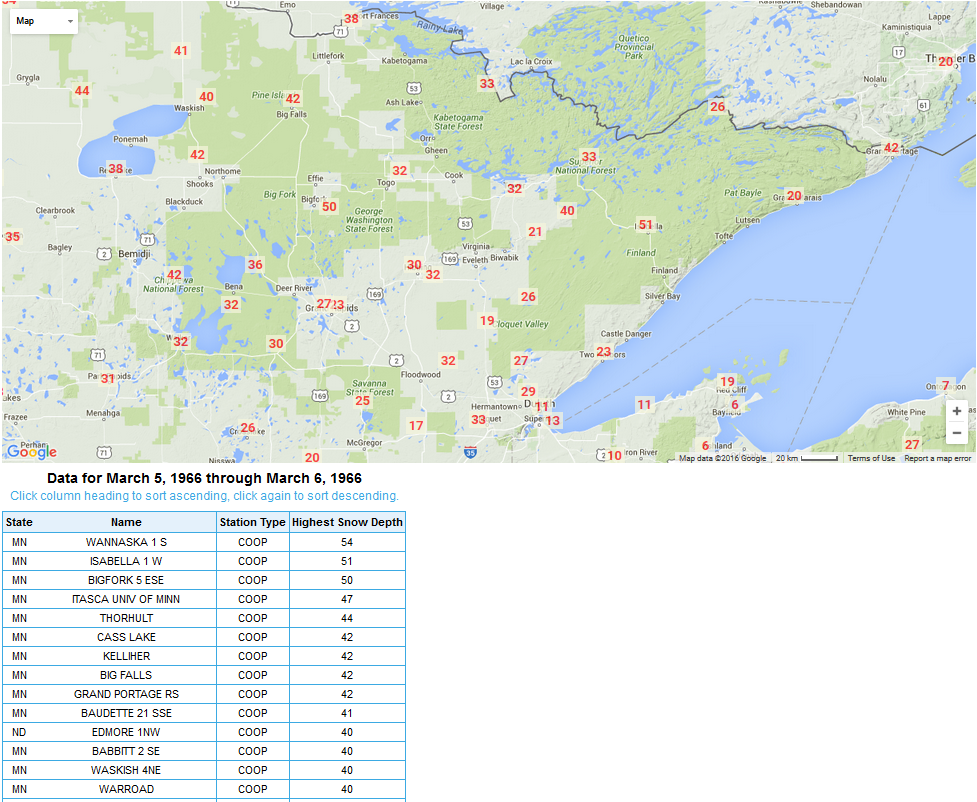
Across northern Minnesota snow amounts from this system were up to 2-3 feet, which brought snow depths up to 51 inches. Due to this system, International Falls March monthly record snow depth was set and still stands at 38 inches from the 5th through the 7th.
Heavy snow combined with strong winds, which resulted in impassable highways and roadways throughout northern Minnesota and the Dakotas.
For more information on this event click on the links below to see where the brunt of the storm caused major widespread impacts.
For northwest Minnesota and eastern North Dakota, click here
For central and western North Dakota, click here
For eastern South Dakota, click here
For western South Dakota, click here
| March 2-5, 1966 Storm Total Snowfall |
 |
| March 5-6, 1966 Maximum Snow Depth |
 |
|
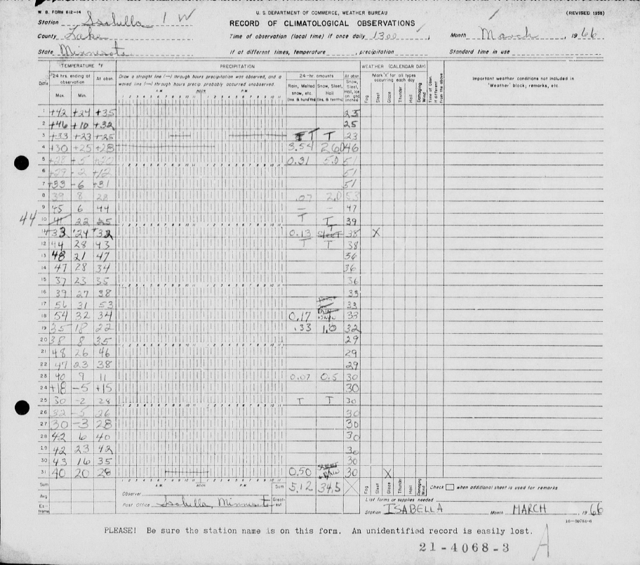
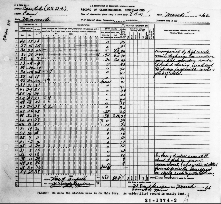
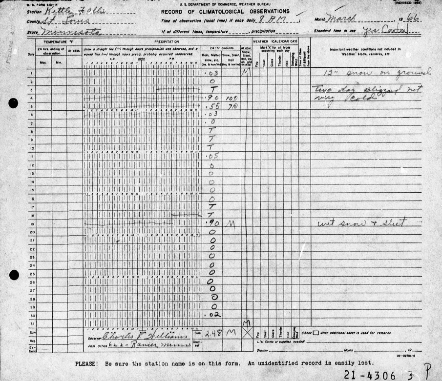
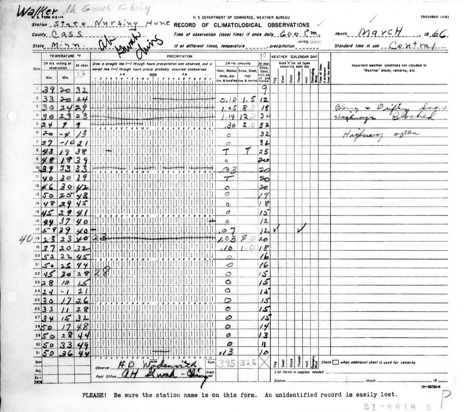
A few of the original hand written reports from CO-OP observers |
|
1 mile West of Isabella, MN
|
|
Cass Lake, MN
|
|
Kettle Falls, MN
|
|
Walker, MN
|
If you are on Twitter follow #Blizzard66 from March 2nd-4th.
Forecasts
Fire Weather
Great Lakes
Local Text Products
Winter Weather
Local Area Forecasts
Aviation
Marine
Rainy River Basin Page
Current Conditions
Current Observations
Public Information Statements
National Snowfall Map
NOHRSC Snow Analysis
Rain/Snow Reports
Winter Monitor
US Dept of Commerce
National Oceanic and Atmospheric Administration
National Weather Service
Duluth, MN
5027 Miller Trunk Highway
Duluth, MN 55811-1442
218-729-6697 - Duluth; 218-283-4615 - Intl Falls
Comments? Questions? Please Contact Us.