|
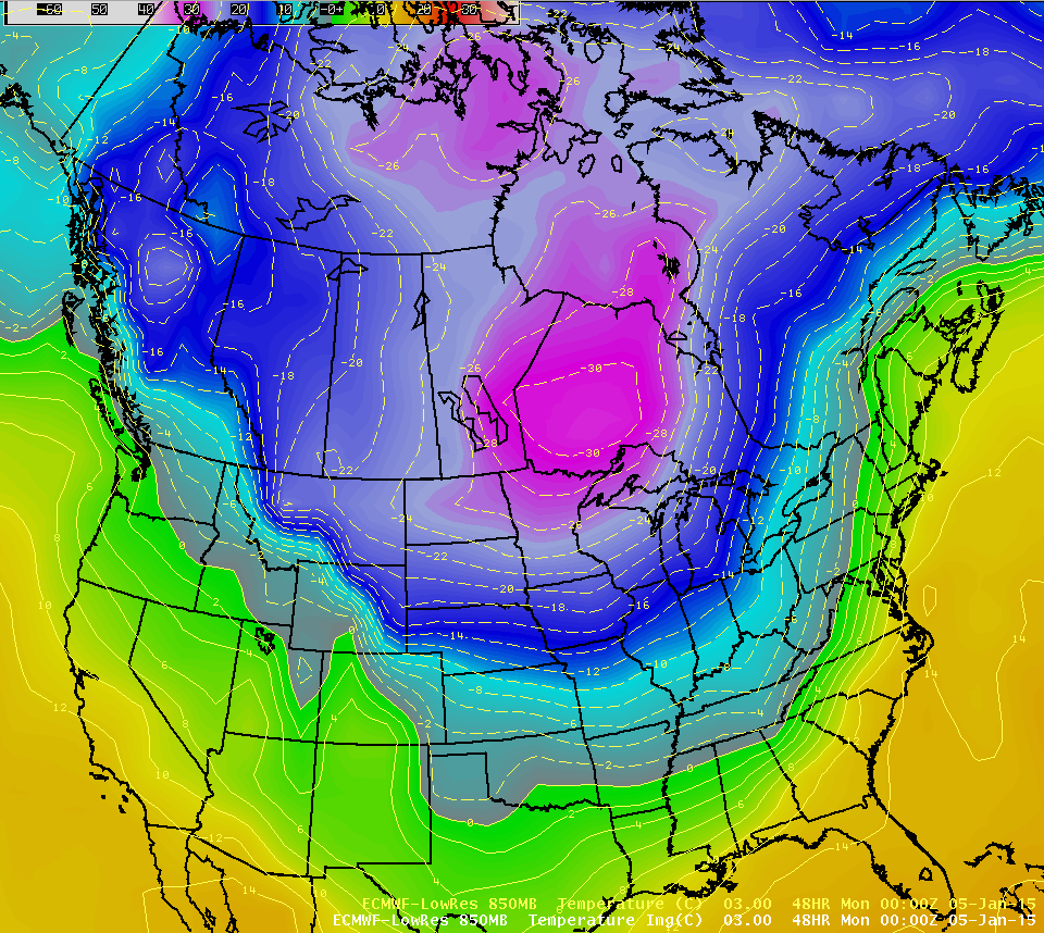
An Arctic air mass is in place across the This bitterly cold air will be dangerous and potentially Until you can get indoors:
Once Indoors
|
 |
|||||||||||||||||
|
Check the link: https://www.weather.gov/safety/winter for more information. |
||||||||||||||||||
|
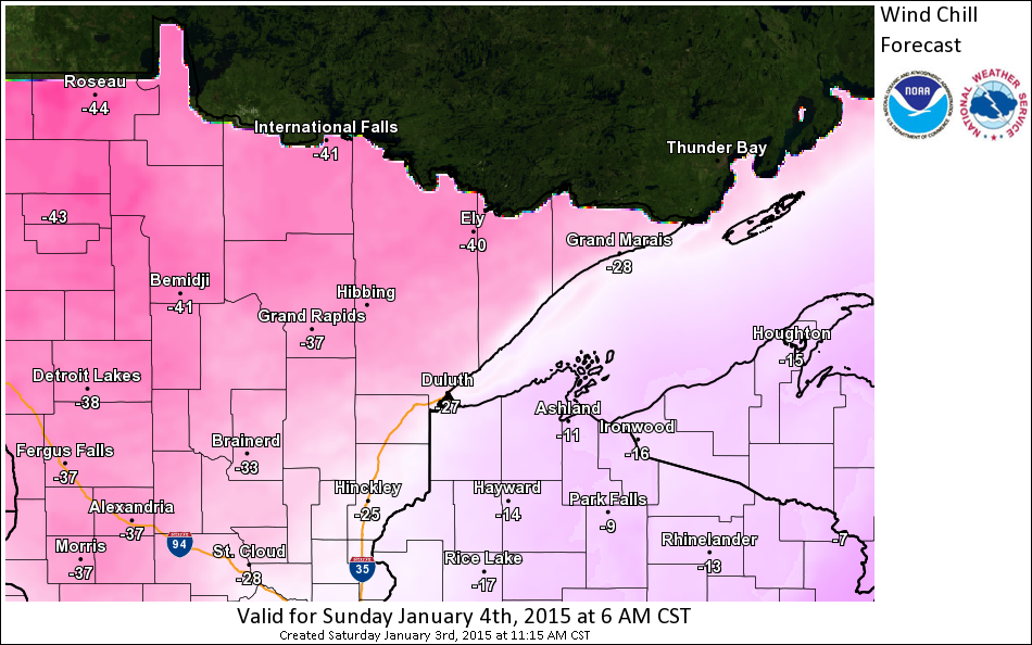
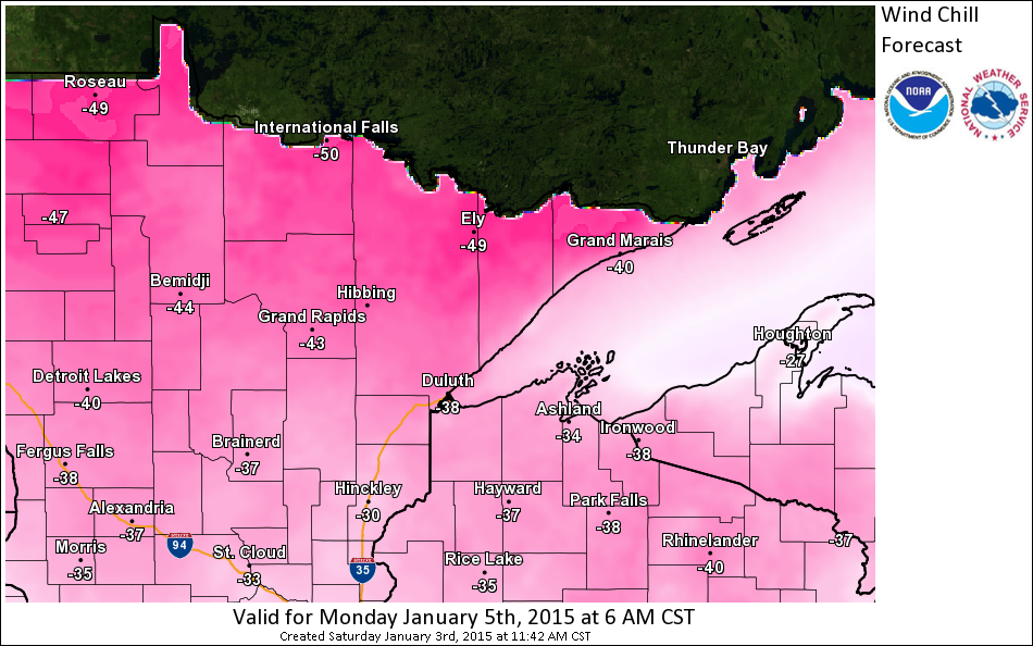
The cold air mass will continue to push into the International Falls area tonight with temperatures dropping to
|
||||||||||||||||||
|
|
||||||||||||||||||
|
|
||||||||||||||||||
 |
|
|||||||||||||||||
|
|
||||||||||||||||||
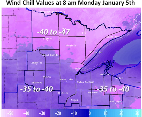
| Record low temperatures for the area for early January will be safe. Here is a list of record lows for International Falls and Duluth from January 4th - 7th. |
||||||||||||||||||
|
Duluth |
International Falls | |||||||||||||||||
| Jan 4 Jan 5 Jan 6 Jan 7 |
-30 in 1884 |
-39 in 1981 |
||||||||||||||||