Overview
|
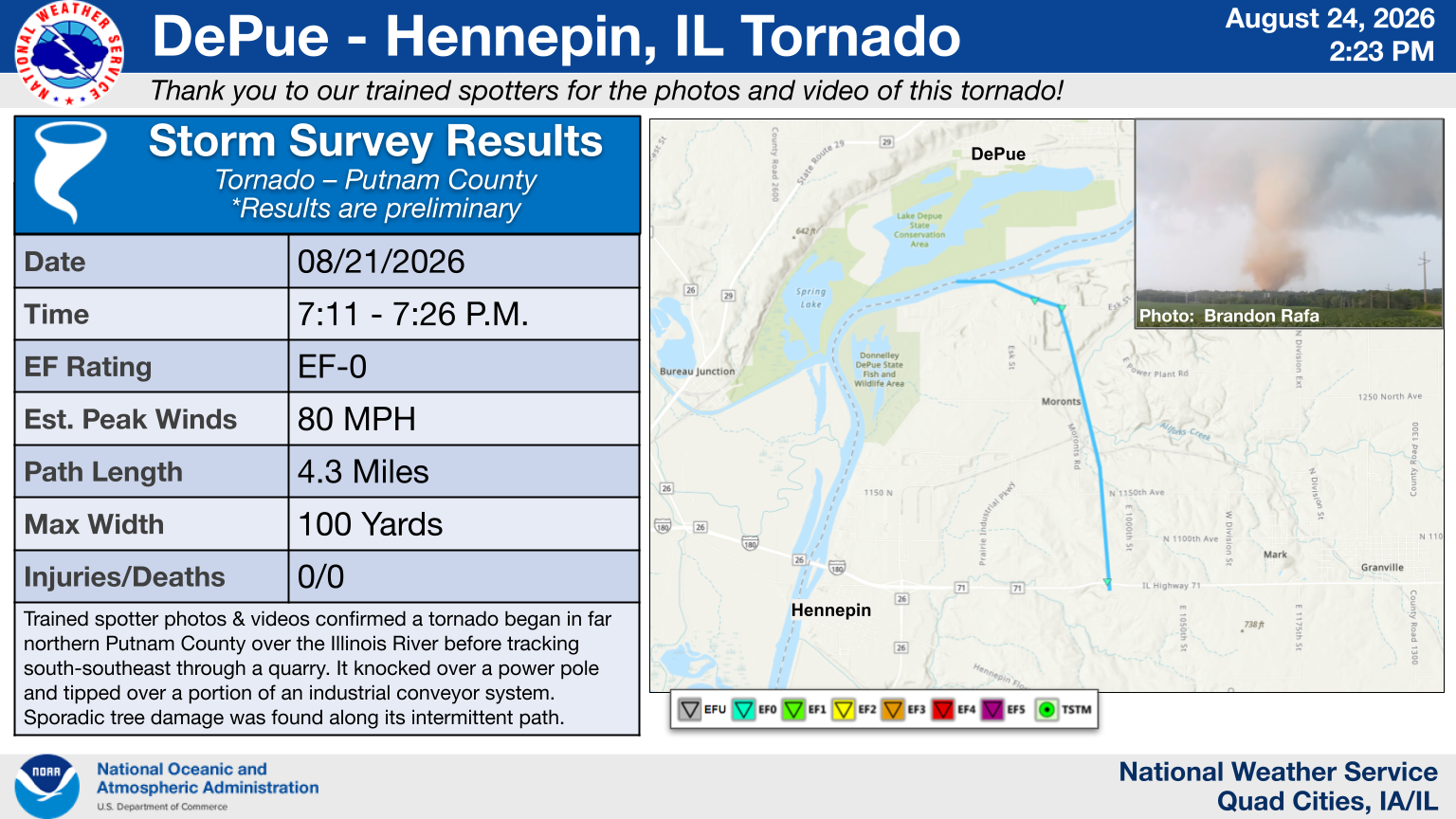
A highly visible tornado developed in Putnam County, IL during the early evening of Friday, August 21, 2026. Photo and video from storm chasers, along with isolated damage and a brief debris signature on radar, was used to confirm the tornado and its estimated attributes. The tornado went through a rock quarry, where it blew over an industrial conveyor system. A Tornado Warning was issued in advance of this tornado developing. Storms continued to regenerate over parts of southern Bureau and Putnam Counties throughout that evening, resulting in localized 4+ inches of rain and isolated flash flooding. Elsewhere, isolated hail and several wall clouds with a few funnel clouds were observed. |
 |
Tornadoes
Select a tornado from the table to zoom into the track and view more information. The default table view is limited to 8 tracks, but can be scrolled by a mouse wheel or dynamically expanded. Additionally, the table can fill the entire window by clicking the small circular expanding arrow icon at the very top right of the table and returned to its original size by clicking the button again. The side information panel that opens over the map can be closed using the "X" on the upper right corner of the pop-up. Zoom into the map and click damage points to see detailed information and pictures from the surveys.
PUBLIC INFORMATION STATEMENT ON DEPUE-HENNEPIN AREA TORNADO
More on the Henkel, IL Tornado in Lee County (NWS Chicago)
|
NOTE: times shown below are local to your device's time zone. |

The Enhanced Fujita (EF) Scale classifies tornadoes into the following categories:
| EF0 Weak 65-85 mph |
EF1 Moderate 86-110 mph |
EF2 Significant 111-135 mph |
EF3 Severe 136-165 mph |
EF4 Extreme 166-200 mph |
EF5 Catastrophic 200+ mph |
 |
|||||
| Tornadoes that fail to impact any ratable damage indicators on the EF-Scale are rated EF-Unknown (EF-U) | |||||
Photos
 |
 |
 |
| Tornado as it was developing just south of DePue as seen from town. Photo: Trent Solorio |
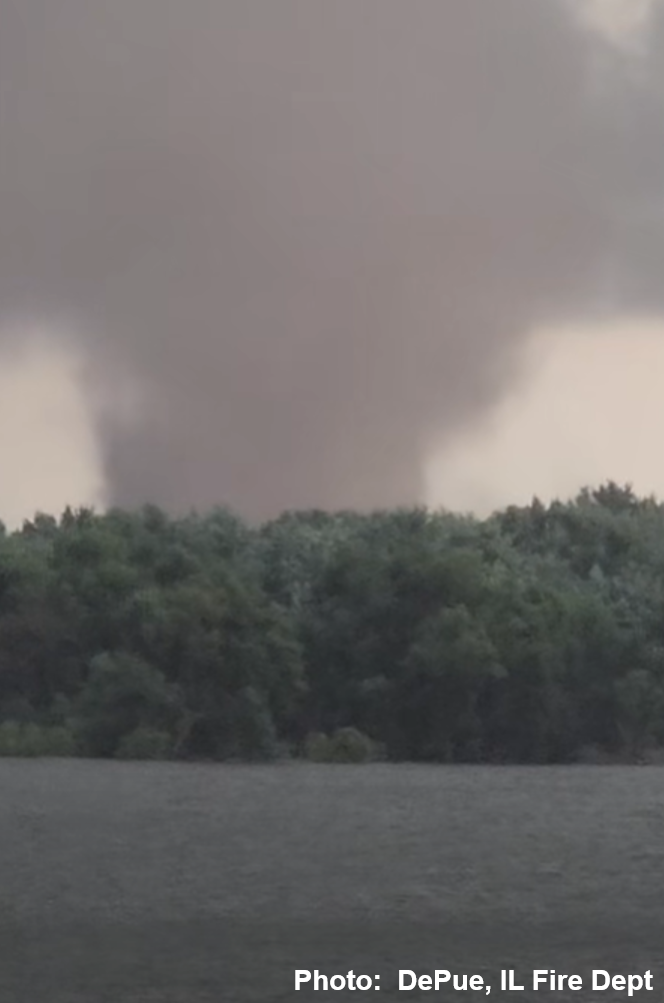
Tornado south of DePue, likely over or near the Illinois River. Bottom of tornado obscured due to trees. Photo: DePue, IL Fire Dept |
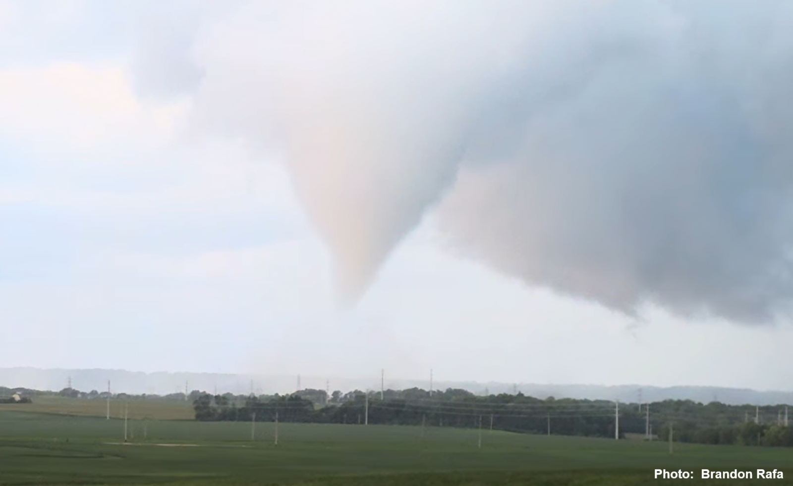
Tornado just onto the shore from the Illinois River. Photo: Brandon Rafa |
 |
 |
 |
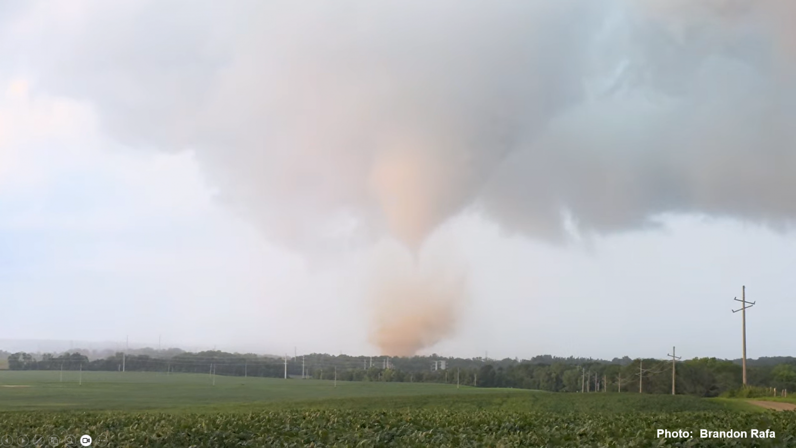
| Tornado moving through a rock quarry. Photo: Brandon Rafa |
Tornado moving through or just past the rock quarry. Photo: @WindyCityWxMan |
Tornado moving through or just past the rock quarry. Photo: Logan Bundy |
Storm Reports
 |
| Nationwide Storm Reports |
Preliminary Local Storm Report...Summary
National Weather Service Quad Cities IA IL
724 PM CDT Mon Aug 24 2026

..TIME...   ...EVENT...      ...CITY LOCATION...     ...LAT.LON...
..DATE...   ....MAG....      ..COUNTY LOCATION..ST.. ...SOURCE....
            ..REMARKS..

0649 PM     Hail             1 WNW Savanna           42.09N 90.16W
08/21/2026  E1.00 Inch       Carroll            IL   Broadcast Media

            Broadcast media report of quarter-sized hail
            in Savanna. Time estimated by radar.

0711 PM     Tornado          1 S Depue               41.30N 89.32W
08/21/2026                   Putnam             IL   NWS Storm Survey

            Corrects previous tornado report starting
            location and time. An EF0 tornado, with
            estimated peak winds of 80 MPH, developed
            near the southern banks of the Illinois
            River and curled its way across northern
            Putnam County. The tornado crossed through a
            rock quarry, where it tipped over a portion
            of an industrial conveyor system. Minor tree
            and utility line damage was noted.

0723 PM     Tstm Wnd Dmg     Fulton                  41.86N 90.15W
08/21/2026                   Whiteside          IL   Trained Spotter

            Power poles down.

0730 PM     Tstm Wnd Dmg     1 E Fulton              41.86N 90.15W
08/21/2026                   Whiteside          IL   Public

            Power lines down across the road in Fulton
            Illinois on Illinois 136 towards Clinton.
            Time estimated from radar.

0734 PM     Funnel Cloud     3 S Granville           41.23N 89.23W
08/21/2026                   Putnam             IL   Trained Spotter

            Based on multiple spotter photos and
            reports.

0738 PM     Hail             1 NE Fulton             41.87N 90.15W
08/21/2026  M0.88 Inch       Whiteside          IL   Trained Spotter

            Largest hailstone seen was the size of
            nickels.

0830 PM     Tstm Wnd Dmg     2 SSE Osborn            41.49N 90.25W
08/21/2026                   Henry              IL   Trained Spotter

            Large branches down.

0850 PM     Flash Flood      Mark                    41.26N 89.24W
08/21/2026                   Putnam             IL   Emergency Mngr

            Reports of street flooding at a few
            locations around the town of Granville.
Radar
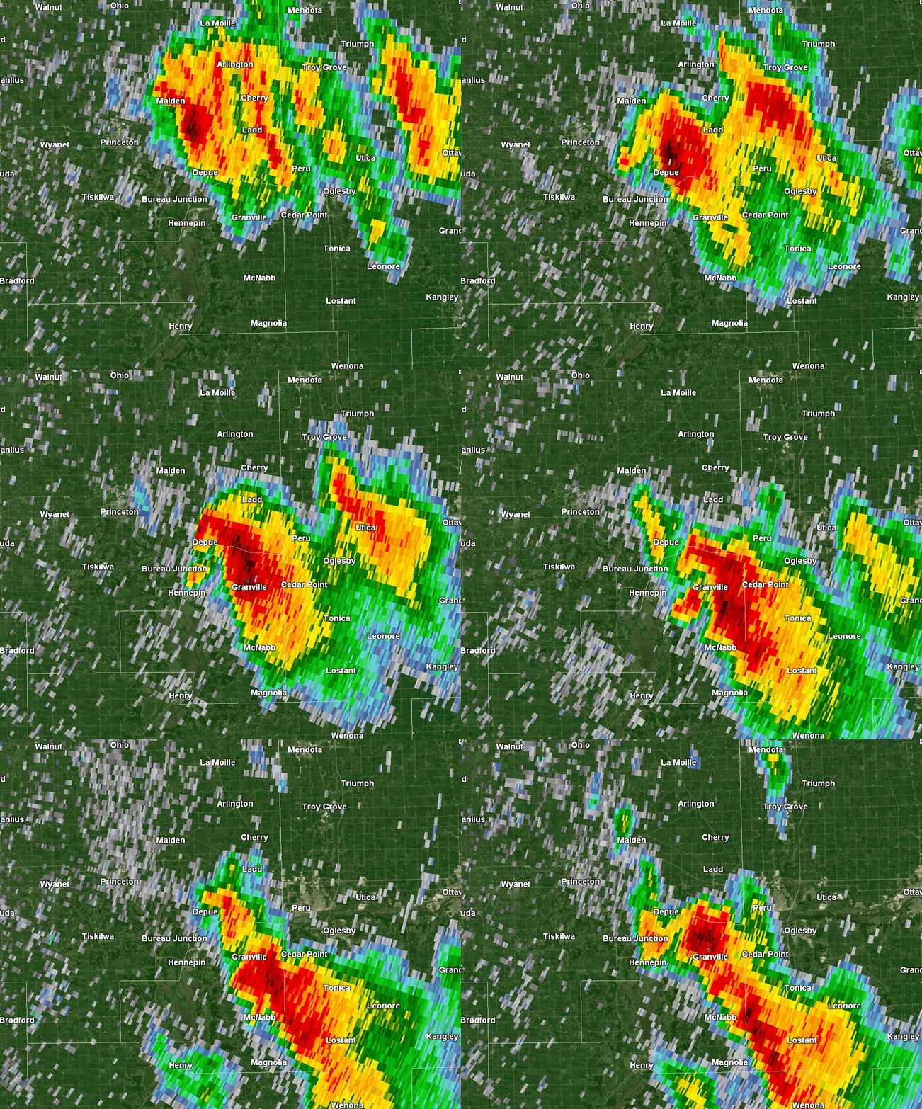 |
| August 21, 2026, 6:53 P.M.-7:53 P.M. CDT KDVN 0.5° Reflectivity |
Rainfall
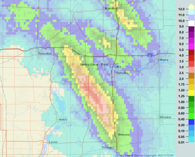 |
| Radar estimated rainfall from 6-9 P.M. CDT on August 21, 2026. |
Forecast & Environment
Forecasts & Warnings
 |
 |
 |
| August 21: Severe T-Storm Watch issued at 3 PM. | August 21: NWS Graphicast issued at 5:46 PM. | August 21: Tornado Warning issued for southern Bureau County & northern Putnam County at 6:56 P.M. |
Near-Storm Environment Summary
 |
 |
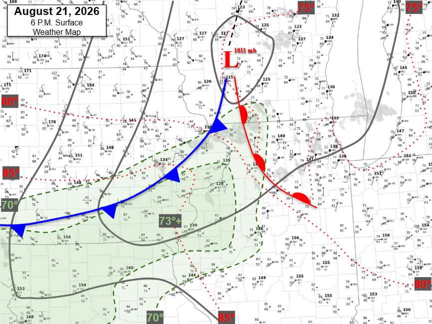 |
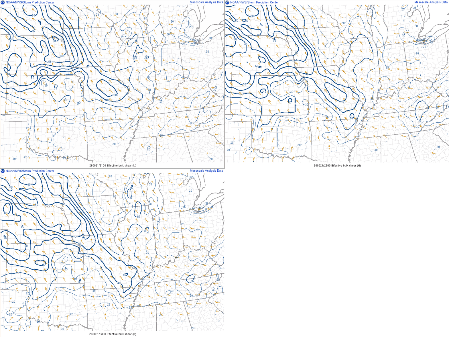
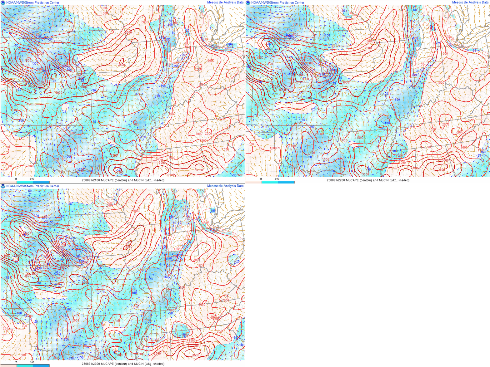
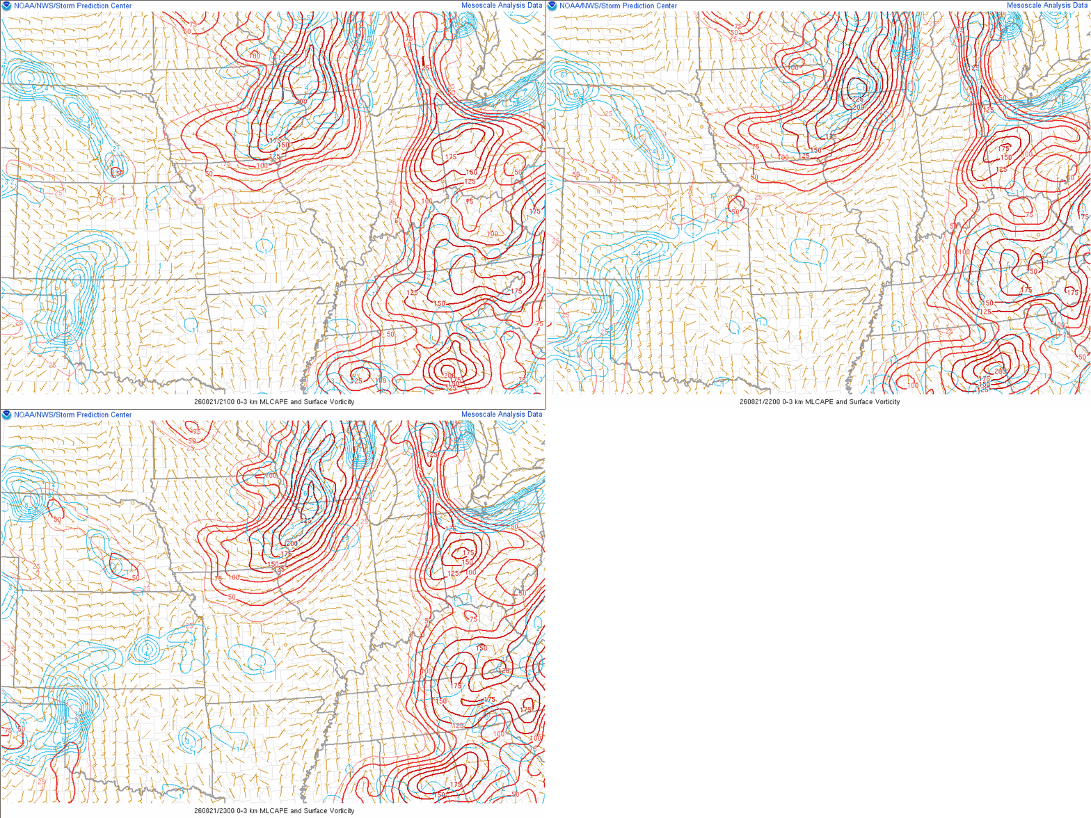
| August 21, 1 PM CDT (18Z): NWS Quad Cities weather balloon data. The wind profile is veering in the lowest ~2 km, with seasonably fast paced northwest flow above that. The moisture profile is quite good with modestly high CAPE (~2,400 J/kg mixed layer CAPE), as well as 0-3 km CAPE of 113 J/kg (>50 J/kg is quite favorable for low-level stretching). All in all this is supportive of mesocyclone development and especially notable near boundaries. | August 21, 7 PM CDT (00Z): NWS Central Illinois weather balloon data. This profile is shown as it likely better captures the ambient environment in Putnam County during the early evening. The pre-frontal wind profile is similar to that of the 1 PM DVN sounding. The rest of the profile is more mixed, somewhat common after a warm afternoon. The veering wind profile is the most notable feature, and the fact speeds are not that high in the lowest 2 km is likely why more prolific or strong tornado development was not noted. | August 21, 6 PM CDT Analyzed Surface Weather Map: A somewhat subtle surface wind shift was moving into north central Illinois late in the day, and this had low-level warm and moist advection characteristics. Also a few sites had backed surface winds in the area. |
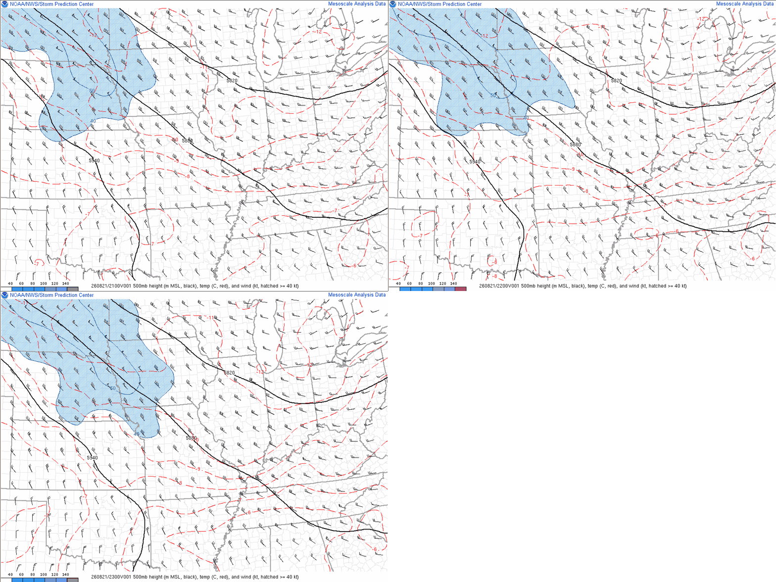 |
 |
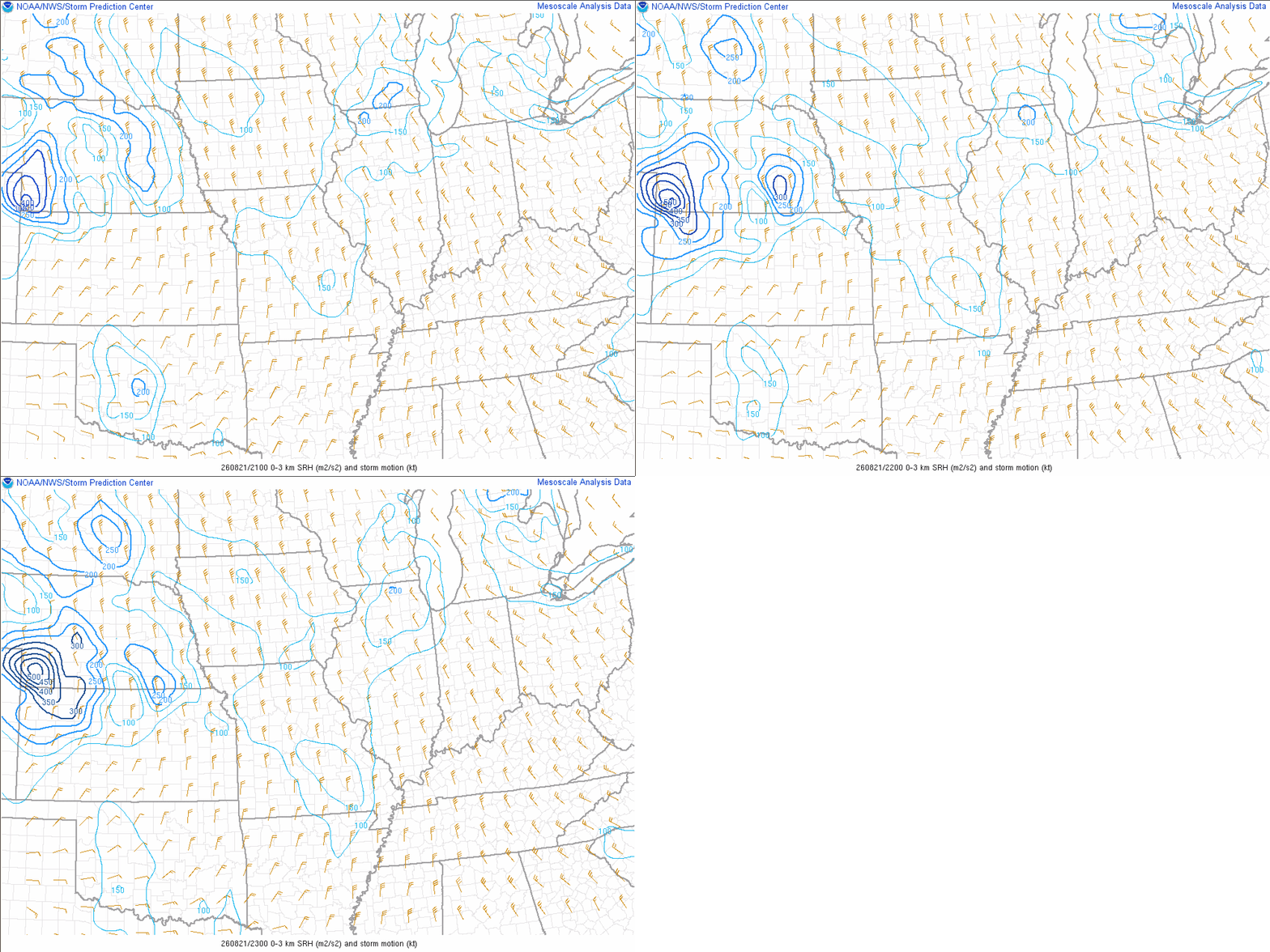 |
| August 21, 6 PM CDT (23Z) 500 mb | August 21, 6 PM CDT (23Z) Effective Shear | August 21, 6 PM CDT (23Z) 0-3 km Storm-Relative Helicity |
 |
 |
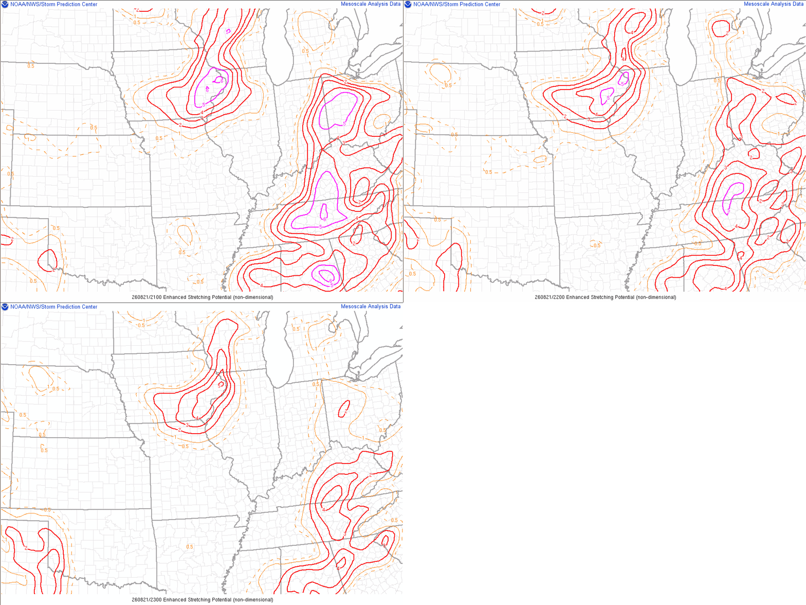 |
| August 21, 6 PM CDT (23Z) Mixed-Layer CAPE | August 21, 6 PM CDT (23Z) 0-3km Mixed-Layer CAPE and Surface Vorticity | August 21, 6 PM CDT (23Z) Enhanced Stretching Potential (ESP): Shows the collocation of low-level buoyancy and steep low-level lapse rates, where stretching of updrafts can more readily occur. Combined with favorable ingredients for supercells (parent mesocyclones), this can enhance localized tornado potential on boundaries. |
 |
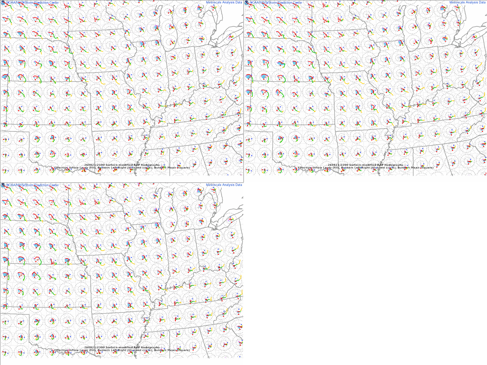 |
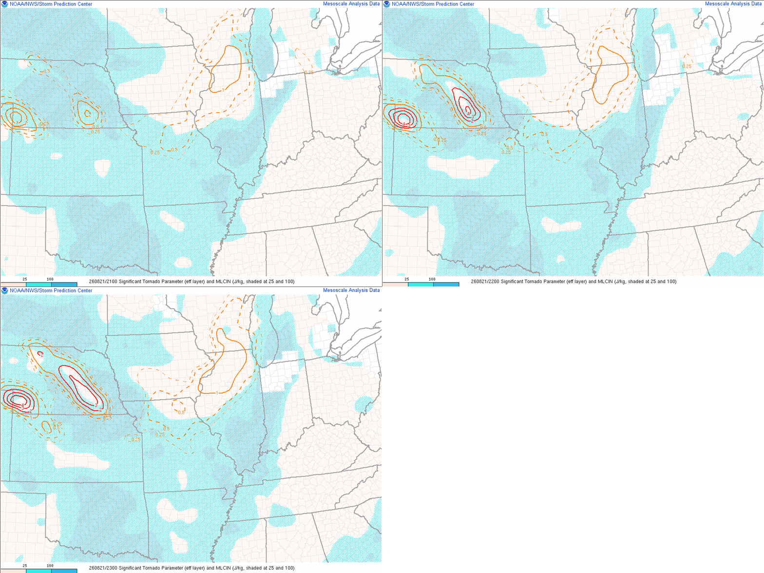
| August 21, 6 PM CDT (23Z) Effective Significant Tornado Parameter (STP) | August 21, 6 PM CDT (23Z) RAP Hodographs: Gives a visualization for where there may be low-level turning in the wind fields, which with right-moving supercells would tend to favor low-level vorticity ingest (i.e. more readily support low-level mesocyclones). |
 |
Media use of NWS Web News Stories is encouraged! Please acknowledge the NWS as the source of any news information accessed from this site. |
|



 Follow us on X
 Follow us on Facebook
 Follow us on YouTube
 DVN RSS Feed