
Numerous severe thunderstorms are expected across a broad region from the Ohio Valley to the Mid-Atlantic and Northeast States today into tonight. Swaths of damaging wind gusts are expected and some tornadoes are possible. Bertha is expected to bring tropical storm conditions to portions of the Gulf Coast from the Florida Panhandle westward to southeastern Louisiana later today and Wednesday. Read More >
Last Map Update: Tue, Jul 21, 2026 at 2:56:39 pm MDT
 Briefing |
 Forecast Discussion |
 Weather Hazards Outlook |
 Hourly Forecast |
 Gridded Forecast |
 Weather Calculator |
|
|
 Satellite |
|
 Past Weather |
 Drought |
 Hydrology |
 Wx Radio |
 Skywarn |
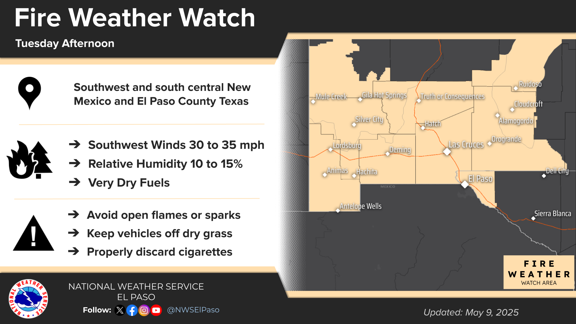
 Fire Weather |
Vo1lunteer |
 Aviation |
 Social Media |
 Weather Digest |
 Monsoon/Tropical |


 Radar
Radar Weather Map
 Satellite