Overview
|
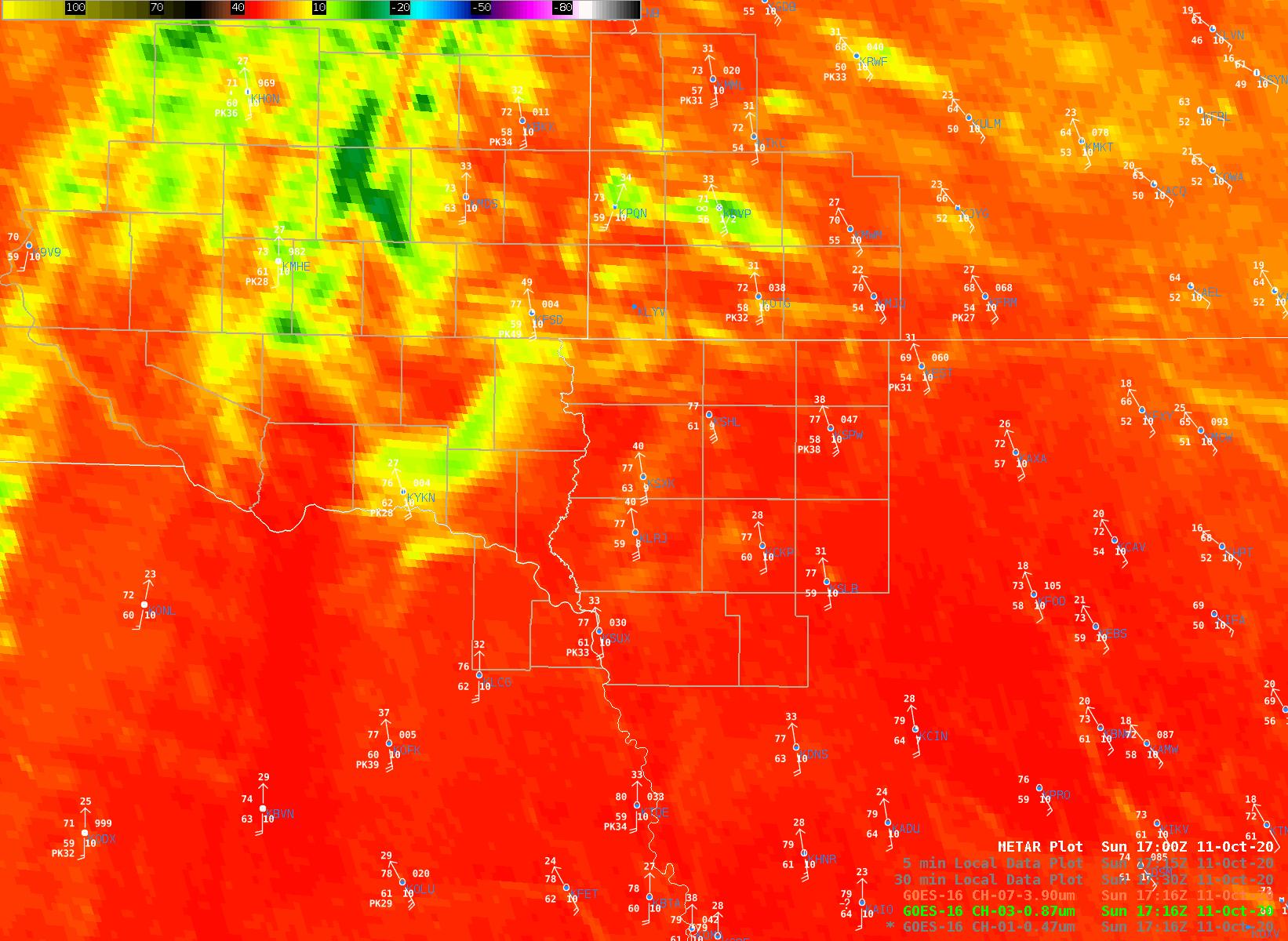
After a day with significant winds across the region, a strong cold front approached during the evening of Sunday, October 11th. This cold front sparked thunderstorms across eastern Nebraska and South Dakota which pushed eastward through the evening into Minnesota and Iowa. |
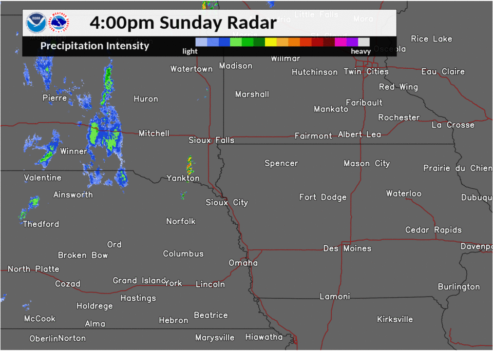 Radar Overview |
 |
 |
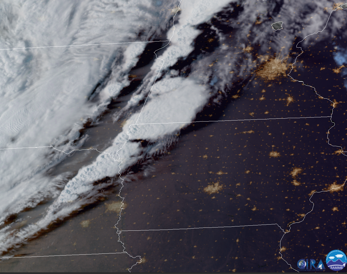 |
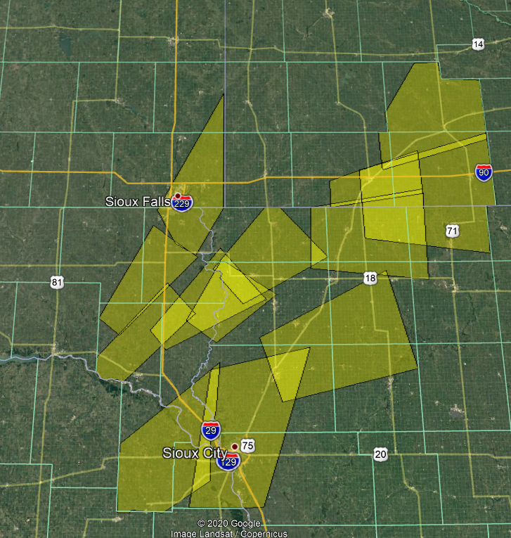
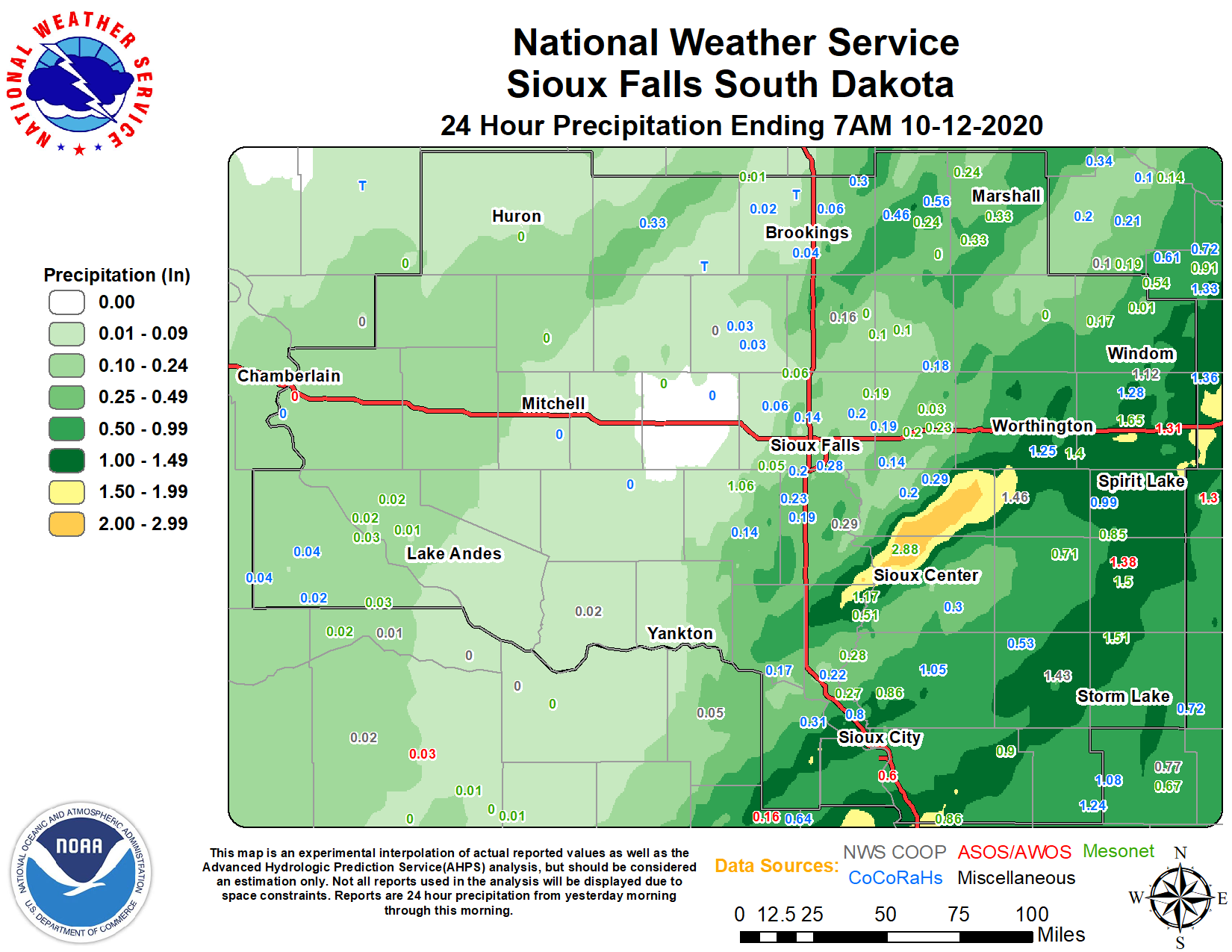
| Severe Weather Warnings Issued | Total Precipitation | Satellite View |
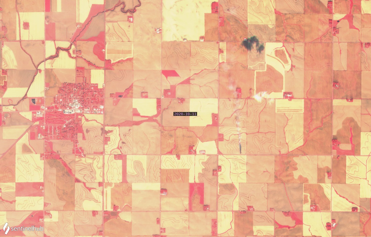
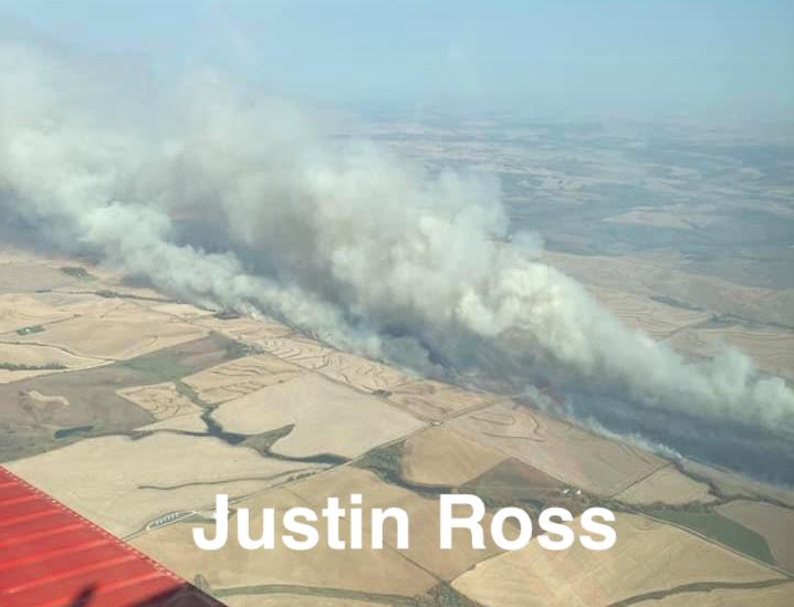
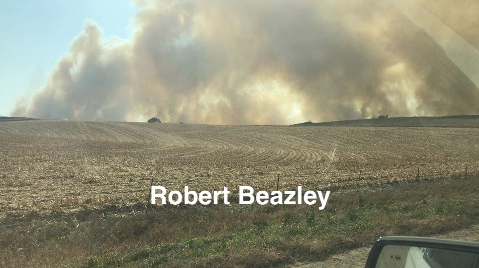
Wild Fire Photos
 |
 |
 |
 |
| Fire Hot Spot Detections |
Burn Scar Near Kingsley, IA (Sentinel) |
Anthon Fire (Justin Ross on Facebook) |
Anthon Fire (Robert Beezley on Facebook) |
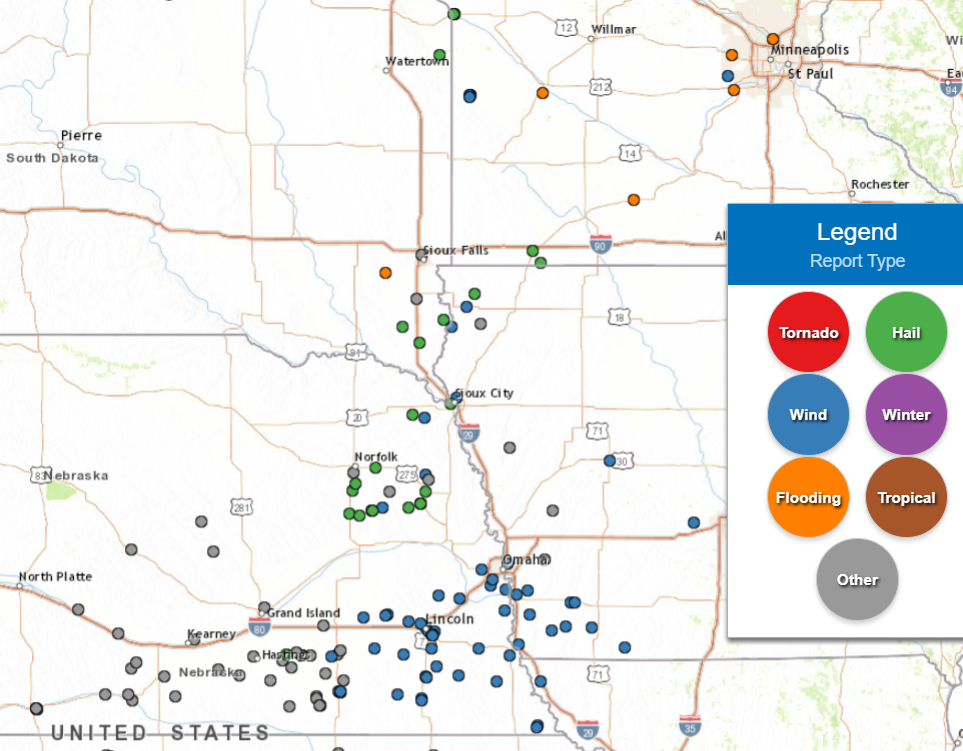
Storm Reports
Here is a map and listing of storm reports from October 11, 2020.
 |
PRELIMINARY LOCAL STORM REPORT...SUMMARY
NATIONAL WEATHER SERVICE SIOUX FALLS SD
757 PM CDT MON OCT 12 2020

..TIME...   ...EVENT...      ...CITY LOCATION...     ...LAT.LON...
..DATE...   ....MAG....      ..COUNTY LOCATION..ST.. ...SOURCE....
            ..REMARKS..

0507 PM     HAIL             9 SW ALCESTER           42.94N 96.77W
10/11/2020  E1.50 INCH       UNION              SD   PUBLIC


0554 PM     HAIL             4 WSW HUDSON            43.11N 96.53W
10/11/2020  E1.75 INCH       LINCOLN            SD   PUBLIC

            REPORT VIA SOCIAL MEDIA. LOCATION ESTIMATED
            VIA RADAR.

0432 PM     HAIL             4 SSE CENTERVILLE       43.06N 96.94W
10/11/2020  E1.00 INCH       CLAY               SD   PUBLIC


0612 PM     HAIL             ALLEN                   42.41N 96.84W
10/11/2020  E0.75 INCH       DIXON              NE   PUBLIC

            DELAYED REPORT VIA SOCIAL MEDIA.

0631 PM     TSTM WND GST     4 S WATERBURY           42.39N 96.72W
10/11/2020  E60 MPH          DAKOTA             NE   TRAINED SPOTTER

            DELAYED REPORT. ESTIMATES THE WIND GUSTS
            WERE UP TO 60 MPH IN THE RAIN CORE. NO HAIL,
            BUT DID GET 0.65 OF RAIN.

0723 PM     HAIL             5 WSW ROUND LAKE        43.52N 95.56W
10/11/2020  E0.70 INCH       NOBLES             MN   TRAINED SPOTTER

            DELAYED REPORT. ESTIMATES DIME SIZE HAIL,
            VAST MAJORITY WAS PEA-SIZED AND ONLY LASTED
            ABOUT 5 MINUTES.

0723 PM     TSTM WND GST     5 WSW ROUND LAKE        43.52N 95.56W
10/11/2020  E65 MPH          NOBLES             MN   TRAINED SPOTTER

            DELAYED REPORT.

0714 PM     HAIL             2 SW WORTHINGTON        43.61N 95.64W
10/11/2020  M1.00 INCH       NOBLES             MN   PUBLIC

            DELAYED REPORT. PUBLIC REPORTS QUARTER INCH
            HAIL FELL FOR ABOUT 10 SECONDS LAST NIGHT.
            TIME AND LOCATION BASED ON RADAR.

0659 PM     TSTM WND GST     3 N SIOUX CITY          42.54N 96.40W
10/11/2020  M62 MPH          WOODBURY           IA   PUBLIC

            PERSONAL WEATHER STATION MEASURED GUST.

0648 PM     HAIL             4 W SIOUX CITY          42.49N 96.46W
10/11/2020  E0.70 INCH       WOODBURY           IA   BROADCAST MEDIA

            REPORT VIA SOCIAL MEDIA.

0620 PM     TSTM WND DMG     4 NNE HAWARDEN          43.06N 96.45W
10/11/2020                   SIOUX              IA   TRAINED SPOTTER

            DELAYED REPORT. DID HAVE A 3 INCH TREE
            DIAMETER BROKEN OFF TREE, ALONG WITH
            PEA-SIZED HAIL. ALSO RECEIVED 0.8 OF RAIN.

0614 PM     TSTM WND GST     ROCK VALLEY             43.20N 96.30W
10/11/2020  M58 MPH          SIOUX              IA   PUBLIC

            PERSONAL WEATHER STATION MEASURED WIND GUST.

0559 PM     HAIL             1 NNE DOON              43.30N 96.22W
10/11/2020  E0.70 INCH       LYON               IA   PUBLIC

            GUSTY WINDS AT TIME. TIME ESTIMATED VIA
            RADAR.


&&
|
 |
Media use of NWS Web News Stories is encouraged! Please acknowledge the NWS as the source of any news information accessed from this site. |
|


 Weather Story
 Weather Map
 Local Radar