A significant heat wave continues for the Rockies, Northern Plains, and Great Lakes into the Mid-Atlantic, peaking in intensity through midweek and lingering across parts of the Northern Plains and Midwest until this weekend. Excessive rainfall my bring life-threatening and locally catastrophic flash and urban flooding across portions of southwestern Texas through early Friday. Read More >
Fort Worth/Dallas, TX
Weather Forecast Office
|
|
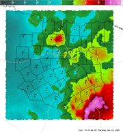
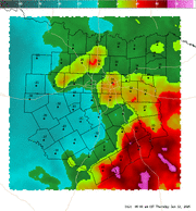
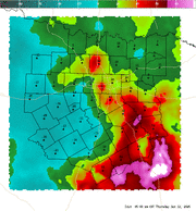
4 Panel Display | Animated Loop Convective Interest This is a highly experimental index which attempts to show areas where surface based convection is favorable or may initiate within the next hour. The index uses a combination of several fields, (CAPE, CIN, low level lapse rates, moisture convergence, satellite, and most unstable LI) to develop a number between -100 and 100. Negative values are indicative of an environment not supportive of surface based convection. The higher the value, the more favorable the environment is for surface based convection. Values greater than 70 are suggestive that convective initiation will likely occur within the next hour in that region. This index works best in regimes of airmass (or pulse) convection or on days where the cap is the primary inhibiting factor for convection. |
Current Hazards
National Outlooks
Tropical
Local Storm Reports
Storm Reports (Graphical)
Submit Storm Report
Tornado Warnings
Severe Thunderstorm Warnings
Flash Flood Warnings
Forecasts
Forecast Discussion
Graphical Forecast
Aviation Forecasts
Fire Weather
Hazard Planner
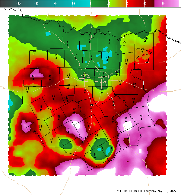
N. Texas Convective Parameters
US Dept of Commerce
National Oceanic and Atmospheric Administration
National Weather Service
Fort Worth/Dallas, TX
3401 Northern Cross Blvd.
Fort Worth, TX 76137
817.429.2631
Comments? Questions? Please Contact Us.