National Weather Service United States Department of Commerce

Thunderstorms Across the Southeast U.S.; Elevated to Locally Critical Fire Weather in Colorado

A few strong to marginally severe thunderstorms are possible across the Southeast U.S. Friday. A Marginal Risk (Level 1 of 5) outlook has been issued. Strong winds and hail will be the main threats. Elevated to locally critical fire weather conditions will persist across south-central Colorado today due to dry conditions and gusty winds. Read More >

Ice Accumulation January 30 - February 1, 2023

Ice Accumulation Jan 30 - Feb 1, 2023


Sleet Accumulation January 30 - February 1, 2023

Sleet Accumulation Jan 30 - Feb 1, 2023


Consecutive Hours at or Below Freezing

Consecutive Hours at or Below Freezing


  • A multi-day ice and sleet event occurred across much of North and Central Texas on Monday Jan 30 through Wednesday Feb 1st. This resulted in several hundreds traffic accidents across the region due to icy roads and highways.
  • The official event snowfall total for Dallas/Fort Worth International Airport was 1.3". As frozen precipitation, sleet is included in snowfall tallies for climate records. The 1.3" on January 31 broke the record snowfall for the date, which was 1.2" in 1985.
  • The NWS received several reports of ice accumulations of 0.5" across North and Central Texas.
  • The heaviest precipitation occurred from Tuesday (January 31) through Wednesday morning (February 1).
  • Consecutive hours at or below freezing ranged from 19 hours in Hearne (Robertson County) to 111 hours in Granbury (Hood County). DFW Airport's tally was 88 hours, and Waco's was 84 hours.
  • This significant event impacted most of Texas and the South Central US. The image below shows the NWS winter weather products on Wednesday February 1st, 2023.


NWS Warnings, Watches, and Advisories on February 1, 2023

NWS Warnings, Watches, and Advisories on February 1, 2023  (image by: NWS Southern Region ROC)


Water Vapor Satellite Imagery


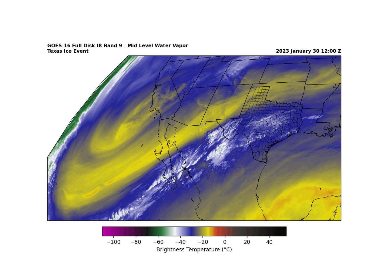
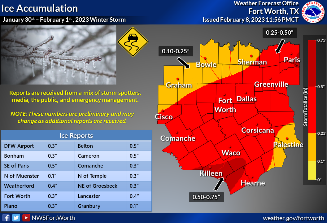
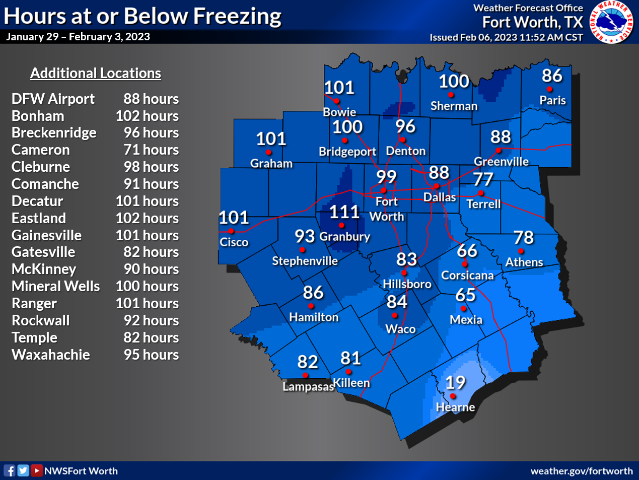
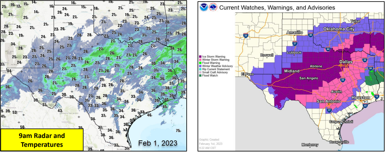
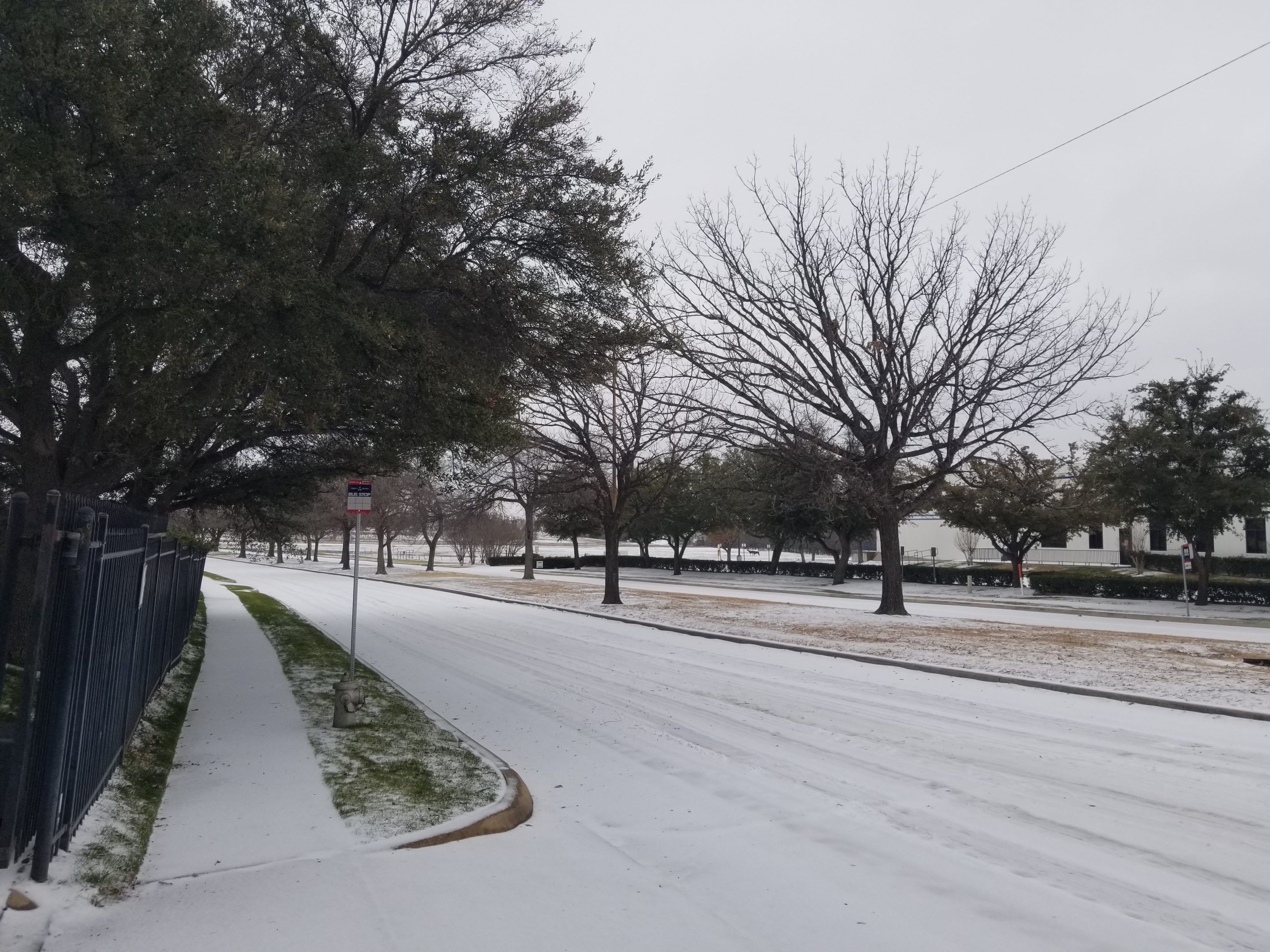
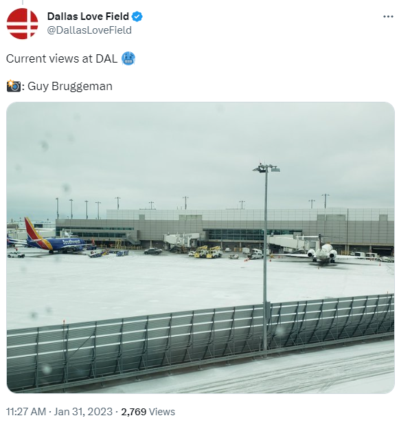
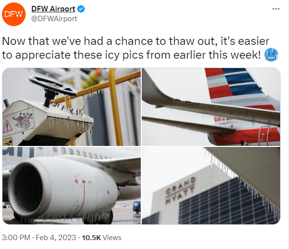
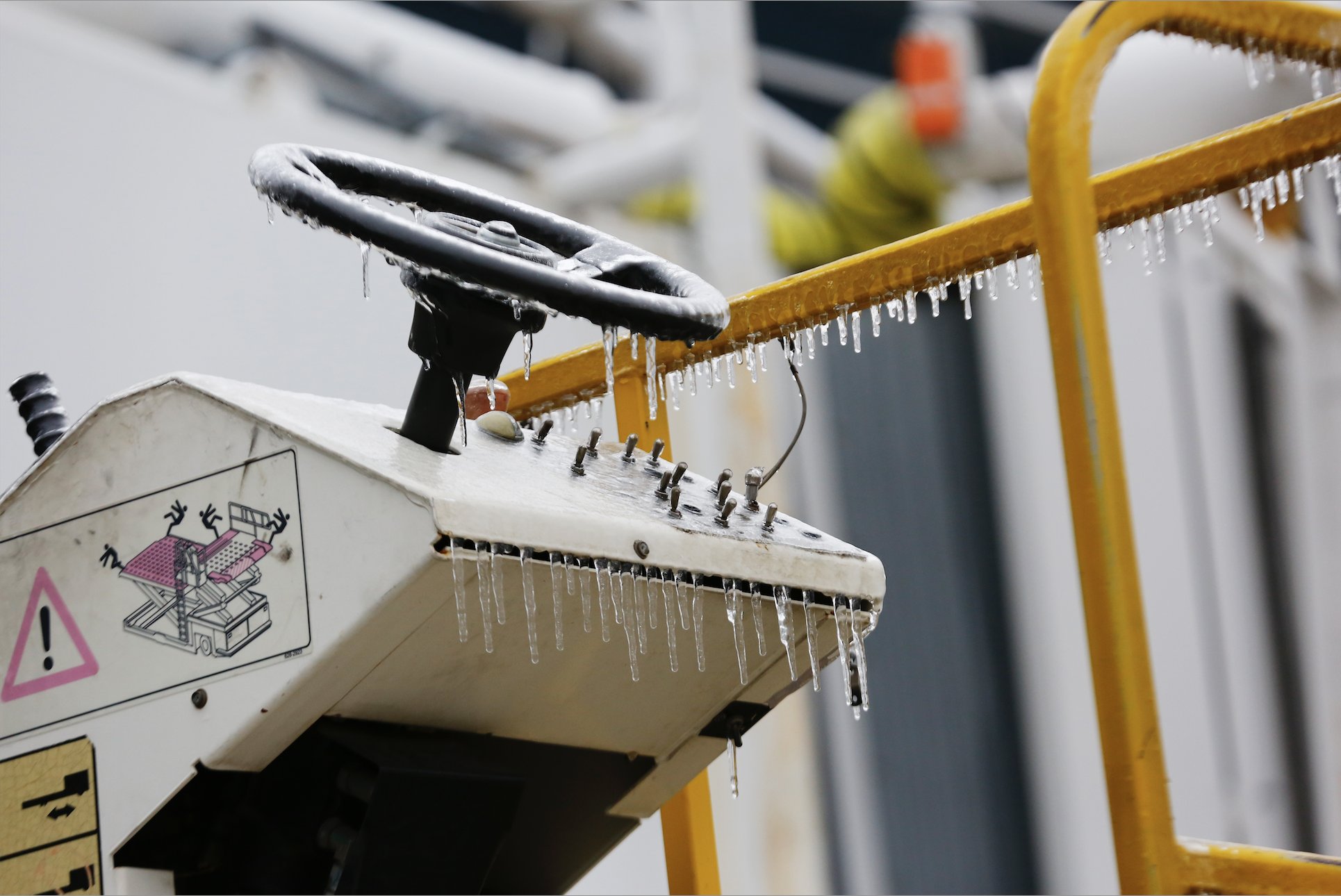
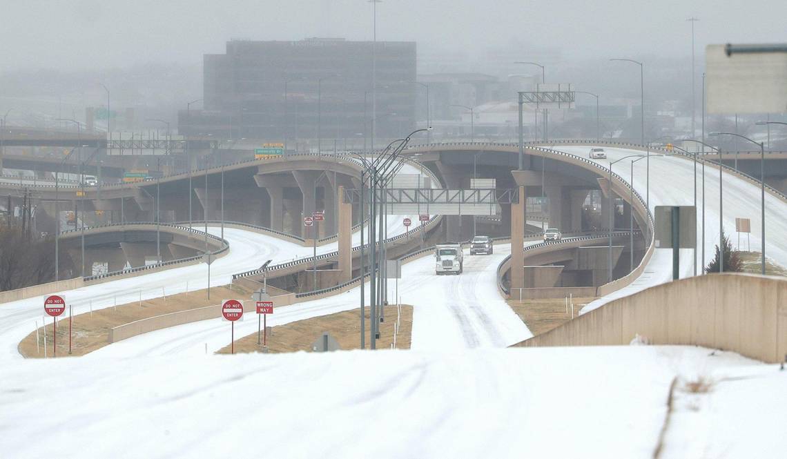
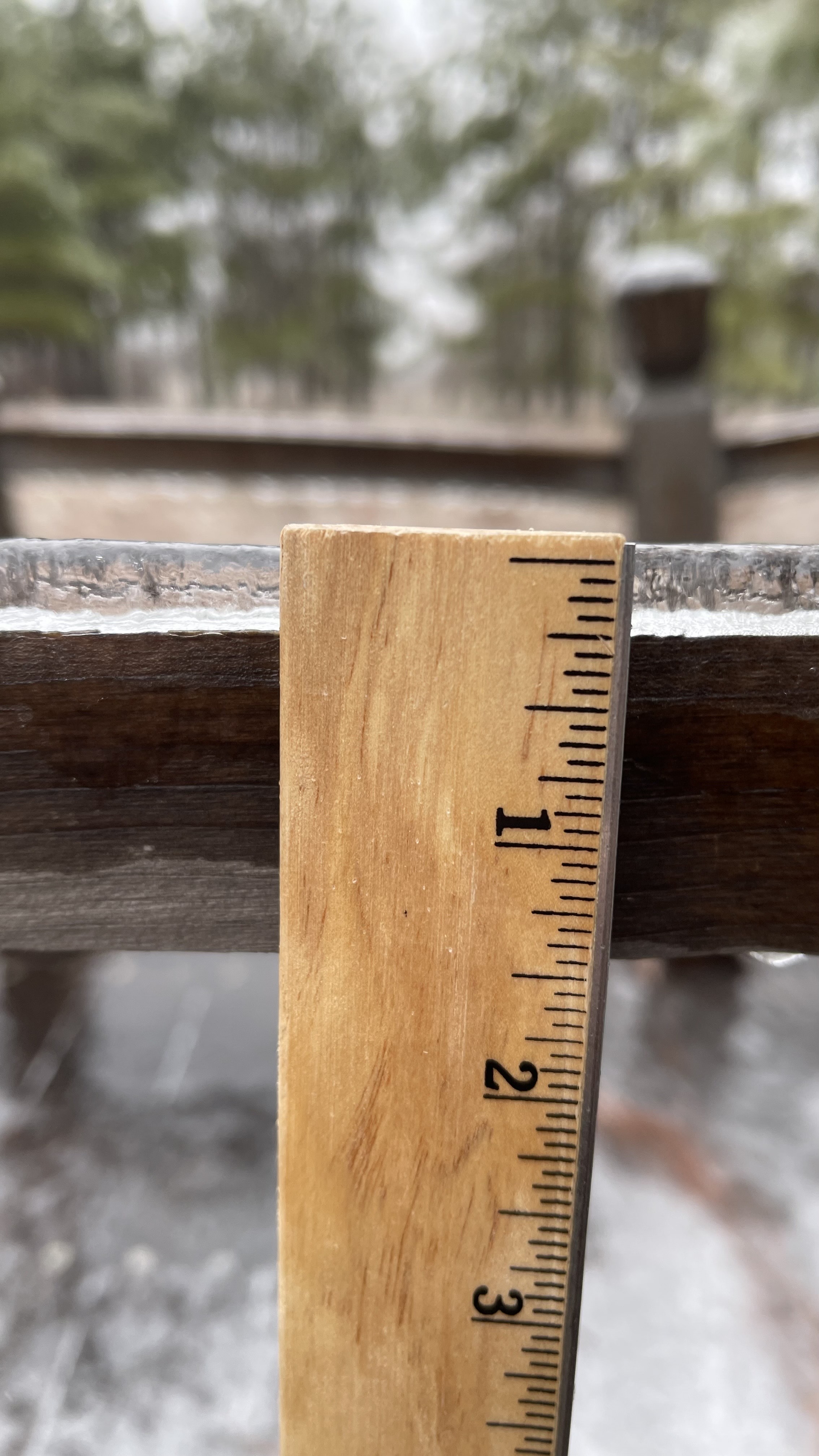
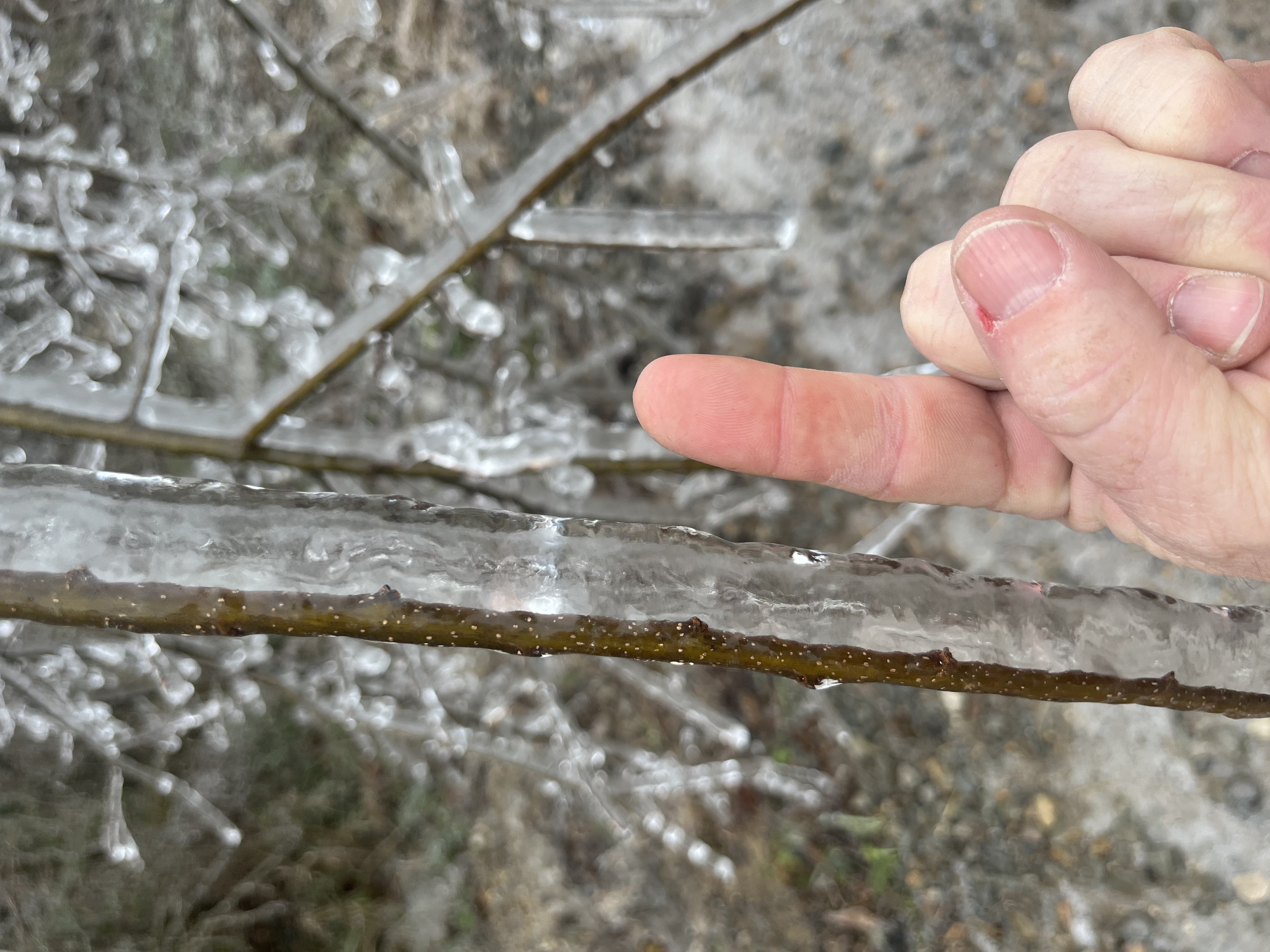
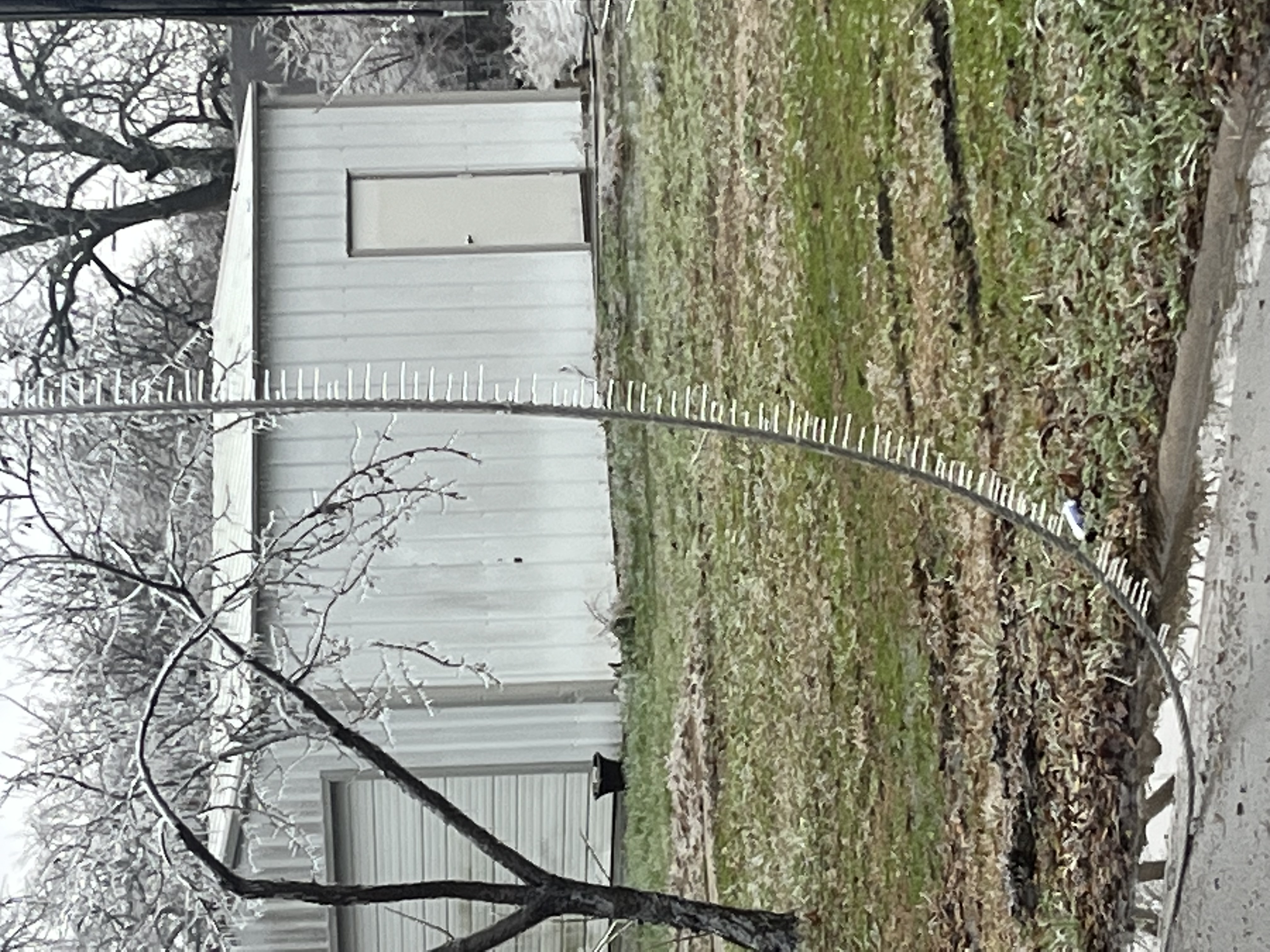
On the evening of January 29, an arctic cold front spilled southward through the Southern Plains and through North Texas sending temperatures tumbling into the 20s where they would remain for the next 2 days.  The shallow cold airmass set the stage for a prolonged period of wintry weather as a slow moving upper level low pressure system meandered across southern California and northwest Mexico.  This low pressure system would send a series of fast moving disturbances northeastward across Texas. The lift and moisture associated with these disturbances would result in widespread precipitation. Most of this fell in the form of sleet and freezing rain on January 31. Periods of rain would continue into February 1. With surface temperatures below freezing, a layer of ice would form across much of North and Central Texas. The best combination of rainfall rates, sub-freezing temperatures, and winds for ice development occurred across parts of Central Texas on February 1st. Temperatures would warm above freezing on February 2nd as the upper low finally moved east of the area.


DFW Airport

  • 1.3" of sleet on January 31
    • 1.3" is a new record snowfall for the date (previous record was 1.2" on January 31, 1985)
    • 1.3" is the greatest event snowfall during January since 1985 (2.2" January 1-2, 1985)
    • 1.3" is the greatest monthly snowfall total for January since 1985 (3.4" in 1985)
  • 88 consecutive hours at or below freezing
    • 7 pm on January 29 through 11 am on February 2
    • longest stretch since February 2021


Waco Regional Airport

  • 0.1" of sleet on January 31
    • only the second occurrence of measurable snowfall during January since 1988 (other was 4.4" on January 10, 2021) 
    • 5th consecutive winter with measurable snowfall (longest streak since the 1960s)
  • 84 consecutive hours at or below freezing
    • 11 pm on January 29 through 11 am on February 2
    • longest stretch since February 2021


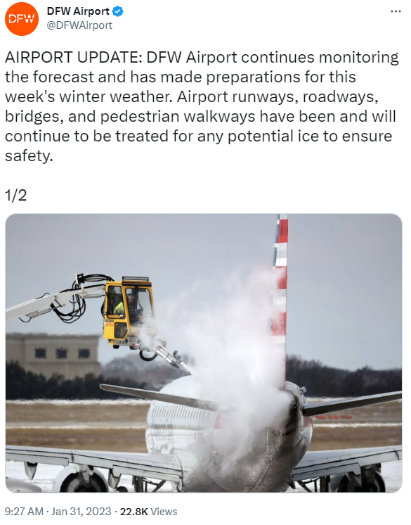
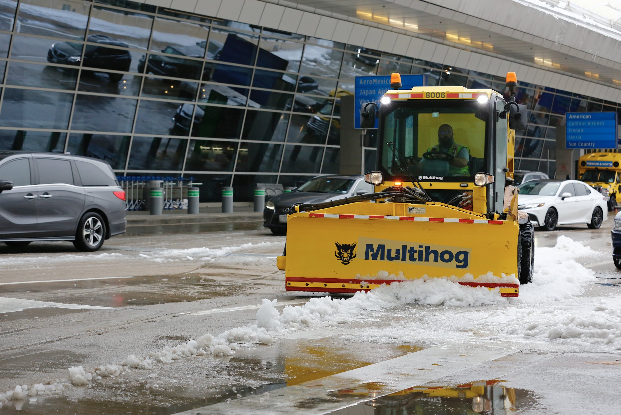
This winter weather event was extraordinarily impactful from an aviation standpoint.

  • Between January 30th and February 3rd, DFW Airport had 3,544 cancellations and Dallas Love Field (DAL) Airport had 982. This resulted in hundreds of millions of dollars in economic cost. (Source: ZFW Traffic Management Officer)

  • Both airports had nearly constant deicing operations during this period. 

  • There were times during the winter storm that wintry precipitation was falling so quickly that DFW Airport was operating both arrivals and departures off of one single runway, lowering the arrival rate as low as 12 aircraft per hour (the arrival rate is 130-140 on a good day).

  • There was also a prolonged ground stop during the convective sleet on Tuesday morning (January 31).


DFW Airport - airplane and deicing

DFW Airport - social media post

Dallas Love Field - ice removal operations
Dallas Love Field - social media post
DFW Airport - ice removal operations
Ice Removal Operations at DFW Airport (photo by DFW Airport)


Ice Accumulation January 30 - February 1, 2023

Ice Accumulation Jan 30 - Feb 1, 2023


Sleet Accumulation January 30 - February 1, 2023

Sleet Accumulation Jan 30 - Feb 1, 2023


NWS Fort Worth Office on January 31, 2023
NWS Fort Worth Office on Jan 31, 2023 
balloon launch - NWS Fort Worth
Balloon Launch - NWS Fort Worth


street near NWS Fort Worth on January 31, 2023

Street near NWS Fort Worth
on January 31, 2023 


Dallas Love Field tweet on January 31, 2023
Dallas Love Field tweet on Jan 31, 2023


DFW Airport tweet on February 4, 2023

DFW Airport tweet on February 4, 2023


ice at DFW Airport (photo by DFW Airport)
Ice at DFW Airport (photo by DFW Airport)


I-35 near downtown Fort Worth (photo by Fort Worth Star-Telegram)
I-35 near Downtown Fort Worth
(photo by Fort Worth Star-Telegram)


ice on trees, power lines, and a house
Ice on Trees, Power Lines, and a House
 measuring ice on a surface (photo by NWS employee)
Measuring Ice on a Surface
(photo by NWS employee)


ice-coated trees (Lamar County)
Ice-Coated Trees (Lamar County)
ice-coated trees (Lamar County)
Ice-Coated Trees (Lamar County)
icy trees and power lines (Lamar County)
Icy Trees, Power Lines (Lamar County)


ice on a tree branch (Lamar County)
Ice on a Tree Branch (Lamar County)
icy trees and power lines (Lamar County)
Icy Trees, Power Lines (Lamar County)


* photos courtesy of NWS employees, partners, the public, etc.