|
Event Summary:
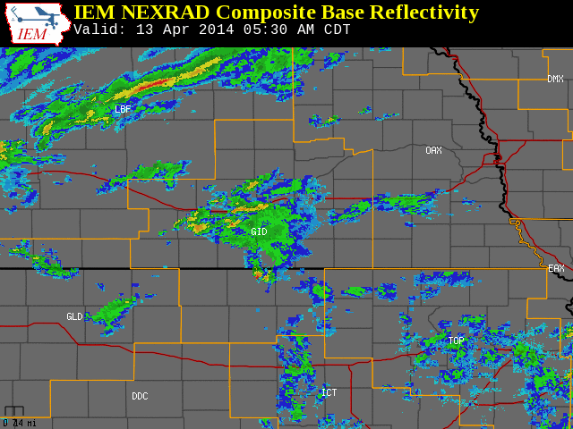
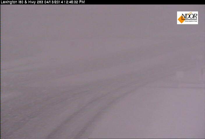
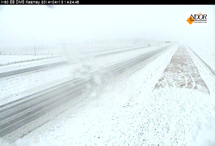
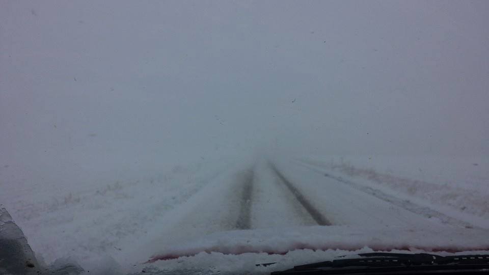
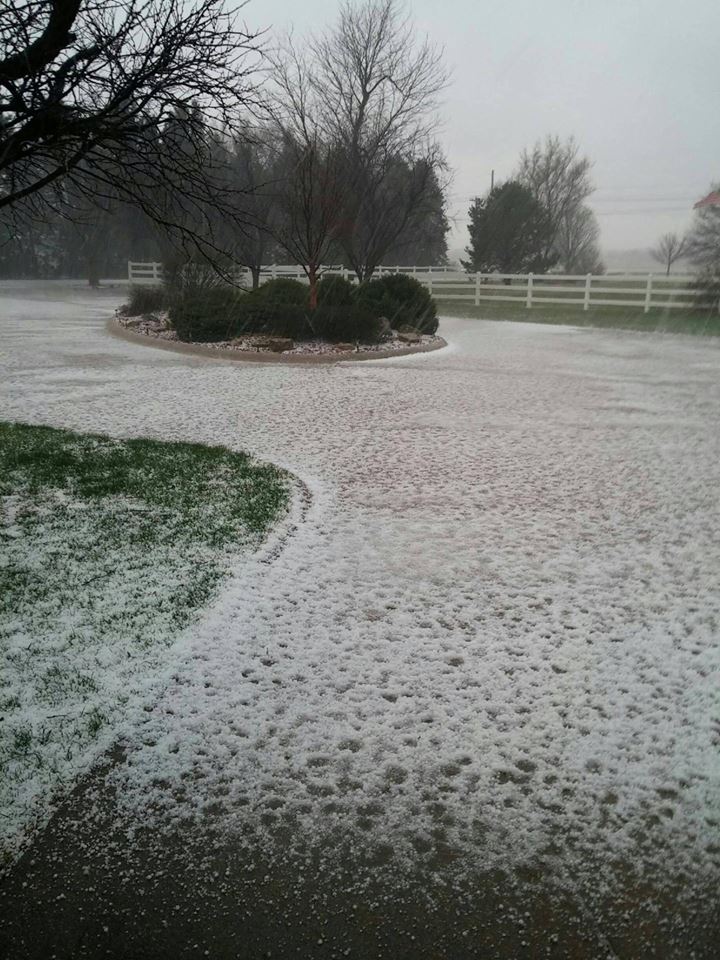
Sunday, April 13, 2014 saw a gamut of weather on a single day as a potent spring storm system crossed the Central Plains. A strong cold front ushered in much colder air and gusty north winds in excess of 50 mph during the early morning hours. Showers and thunderstorms accompanied the front initially, and several thunderstorms produced large quantities of small hail (mainly pea size). Southwest of Upland in Franklin County, the small hail measured a depth of nearly one inch. As cold air continued to invade during the day, the rain mixed with and changed to snow, and a period of sleet was common during the phase change from rain to snow. The snow became banded as an upper low pressure system deepened and slowly crossed Nebraska, and intense snowfall rates occurred within the snow bands. The heavy snowfall, combined with the north wind gusts around 50 mph produced white-out conditions at times, and several accidents and road closures were reported. Interstate 80 was closed for a period during the day from Kearney to Elm Creek, and a shelter was opened in Holdrege for stranded motorists. Power outages were reported from Sherman through Phelps Counties, including the Kearney, Gibbon, Elm Creek, Loup City and Ashton areas.
The cold air accompanying the front arrived quicker and colder than expected. Combined with the strength of the upper level system, this resulted in heavier snow across the area, especially within the strongest band. The greatest snowfall amounts of 4 to 7 inches fell from Lexington to Wilsonville, northeast through Holdrege, Kearney, Litchfield and St. Paul. Much needed moisture (rain, melted snow or a mix) fell across south central Nebraska, with liquid totals ranging from a few tenths of an inch in the Ord and Arcadia areas to nearly 2 inches in the Holdrege area.
The sharp contrast, from rain and thunderstorms in the morning to wind driven snow and near white out conditions in the afternoon, provided a stark reminder that Mother Nature can throw a curveball when it comes to spring weather systems. Although not a common occurrence, storm systems with rapidly changing precipitation types is not unheard of in the transition from winter to spring.
Below is a list of some of the higher snow totals from NWS Cooperative Observers, with a * noting reports from NeRAIN Observers. More information will be added as it becomes available.
| Location |
Snowfall Total |
| 3 W Elba* |
7.5" |
| 7 S Litchfield* |
7.0" |
| Wolbach |
6.7" |
| St. Paul |
6.1" |
| Wilsonville |
6.0" |
| 5 WNW Elm Creek* |
6.0" |
| Ravenna |
5.2" |
| 4 SW Bladen* |
5.0" |
| 1 E Lexington* |
5.0" |
| Holdrege |
4.0" |
| 8 S Elwood |
4.0" |
| 4 E Scotia* |
4.0" |
| Beaver City |
3.0" |
| Osceola |
3.0" |
| Greeley |
2.5" |
| Cambridge |
2.5" |
| Minden |
2.0" |
| 6 SSE Lexington (Canaday Steam Plant) |
2.0" |
Below is a list of some of the higher liquid totals from NWS Cooperative Observers, with a * noting reports from NeRAIN Observers. Keep in mind these amounts could come from rain, melted snow, or a rain/snow mix.
| Location |
Liquid Total |
| Holdrege |
1.98" |
| Beaver City |
1.37" |
| Wilsonville |
1.30" |
| Wilcox |
1.30" |
| 7 S Litchfield* |
1.22" |
| St. Paul |
1.20" |
| Ravenna |
1.14" |
| 5 WNW Elm Creek* |
1.08" |
| 4 E Scotia |
1.01" |
| 8 S Elwood |
0.90" |
| Osceola |
0.85" |
| Wolbach |
0.62" |
| Bruning |
0.55" |
| Minden |
0.54" |
| 3 NE Shelby |
0.52" |
| Cambridge |
0.44" |
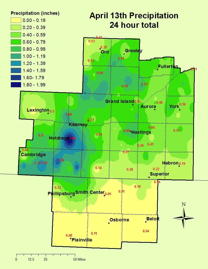 |
24 Hour Precipitation Totals
Ending Monday Morning. |
 |
24 Hour Snowfall Totals
Ending Monday Morning. |
Here are a few photos from the morning thunderstorm activity:
 |
 |
 |
Small hail on the ground in east Hastings.
Photo courtesy of Jeremy Wesely. |
Though small, the hail fell hard and piled up quickly. This photo was taken just south of the junction of Highways
4 and 10 southwest of Upland in Franklin County.
Photo courtesy of Mitchell Dallman. |
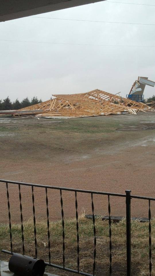
Wind damage to a building under construction 8 miles south of Cambell.
Photo courtesy of Jenn Frannsen. |
Here are a few photos from the area hardest hit by the heaviest snow, taken Sunday afternoon:
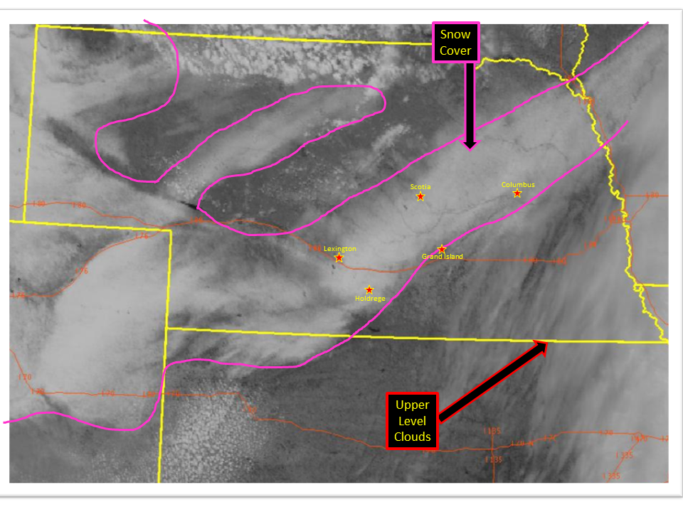
Here is a visible satellite image of the lingering snowpack, taken Monday afternoon around 1 p.m.
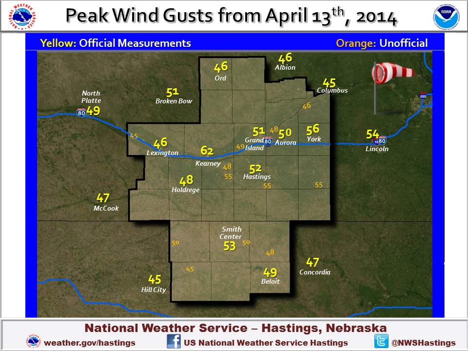
Here is a map showing some of the peak wind gusts from the area.
|