National Weather Service United States Department of Commerce
 
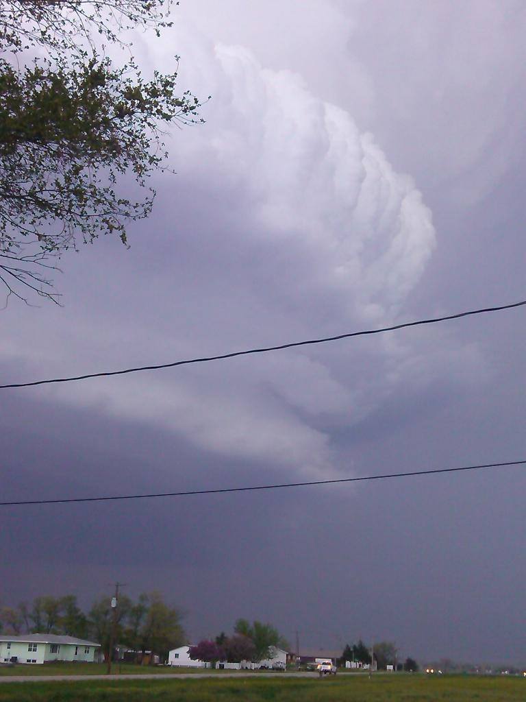
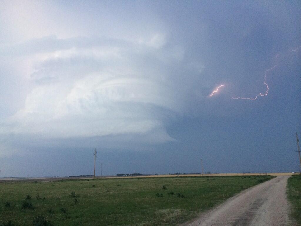
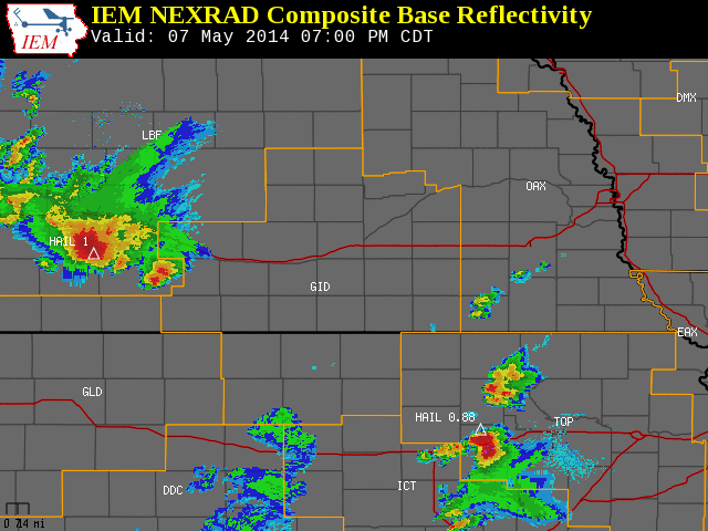
May 7, 2014

Isolated Severe Thunderstorms Affect Far Northwestern & Southeastern Portions of the Area

To the right is a National Weather Service Radar loop, valid from 7:00 p.m. on Wednesday, May 7th to 11:00 p.m. on Wednesday, May 7th.

The NWS Hastings coverage area is located within the orange outlined area labeled "GID", with the Interstate highways in red.

(Click Radar Loop To Enlarge)


Event Summary:

Though the majority of the activity split around to the west and east of the NWS Hastings coverage area, there was plenty to keep an eye on during the evening hours.  Most notably, a strong supercell storm developed over far southwestern portions of Dawson county early in the evening, then took off to the northeast through Buffalo, Sherman, Howard and Greeley Counties.  As it was passing through the Lexington area, this storm dropped hail ranging in size anywhere from quarters to baseballs. It continued to drop hail as it trekked northeast, and even spawned a few funnel clouds on the way. Although there was some gustnado activity with this storm, no actual tornadoes were confirmed. Though demonstrating a weakening trend the farther northeast it went, wind damage in the form of downed trees was reported in Elba.

Farther to the southeast, a cluster of thunderstorms sliding from central into northeastern Kansas managed to clip the far eastern edge of Mitchell County, dropping quarter size hail near both Asherville and Simpson before moving east out of the county.


A few of the severe weather "highlights" from the event:

  • Hail ranging from quarter size (1") to baseball size (2.75") was reported in and near Lexington.
  • Ping pong ball size (1.5") to tennis ball size (2.5") was reported near the northwest corner of Johnson Lake.
  • Quarter size (1") hail was reported near Asherville and Simpson in Mitchell County, KS.
  • Funnel clouds were reported south of Lexington and north of Amherst.
  • Southeast of Lexington, a power pole was snapped and an irrigation well engine shed was damaged.
  • A cattle outbuilding was damaged 4 miles east of Hazard.
  • 2.5 miles northwest of Rockville, a house sustained garage door damage and an irrigation pivot was partially overturned.
  • Trees were downed in Elba, resulting in power outages.
     
    Preliminary storm reports (click image)
 

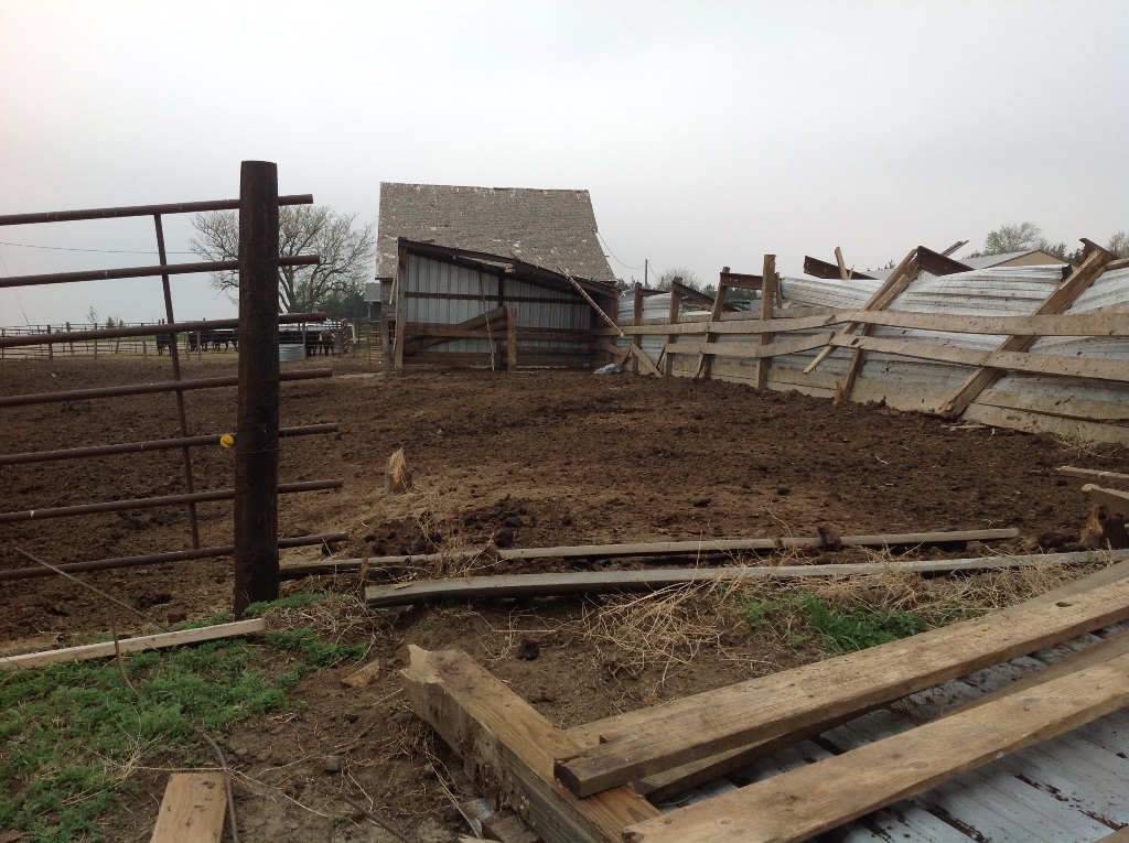
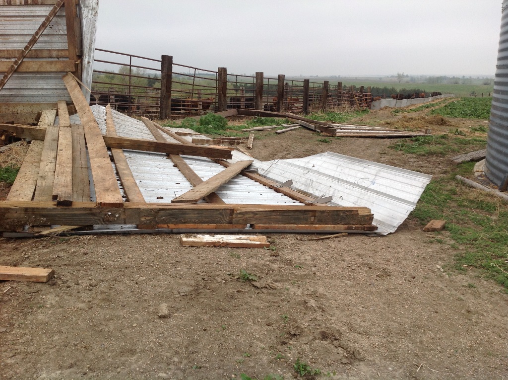
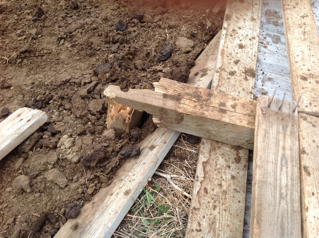
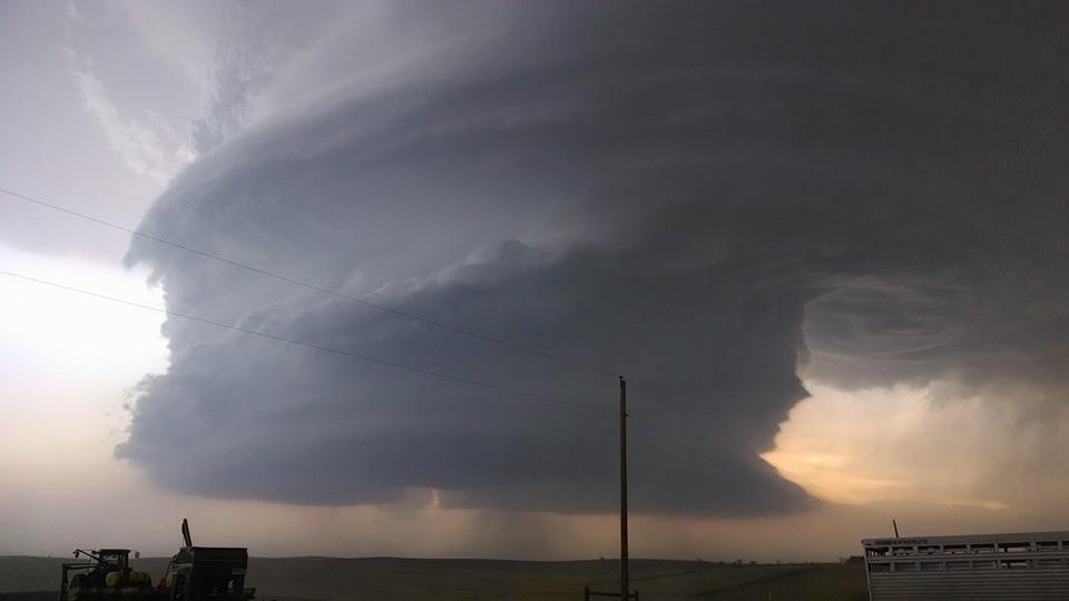
Here are a few photos of some of the damage in the Hazard and Rockville areas of Sherman County. Photos are from NWS Hastings, click for a larger version:

 
Damage 4 miles east of Hazard. Damage 4 miles east of Hazard.
 
Damage 4 miles east of Hazard. Damage 4 miles east of Hazard.
 
Damage 2.5 NW of Rockville.


Here are a few photos of the incredible structure of the supercell as it passed through Dawson and Buffalo Counties:

 
Photo of the storm structure as it passed near Overton.  Photo courtesy of
Sean Larson.
Photo of the storm and lightning as it passed near Amherst. Photo courtesy of Jared Petr. Storm passing near Pleasanton.
Photo courtesy of Tyler Kohlscheen.


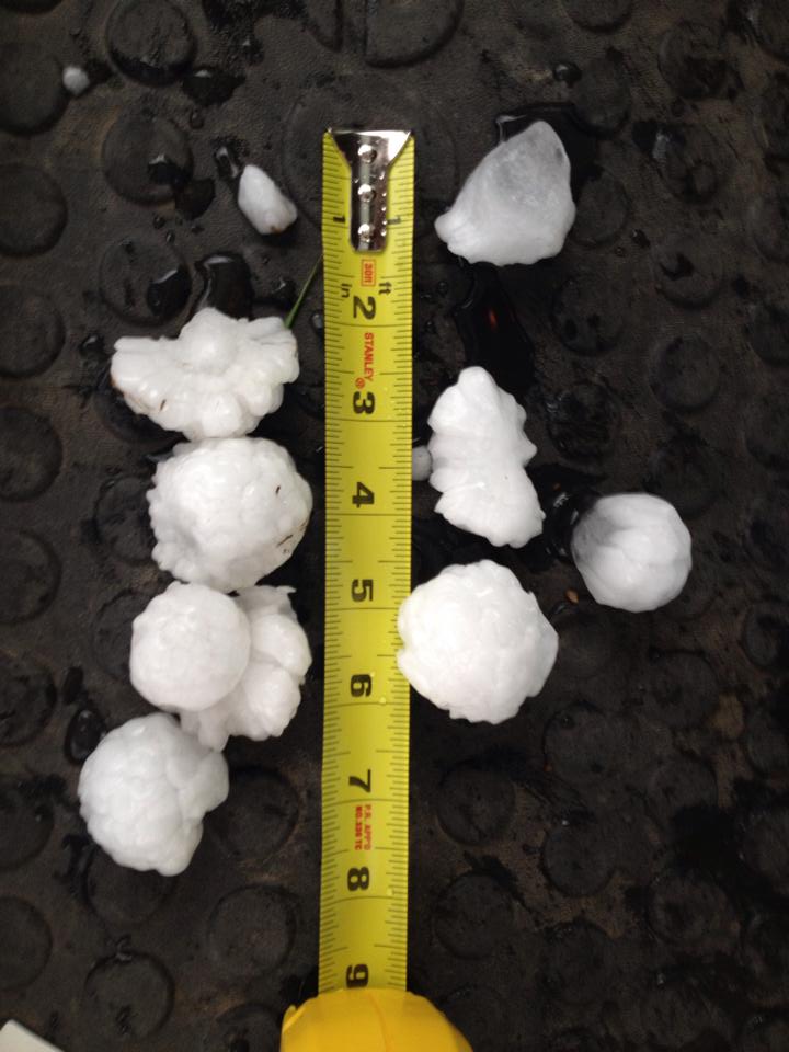
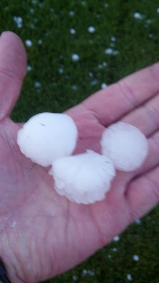
Here are a few hail photos:
Hail approximately 
6 SSE of Cozad. Photo courtesy of Michael McLaughlin.
Hail in Lexington. Photo courtesy of Jared Woody.