A significant heat wave is underway for the Intermountain West, Northern Plains, and Upper Great Lakes, peaking in intensity through midweek and lingering across parts of the Northern Plains and Midwest until this weekend. In southwest Texas, excessive rainfall may bring a risk for potentially life-threatening flash and arroyo flooding through Thursday. Read More >
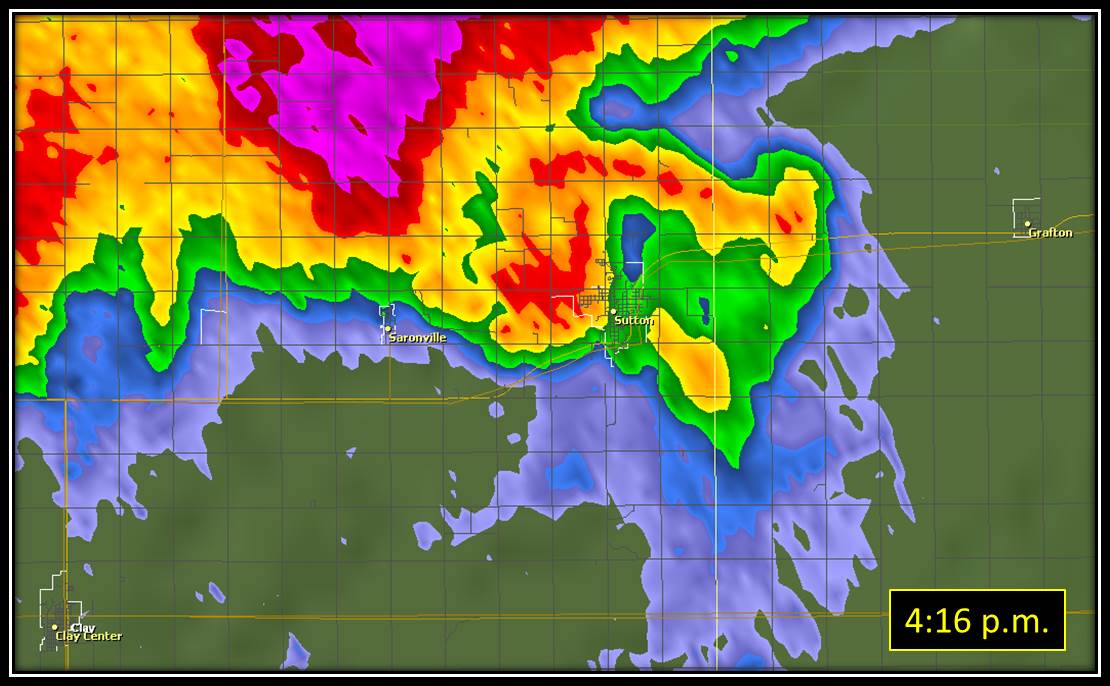
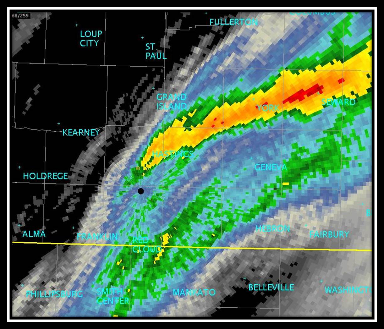
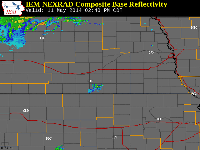
| Mother's Day - May 11, 2014 Tornadoes, Large Hail, Damaging Winds and Heavy Rain Affect Mainly Eastern Portions of the Coverage Area To the right is a National Weather Service Radar loop, valid from 2:40 p.m. on Saturday, May 11th to 10:00 p.m. on Sunday, May 11th. The NWS Hastings coverage area is located within the orange outlined area labeled "GID", with the Interstate highways in red. (Click Radar Loop To Enlarge)
|
 |
|
Event Summary: Some much-needed rainfall was also observed across the area, with several locations seeing rainfall amounts in excess of 1 inch. Locations across portions of Adams county, Clay county, Hamilton county and York county in south central Nebraska saw some of the heaviest rainfall on Sunday afternoon...with rain amounts of two to three inches common through many locations. The combination of rain that fell early Sunday morning along with that which fell Sunday afternoon into Sunday night totaled as high as 5-7", primarily in parts of York County. This resulted in minor flooding of several creeks and streams in the area.
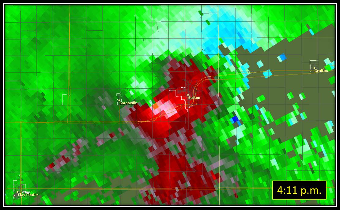
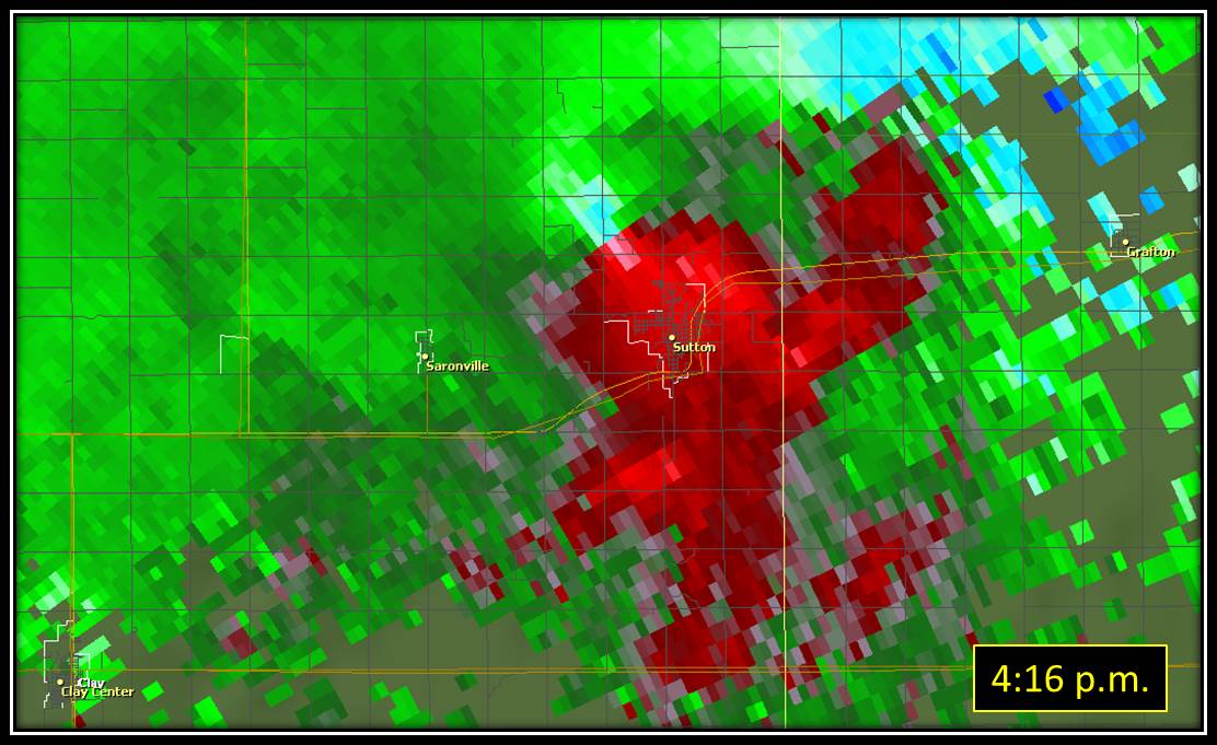
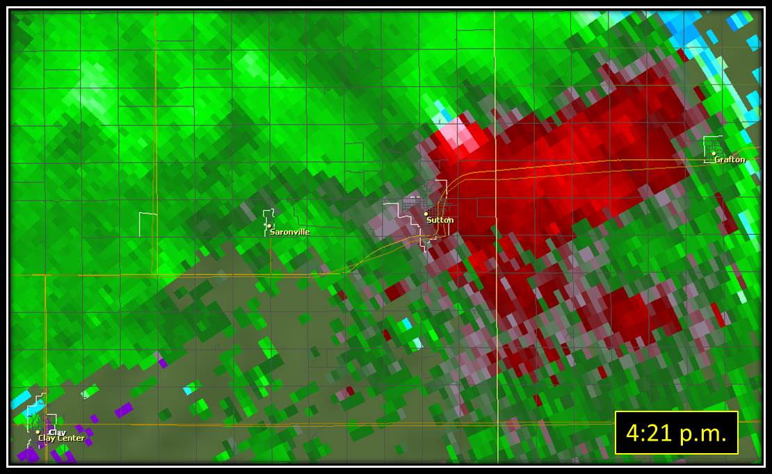
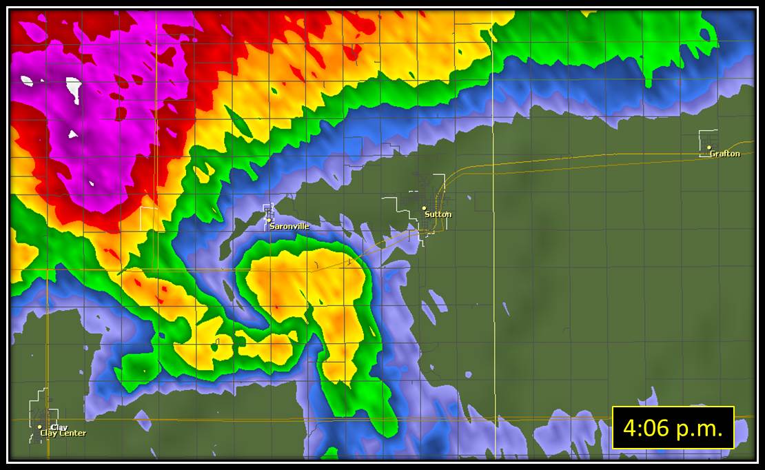
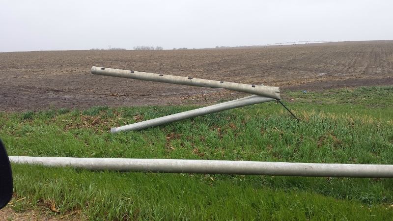
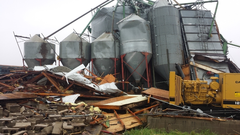
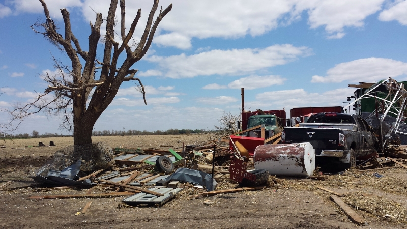
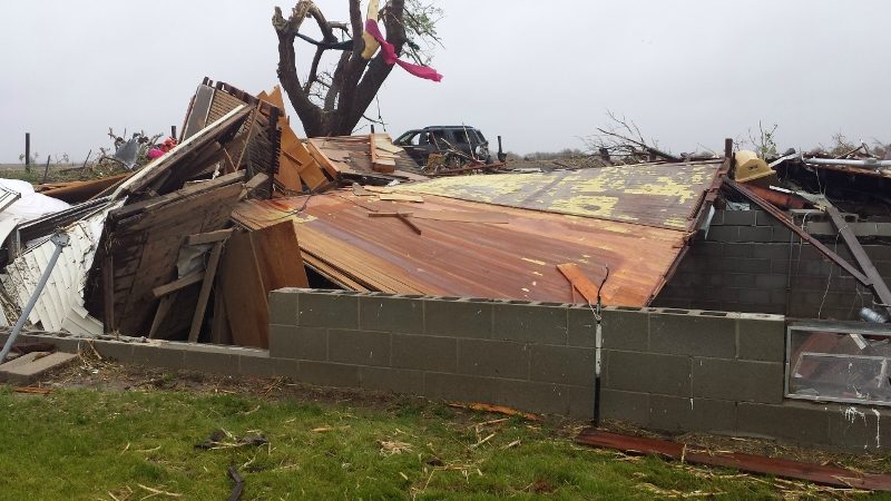
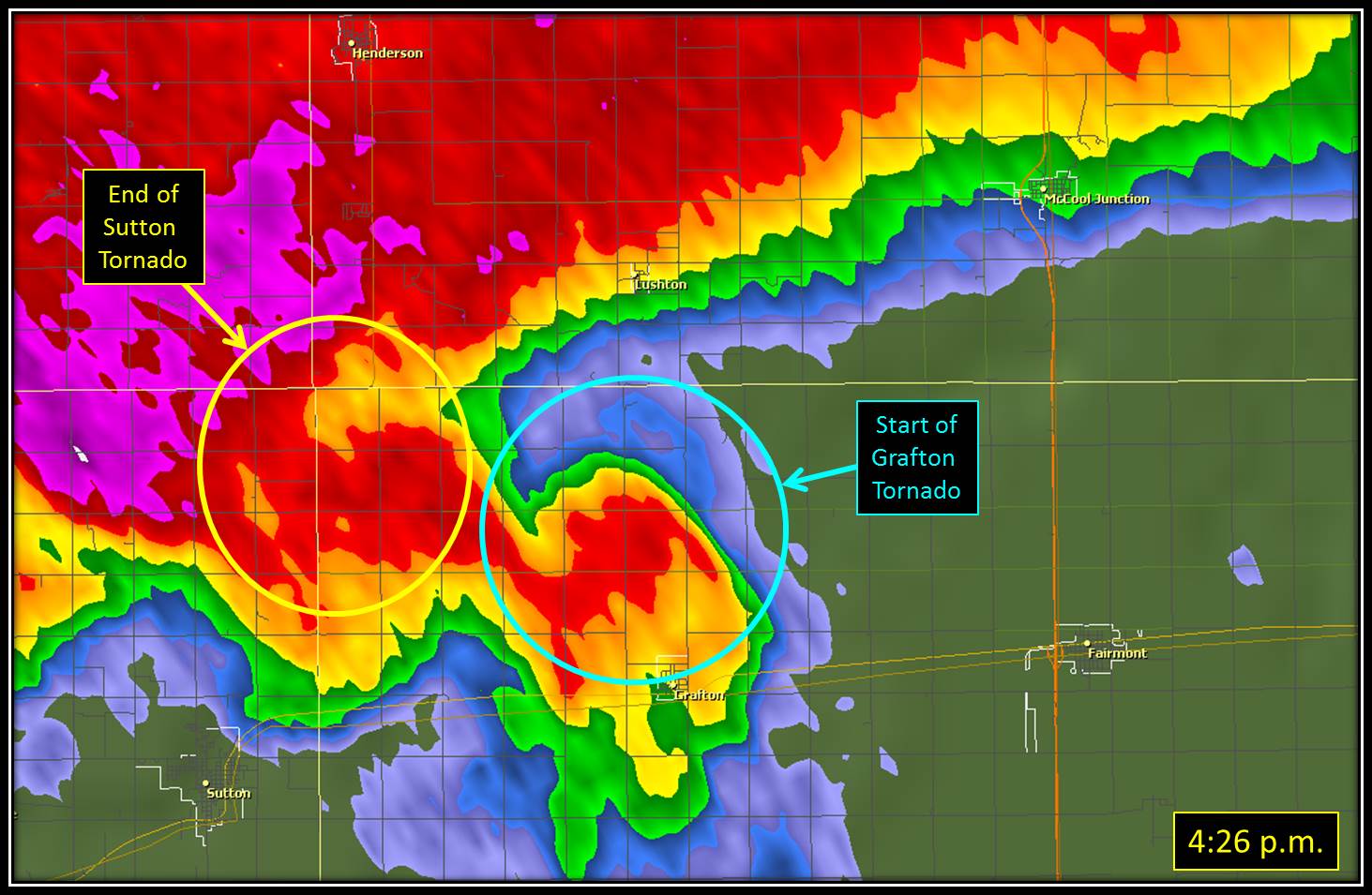
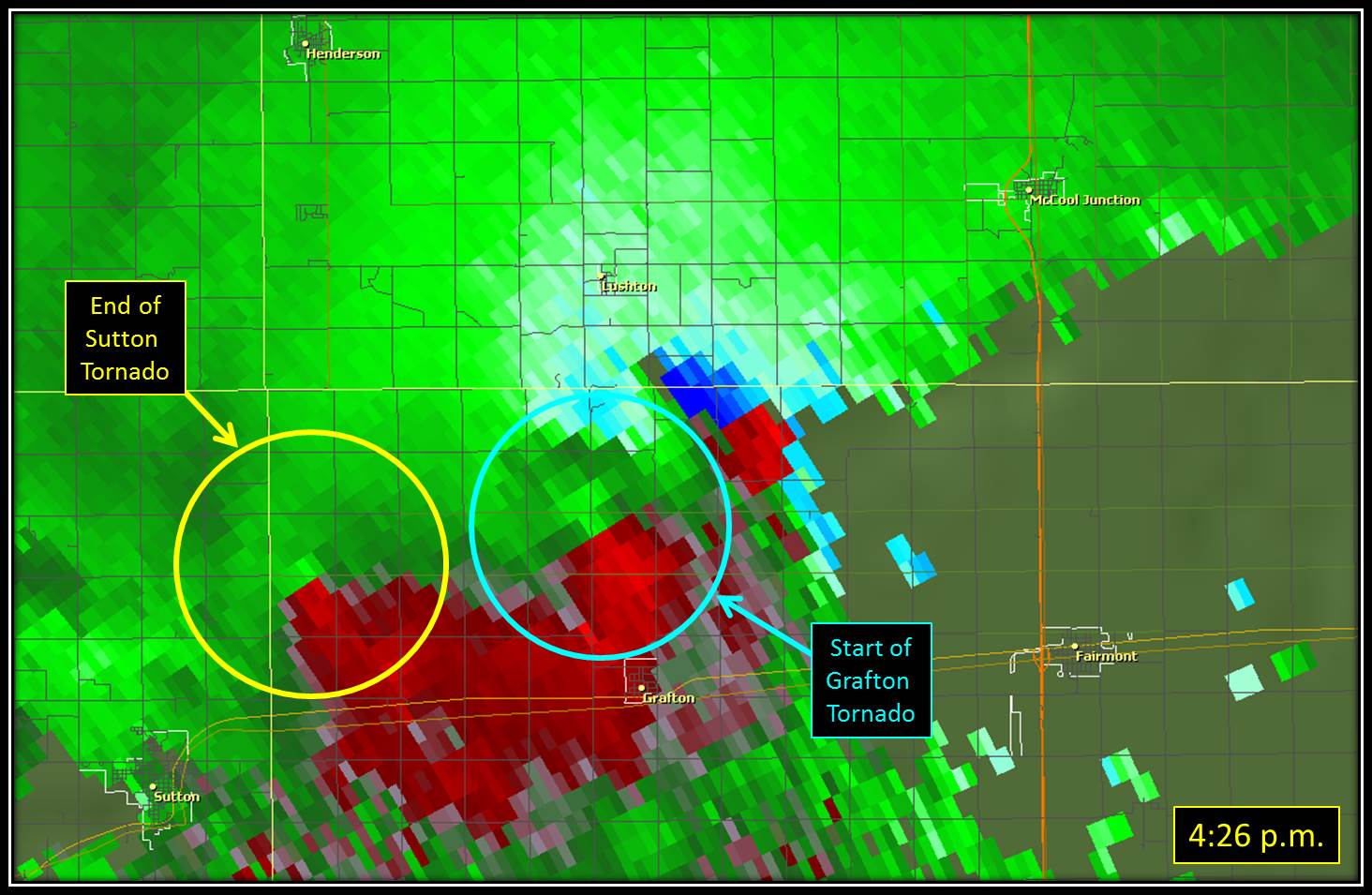
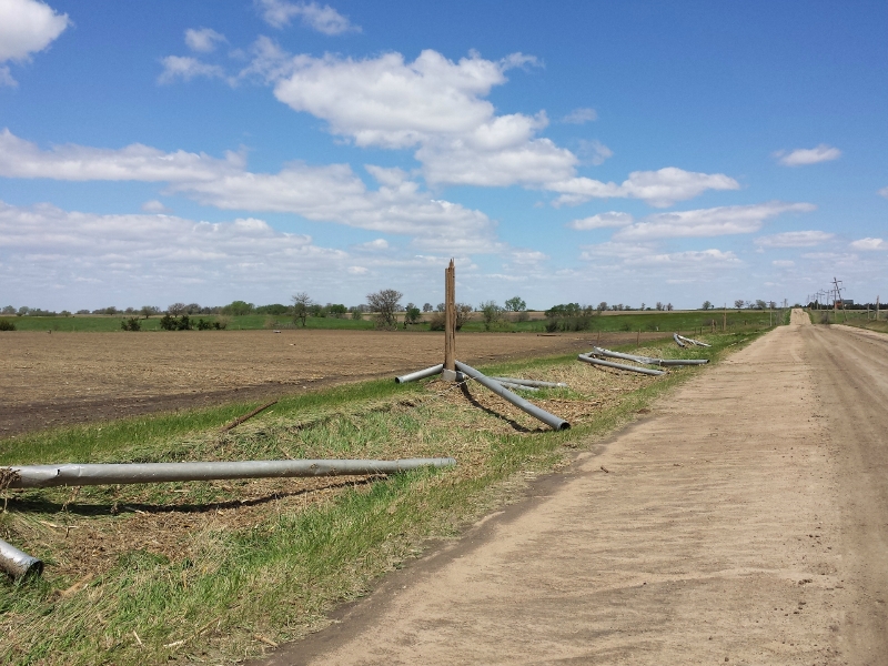
Tornado #2: 4.3 miles north-northwest of Fairfield (Clay County) to 4.8 miles northeast of Sutton (Fillmore County) Rating: EF-3 Estimated Peak Wind Speed: 150 mph Time: 3:50 to 4:28 p.m. CDT Path Length: 21.7 miles Max Path Width: 1300 yards (approximately 3/4 mile) Fatalities/Injuries: 0 / 0 This tornado was reported initially as a multi-vortex tornado for several miles before taking on a more traditional look south of Saronville, where it was described as a wedge tornado. Based upon reports and video, it appears the entire mesocyclone of the storm was near ground level southwest of Sutton. Damage from this tornado was first noted north of Fairfield, where large tree limbs were knocked down and power poles broken. The tornado shifted mainly east across Highway 14 south of Clay Center, with additional tree damage as well as irrigation pivots overturned. It then started to move to the northeast, crossing Highway 41 east of Clay Center and Highway 6 a few miles west of Sutton, but powerful rear flank downdraft winds of 100 mph hammered Sutton and areas south-southwest of town, causing widespread property damage. Moving in between Saronville and Sutton, the tornado then started a more east-northeast path, crossing Road 6 north of Sutton before dissipating approximately 5 miles northeast of town. As the tornado approached and crossed Highway 6 it intensified to it strongest point. Damage peaked a few miles north of Sutton, where the EF-3 rating was assigned, resulting from the destruction of a home. Elsewhere along the path, a few other homes sustained less significant damage than the one north of Sutton, and a number of other outbuildings and grain bins were also damaged or destroyed. Many trees were damaged, destroyed or contained debris (mainly from destroyed grain bins), irrigation pivots were overturned and power poles broken.
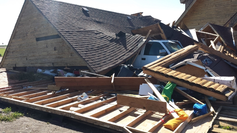
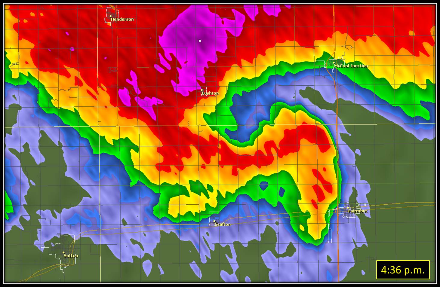
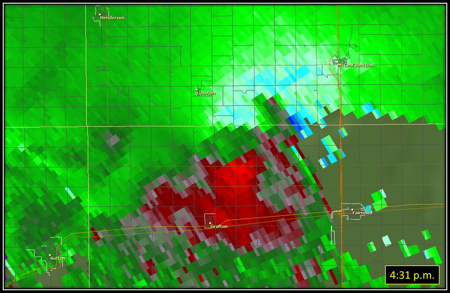
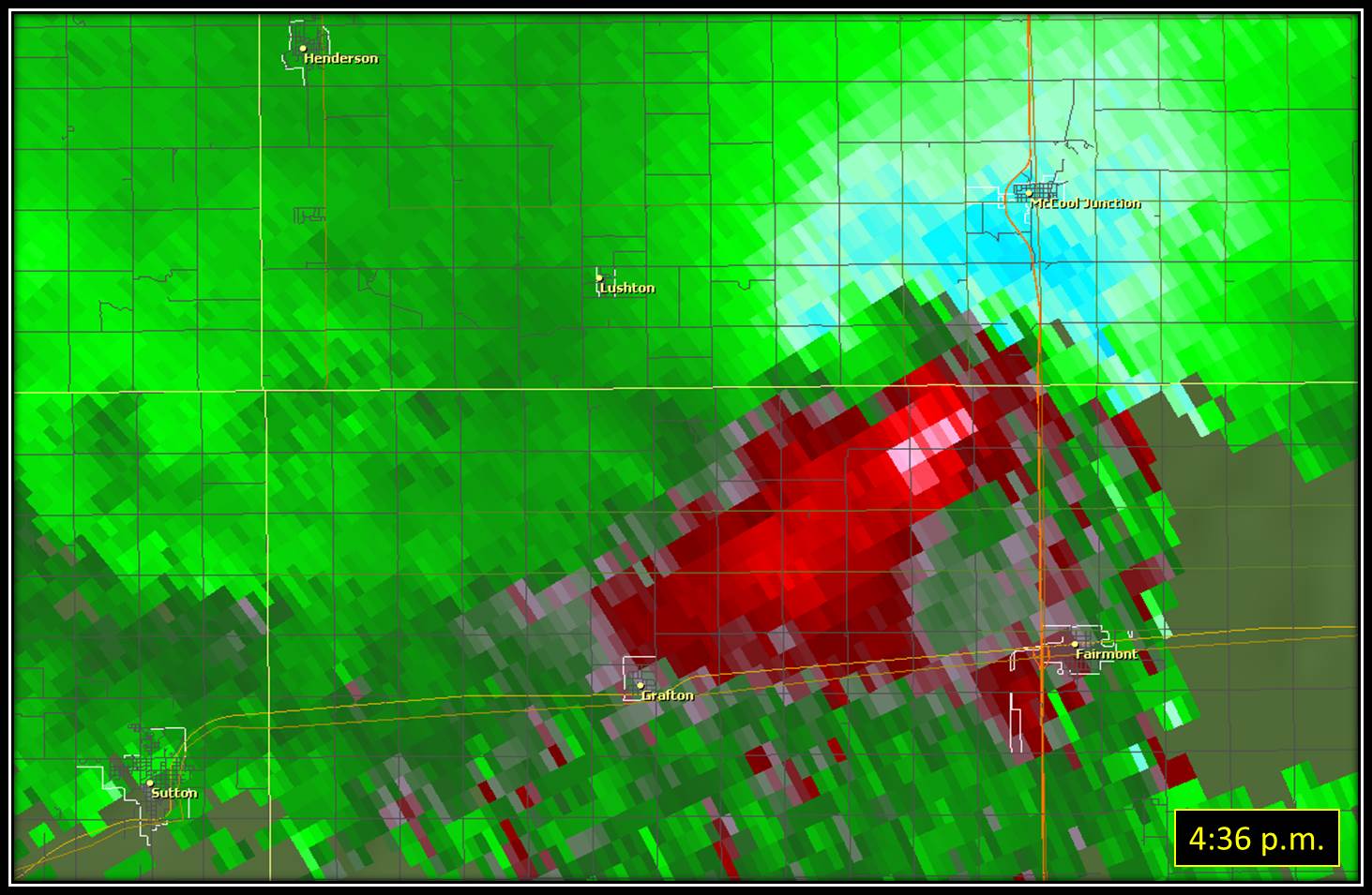
Tornado #4: 2.6 miles northwest of Grafton (Fillmore County) to 4 miles east-northeast of Fairmont (Fillmore County) Rating: EF-2 Estimated Peak Wind Speed: 120 mph Time: 4:25 to 4:41 p.m. CDT Path Length: 9.7 miles Max Path Width: at least 750 yards (approximately 1/2 mile) Fatalities/Injuries: 0 / 0 This tornado traveled rural areas of northern Fillmore County, bumping the York County line along the way. One home suffered damage when part of the roof was torn away, while another older home was pushed approximately 30 feet off of its foundation. There was widespread power pole and tree damage, with some trees containing debris from grain bins, and a number of irrigation pivots were overturned.
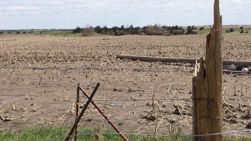
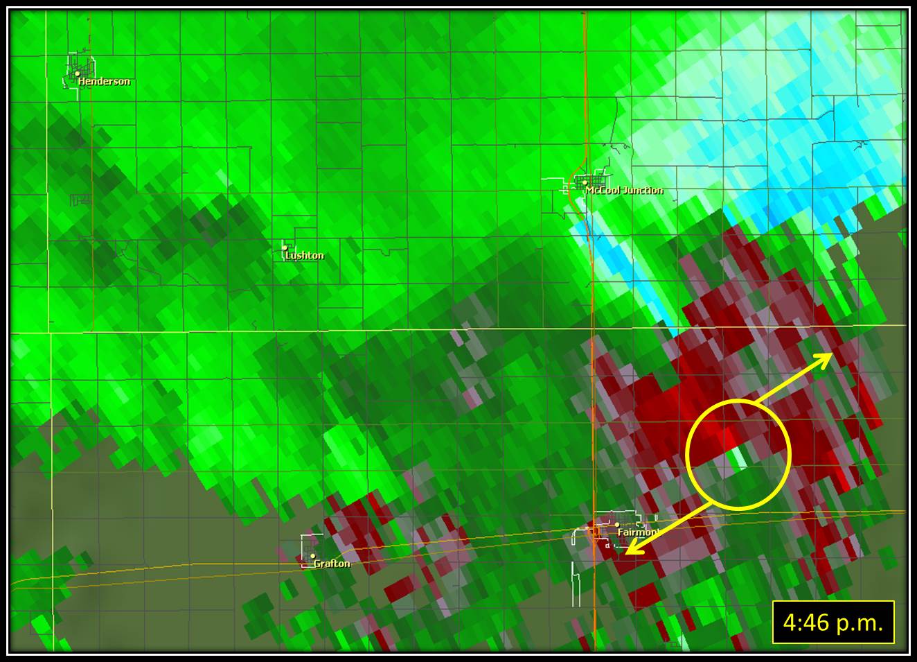
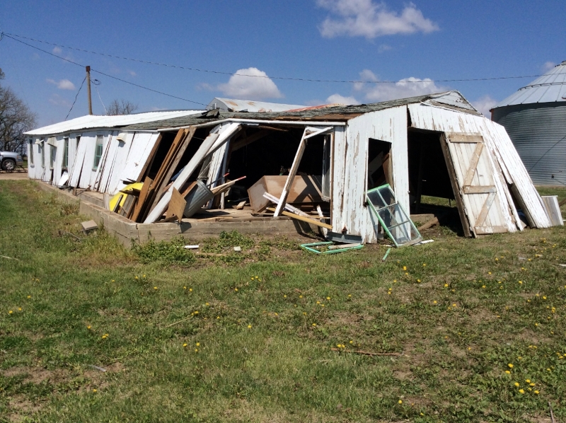
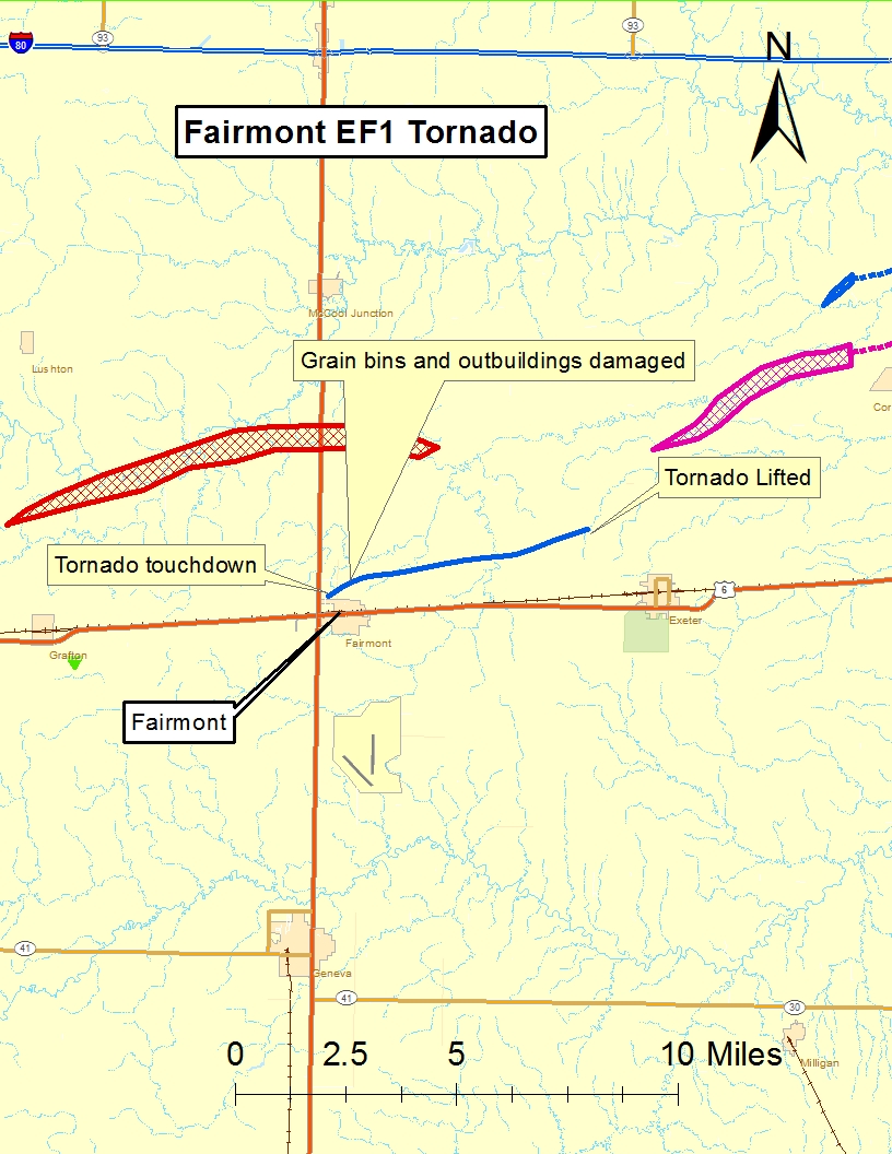
Tornado #5: 0.5 mile northwest of Fairmont (Fillmore County) to 2.2 miles northwest of Exeter (Fillmore County) Rating: EF-1 Estimated Peak Wind Speed: 90 mph Time: 4:40 to 4:48 p.m. CDT Path Length: 6.2 miles Max Path Width: 150 yards Fatalities/Injuries: 0 / 0 This tornado traveled rural areas and was witnessed by several storm chasers and experienced meteorologists. Video evidence, eyewitness accounts, radar imagey and even some of the damage confirm this tornado rotated anti-cyclonically, or the opposite direction most tornadoes rotate. Damage along the path of the tornado included a grain bin and an old outbuiding being pushed off of their foundations, along with a roof partially blown off of another outbuilding. Numerous irrigation pivots were overturned, and there was plenty of tree damage. There was a home with minor roof damage.
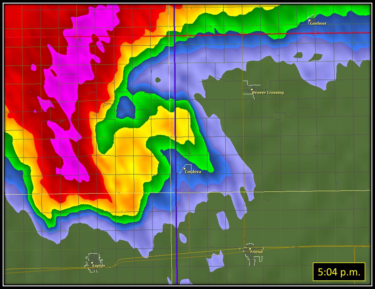
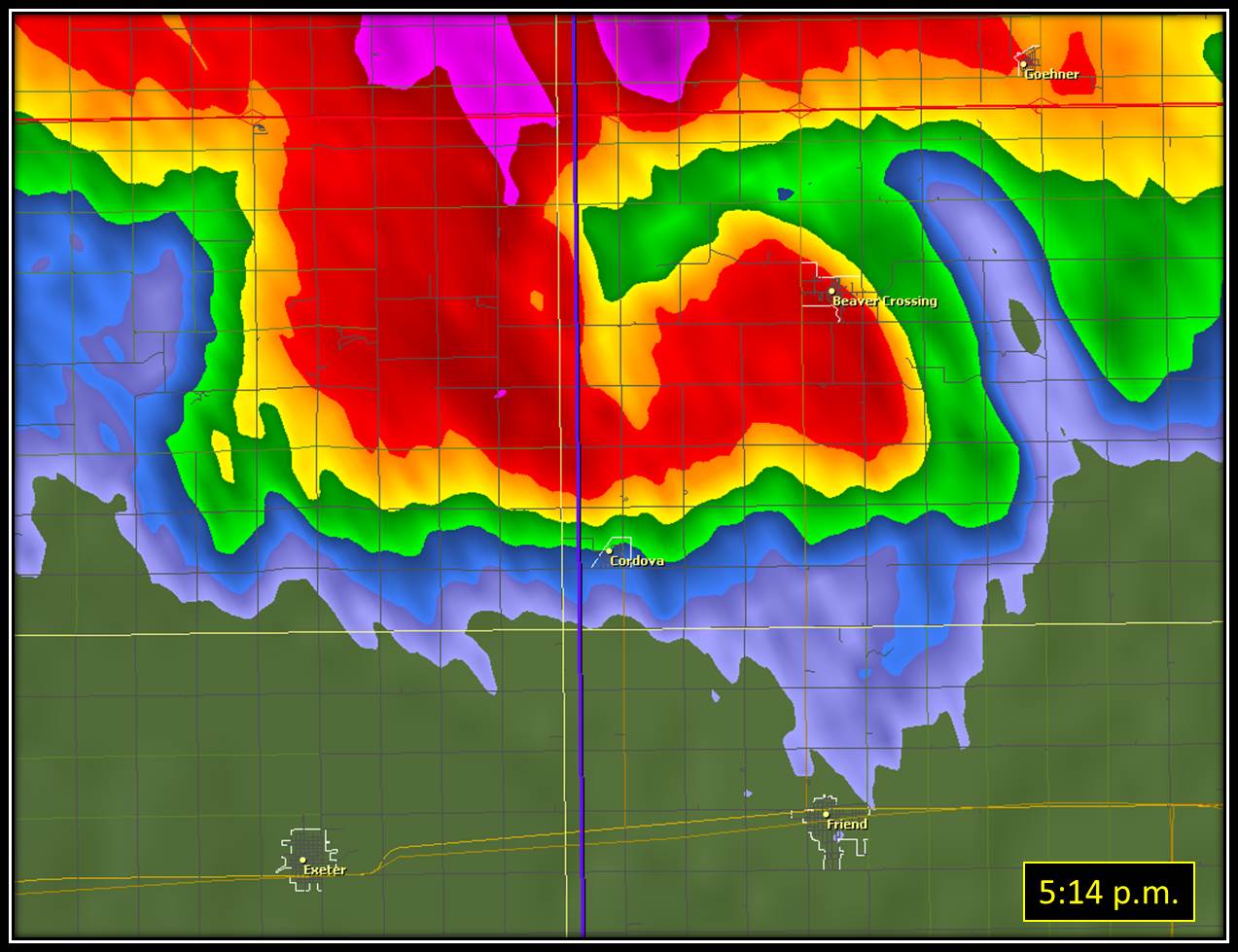
Tornado #6: 3 miles north of Exeter (Fillmore County) to near Goehner (Seward County, part of NWS Omaha/Valley's coverage area) Rating: EF-3 Estimated Peak Wind Speed: 140 mph (occurred in Seward County) Time: 4:57 to approximately 5:23 p.m. CDT Path Length: A total of 15.2 miles, 5.1 miles of which occurred in Fillmore and York Counties Max Path Width: 2640 yards (approximately 1.5 miles - occurred in Seward County) Fatalities/Injuries: 0 / 1 minor injury This tornado started in far northern Fillmore County, traversed a portion of York County and passed north of Cordova in Seward County. Damage along the track was widespread, including one home which was totally destroyed. All 6 occupants took shelter in the basement. Another home suffered less signifcant damage, but outbuildings on the same property were destroyed. Along the path of this tornado, there were numerous irrigation pivots overturned, power poles broken as well as trees and grain bins either damaged or destroyed.
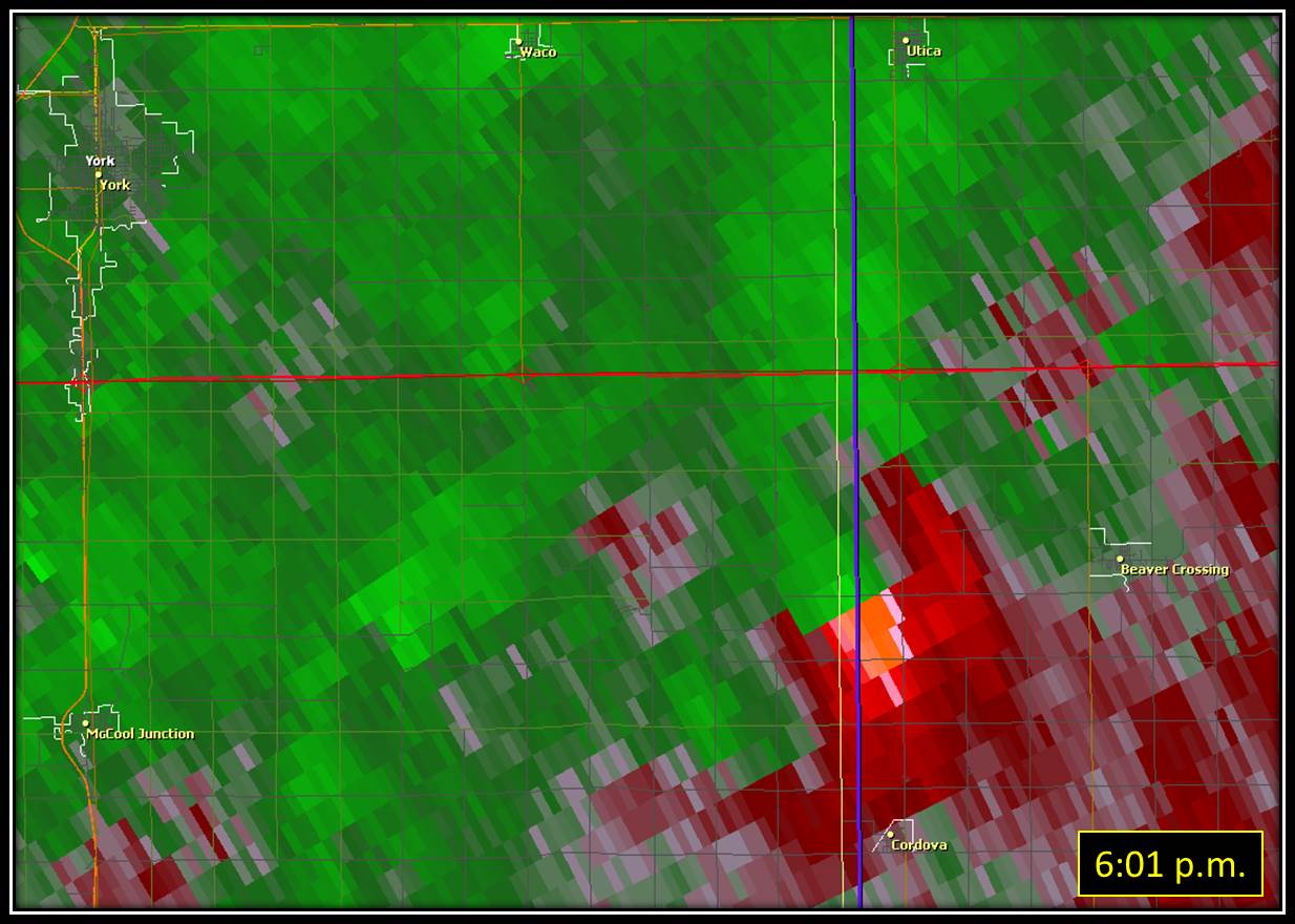
Tornado #7: 11.3 miles east of McCool Junction (York County) to 1 mile north of Beaver Crossing (Seward County) Rating: EF-1 Estimated Peak Wind Speed: 90 mph (on York/Seward County line) Time: 5:58 to approximately 6:09 p.m. CDT Path Length: A total of 5.5 miles, 0.8 mile of which occurred in York County Max Path Width: 700 yards (occurred in Seward County) Fatalities/Injuries: 0 / 0 This tornado started just inside York County by about 0.8 mile and quickly strengthened. It destroyed a grain bin and power poles on the York/Seward County line. This tornado was only in York County for a short time, with most of its damage occurring in Seward County. Damage along the path of the tornado included overturned irrigation pivots, broken power poles, and the destruction of grain bins.
Tornado #8: Approximately 10 miles east of McCool Junction (York County) Rating: EF-0 Estimated Peak Wind Speed: 85 mph Time: 5:04-5:06 p.m. CDT Path Length: About one half mile Max Path Width: 25 yards Fatalities/Injuries: 0 / 0 This tornado actually moved southwest and was eventually engulfed into the main Cordova tornado. No damage was reported with this tornado.
A few of the other severe weather highlights from the afternoon/evening event:
Below is a table which includes some of the highest 24-30 hour rain amounts reported to the National Weather Service in Hastings. These rain amounts are a combination of rain during the TWO main rounds of storms (the first early morning on the 11th and the second the afternoon of the 11th into early morning of the 12th).
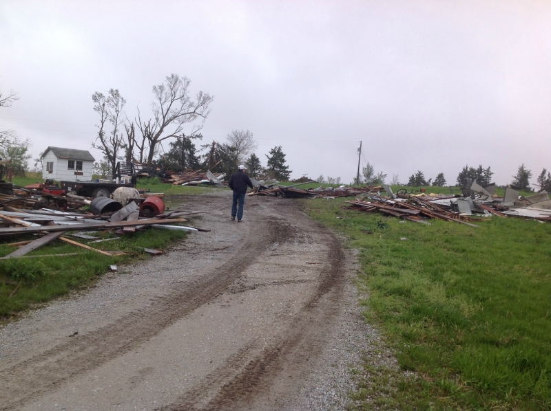
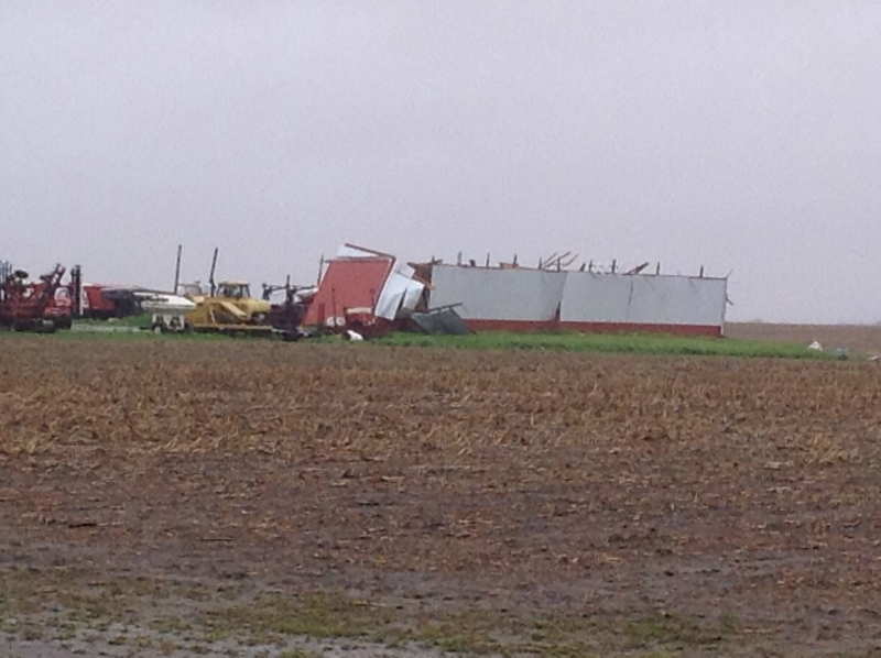
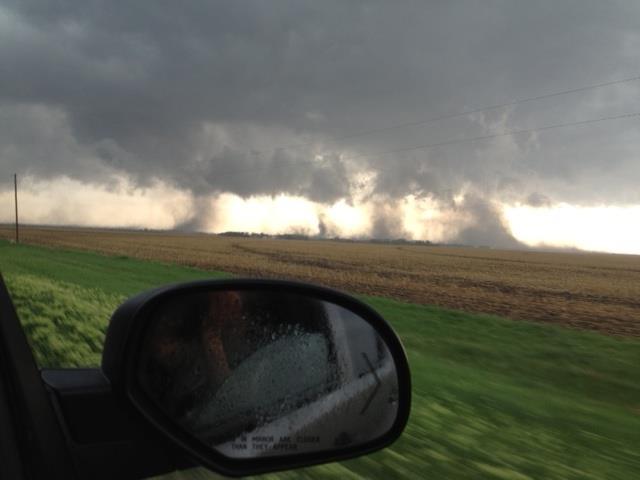
Here are a few photos of the storms as they crossed portions of the area:
Here are a few hail photos:
|
|||||||||||||||||||||||||||||||||||||||||||||||||||||||||||||||||||||||||||||||||||||||||||||||||||||||||||||||||||||||||||||||||||||||||||||||||||||||||||||||||||||||||||