|
Event Summary:
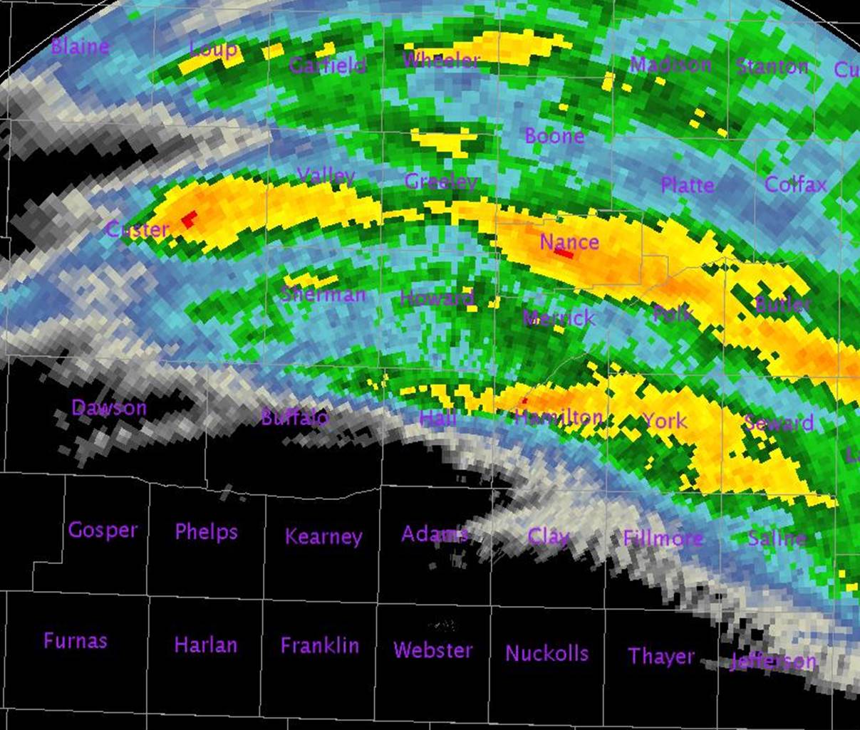
The afternoon and evening hours of Tuesday, June 3, 2014, featured a number of severe thunderstorms across primarily northern and eastern portions of the NWS Hastings coverage area, with the majority of severe weather reports concentrated northeast of a line from Litchfield-Grand Island-Geneva. In these areas, there were numerous reports of large hail up to around golf ball size or slightly larger, and damaging wind gusts of 60-80 MPH. In addition to widespread severe weather, most of the affected counties observed widespread coverage of 1-3" of rainfall, with locally higher amounts mainly in Nance, Polk and York counties that resulted in some flooding mainly in fields and along small streams.
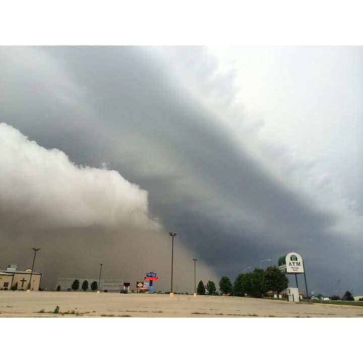
In sharp contrast to the very active weather in northern and eastern counties, the majority of southern and western counties in the local area, especially those in North Central Kansas, did not see any severe storms and in fact saw no storms or rainfall at all. However, one major exception to this lack of active weather occurred along a very strong, southward-surging outflow boundary that produced 70+ MPH winds and significant blowing dust in the immediate Hastings area around 8 PM. This west-to-east outflow boundary also brought severe wind gusts to several nearby counties as well, including Buffalo and Clay. Considering that these outflow winds occurred several miles away from the nearest actual thunderstorm activity off to the north, they were unusually strong.
Although these storms resulted in considerable damage, no injuries were reported within the NWS Hastings coverage area. Furthermore, the local area was spared the development of significant, "long-track" tornadoes, which had been advertised as a possibility during the days leading up to the event. One likely reason that long-track tornadoes were held at bay involved the fact that many storms generated a large amount of cool, northerly outflow winds that "undercut" storm updrafts.
All of this information is considered preliminary and subject to change pending final review of the event and publication in NCDC StormData.
Tornado #1: 4.6 miles NW of Elyria to 3.8 miles NNW of Elyria (Valley County)
Rating: EF-0
Estimated Peak Wind Speed: 85 MPH
Time: 4:18 - 4:21 PM CDT
Path Length: 1.2 miles
Max Path Width: 50 yards
Fatalities/Injuries: 0 / 0
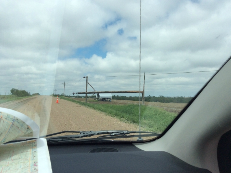
This tornado was witnessed by spotters in the area. The tornado started in a grove of trees along the North Loup River. It snapped a power pole and damaged a pivot as it traveled east-southeast before lifting. A widespread area of sporadic wind damage extended south and east of this tornado, including across Fort Hartsuff State Park. The buildings at the park sustained no damage but some trees on the property were damaged. At least one badly damaged tree was planted during the Fort's active tenure of 1874 to 1881.
Tornado #2: 6.3 miles north of Greeley (Greeley County)
Rating: EF-0
Estimated Peak Wind Speed: 70 MPH
Time: 5:01 PM CDT
Path Length: Was a brief touchdown
Max Path Width: 25 yards
Fatalities/Injuries: 0 / 0
This brief tornado was witnessed by storm spotters just east of Highway 281.
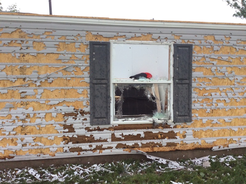
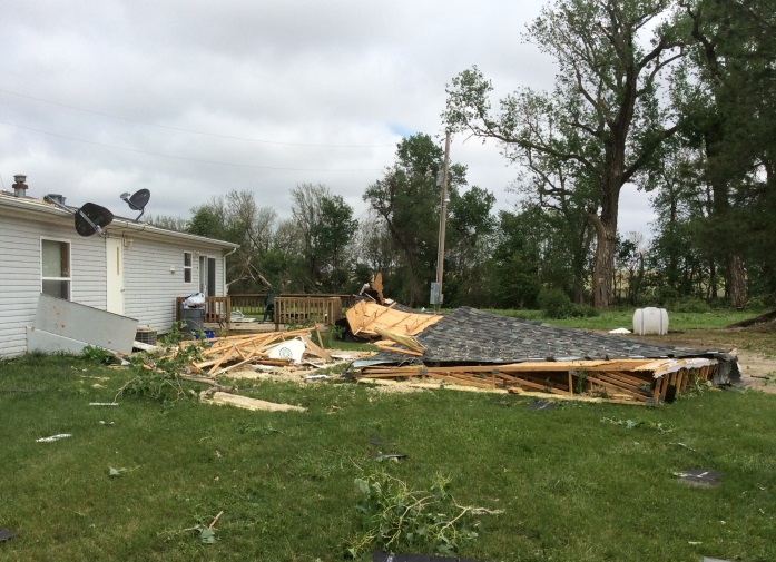
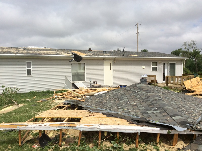
Tornado #3: 2.8 miles NW of Hampton to 3.6 miles ENE of Hampton (Hamilton County)
Rating: EF-1
Estimated Peak Wind Speed: 110 MPH
Time: 10:33 - 10:40 PM CDT
Path Length: 4.2 miles
Max Path Width: 700 yards
Fatalities/Injuries: 0 / 0
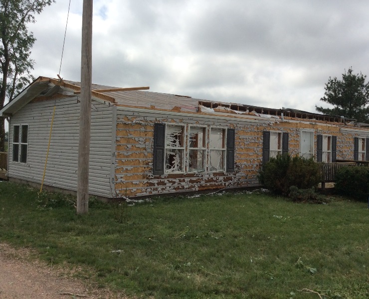
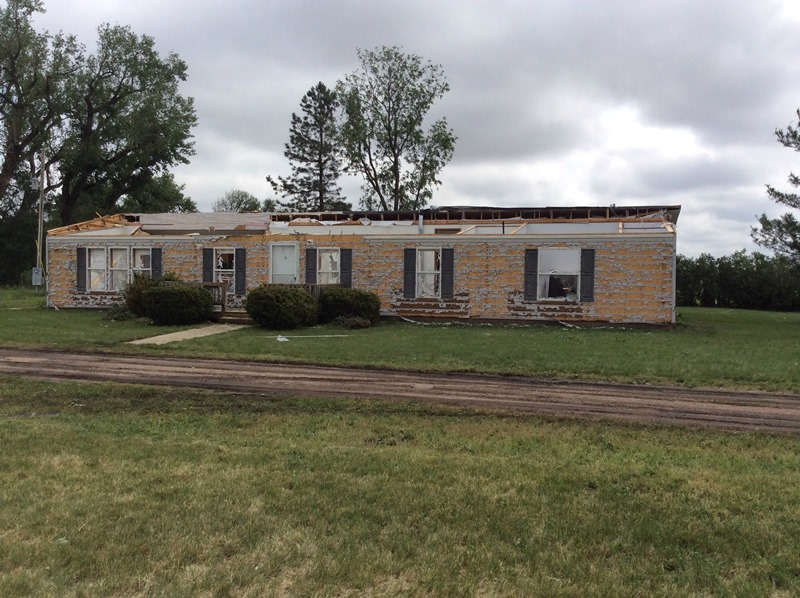
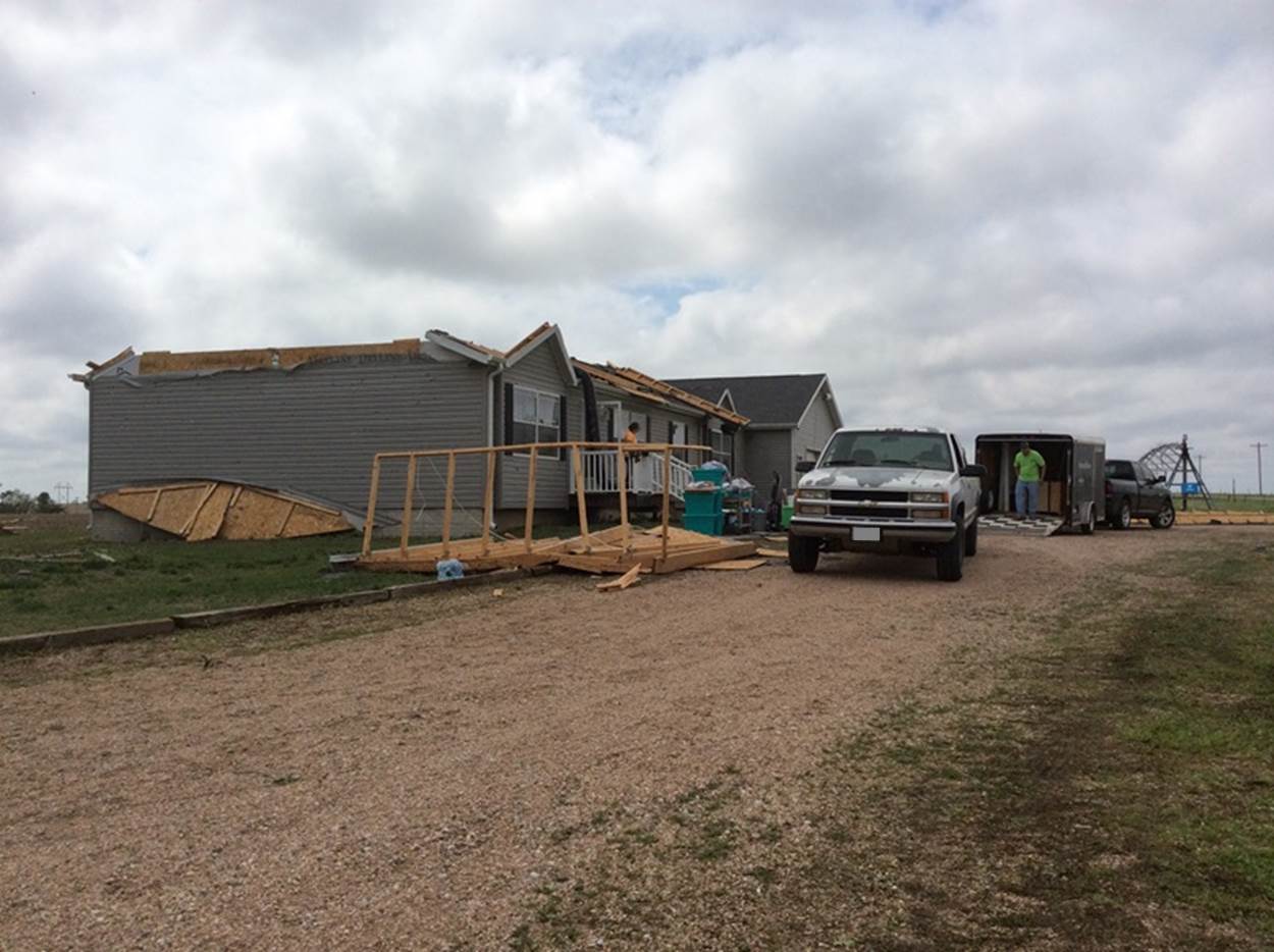
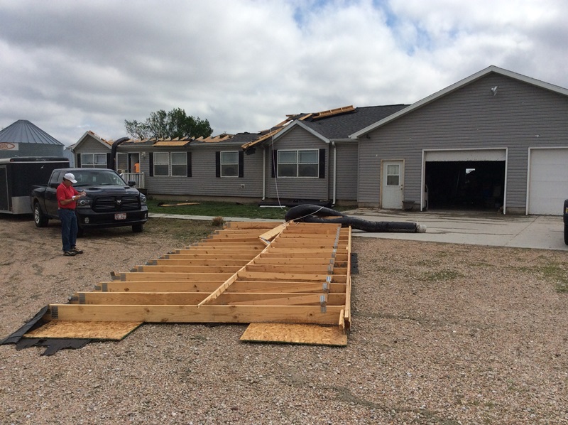
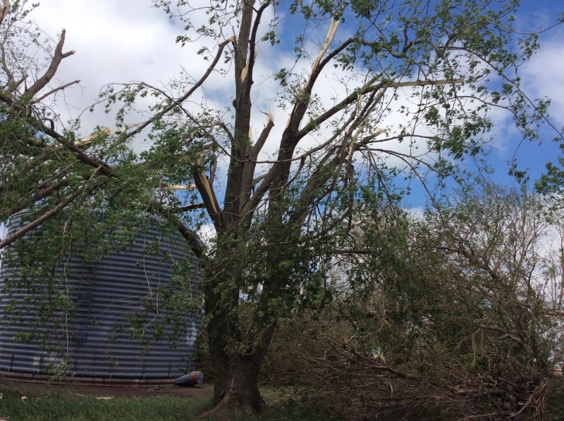
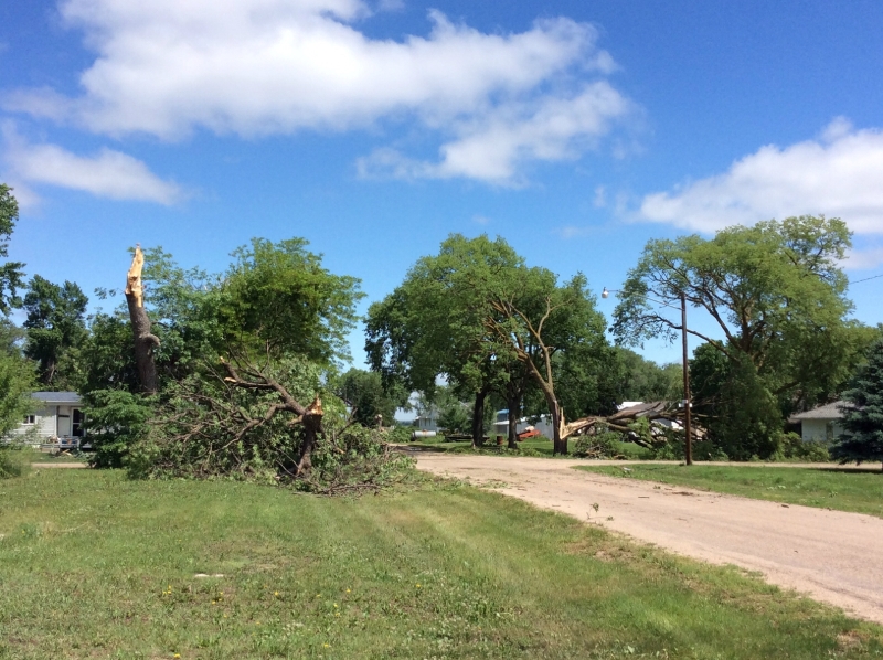
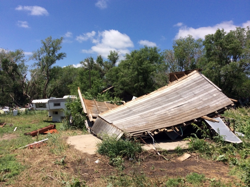
This tornado had few, if any, witnesses given that it occurred after dark. A large area of damaging winds occurred northwest of where the tornado apparently formed. Tree damage, snapped power poles and overturned pivots were common from just south of Marquette to southeast of Hampton. The most evident tornado damage was observed at two homes north of Hampton. Both homes lost part of the roof. One home was a manufactured home and the other was of conventional construction. The southern of the two homes had parts of the roof blown back to the west and southwest, while the rest of the debris was thrown southeast along the storm path. Leaves and mud were plastered on the east side of both homes. Radar data did not show any obvious tornado-like signatures. Due to the widespread damage, it was difficult to identify exactly where the tornado began and ended.
These photos are from the two homes that were damaged north of Hampton.
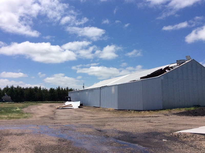
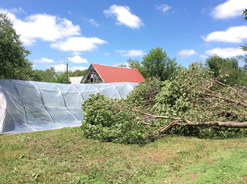
High winds impacting portions of Greeley and Valley Counties: Widespread straight-line wind damage occurred in North Loup and the surrounding area to the south and east of town. Large trees were snapped or uprooted. Six sections of a Nebraska Public Power District transmission line were snapped southeast of town. There was minor damage at the Scotia airport. Winds were estimated to be at least 85 MPH at times. The wind damage spread into the town of Scotia. Overall, an area of about 15 square miles was impacted by this wind.
 |
 |
 |
 |
| Damage in the North Loup area. |
Damage approximately 4 NE of Scotia. |
A few of the other severe weather highlights from the event:
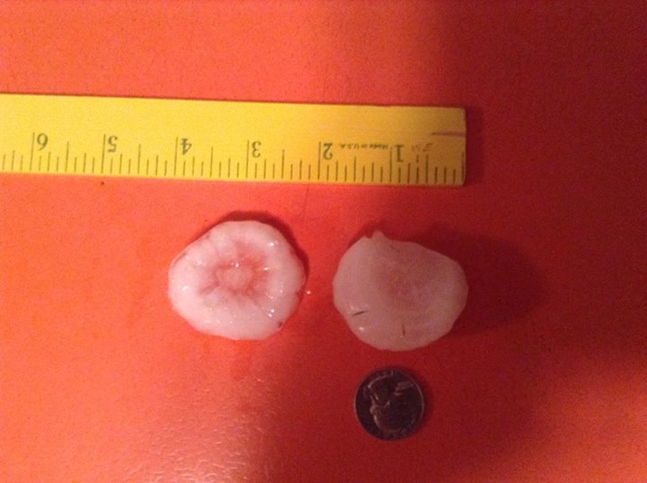
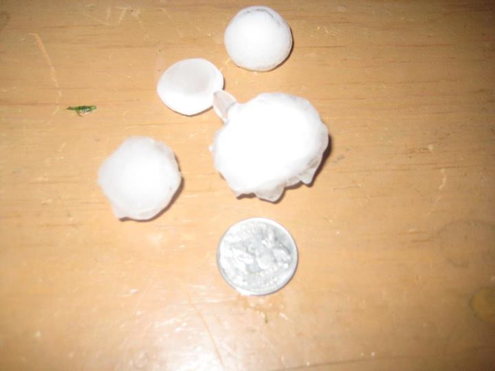
- Hen egg size (2") hail was reported 4 SW Dannebrog.
- Golf ball size (1.75") hail was reported at the following locations: Arcadia, 5 WSW St. Paul, Spalding, 3 NW Boelus, 2 E Chapman, Osceola, McCool Junction and in the York area.
- Ping pong ball size (1.5") hail was reported in Loup City and St. Paul.
- Half dollar size (1.25") hail was reported in North Loup.
- Quarter size (1") hail was reported at the following locations: Litchfield, Farwell, 4 NE Silver Creek, Central City, Aurora, Bradshaw and Gresham.
- A wind gust of 79 MPH was measured by the Ord Airport ASOS.
- A wind gust of 73 MPH was recorded at the NWS Hastings Office located 4 N of Hastings.
- A wind gust of 70 MPH was recorded by the Hastings Airport ASOS.
- An estimated wind gust of 70 MPH was reported in St. Paul.
- A wind gust of 65 MPH was recorded by a mesonet site 3 ESE of St. Paul.
- A wind gust of 64 MPH was recorded by a mesonet site 9 WNW of Osceola.
- A wind gust of 62 MPH was recorded by the York Airport AWOS and mesonet sites located 6 NNE Palmer and near Prosser.
- An estimated wind gust of 60 MPH was reported in Bruning.
- A wind gust of 55 MPH was recorded by a mesonet site near Plesanton.
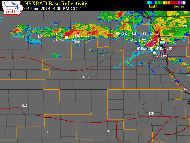
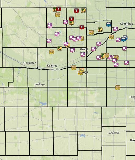 |
| Preliminary storm reports (click image) |
Here is an image of radar-estimated rainfall:
Below is a table which includes some of the highest rainfall amounts from across the area. These are 24 hour totals ending around 8 a.m. on the morning of June 4th and are a combination of NWS Cooperative Observer, NeRAIN and public reports.
| Location |
Rainfall Amount |
| 3.90 |
Shelby |
| 3.68 |
7 N Osceola |
| 3.18 |
1 ESE York |
| 3.15 |
3 NE Shelby |
| 3.00 |
Belgrade |
| 2.59 |
2 W Grand Island |
| 2.54 |
3 WSW Genoa |
| 2.44 |
7 SSE Ord |
| 2.37 |
Bradshaw |
| 2.34 |
3 N York |
| 2.33 |
4 N Aurora |
| 2.15 |
Greeley |
| 2.01 |
Central City |
| 1.98 |
Wolbach |
| 1.93 |
Grand Island airport ASOS |
| 1.79 |
St. Paul |
| 1.61 |
Ravenna |
| 1.44 |
Ord ASOS |
| 1.37 |
Arcadia |
Here are a few photos from across the area:
 |
 |
 |
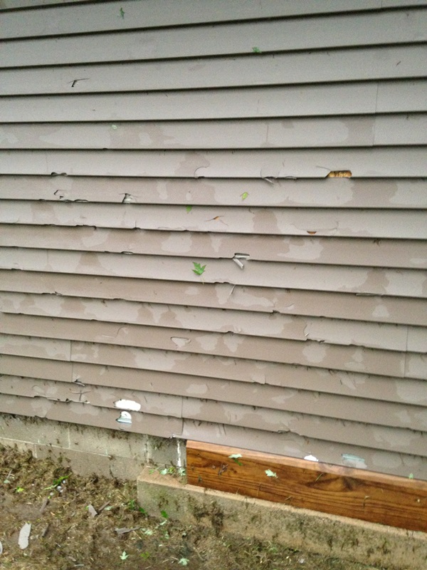
Hail damage
near Spalding. Photo courtesy of
Scott Reilly. |
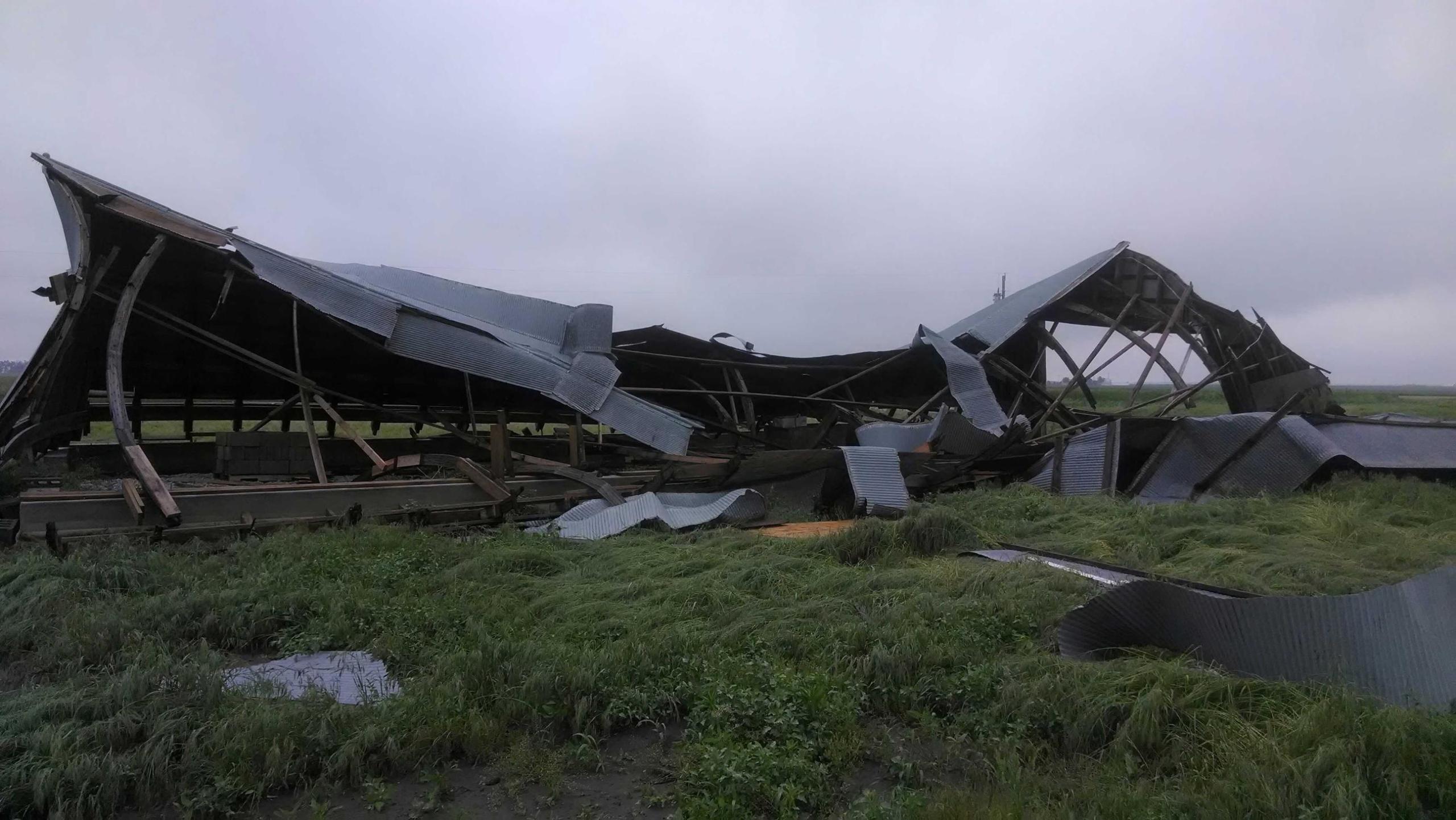
Outbuilding damage approximately 2 miles south of Shelby. Photo courtesy of Chase Kumpf. |
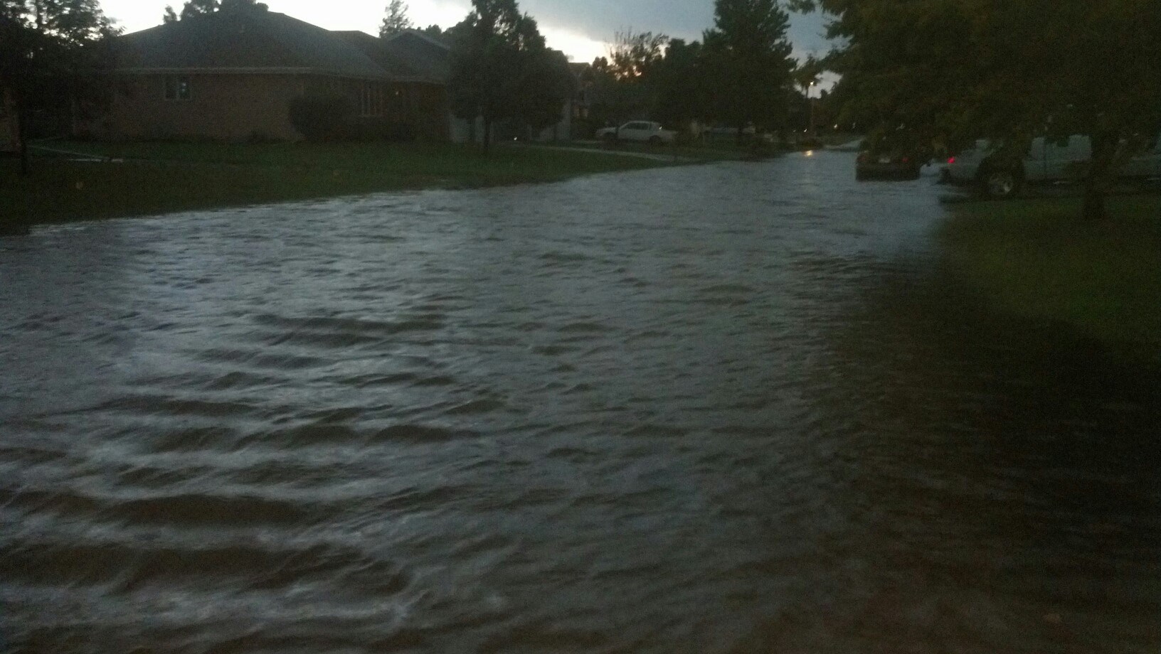
Flooding in Shelby.
Photo courtesy of Grant Gabel. |
 |
 |
 |
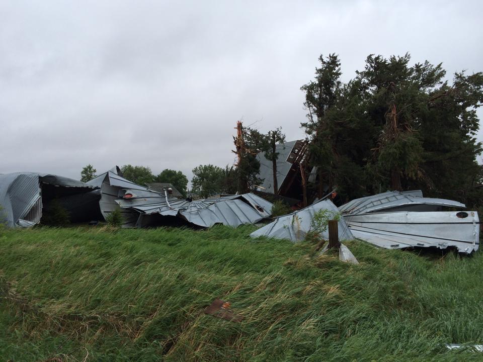
| Wind damage near Marquette. Photo courtesy of Julie Nelson Smith. |
Hail near McCool Junction.
Photo courtesy of Steve Green. |
Hail near York.
Photo courtesy of Jr Wolfe. |
 |
 |
Dust storm moving into Hastings. Photo courtesy
of Hannah Keen. |
View of the incoming storm from the NWS Hastings Office. |
|