Widespread, life-threatening considerable flash flooding is expected in south-central Texas through at least Friday. Catastrophic river flooding and rapid rises on small streams, arroyos, and typically dry washes are expected in the Texas Hill Country. Wildfire smoke is impacting air quality across much of the Great Lakes region into the Northeast U.S. with Air Quality Alerts in effect. Read More >
Hastings, NE
Weather Forecast Office
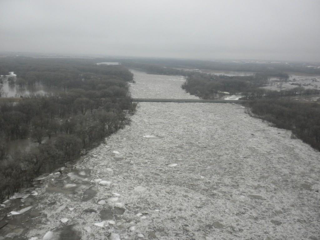
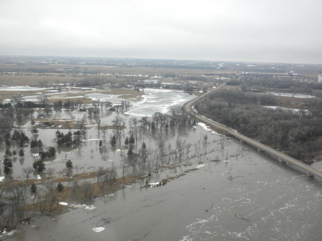
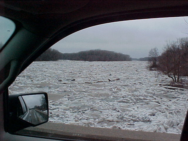
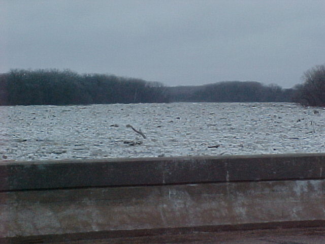
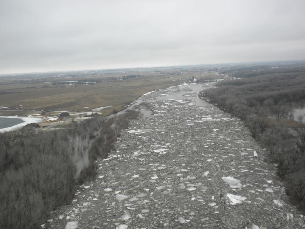
Flooding occurred along the Loup River near Genoa for several days the first part of March. The flooding began Saturday evening March 6th, but was aggravated on Wednesday, March 10th as an ice jam sent the river to near record stage levels. Major flooding was ongoing through much of the afternoon on Wednesday (March 10th). The ice moved downstream of Genoa on Thursday, March 11th, and river stage levels dropped.
Platte County Emergency Management provide two videos of the ice jam clearing out of the Genoa area. Click here for a one minute video, and click here for a three minute video.
The following pictures of the Loup River were taken March 10th by Platte County Emergency Management officials. Click on the images to enlarge.
|
|
|
 |
|
| Hwy 39 Bridge Near Genoa | Ice Jam at Hwy 39 Bridge south of Genoa |
Ice Jam at Lake Oconee |
Monroe Bridge |
The following pictures were also taken on March 10th and were provided by Nance County Emergency Management. Click on the images to enlarge.
|
|
|
| Loup River Ice Jam Near Genoa | Loup River Ice Jam Near Genoa |
Hazardous Weather
Submit A Storm Report
Storm Prediction Center
Local Storm Reports
Experimental Graphical Hazardous Weather Outlook
Forecasts
Area Forecast Discussion
Fire Weather
Aviation Weather Center
Experimental Probabilistic Precip Amount Forecast
Winter Weather
Winter Storm Severity Index
Experimental Winter Storm Outlook
Wet Bulb Globe Temp
Activity Planner
Current Conditions
Current Area Observations
Text Products
Satellite
Rivers and Lakes
Local 24 Hour Precip Maps
Local Archived Precip Maps
NWPS Precipitation Analysis
Local Snowfall Maps
Snowfall Analysis
Snow Cover
Climate
Local Database (NOWData)
Local Climate Webpage
Hastings/G. Island Records
Local Historical Tornado Info
U.S. Drought Monitor
Grand Island - Daily
Grand Island - Monthly
Hastings - Daily
Hastings - Monthly
Kearney - Daily
Kearney - Monthly
Ord - Daily
Ord - Monthly
US Dept of Commerce
National Oceanic and Atmospheric Administration
National Weather Service
Hastings, NE
6365 North Osborne Drive West
Hastings, NE 68901-9163
402-462-4287
Comments? Questions? Please Contact Us.