
Thunderstorms with severe wind gusts and hail will be possible today across parts of the central Plains, and from the Missouri Valley into the upper Mississippi Valley. Heavy rain associated with the thunderstorms may also produce flash/urban flooding. Critical fire weather conditions expected in the Great Basin and interior Northwest. Dangerous heat continues across the Southwest and Southeast. Read More >
Hastings, NE
Weather Forecast Office
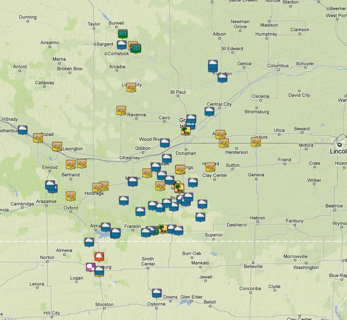
Thunderstorms from Friday night June 11th into Saturday morning June 12th brought two to three inches of rain to much of the south central Nebraska and north central Kansas. The storms also brought a couple rounds of severe weather primarily in the form of straight line wind damage. Below (clickable image) are reports from the evening of Friday June 11th into the morning of Saturday June 12th.
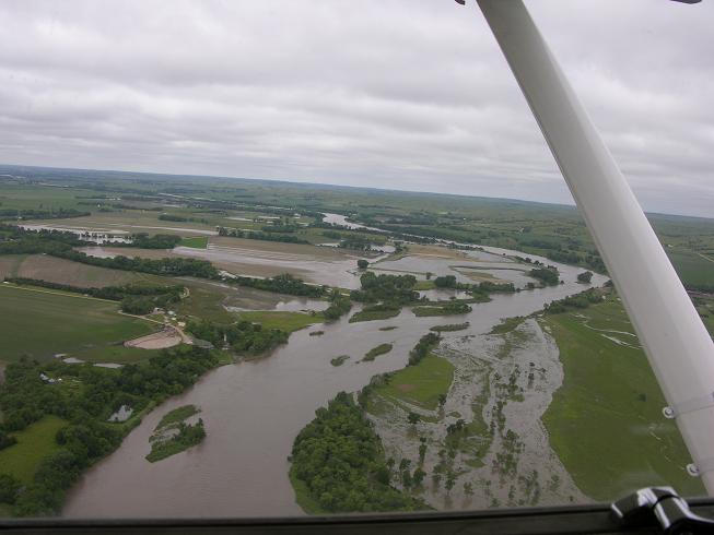
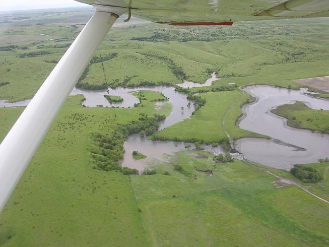
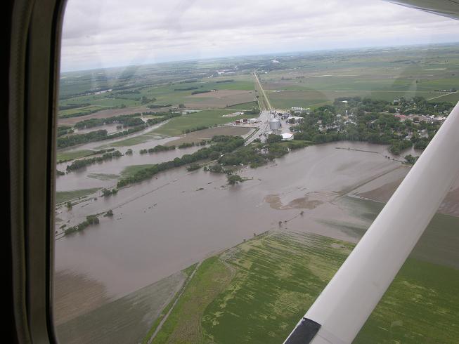
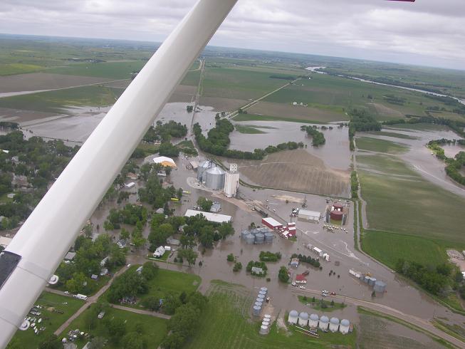
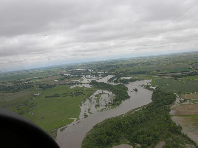
The very heavy rainfall also created excessive runoff across portions of Valley County Nebraska which caused the Bredthauer Dam (located approximately 4 1/2 miles upstream of North Loup) to break. Once the dam broke Saturday afternoon, the water went downstream into North Loup creating extensive flooding throughout town. At one point, the entire town was evacuated due to the flooding. Below are aerial images of the dam and flooding that occurred during Saturday afternoon.
Hazardous Weather
Submit A Storm Report
Storm Prediction Center
Local Storm Reports
Experimental Graphical Hazardous Weather Outlook
Forecasts
Area Forecast Discussion
Fire Weather
Aviation Weather Center
Experimental Probabilistic Precip Amount Forecast
Winter Weather
Winter Storm Severity Index
Experimental Winter Storm Outlook
Wet Bulb Globe Temp
Activity Planner
Current Conditions
Current Area Observations
Text Products
Satellite
Rivers and Lakes
Local 24 Hour Precip Maps
Local Archived Precip Maps
NWPS Precipitation Analysis
Local Snowfall Maps
Snowfall Analysis
Snow Cover
Climate
Local Database (NOWData)
Local Climate Webpage
Hastings/G. Island Records
Local Historical Tornado Info
U.S. Drought Monitor
Grand Island - Daily
Grand Island - Monthly
Hastings - Daily
Hastings - Monthly
Kearney - Daily
Kearney - Monthly
Ord - Daily
Ord - Monthly
US Dept of Commerce
National Oceanic and Atmospheric Administration
National Weather Service
Hastings, NE
6365 North Osborne Drive West
Hastings, NE 68901-9163
402-462-4287
Comments? Questions? Please Contact Us.

