
A significant heat wave continues for the Rockies, Northern Plains, and Great Lakes into the Mid-Atlantic, peaking in intensity through midweek and lingering across parts of the Northern Plains and Midwest until this weekend. Excessive rainfall my bring life-threatening and locally catastrophic flash and urban flooding across portions of southwestern Texas through early Friday. Read More >
Hastings, NE
Weather Forecast Office
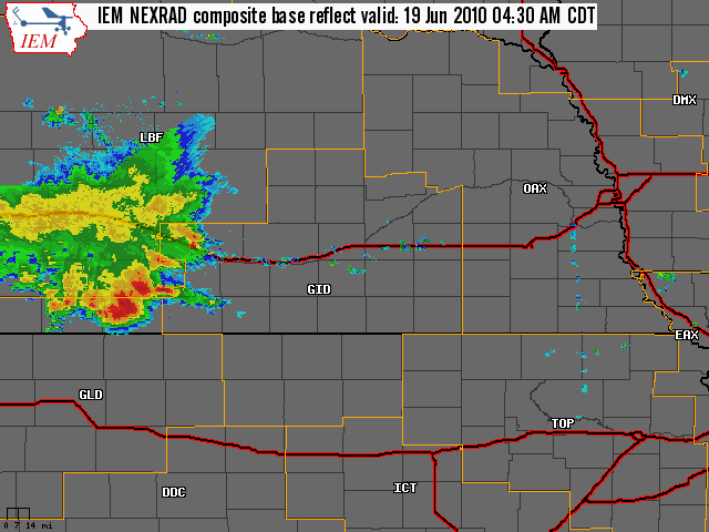
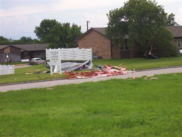
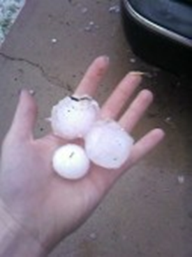
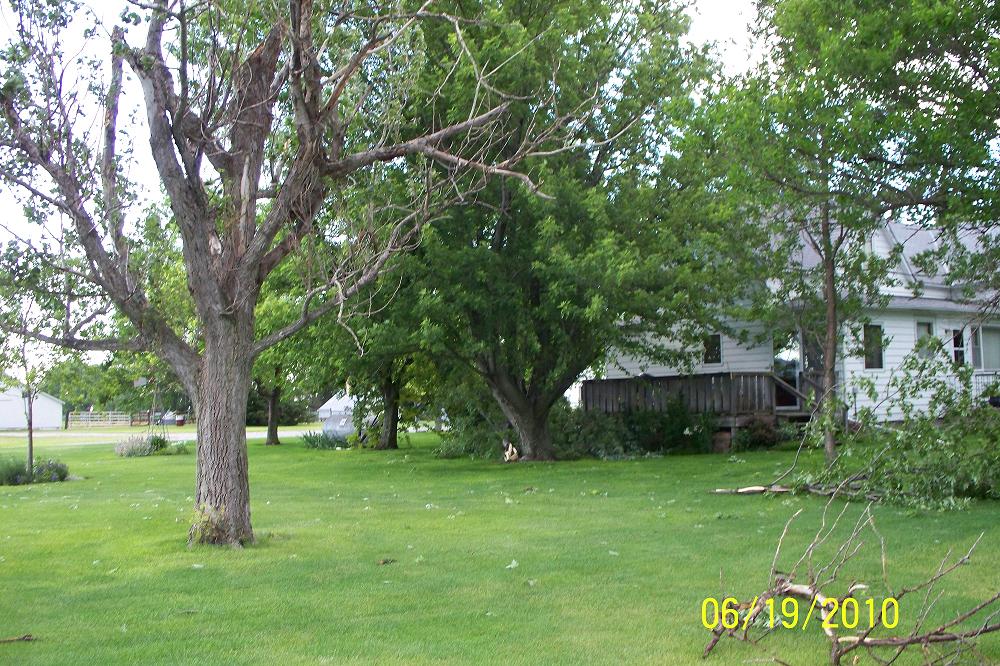
Thunderstorms pushed across portions of south central Nebraska and north central Kansas Saturday morning, June 19, 2010, bringing with them large hail and gusty thunderstorm winds. The radar loop below shows the thunderstorm activity as it pushed through the area...
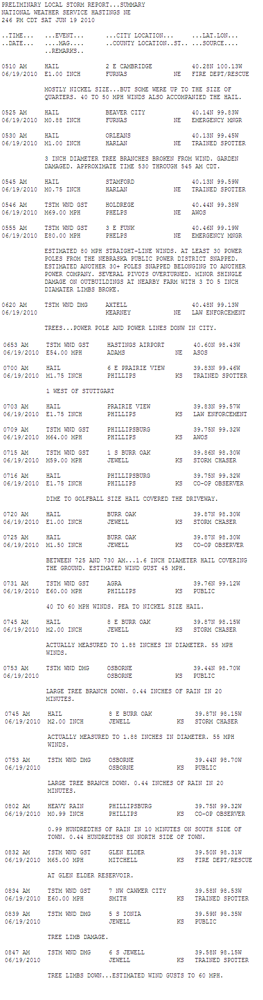
Below is a list of severe weather reports received by the National Weather Service in Hastings, NE...
Click here for an interactive map of severe weather reports from across the area.
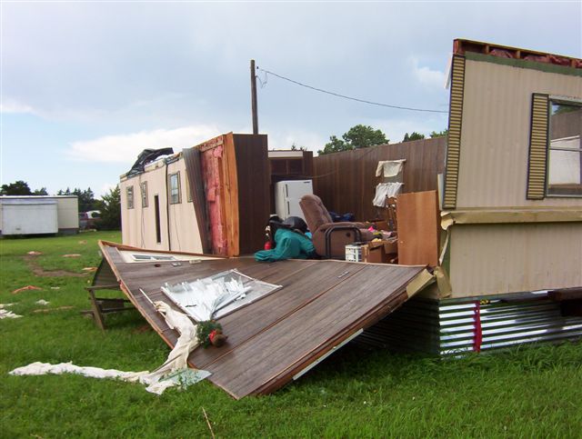
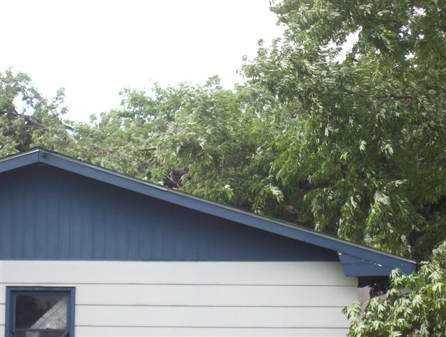
Below are pictures of damage from morning thunderstorms. Click on each thumbnail for a larger image.
 |
 |
 |
 |
| Mobile Home Damage in Cawker City, KS | Tree Damage in Cawker City, KS | Scattered Debris in Cawker City, KS | Hail 6 NNE of Mankato, KS |
 |
.jpg) |
||
| Tree Damage | Snapped Power Poles |
Hazardous Weather
Submit A Storm Report
Storm Prediction Center
Local Storm Reports
Experimental Graphical Hazardous Weather Outlook
Forecasts
Area Forecast Discussion
Fire Weather
Aviation Weather Center
Experimental Probabilistic Precip Amount Forecast
Winter Weather
Winter Storm Severity Index
Experimental Winter Storm Outlook
Wet Bulb Globe Temp
Activity Planner
Current Conditions
Current Area Observations
Text Products
Satellite
Rivers and Lakes
Local 24 Hour Precip Maps
Local Archived Precip Maps
NWPS Precipitation Analysis
Local Snowfall Maps
Snowfall Analysis
Snow Cover
Climate
Local Database (NOWData)
Local Climate Webpage
Hastings/G. Island Records
Local Historical Tornado Info
U.S. Drought Monitor
Grand Island - Daily
Grand Island - Monthly
Hastings - Daily
Hastings - Monthly
Kearney - Daily
Kearney - Monthly
Ord - Daily
Ord - Monthly
US Dept of Commerce
National Oceanic and Atmospheric Administration
National Weather Service
Hastings, NE
6365 North Osborne Drive West
Hastings, NE 68901-9163
402-462-4287
Comments? Questions? Please Contact Us.

