
A significant heat wave continues for the Rockies, Northern Plains, and Great Lakes into the Mid-Atlantic, peaking in intensity through midweek and lingering across parts of the Northern Plains and Midwest until this weekend. Excessive rainfall my bring life-threatening and locally catastrophic flash and urban flooding across portions of southwestern Texas through early Friday. Read More >
Hastings, NE
Weather Forecast Office
 |
Results of Tornado |
|
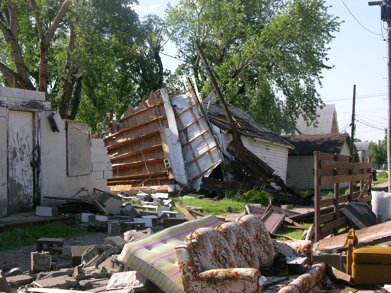
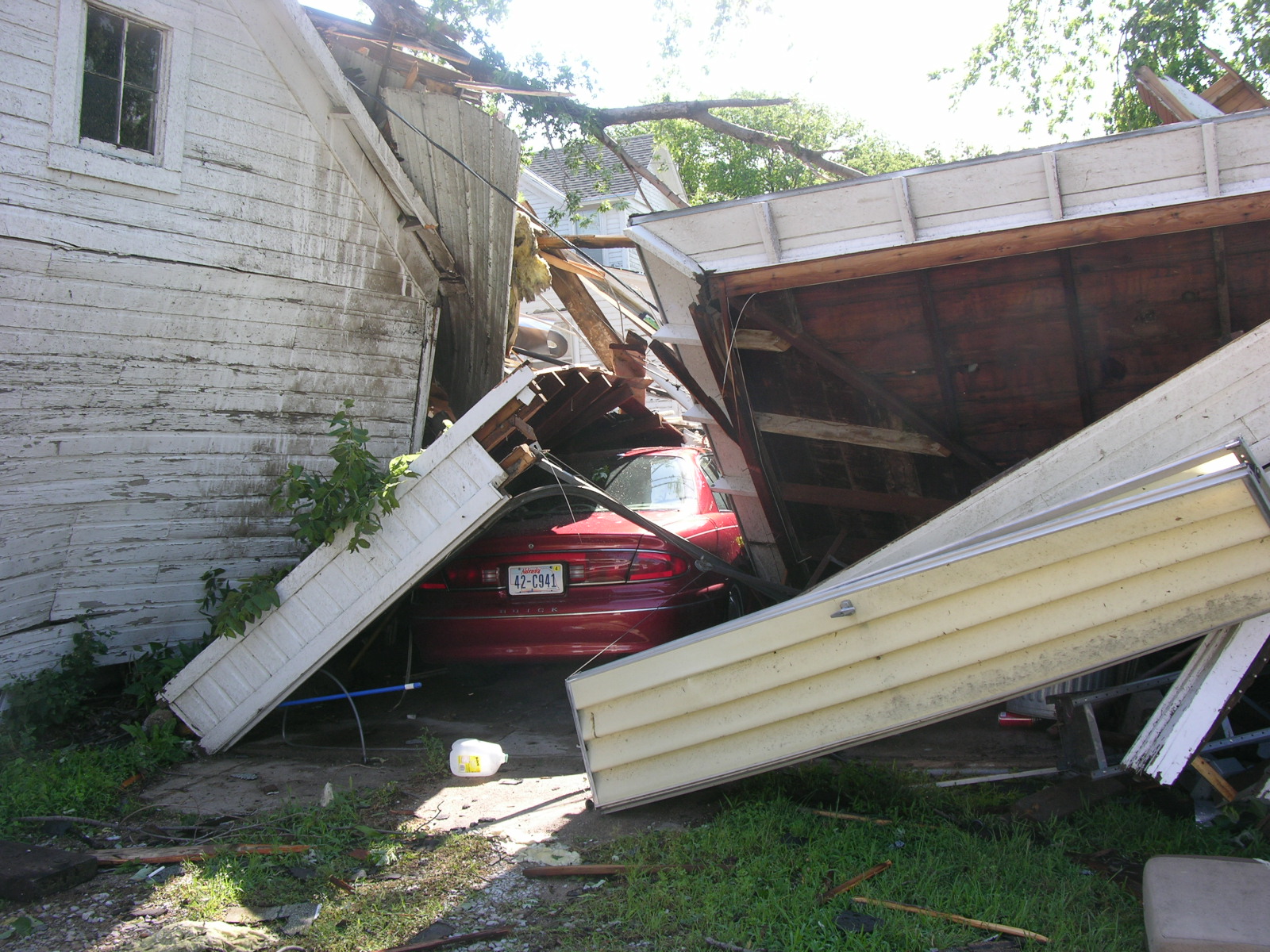
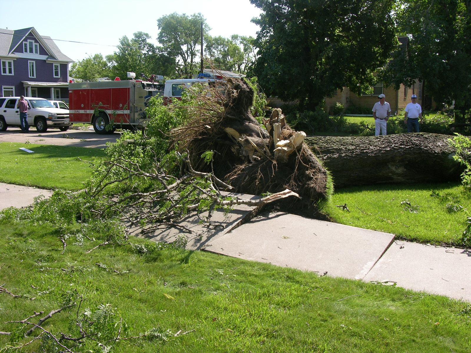
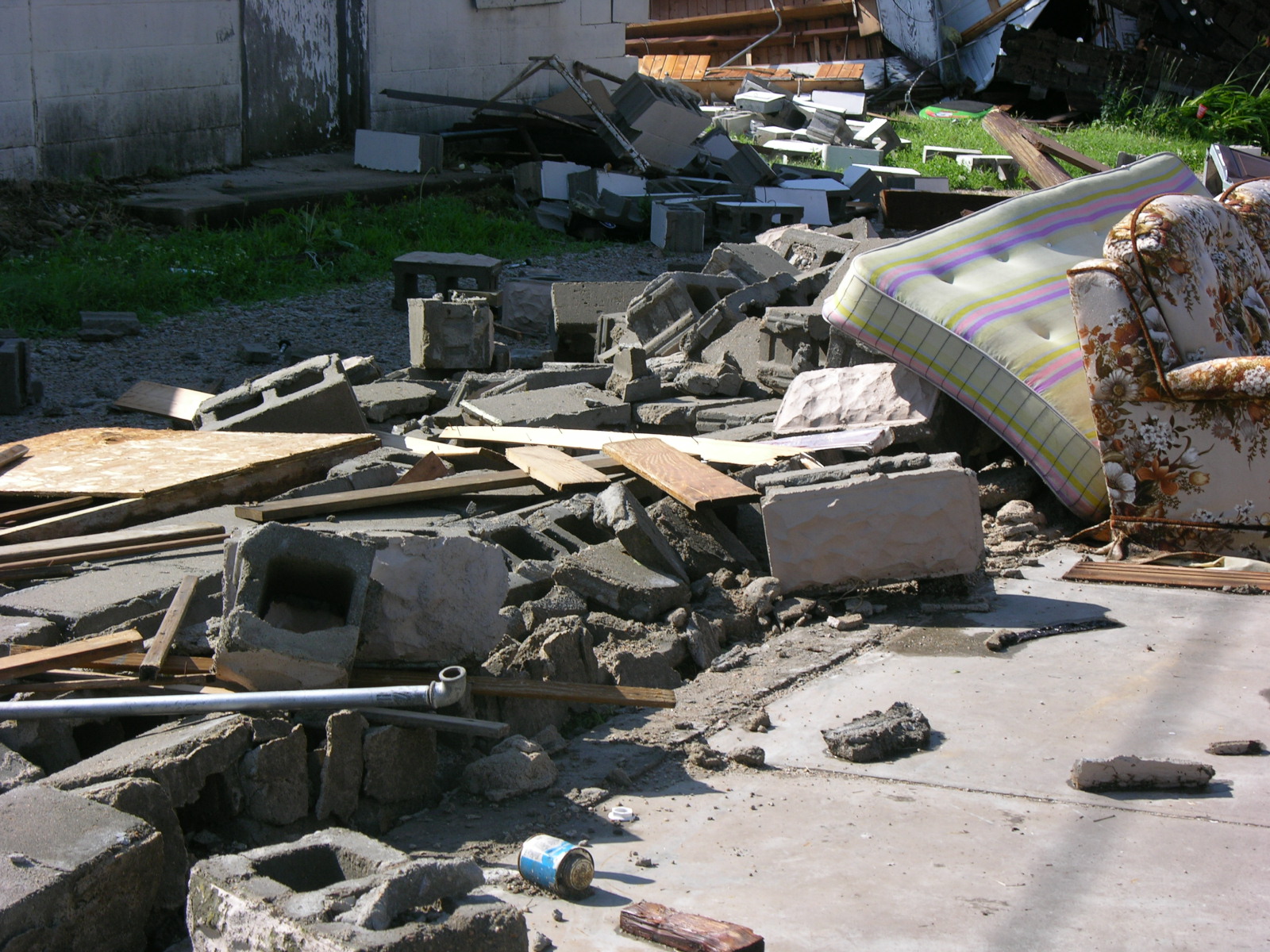
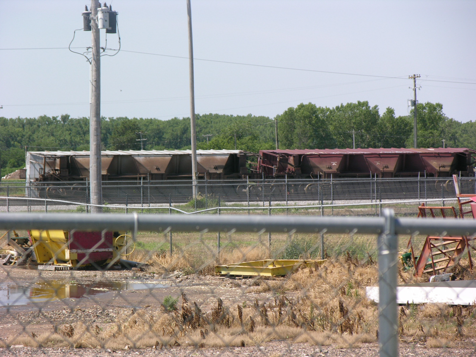
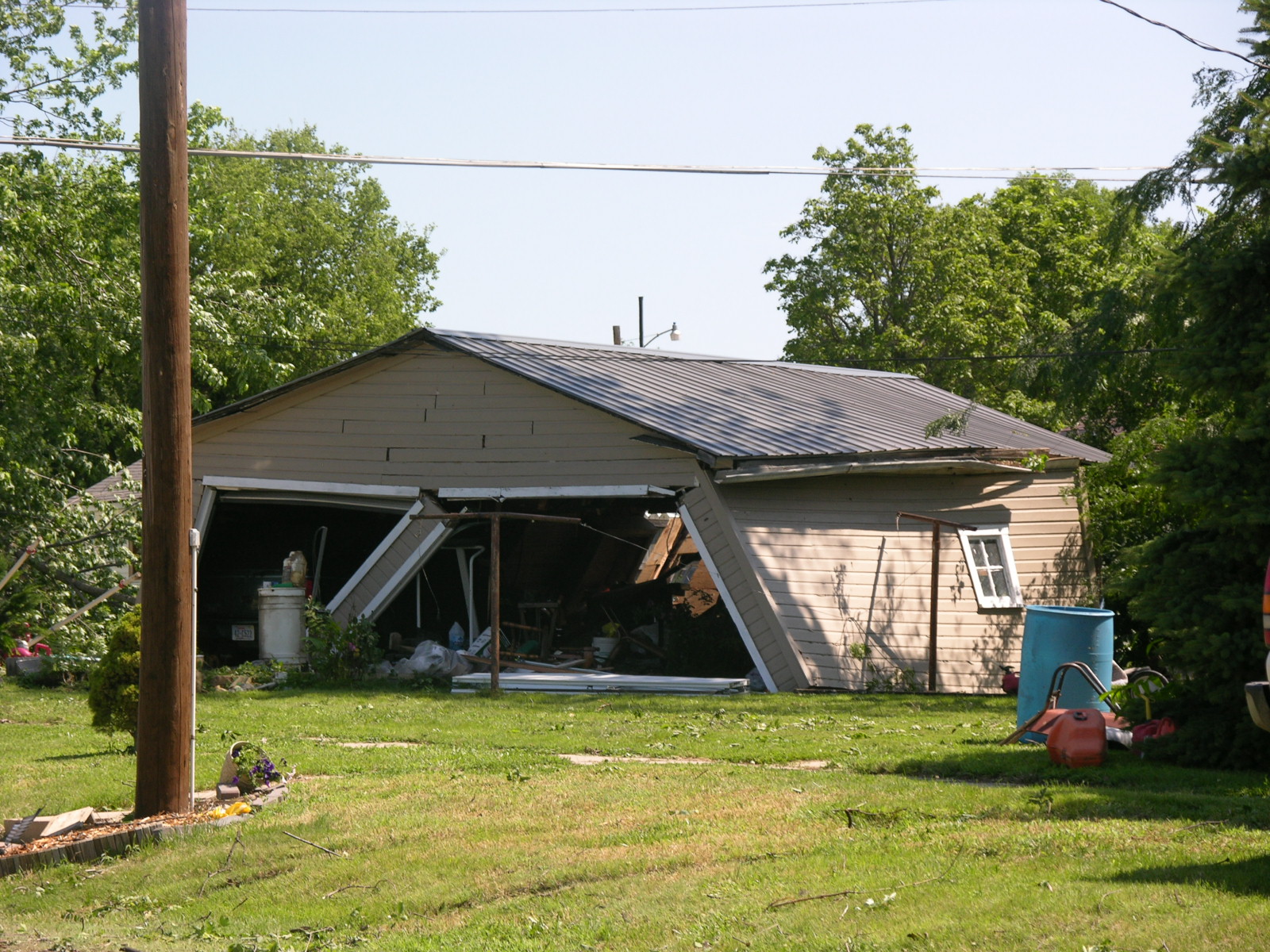
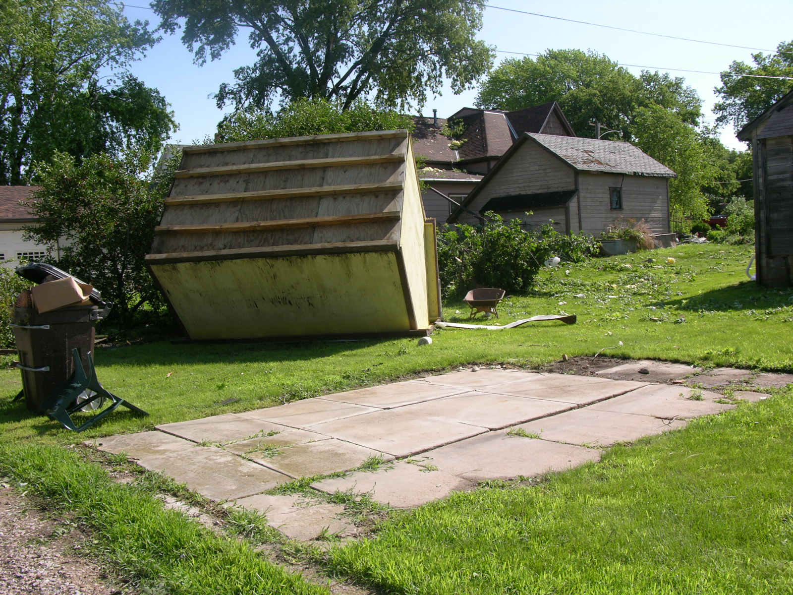
The National Weather Service in Hastings conducted a damage survey of a tornado in Superior, Nebraska on Monday, June 21. The survey was an attempt to retrace the path of a tornadic supercell thunderstorm which occurred Sunday evening, June 20. The results of that survey follow.
The maximum rating of the tornado on the Enhanced Fujita scale was an EF2. This rating was assigned based upon the damage observed.
|
||||||||||
.png) |
Photographs of the Storm Damage From NWS Survey
Click on any image to enlarge.
 |
 |
| Warehouse Roof Blown Off |
Car Damaged by Debris |
 |
 |
| Tree Uprooted |
Garage Destroyed |
 |
 |
|
Overturned Rail Cars |
Damaged Garage |
 |
 |
| Shed off Foundation | Broken Windows - Shingles off House |
Hazardous Weather
Submit A Storm Report
Storm Prediction Center
Local Storm Reports
Experimental Graphical Hazardous Weather Outlook
Forecasts
Area Forecast Discussion
Fire Weather
Aviation Weather Center
Experimental Probabilistic Precip Amount Forecast
Winter Weather
Winter Storm Severity Index
Experimental Winter Storm Outlook
Wet Bulb Globe Temp
Activity Planner
Current Conditions
Current Area Observations
Text Products
Satellite
Rivers and Lakes
Local 24 Hour Precip Maps
Local Archived Precip Maps
NWPS Precipitation Analysis
Local Snowfall Maps
Snowfall Analysis
Snow Cover
Climate
Local Database (NOWData)
Local Climate Webpage
Hastings/G. Island Records
Local Historical Tornado Info
U.S. Drought Monitor
Grand Island - Daily
Grand Island - Monthly
Hastings - Daily
Hastings - Monthly
Kearney - Daily
Kearney - Monthly
Ord - Daily
Ord - Monthly
US Dept of Commerce
National Oceanic and Atmospheric Administration
National Weather Service
Hastings, NE
6365 North Osborne Drive West
Hastings, NE 68901-9163
402-462-4287
Comments? Questions? Please Contact Us.

