A significant heat wave continues for the Rockies, Northern Plains, and Great Lakes into the Mid-Atlantic, peaking in intensity through midweek and lingering across parts of the Northern Plains and Midwest until this weekend. Excessive rainfall my bring life-threatening and locally catastrophic flash and urban flooding across portions of southwestern Texas through early Friday. Read More >
 |
Severe Weather Event Damaging Winds & Large Hail
National Weather Service Radar (KUEX) loop (Click Radar Loop To Enlarge) |
|
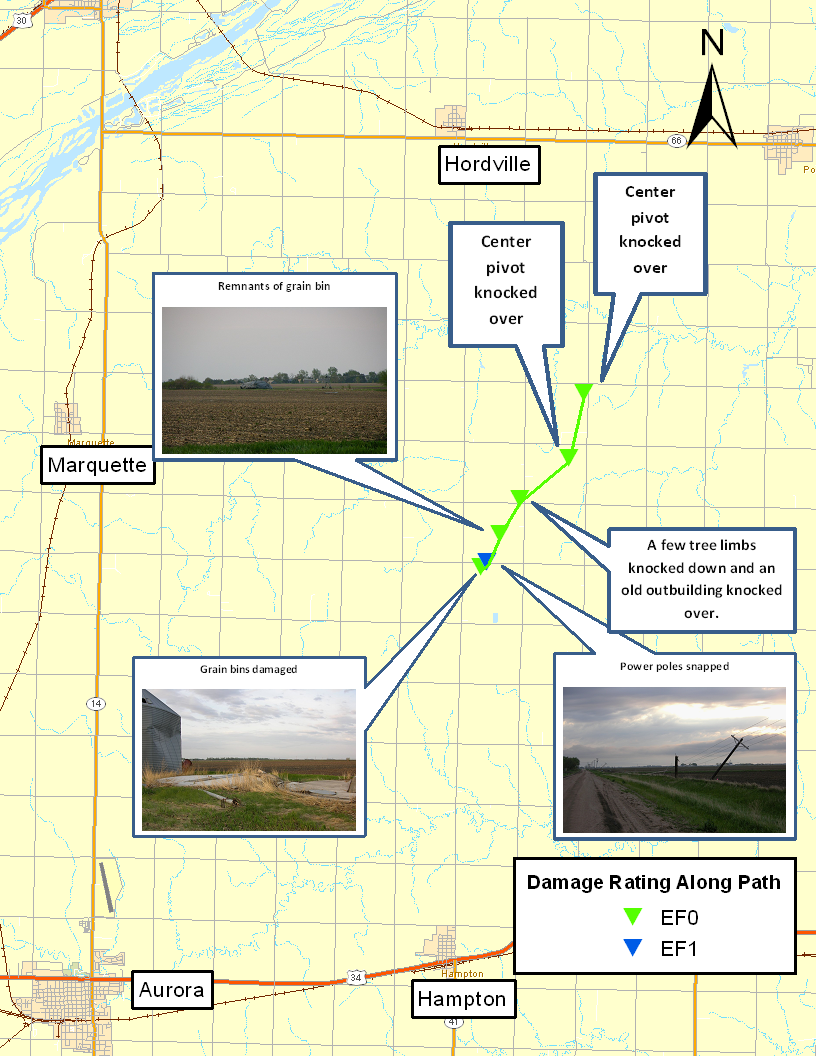
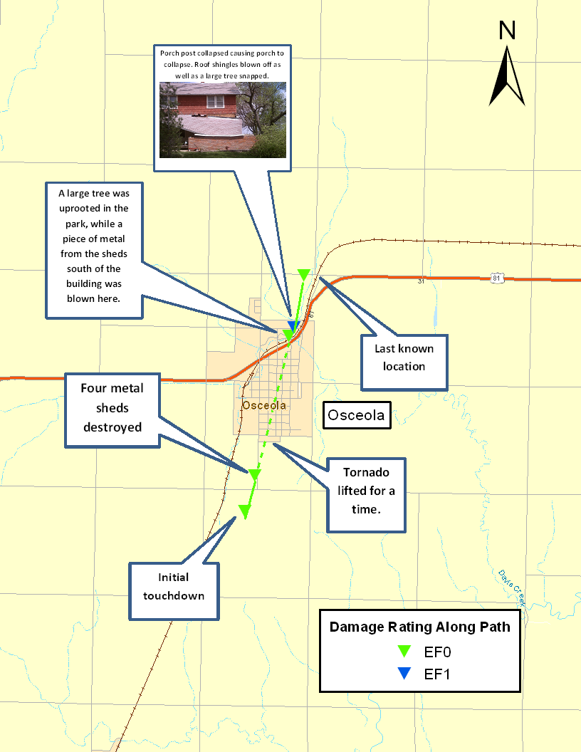
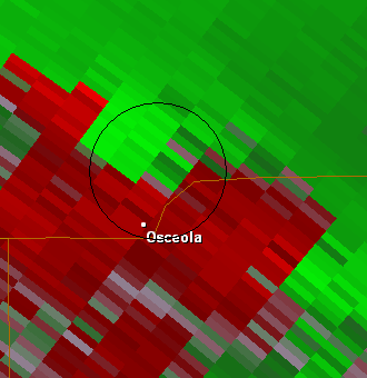
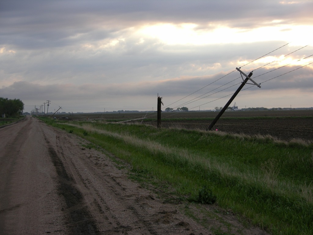
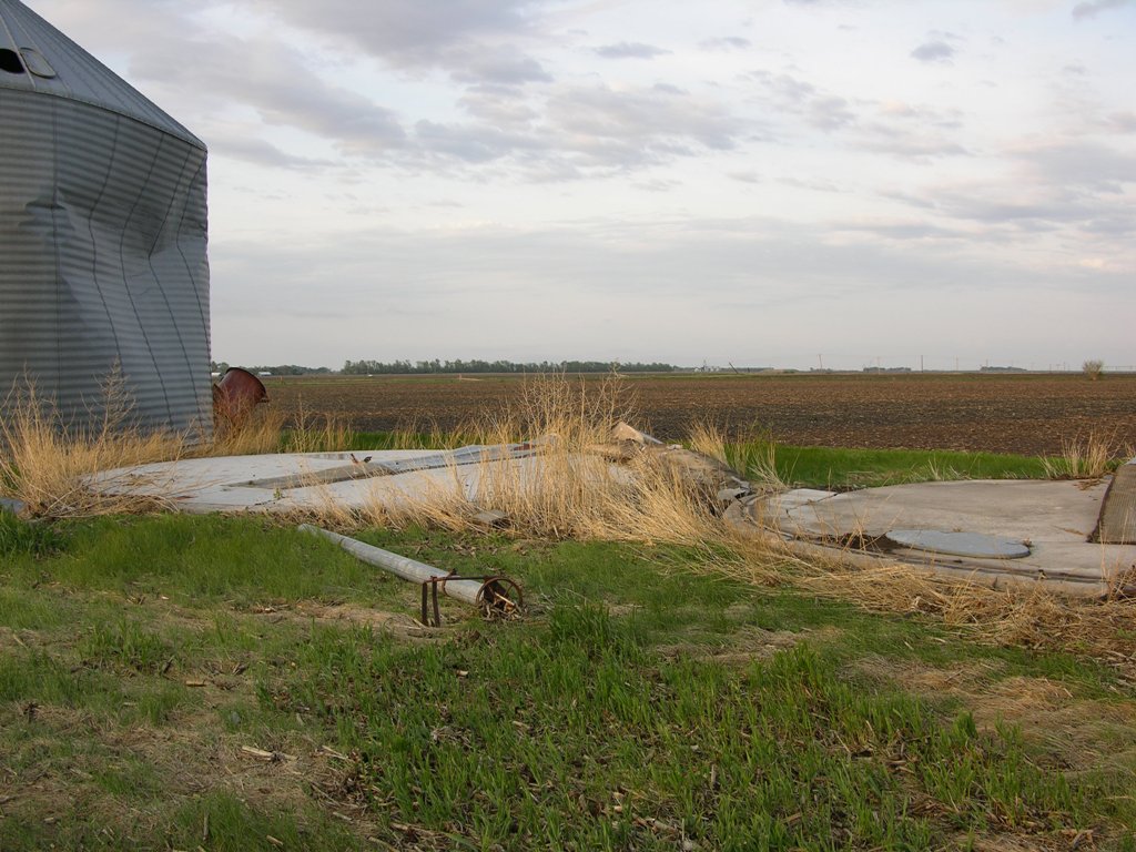
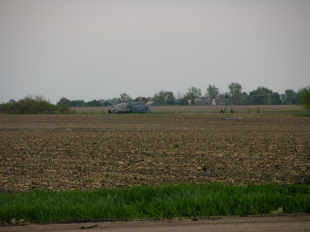
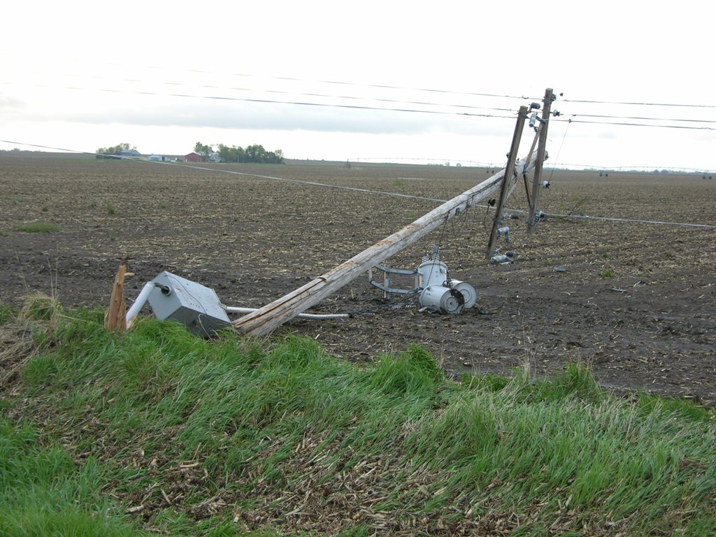
Hamilton County: As the line of storms intersected the nearly-stationary frontal boundary in south central Nebraska, a few tornadoes were reported and at least one tornado was confirmed. The confirmed tornado touched down approximately 6 miles north of Hampton in Hamilton County Nebraska, and tracked northward to approximately 5 miles south and 2 miles east of Hordville, where it then lifted. In total, this tornado overturned 3 irrigation pivots, destroyed 2 grain bins and downed 7 power poles. This tornado was rated a weak EF-1, with an estimated top wind speed of 95 mph and maximum width of 200 yards along an approximately 3.5 mile path. Polk County: This line of storms continued to the north and resulted in another tornado, this time affecting the central Polk County town of Osceola. This tornado was witnessed by a number of spotters, including the Emergency Manager and Fire Chief. The initial touchdown was approximately 3/4 of a mile south of Osceola, but lifted as it approached the town. It then touched down once again on the northeast edge of town, before lifting for the final time approximately 3/4 of a mile to the north. This tornado was rated a weak EF-1, with an estimated top wind speed of 90 mph and a maximum width of 75 yards along an approximately 2.5 mile path. Adams County: There may have had a brief tornado touchdown in the vicinity of Ayr, but no damage has been reported in this area to survey. |
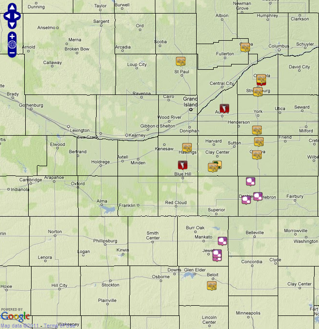
Tornado Damage Survey Maps and Preliminary Storm Reports
are shown on the graphics below. (Click on images for more information.)
 |
 |
|
Map from tornado in Hamilton County. |
Map from tornado in Polk County. |
 |
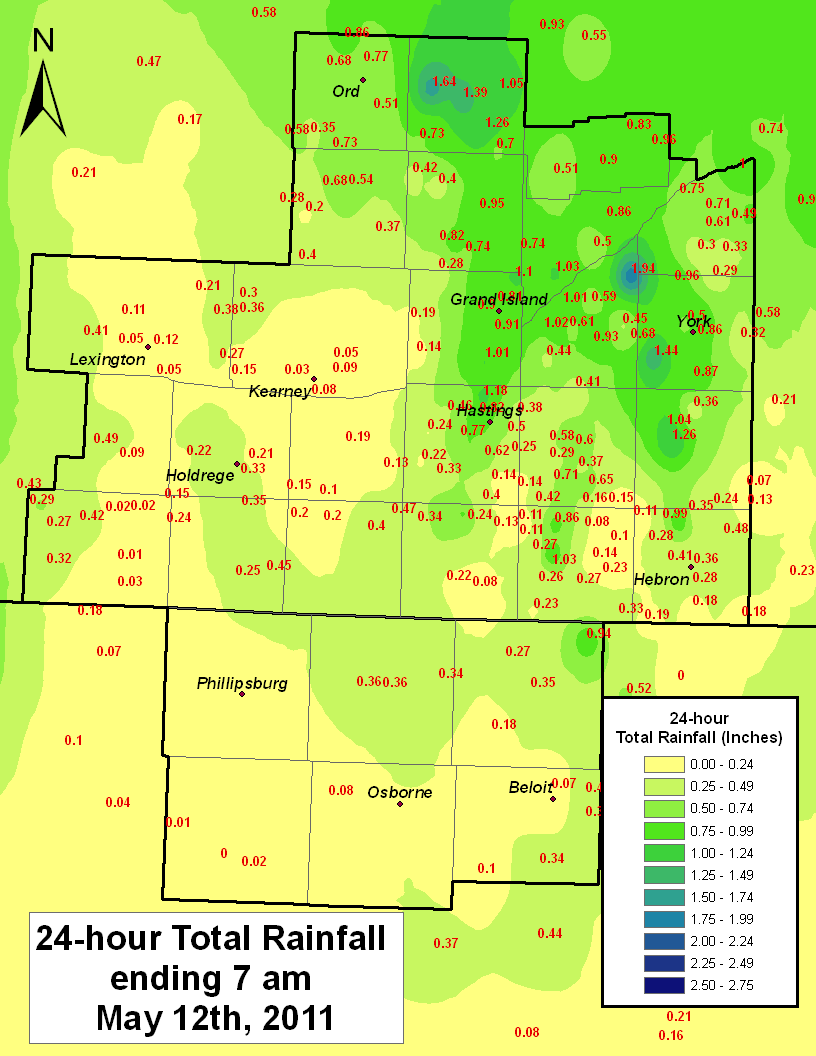 |
| Preliminary Storm Reports. | 24 Hour Rainfall Totals. |
Radar Images, Surface Chart, Storm Damage Photographs (Click on any image to enlarge)
 |
 |
|
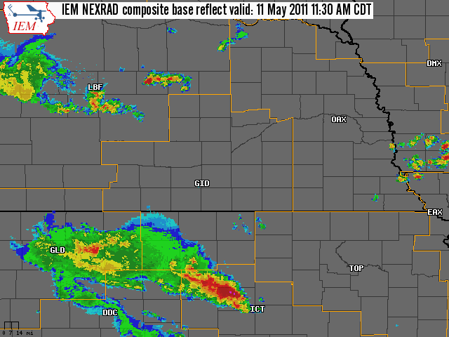
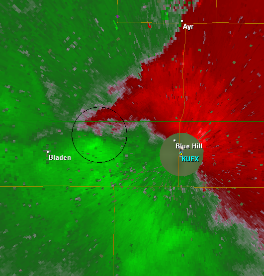
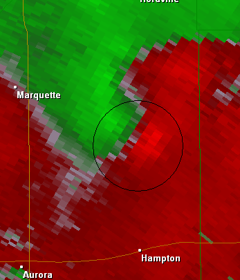
KUEX Radar 0.5 Degree Storm Relative Velocity |
KUEX Radar 0.5 Degree Storm Relative Velocity at 1952 UTC of tornado north of Hampton, NE. |
 |
|
|
KUEX Radar 0.5 Degree Storm Relative Velocity |
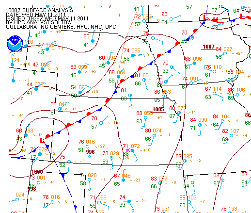
Surface plot and analysis at 18 UTC. |
 |
 |
| Power poles snapped from possible tornado 6.5 miles north and 0.5 mile east of Hampton on County Road 20 in Hamilton County. |
2 grain bins destroyed at farm north of Hampton |
 |
 |
| Grain bin carried from farm north of Hampton | Snapped power pole north of Hampton |
 |
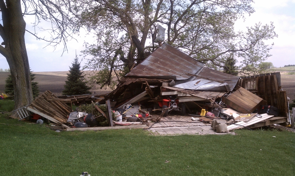 |
| Damage to the porch at residence on the far northeast corner of Osceola. | Shed damage at residence on the far northeast corner of Osceola. |