A significant heat wave is underway for the Intermountain West, Northern Plains, and Upper Great Lakes, peaking in intensity through midweek and lingering across parts of the Northern Plains and Midwest until this weekend. In southwest Texas, excessive rainfall may bring a risk for potentially life-threatening flash and arroyo flooding through Thursday. Read More >
|
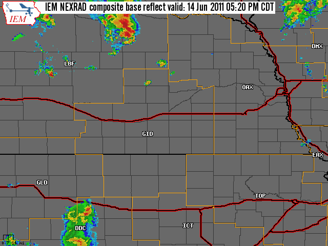
June 14, 2011 Severe Weather Event Large Hail, Damaging Winds and an EF0 Tornado The NWS Hastings coverage area is located within the orange outlined area labeled "GID", with the interstates in red. (Click Radar Loop To Enlarge)
|
|
|
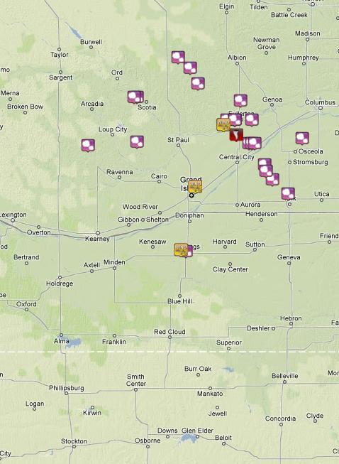
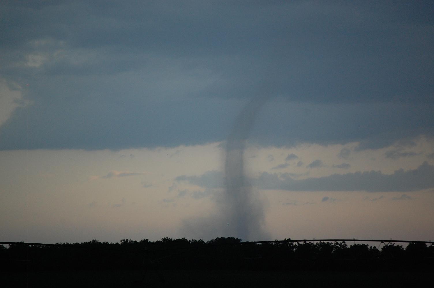
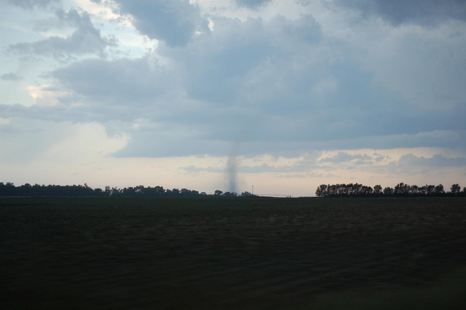
Severe Weather Summary: Portions of South Central Nebraska saw strong to severe thunderstorms during the late afternon and evening hours on Tuesday, June 14th. The primary forcing mechanism was an upper level trough swinging through the Northern and Central Plains, and with sufficient shear and instability present across the area, the thunderstorms that did develop were capable of hail anywhere from pea to golf ball size and wind gusts up to 60 mph. In addition, a weak tornado was sighted between the Fullerton and Central City areas (see below). These thunderstorms were generally confined to areas east of a line from Litchfield to Hastings and to Hebron. The golf ball size hail was reported near Clarks (Merrick County) and Spalding (Greeley County). For a complete listing of the PRELIMINARY storm reports, please click the linked image below.
|