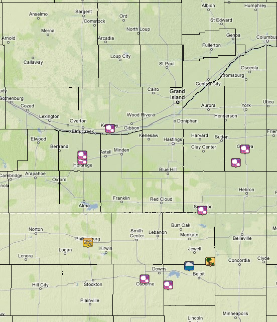
A significant heat wave is underway for the Intermountain West, Northern Plains, and Upper Great Lakes, peaking in intensity through midweek and lingering across parts of the Northern Plains and Midwest until this weekend. In southwest Texas, excessive rainfall may bring a risk for potentially life-threatening flash and arroyo flooding through Thursday. Read More >
|
|
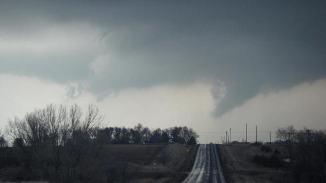
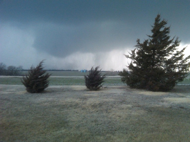
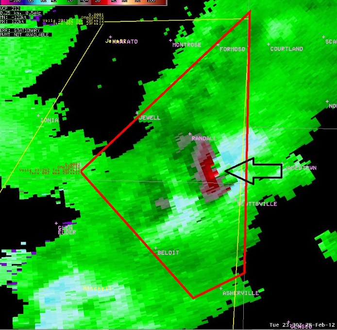
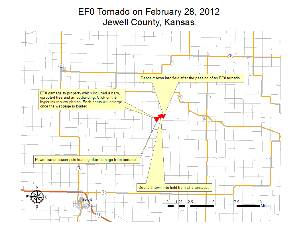
EF0 Tornadoes confirmed near Randall, KS and near Greeley, NE |
|
| Funnel cloud near Greeley, NE. Photo courtesy of Tim Marquis. |
Developing tornado southeast of Randall, KS. Photo courtesy of Paula Jones. |
|
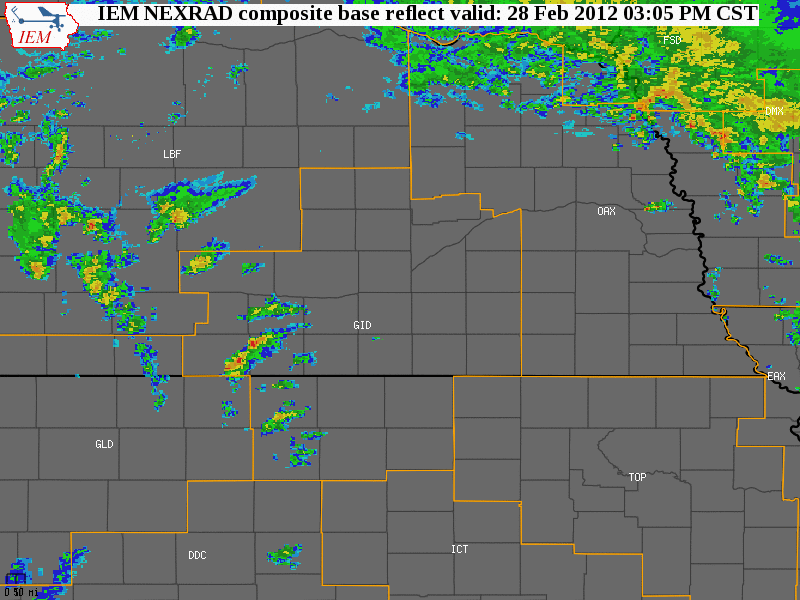
A rare set up for thunderstorms and severe weather set up across the Central Plains region on Tuesday, February 28th, as an intense low pressure system emerged from the central Rockies and crossed the Central Plains. Ahead of the approaching system, warm and moist air was drawn north, and by afternoon dewpoints rose into the 50s across eastern Kansas into central and eastern Nebraska, and caused instability to increase (dewpoints this high are greater than our seasonal normal high temperatures in the mid 40s for this time of year). Strong to severe thunderstorms developed along frontal boundaries (dry line and cold front) by mid-afternoon and the storms persisted into the early-evening hours. Although strong straight-line winds and small hail were the primary features with these storms, two EF0 tornadoes were confirmed within the NWS Hastings coverage area, one in Jewell County, KS and another in Greeley County, NE:
|
 |
 |
 |
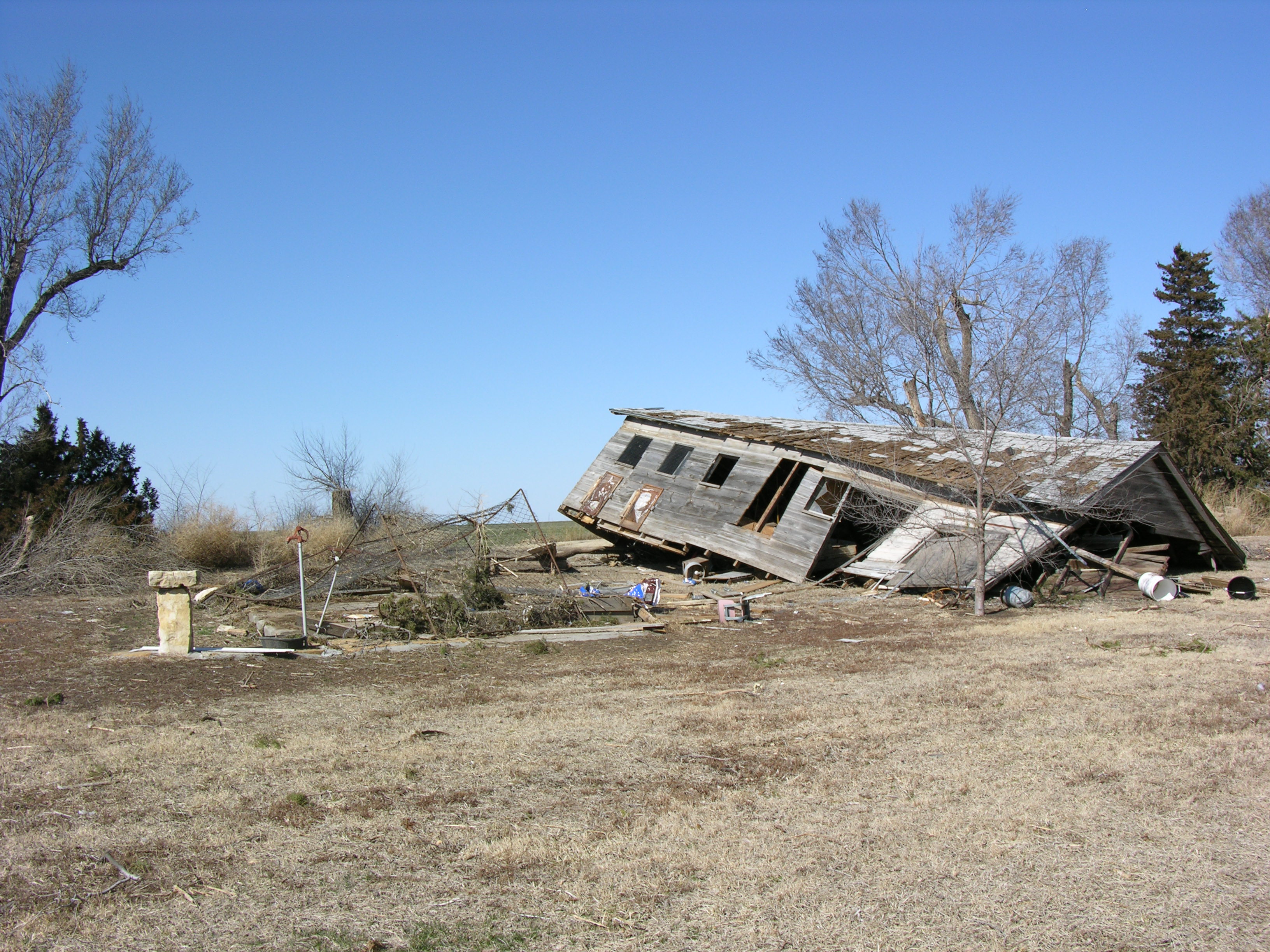
| Outbuilding roof removed by EF0 tornado in Jewell County Kansas on February 28, 2012. | Outbuilding displaced from foundation as a reult of an EF0 tornado in Jewell County Kansas on February 28, 2012. |
Tree split from tornado near Randall Kansas (Jewell County) on February 28, 2012. |
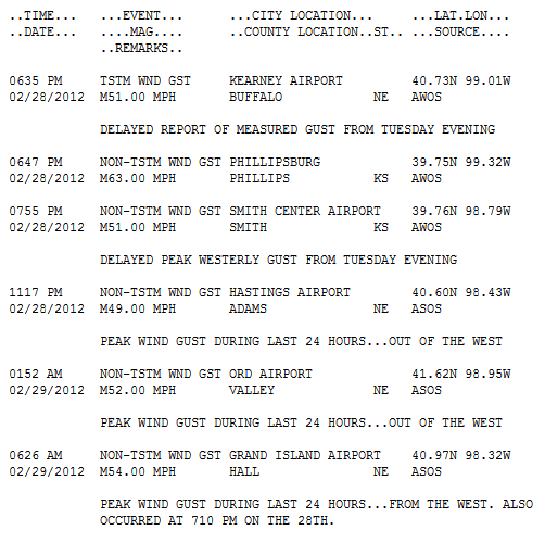
In addition to strong to severe thunderstorms, westerly winds became very strong behind a passing dryline and cold front from the evening of the 28th into the morning of the 29th, with widespread gusts to around 50 mph or higher. Although some of these gusts were directly associated with nearby thunderstorm activity, most were not, and occurred well after storms moved off to the east. One of the strongest measured gusts was 63 mph at the Phillipsburg KS airport during the evening (see peak gusts listed below).