|
Detailed Event Summary:
Another afternoon with a very unstable air mass developed across the Central Plains on Wednesday, May 2, 2012, and as a weak upper level disturbance moved in from the west, thunderstorms developed along a weak surface boundary draped across the region. With plenty of instability in place, these thunderstorms quickly became severe, dropping at times very large hail and torrential rainfall. Thunderstorms started during the early evening on Wednesday (around 7 pm), and continued on all night before the last thunderstorm finally exited to the east out of York and Fillmore Counties around 7 am Thursday. Hardest hit were the counties of South Central Nebraska along and east of Highway 281, seeing hail ranging anywhere from the size of a dime up to a softball. A few counties to the west of Highway 281, primarily Buffalo as well as Phillips County of North Central Kansas, also saw large hail ranging from the size of golf balls to tennis balls.
Preliminary information from the NWS survey teams has determined that a tornado did touch down late Wednesday evening.
Rating: EF-1
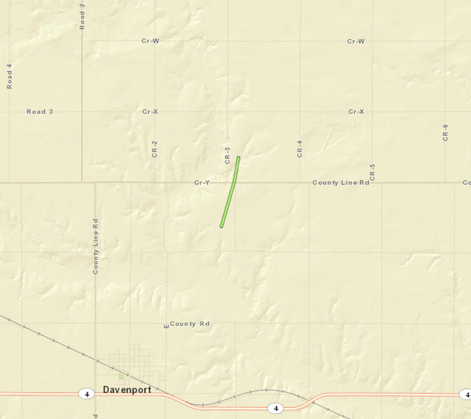
Path: Approximately 1 mile, starting approximately 2 miles northeast of Davenport and ending 3 miles northeast of Davenport. This is right near/on the Fillmore and Thayer County border.
Path Width: 250 yards
Estimated Maximum Wind Speed: 105 mph
Time: 10:03 p.m. CDT to 10:07 p.m. CDT
(Click on any image below for a larger version):
 |
 |
 |
|
Overturned pivot near Davenport.
|
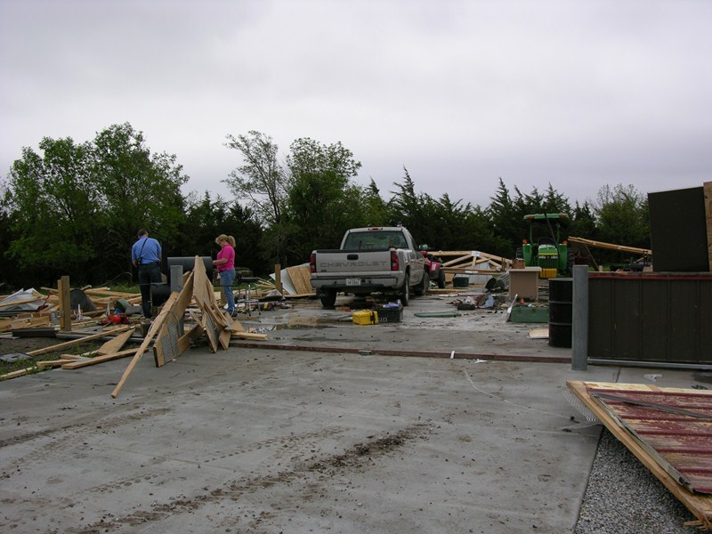
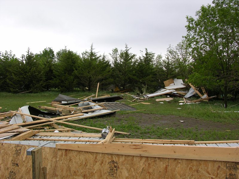
Destroyed building at residence
northeast of Davenport.
|
Destroyed building at residence
northeast of Davenport.
|
.jpg) |
.jpg) |
 |
|
Garage damage at residence
northeast of Davenport.
|
Grain bin destroyed near Davenport.
|
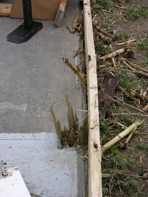
Base of destroyed building at
residence northeast of Davenport.
|
 |
 |
 |
|
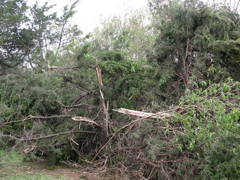
Damaged trees at residence
northeast of Davenport.
|
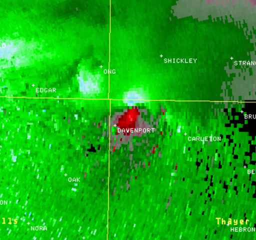
KUEX reflectivity image at
10:00 p.m. CDT.
|
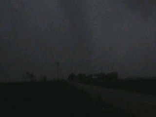
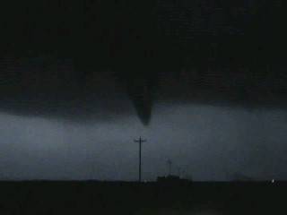
Tornado northeast of Davenport.
Photo courtesy of Brandon Lovegrove.
|
 |
 |
 |
|
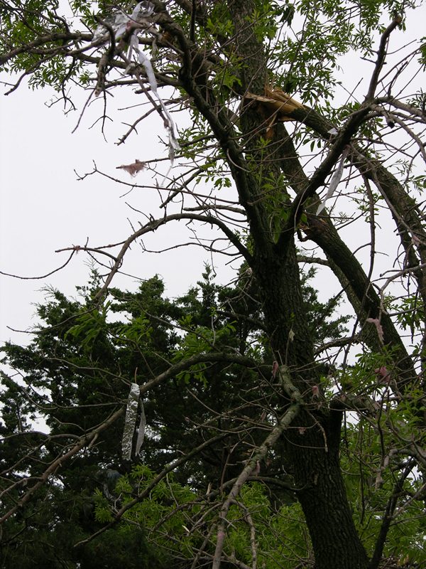
Debris in damaged trees at
residence northeast of Davenport.
|
KUEX SRM velocity image
at 10:00 p.m. CDT.
|
Track of the tornado northeast of Davenport.
|
Listed below are a few other "highlights" from this event:
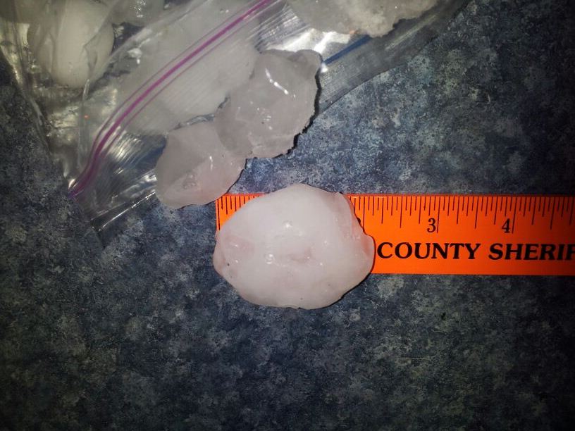
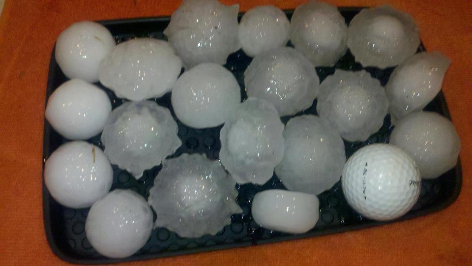
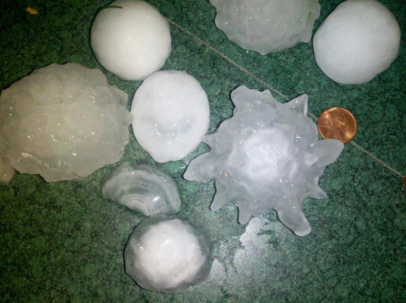
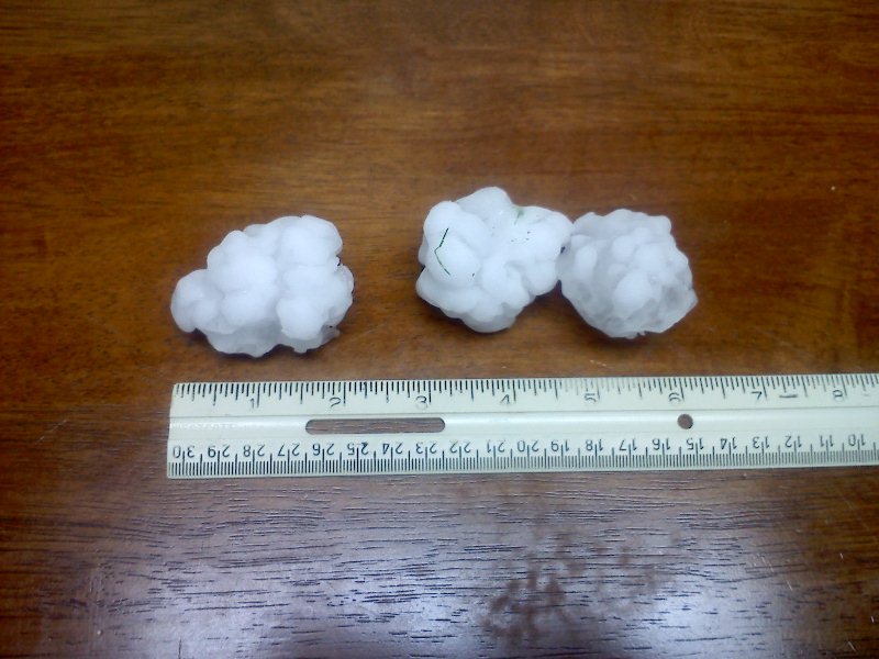
- Softball size hail (4.25") - North side of Hastings
- Tennis Ball size hail (2.5") - Near Hastings (3 miles north-northwest) and Logan, KS (5 S)
- Hen Egg size hail (2.0") - Near Fullerton (2 NNE), Genoa (5 S), Juniata (1 E) and Hastings (4 N at the NWS Office)
- Golf Ball size hail (1.75") - Near Belgrade (7 SW), Clay Center (3 E), Amherst (1 E) and Fairfield (2 E) and in Genoa, Hastings and Holstein
- Numerous reports of penny to quarter size hail from around the area.
- Reports of 3"+ of rain, including 3.55" 4 miles west of Geneva, 3.45" in Fairmont and 3.43" 5 mile south-southeast of Clay Center. Law enforcement reported water running across Highway 74 east of the Highway 14 junction as well as numerous county roads Wednesday night.
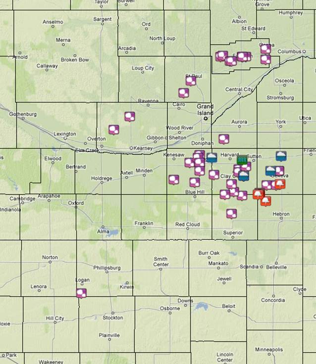 |
|
Preliminary Storm Reports from
May 2nd.
|
click on photos for larger versions
 |
 |
|
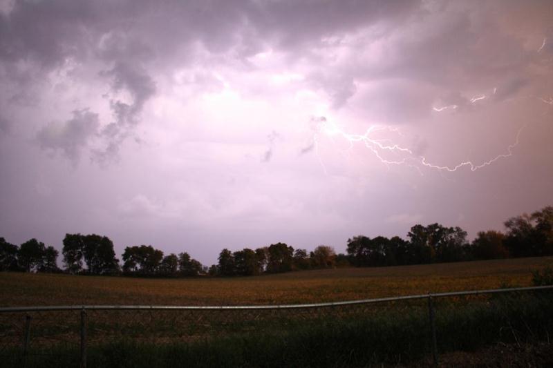
Lightning looking west of Duncan.
Photo courtesy of Dallas Thelen.
|
Lightning looking west of Duncan.
Photo courtesy of Dallas Thelen.
|
 |
|
Funnel cloud near Strang.
Photo courtesy of Brandon Lovegrove.
|
 |
 |
 |
|
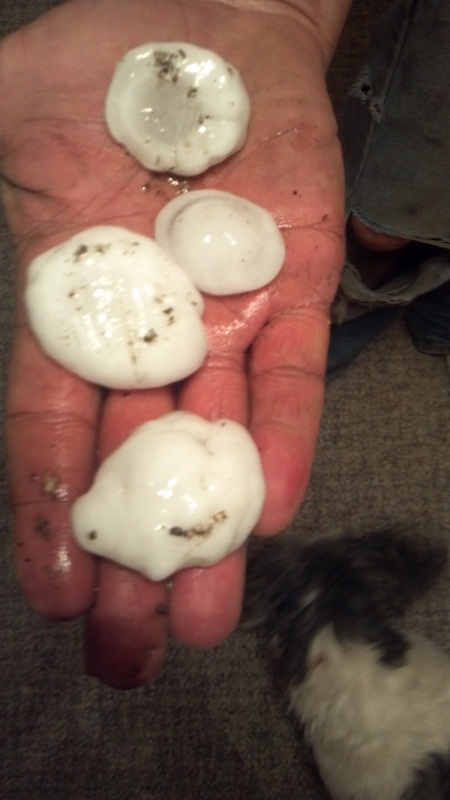
Hail near Amherst. Photo courtesy of Mason Klingelhoefer.
|
Hail 1 mile east of Juniata. Photo courtesy of Steve Eddy.
|
Hail from the Hastings Lake area. Photo courtesy of Georgina Hueske.
|
 |
 |
 |
|
Hail from the north side of Hastings. Photo courtesy of Sarah Boucher Kranjc.
|
Hail from the northwest side of Hastings. Photo courtesy of Mike Moritz.
|
Hail from the Hastings NWS Office - 4 miles north of Hastings.
|
|