A significant heat wave continues for the Rockies, Northern Plains, and Great Lakes into the Mid-Atlantic, peaking in intensity through midweek and lingering across parts of the Northern Plains and Midwest until this weekend. Excessive rainfall my bring life-threatening and locally catastrophic flash and urban flooding across portions of southwestern Texas through early Friday. Read More >
|
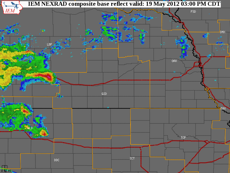
The NWS Hastings coverage area is located within the orange outlined area labeled "GID", with the Interstate highways in red. (Click Radar Loop To Enlarge)
|
|
|
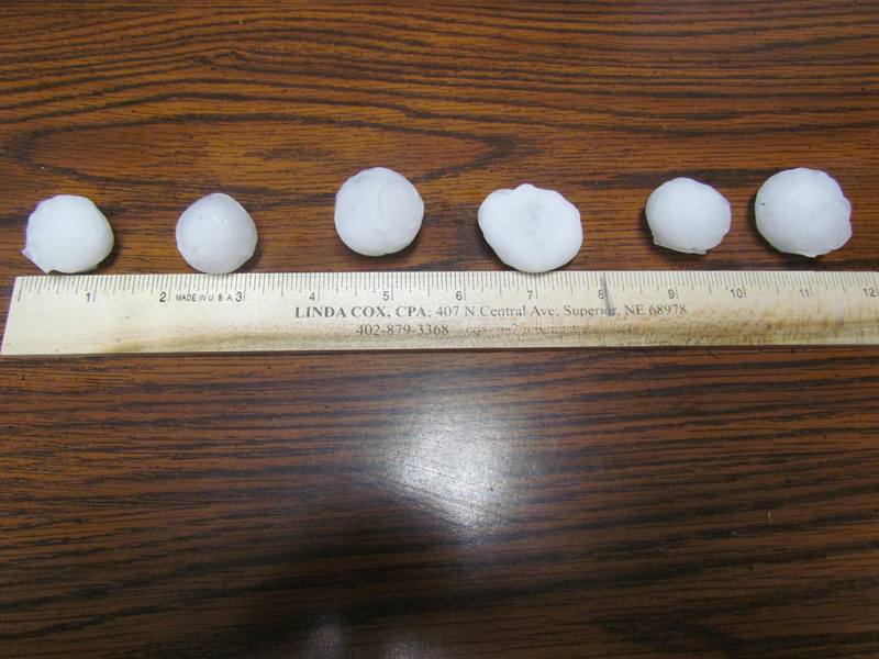
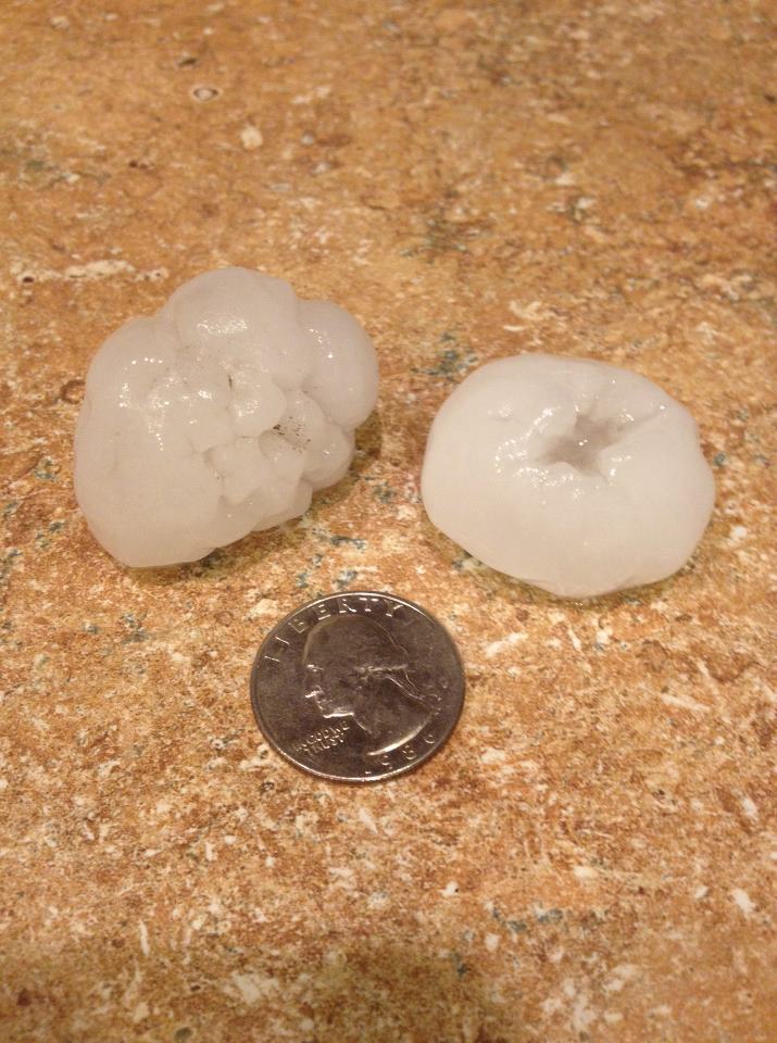
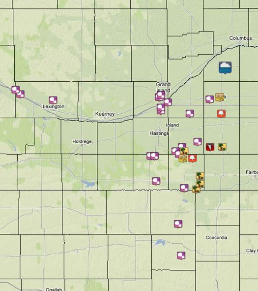
Detailed Event Summary: A stout upper level disturbance moved out of the Rocky Mountains and onto the Central Plains during the afternoon and early evening hours on Saturday, May 19th, 2012, bringing strong to severe thunderstorms to the NWS Hastings coverage area. As large scale lift increased ahead of the main system, the event started off across far western portions of Dawson County, with hail up to the size of ping pong balls reported northwest of Gothenburg. The main portion of this event would occur further east, primarily along and east of Highway 281, with the hardest hit areas in Clay, Nuckolls and Fillmore Counties. A surface cold front draped across the middle of the Hastings coverage area would provide the primary focus for thunderstorm development, and with sufficient instability and shear present, many had little trouble becoming severe. There were numerous reports of funnel clouds and gustnadoes through the event. In addition, strong straight line winds and hail up to the size of hen eggs occurred across the area. Gustnadoes are formed by very different processes than tornadoes. The differences between gustnadoes and "true" tornadoes are not often clear cut, as both involve rotating columns of air, but one of the primary differences is that gustnadoes are NOT connected to a parent rotating cloud base above. Here is a brief definition of both: TORNADO: A violently rotating column of air, usually a pendant (attached) to a cumulonimbus cloud, with the circulation reaching the ground. In supercell thunderstorms, tornadoes are often associated with deep rotation in the updraft area of the storm, often on the south or southwest side of an east or northeast-moving storm. GUSTNADO: A typically small whirlwind which forms as an eddy in thunderstorm outflows. They do not connect with any cloud-base rotation. Like dust devils, some stronger gustnadoes can cause damage. Often, gustnadoes are observed miles out ahead of the parent storm and associated precipitation. Despite these "technical" and sometimes unclear differences, strong gustnadoes sometimes do cause damage similar to tornadoes, and this was likely the case across parts of the area during the afternoon and evening of May 19th. However, the vast majority of wind damage was likely from very strong straight line winds.
Some of the notable reports from Saturday afternoon and evening follow below:
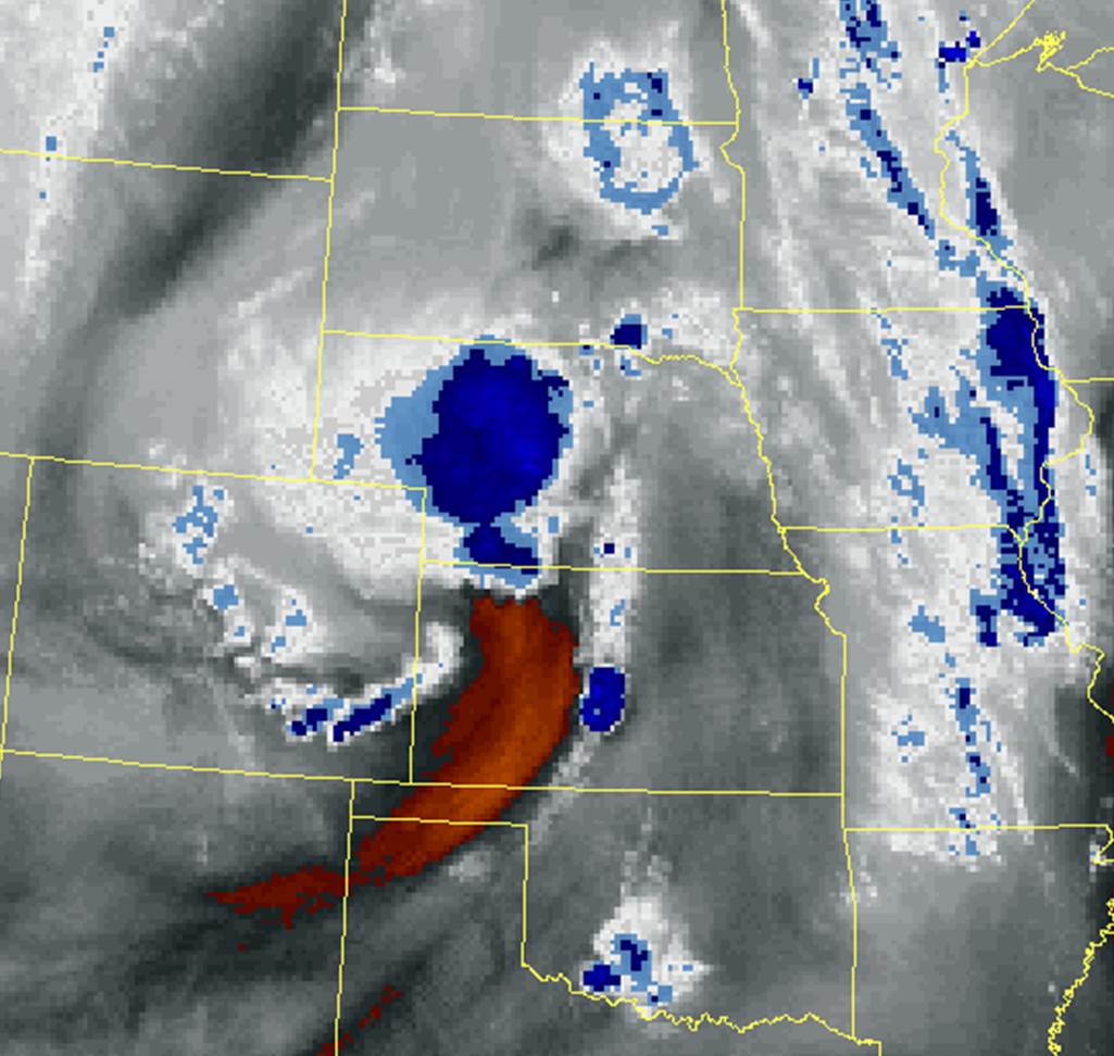
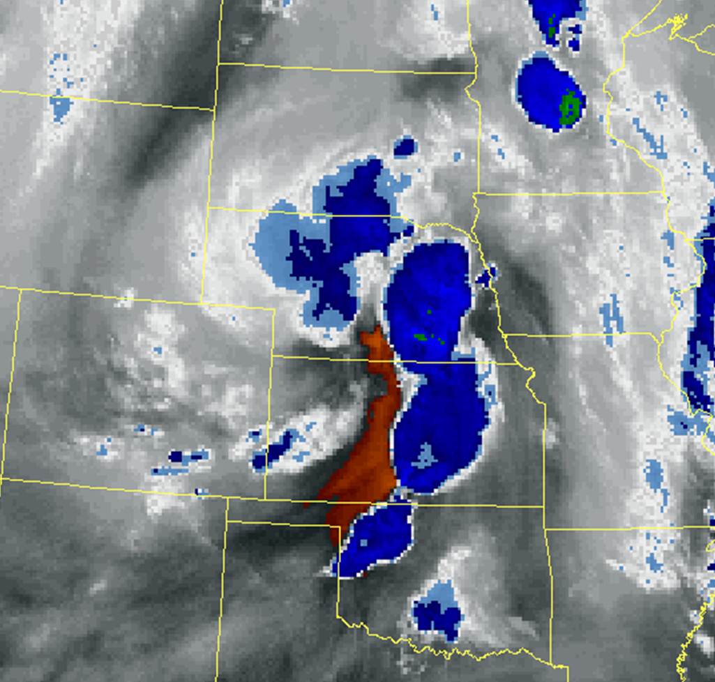
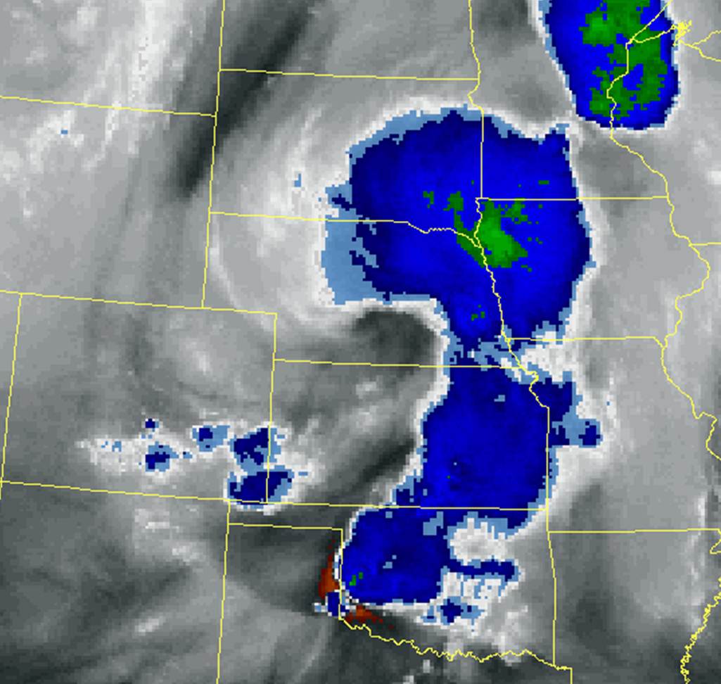
Below are screen captures of Water Vapor Satellite Imagery through the afternoon and evening hours, showing the upper level disturbance making its way across the Central Plains. The brighter white and dark blue colors depict higher amounts of cloud cover and the developing convection, the area of orange is drier air punching in from the southwest.
|