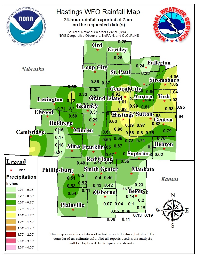
Widespread, life-threatening considerable flash flooding is expected in south-central Texas through at least Friday. Catastrophic river flooding and rapid rises on small streams, arroyos, and typically dry washes are expected in the Texas Hill Country. Wildfire smoke is impacting air quality across much of the Great Lakes region into the Northeast U.S. with Air Quality Alerts in effect. Read More >
Snow, Wind and all out Blizzard Conditions on December 19, 2012 |
|||||||||||||||||||||||||
|
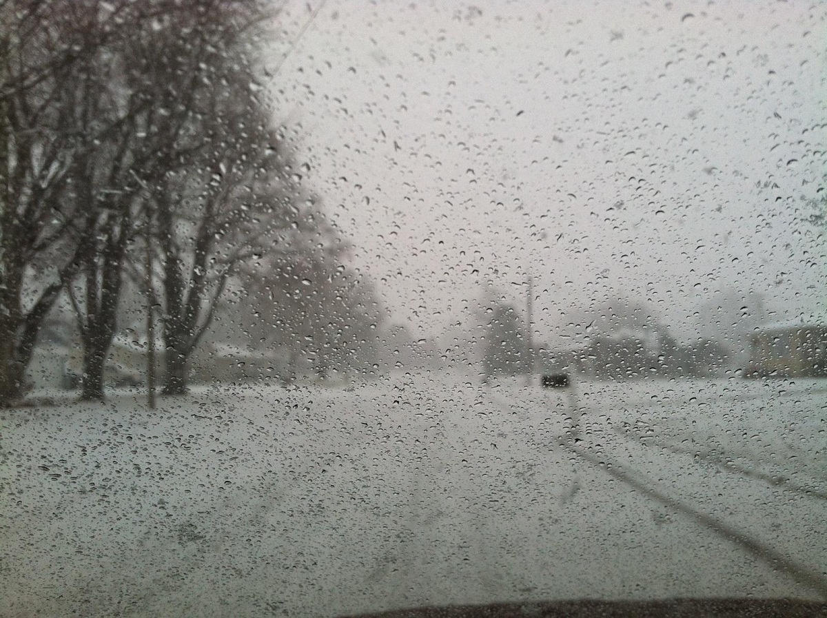
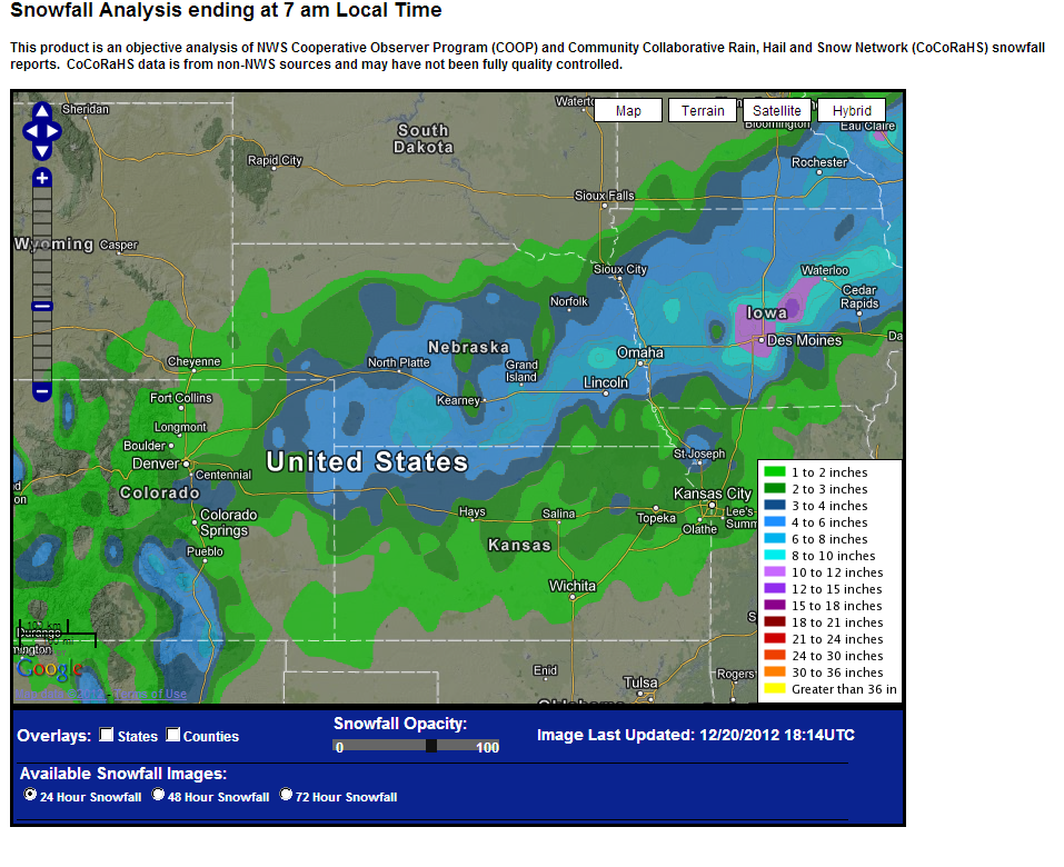
Snow and wind combined to create blizzard conditions on Wednesday, December 19th, as a low pressure system moved out of the central Rockies and lifted northeast across Kansas to Missouri. As the system advanced, snow developed and spread east across the central plains throughout the day and carried into the first part of the night. Winds increased from the north during the afternoon with wind gusts of 45 mph common, and the combination of the wind and snow created blizzard or 'white out' conditions during the afternoon and evening, especially in open areas. Travel became difficult if not impossible Wednesday evening, with reports of numerous accidents and road closures. Interstate 80 remained closed across Nebraska on Thursday morning, December 20th. |
|||||||||||||||||||||||||
|
|||||||||||||||||||||||||
|
|
|||||||||||||||||||||||||
|
|||||||||||||||||||||||||
|
|
|||||||||||||||||||||||||
| Snow pictures from December 19-20th. | |||||||||||||||||||||||||
|
|
|||||||||||||||||||||||||
 |
 |
 |
 |
||||||||||||||||||||||
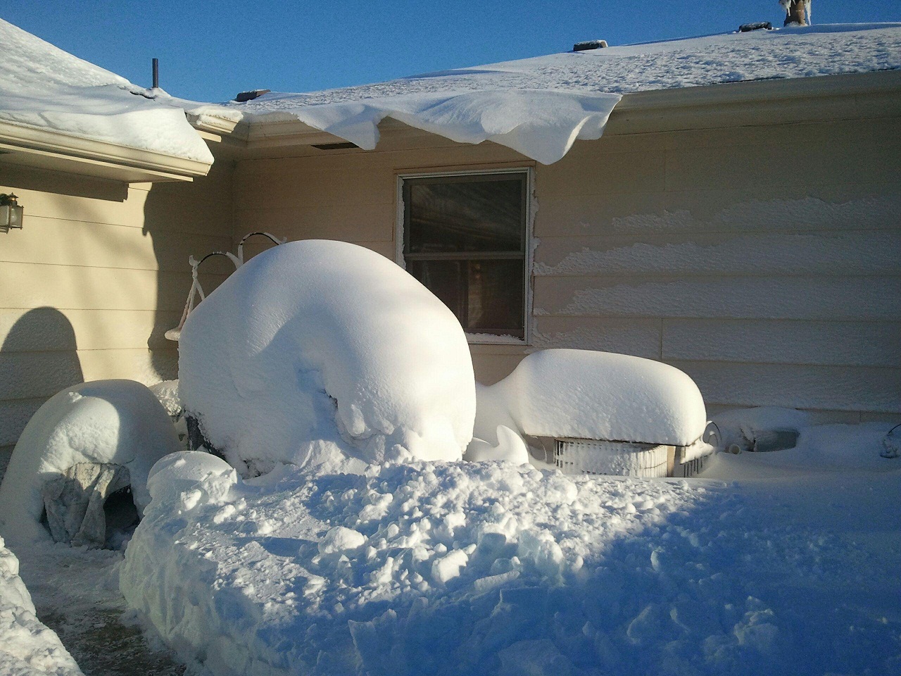
| Snow falling in Hastings December 19. | After the storm. Residential Hastings on December 20. |
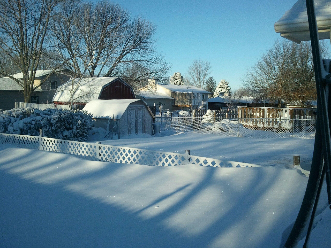
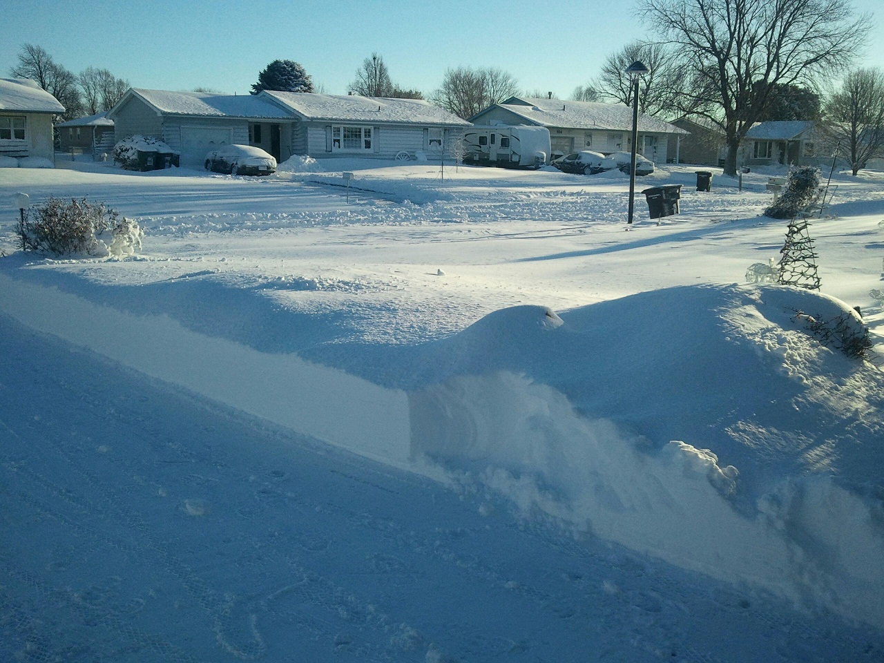
After the storm. Residential Hastings on December 20. |
After the storm. Residential Hastings on December 20. |
||||||||||||||||||||||
 |
 |
 |
 |
||||||||||||||||||||||
| Visible satellite imagery showing snow on the ground (clear skies) across the Central Plains on December 20. | Snow and icicle picture in Hastings. Photo by Hannah Keen. |
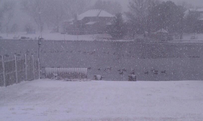
Ducks and geese enjoying the snow. | Our office parking lot the night of December 19. |
||||||||||||||||||||||
|
|
|||||||||||||||||||||||||


.jpg)