Storm Summary:
Starting during the daytime hours on Wednesday, Feb. 20th, 2013, and peaking in intensity that night and into Thursday, Feb. 21st, a major winter storm took aim on the Central Plains, including the entire NWS Hastings coverage area. While essentially the entire 30-county area measured at least 6-10" of snow, much of the southern half of the area and especially parts of North Central Kansas was socked with anywhere from 12-20" of snow, as highlighted in the snowfall table below. A quick glance at long-time climate records reveals that in terms of total snowfall this was one of the most significant winter storms to ever strike Kansas counties such as Phillips, Rooks, Smith and Osborne. In fact, the 15.6" at Smith Center was the largest two-day snowfall on record dating back to 1910! Despite plenty of drifting, the magnitude of blowing snow was held in check by wind gusts that largely averaged under 25 MPH, keeping this storm from reaching official "blizzard" criteria. Snow gradually ended from south to north during the evening of the 21st, with all areas snow-free by sunrise on Friday the 22nd.
In the Nebraska Tri-Cities, daily snowfall and/or liquid equivalent records were tied or set for February 21st at Grand Island and Hastings:
- Grand Island: Feb. 21st record snowfall of 8.8" and record liquid-equivalent of 0.77" (storm-total snow was 10.0")
- Hastings: Feb. 21st daily snowfall record was tied with 8.0" (storm-total snowfall was 9.5")
Although some Nebraska counties did not see quite as much snow as originally expected, this winter storm was in many ways one of the best-forecasted storms in recent memory thanks to incredible consistency in computer model depictions for several days leading up to the storm. Although the finer details of timing and full snowfall potential did not come into focus until a few days before the storm, signs of a potentially significant winter storm were recognized over a week in advance.
** Below is a table of preliminary STORM TOTAL snowfall totals from a combination of NWS Cooperative Observers and NeRAIN/CocoRAHS observers within the NWS Hastings coverage area, Emergency Managers and the public**
| Location |
Total |
| 7 NNE Natoma, KS |
20.5 |
| Natoma, KS |
18 |
| 10 WNW Stockton, KS |
18 |
| Phillipsburg, KS |
18 |
| Smith Center, KS |
15.6 |
| Mankato, KS |
15 |
| Red Cloud, NE |
14 |
| Webster State Park, KS |
14 |
| 8 S Elwood, NE |
13.5 |
| Logan, KS |
13 |
| Hildreth, NE |
13 |
| Lebanon, KS |
13 |
| 6 N Nelson, NE |
12.5 |
| Holstein, NE |
12.5 |
| Naponee, NE |
12.5 |
| 2 S Fairfield, NE |
12 |
| 4 SW of Blue Hill, NE |
12 |
| 4 WNW Plainville, KS |
12 |
| 2 SW Alton, KS |
12 |
| Cambridge, NE |
11.7 |
| Clay Center, NE |
11.5 |
| Downs, KS |
11 |
| 5 WNW Elm Creek, NE |
11 |
| Wilsonville, NE |
11 |
| Franklin, NE |
10.9 |
| Minden, NE |
10.8 |
| 4 E Superior, NE |
10.8 |
| Cawker City, KS |
10.5 |
| Gothenburg, NE |
10.3 |
| Cozad, NE |
10.3 |
| Burr Oak, KS |
10.1 |
|
| 5 SSW Scottsville, KS |
10 |
| 6 SSE Lexington, NE |
10 |
| St. Paul, NE |
10 |
| Holdrege, NE |
10 |
| Ravenna, NE |
10 |
| Grand Island, NE |
10 |
| Edison, NE |
10 |
| Hastings NWS Office |
9.5 |
| 7 SE Stromsburg, NE |
9.1 |
| Fullerton, NE |
9 |
| Beloit, KS |
9 |
| 3 WSW Genoa, NE |
8.5 |
| Hebron, NE |
8.5 |
| Greeley, NE |
8.5 |
| Wolbach, NE |
8.4 |
| 3 SE Hastings, NE |
8.2 |
| Ionia, KS |
8 |
| 3 SSE Scotia, NE |
8 |
| Hunter, KS |
8 |
| 6 ESE Clay Center, NE |
8 |
| Kearney Airport, NE |
7.7 |
| Hubbell, NE |
7 |
| Bruning, NE |
7 |
| 10 SSW Beloit, KS |
7 |
| 4 N Aurora, NE |
6.8 |
| Arcadia, NE |
6.5 |
| Osceola, NE |
6.5 |
| Stromsburg, NE |
6.3 |
| Bradshaw, NE |
6.2 |
| 3 NE Shelby, NE |
6.1 |
| 3 N York, NE |
6 |
| Ord, NE |
6 |
|
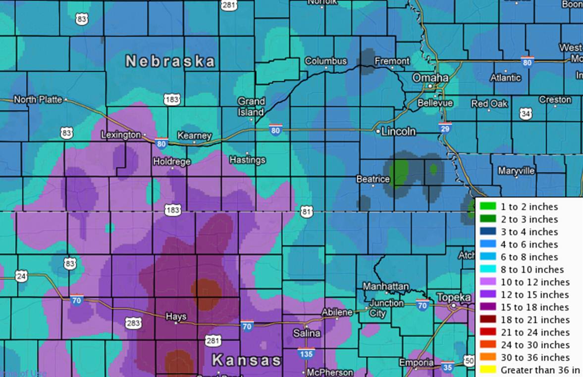 |
| This is a regional map depicting storm total snowfall amounts. |
 |
 |
 |
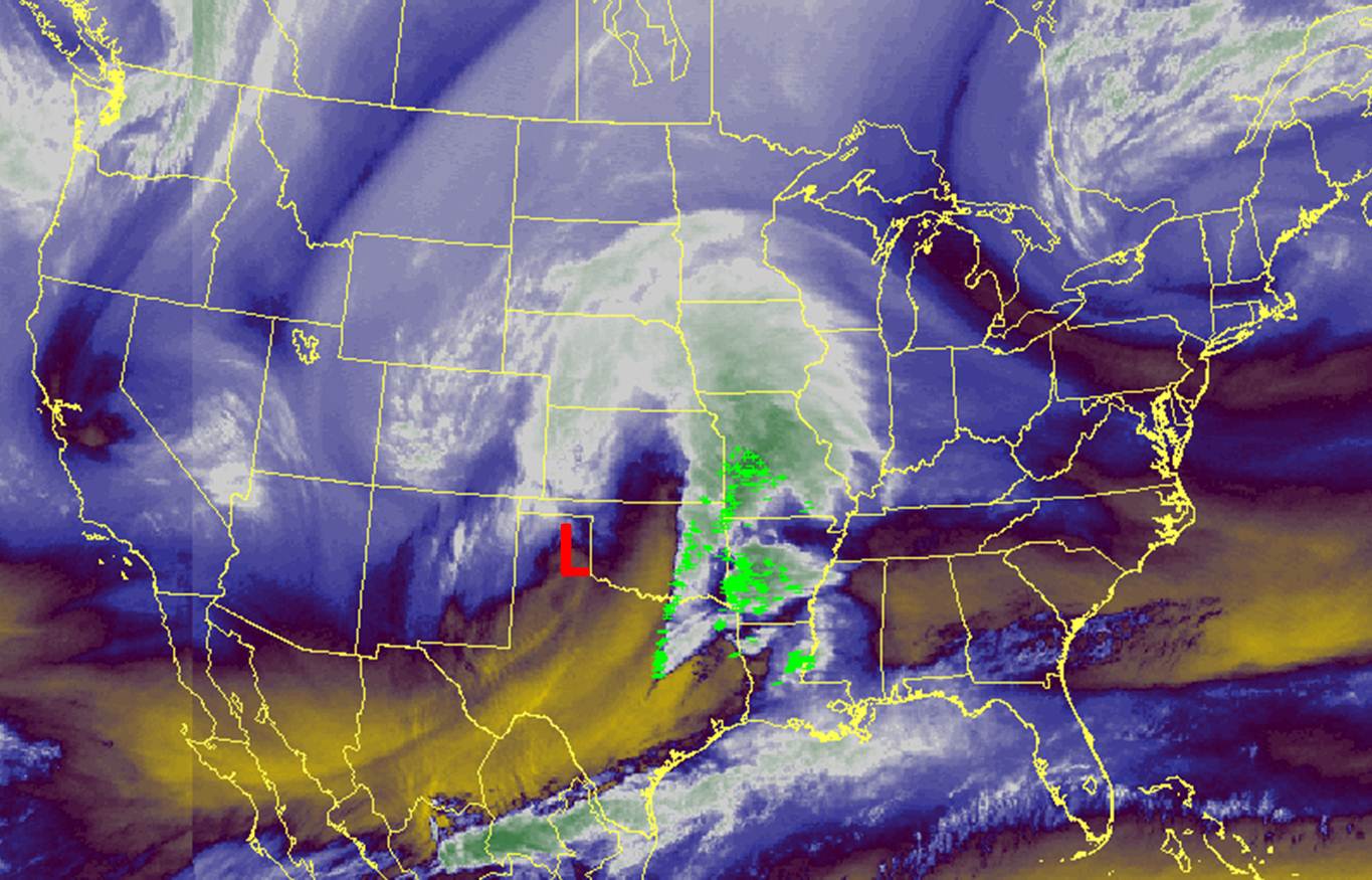
| Water Vapor satellite image from 9:30 a.m. Thursday morning, showing the location of the main storm system over the Southern Plains. |
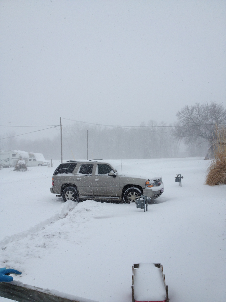
Snow falling in Cawker City, KS at 9:30 a.m. Thursday. Photo courtesy of Misty Thornton. |
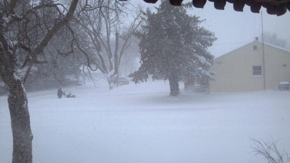
Snow falling in Beloit, KS at 9:30 a.m. Thursday morning. Photo courtesy of Joe Sporleder. |
 |
 |
 |
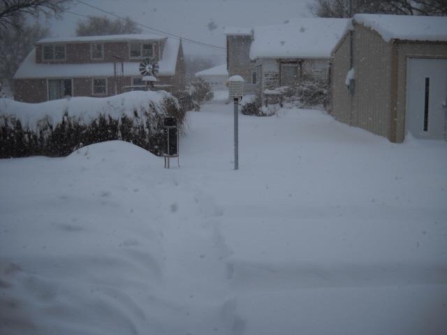
| Plainville, KS at 10:30 a.m. Thursday. Photo courtesy of Wanda Goering. |
Osborne, KS at 10:30 a.m. Thursday. Photo courtesy of Matt Pasilas. |
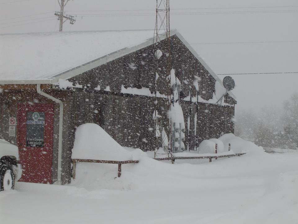
HMT Phil Beda out taking the official noon observation at the NWS Hastings Office. |
 |
 |
 |
 |
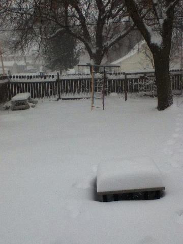
| 2 p.m. - Looking in the backyard of our Cooperative Observer Bob Levin in Smith Center, KS. |
2 p.m. - Drifting Snow in Stockton, KS. Photo courtesy of Damon Arial. |
2 p.m. in Stockton - There is a car under there! |
Our fearless DAPM Marla Doxey taking on the snowdrifts at the NWS Hastings Office. |
|


