
A significant heat wave is underway for the Intermountain West, Northern Plains, and Upper Great Lakes, peaking in intensity through midweek and lingering across parts of the Northern Plains and Midwest until this weekend. In southwest Texas, excessive rainfall may bring a risk for potentially life-threatening flash and arroyo flooding through Thursday. Read More >
Hastings, NE
Weather Forecast Office
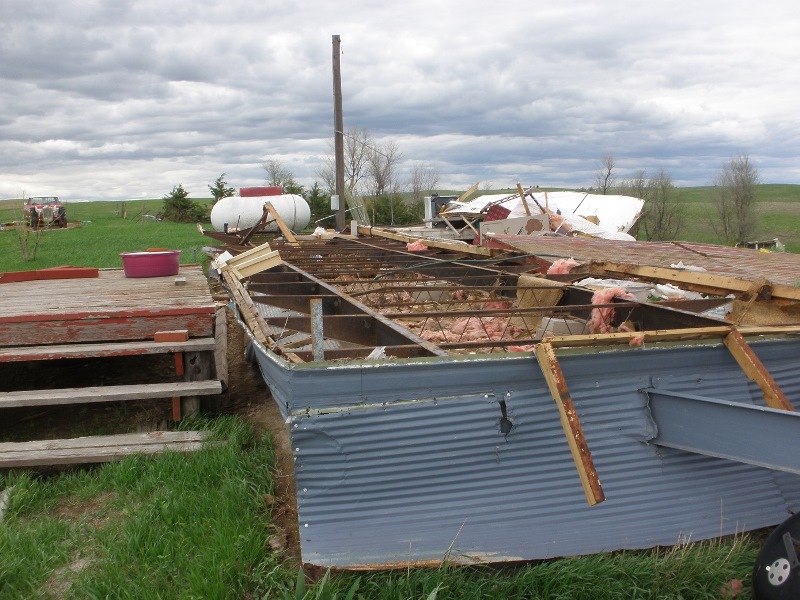
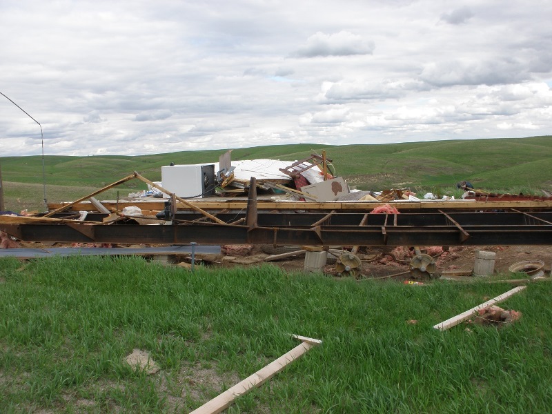
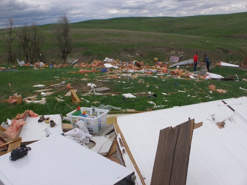
During the mid afternoon hours on Sunday, May 19th, a brief tornado touched down in eastern Greeley County of South Central Nebraska. Touching down approximately 4 miles northeast of the town of Wolbach, this tornado was rated a weak EF-1, with top winds estimated at 90 mph. It touched down at approximately 4:51 p.m. CDT, and was only on the ground for a couple of minutes. This tornado destroyed a mobile home and shed, and broke tree limbs 5 to 8 inches in diameter. Photos of the resultant damage and of the radar signature at that time follow below.
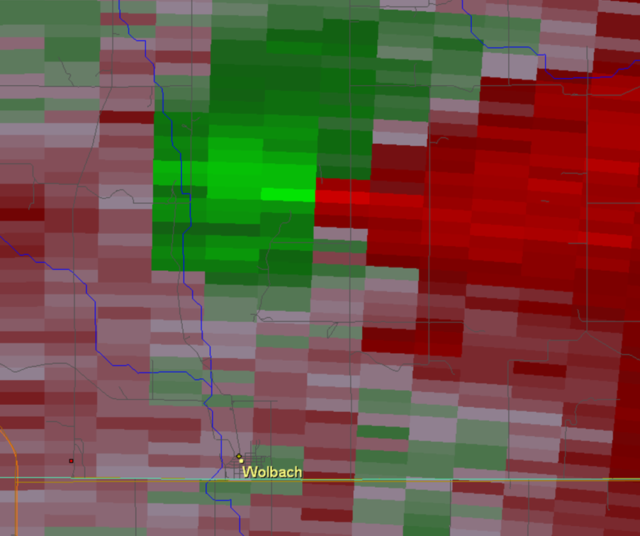 |
| Radar signature from KUEX radar approximately 4:51 p.m. CDT. |
 |
 |
 |
| Mobile home destroyed northeast of Wolbach. | Mobile home destroyed northeast of Wolbach. | Scattered debris from destroyed mobile home. |
 |
 |
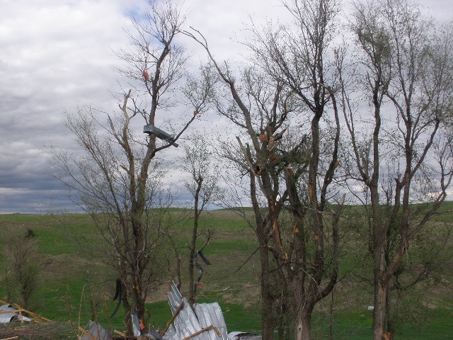 |
| Debris from destroyed mobile home. | Scattered debris in nearby trees. | Scattered debris in nearby trees. |
Hazardous Weather
Submit A Storm Report
Storm Prediction Center
Local Storm Reports
Experimental Graphical Hazardous Weather Outlook
Forecasts
Area Forecast Discussion
Fire Weather
Aviation Weather Center
Experimental Probabilistic Precip Amount Forecast
Winter Weather
Winter Storm Severity Index
Experimental Winter Storm Outlook
Wet Bulb Globe Temp
Activity Planner
Current Conditions
Current Area Observations
Text Products
Satellite
Rivers and Lakes
Local 24 Hour Precip Maps
Local Archived Precip Maps
NWPS Precipitation Analysis
Local Snowfall Maps
Snowfall Analysis
Snow Cover
Climate
Local Database (NOWData)
Local Climate Webpage
Hastings/G. Island Records
Local Historical Tornado Info
U.S. Drought Monitor
Grand Island - Daily
Grand Island - Monthly
Hastings - Daily
Hastings - Monthly
Kearney - Daily
Kearney - Monthly
Ord - Daily
Ord - Monthly
US Dept of Commerce
National Oceanic and Atmospheric Administration
National Weather Service
Hastings, NE
6365 North Osborne Drive West
Hastings, NE 68901-9163
402-462-4287
Comments? Questions? Please Contact Us.

