|
Detailed Event Summary:
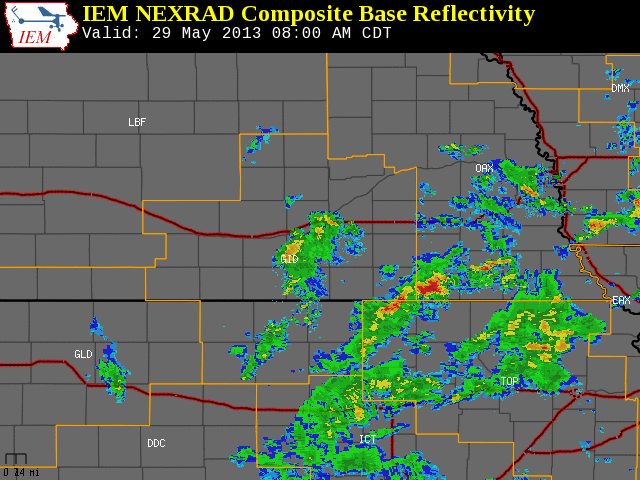
Wednesday brought yet another round of severe weather to South Central Nebraska and North Central Kansas (including numerous reports of tornadoes across Clay, York and Howard Counties), as a strong upper level trough moved out of the Rockies and through the Central Plains. In addition to the tornadoes, large hail up to the size of golf balls, wind gusts near 60 mph and heavy rainfall of anywhere from 1 to near 4 inches was reported across South Central Nebraska.
Severe thunderstorms started up by mid morning across portions of South Central Nebraska along a subtle surface warm front as a weaker upper level disturbance out ahead of the main trough passed through, dropping penny to quarter size hail. After a very short lull, additional severe thunderstorms developed just prior to midday, and kept going right on through the afternoon and well into the mid to late evening hours. However, the time frame roughly between 3 and 6 p.m. is when the tornado reports were received.
Across North Central Kansas, the severe weather held off until the evening hours, when activity along the main surface front finally pushed in from the west. Damaging winds were the main concern across this area through the end of the event, with wind gusts up to 70 mph reported, although one tornado also touched down in northwestern Phillips County Wednesday evening.
Some of the notable reports from Wednesday afternoon and evening follow below:
- Tornadoes reported in Clay, York and Howard Counties of South Central Nebraska and Phillips County of North Central Kansas (See below for additional information)
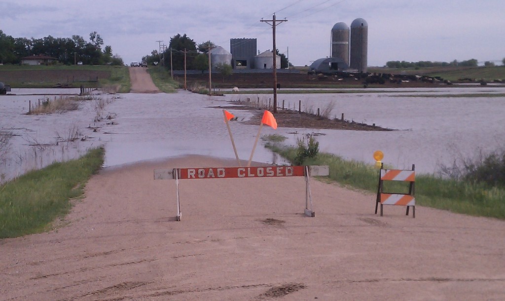
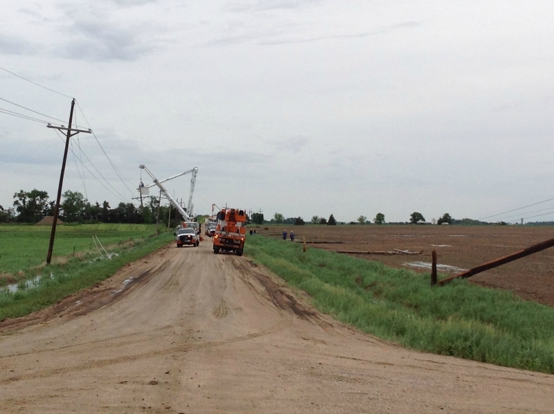
- Numerous county roads were reported to be under water Wednesday evening, especially in the Cotefield area and in southeastern portions of Hamilton County. Minor street flooding was also reported in Gothenburg and Shelby Wednesday evening. As of mid-morning on Thursday, there continued to be flooding along the School Creek east of Harvard, and spots of the Big Blue River near Stockham were out of its banks.
- Golf ball size hail (1.75") was reported near Juniata, Riverdale, Pleasanton and Henderson.
- Ping pong ball size hail (1.5") was reported in Hastings.
- Quarter size hail (1.0") was reported near Franklin, Hildreth, Ravenna, Cotesfield, Kearney and Gothenburg.
- An estimated wind gust of 70 mph was reported near Long Island, KS.
- An estimated wind gust of 65 mph was reported in Bruning.
- A measured wind gust of 61 mph was recorded by the Hebron Airport AWOS.
- An estimated wind gust of 60 mph was reported near Logan, KS, and Webster State Park, KS.
- A measured wind gust of 58 mph was recorded by the Smith Center Airport AWOS.
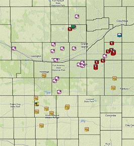 |
May 29, 2013 storm reports.
Click image for detailed reports. |
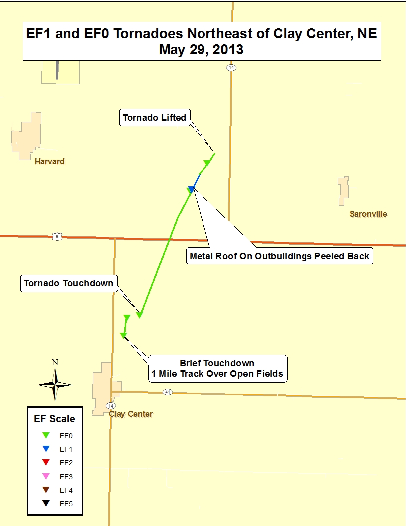
Clay County of South Central Nebraska
Tornado #1: Approximately 2 miles north-northeast of Clay Center
Rating: EF-0
Time: 2:56 to 3:00 p.m. CDT
Path Length: approximately 1 mile
Max Path Width: 25 yards
Estimated Max Wind Speed: 75 mph
Damage: No damage was reported with this tornado.
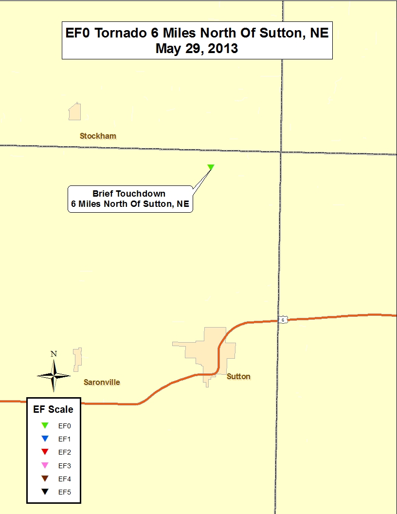
Tornado #2: Approximately 6 miles north of Sutton
Rating: EF-0
Time: 3:45 p.m. CDT
Path Length: Brief touchdown
Max Path Width: 15 yards
Estimated Max Wind Speed: 75 mph
Damage: No damage was reported with this tornado.
Tornado #3: Approximately 2 miles north-northeast of Clay Center to 6.6 miles north-northeast of Clay Center
Rating: EF-1
Time: 4:21 p.m. to 4:29 p.m. CDT
Path Length: approximately 4.4 miles
Max Path Width: 75 yards
Estimated Max Wind Speed: 100 mph
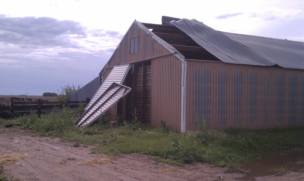
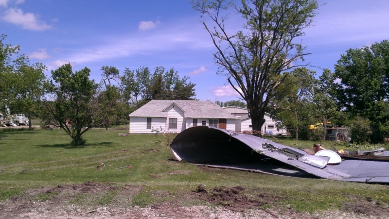
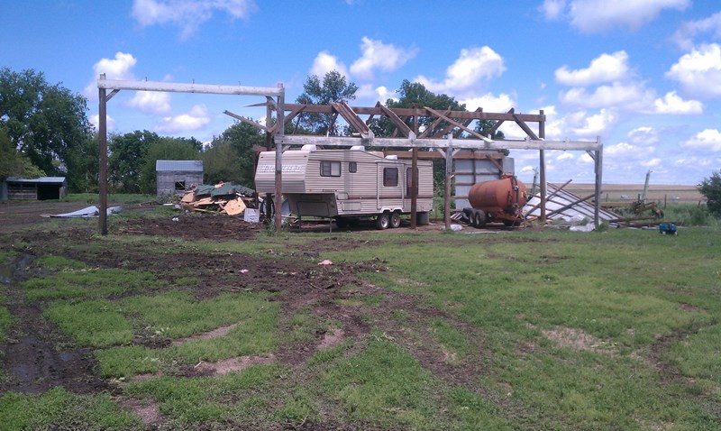
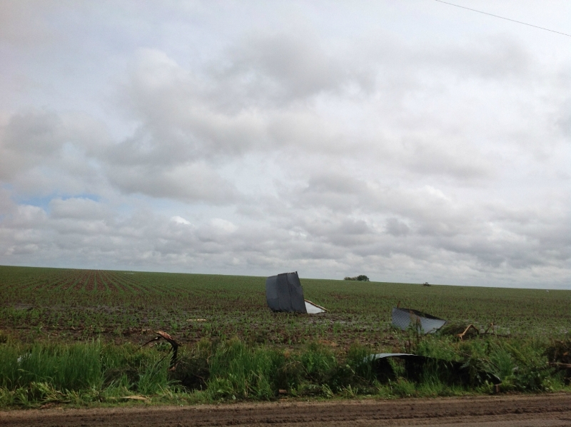
Damage: Minor damage to a home and roof damage to an outbuilding approimately 4 miles ESE of Harvard.
 |
 |
| Track maps of the Clay County tornadoes. |
 |
 |
 |
 |
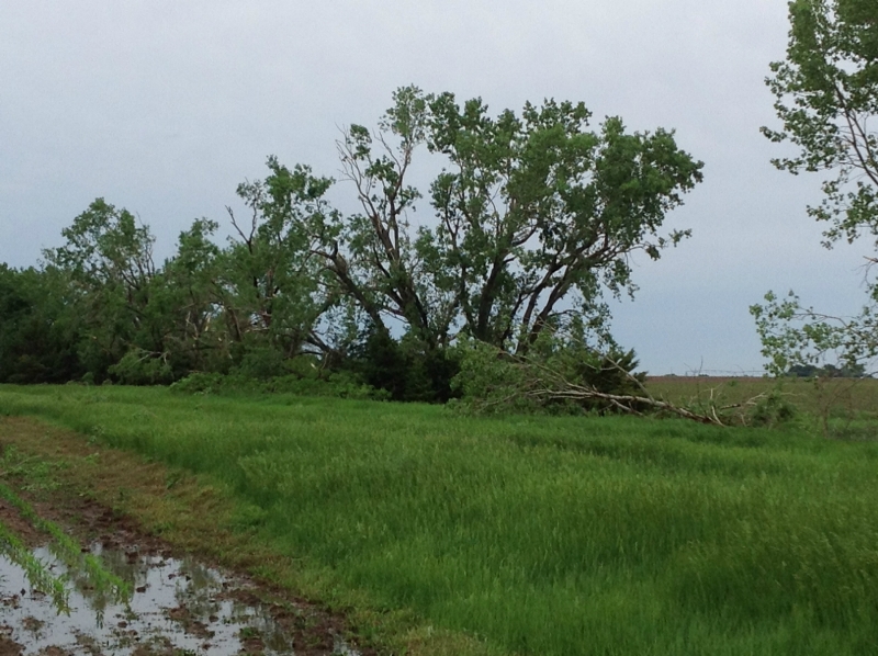
Roof damage and twisted beams of an
outbuilding east of Harvard. |
Water over road caused by flooding of the School Creek east of Harvard. |
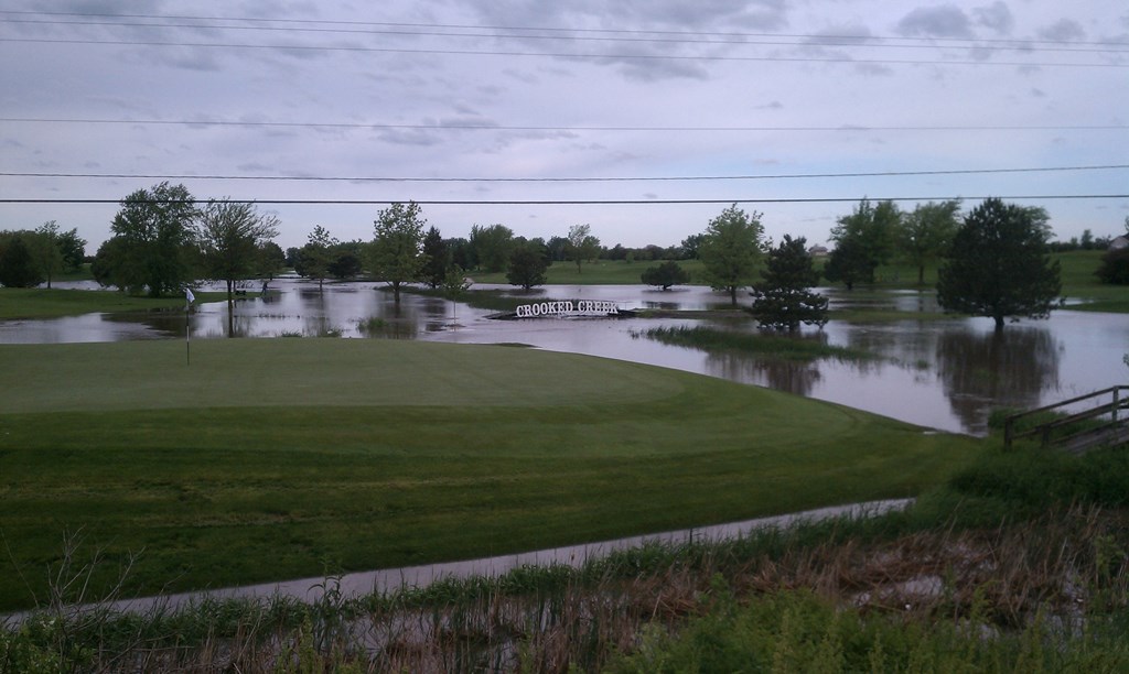
Flooding at the Clay Center Golf Course. |
York County of South Central Nebraska
Tornado #4: Approximately 2 miles south of Bradshaw
Rating: EF-0
Time: 4:20 p.m. CDT
Path Length: Brief touchdown
Max Path Width: 15 yards
Estimated Max Wind Speed: 75 mph
Damage: No damage was reported with this tornado
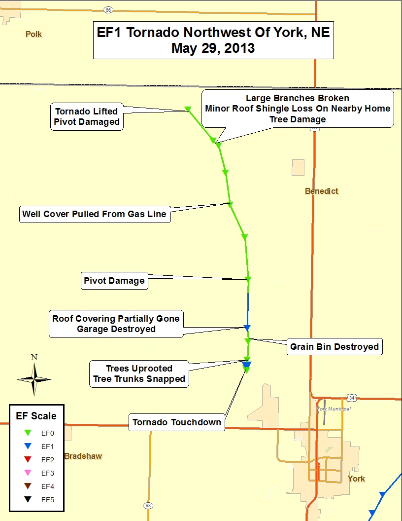
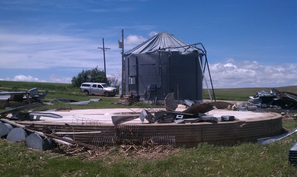
Tornado #5: Approximately 3.7 miles northwest of York to 12.4 miles northwest of York
Rating: EF-1
Time: 4:36 p.m. to 5:00 p.m. CDT
Path Length: 9.4 miles
Max Path Width: 150 yards
Estimated Max Wind Speed: 100 mph
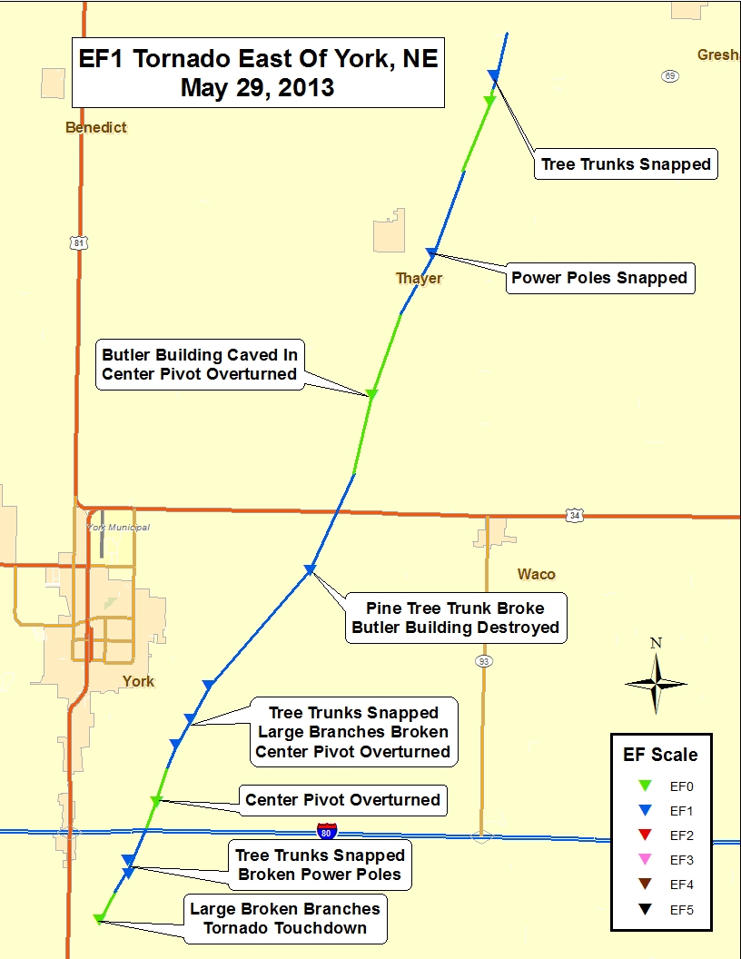
Tornado #6: Approximately 5 miles south York to 12 miles northeast of York
Rating: EF-1
Time: 4:48 p.m. to 5:20 p.m. CDT
Path Length: 16 miles
Max Path Width: 400 yards
Estimated Max Wind Speed: 110 mph
 |
 |
 |
| Track maps of the York County tornadoes. |
 |
 |
 |
 |
| Damage from the tornado which passed northwest of York. |
 |
 |
 |
| Damage from the tornado which passed southeast of York. |
Howard County of South Central Nebraska
Tornado #7: Approximately 6 miles northeast of Ashton
Rating: EF-0
Time: 6:05 p.m. CDT
Path Length: Brief touchdown
Max Path Width: 15 yards
Estimated Max Wind Speed: 75 mph
Damage: No damage was reported with this tornado
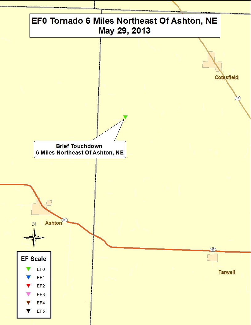 |
| Track map of the Ashton tornado |
Phillips County of North Central Kansas
Tornado #8: Approximately 1 mile south of Prairie View to 0.25 mile southeast of Prairie View
Rating: EF-1
Time: 8:10 p.m. to 8:12 p.m. CDT
Path Length: approximately 1 mile
Max Path Width: 40 yards
Estimated Max Wind Speed: 90 mph
Damage: Tornado damage was mainly confined to 3 outbuildings. In addition to the tornado damage, straight line wind damage was noted in Phillips and parts of Rooks Counties.
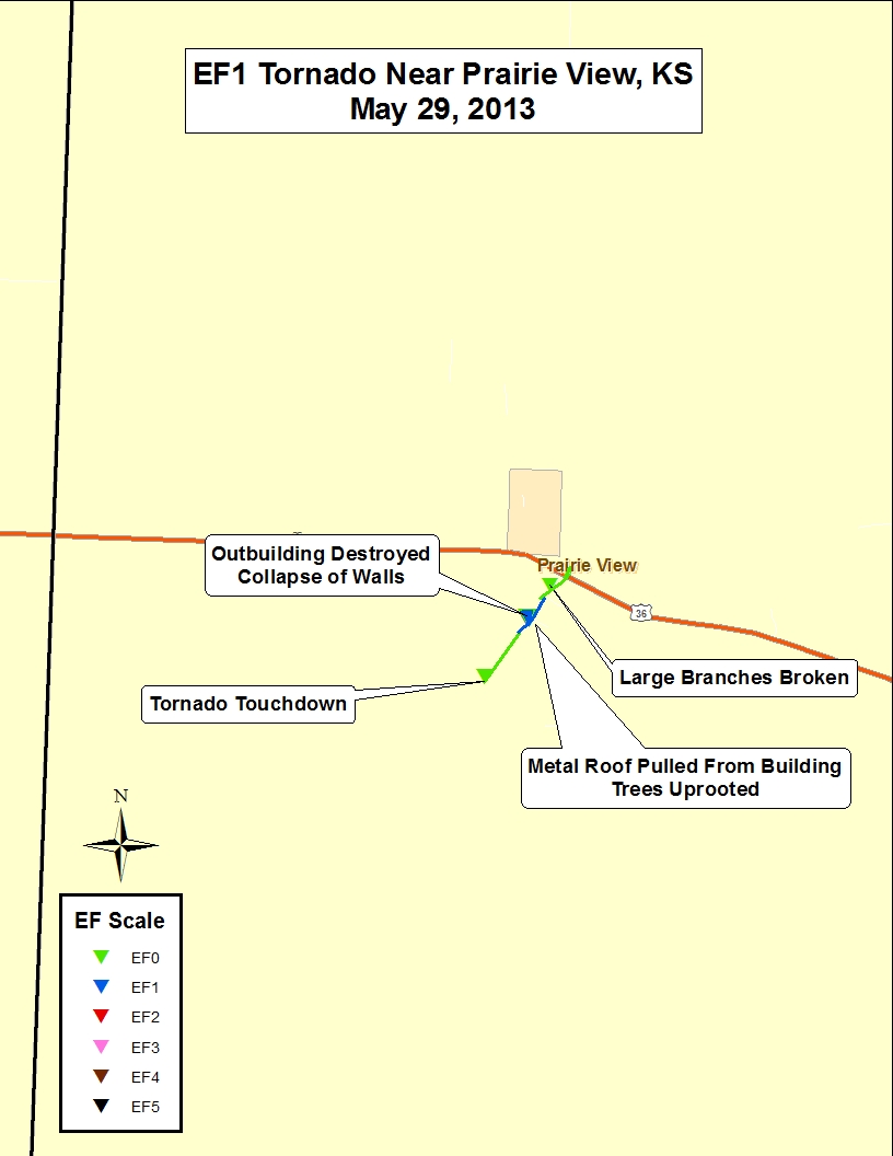 |
Track map of the
Prairie View tornado. |
|