National Weather Service United States Department of Commerce

Severe Thunderstorms in the Central U.S.; Upper Level Low Over California

Scattered severe thunderstorms are possible today across central and eastern Minnesota, Iowa, and western Wisconsin. A few tornadoes, isolated very large hail, and damaging winds may occur. An upper level low will help trigger scattered thunderstorms over portions of central and southern California today along with a few inches of snow in the central Sierra Nevadas. Read More >


Significant rain fell across northeastern Colorado between September 9-16, 2013 (image to left shows totals). This rain fell over the headwaters of the South Platte River Basin near Boulder, Colorado. As a result, record flooding occurred in Colorado and western Nebraska along the South Platte and Platte river. Between September 21-28, 2013, minor flooding worked eastward into roughly the western half of the NWS Hastings coverage area, and even lingered into early October in a few places.

The following link from NWS Boulder, CO describes in more detail the event that
resulted in this record rainfall in Colorado:

September 2013 Floods


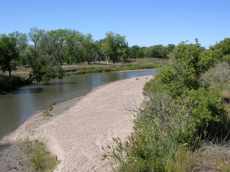
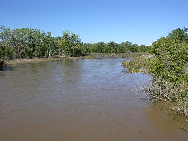
Below is more information about the basin that feeds into South Platte River, which meets up with the North Platte River just east of North Platte, Nebraska, then becoming the Platte River through the remainder of Nebraska.

Then follows information about each of the river gages along the Platte that affect South Central Nebraska, located near Cozad and Overton in Dawson County, Kearney in Buffalo County and Grand Island in Hall County. A hydrograph showing the rise and fall of each gage as the water passed is shown, as well as "before and after" photos.


South Platte River Basin


Platte River Gage @ Cozad

Minor flood stage is 6.5 ft. (orange line on hydrograph)


Before: near Cozad - 9/20/13:
North Channel looking west
After: near Cozad - 9/24/13:
North Channel looking west
Before: Near Cozad - 9/20/13:
South Channel looking west
After: Near Cozad - 9/23/13:
South Channel looking west
Before: Near Gothenburg - 9/20/13 After: Near Gothenburg -9/23/13
Photo courtesy of Julia Berg.


Platte River Gage @ Overton

Minor flood stage is 7.0 ft. (orange line on hydrograph)


Before: Near Overton - 9/22/13
Photo courtesy of Lisa Baker.
After: Near Overton - 9/24/13


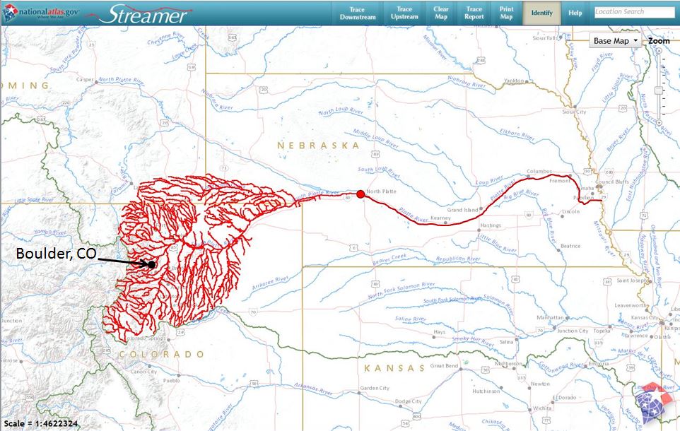
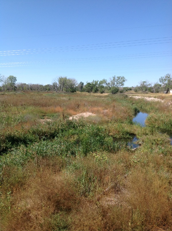
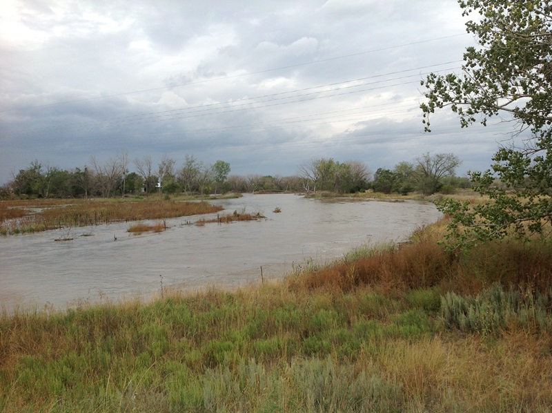
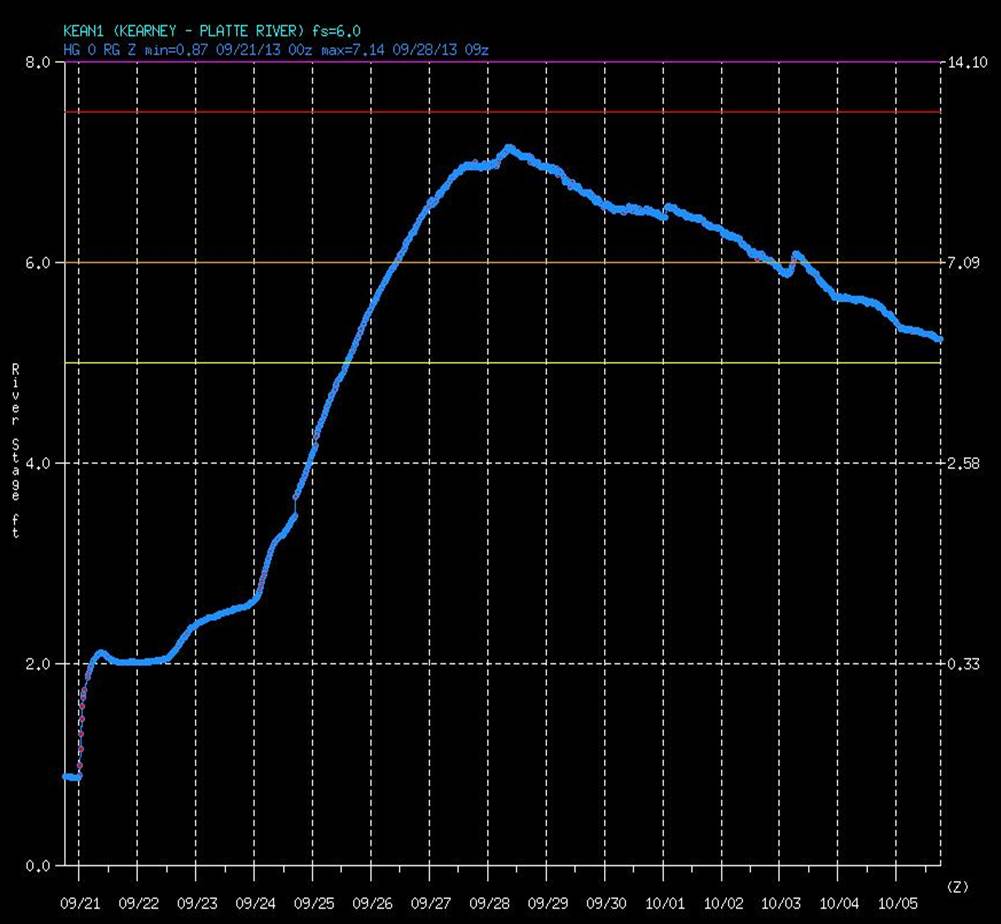
Platte River Gage @ Kearney
Minor flood stage is 6.0 ft. (orange line on hydrograph)
 
Before: Near Kearney - 9/20/13 After: Near Kearney - 9/26/13
 

Platte River Gage @ Grand Island(Nebraska)
Minor flood stage is 6.5 ft. (orange line on hydrograph)
 
Before: Near Grand Island - 9/20/13 After: Near Alda - 9/30/13
Photo courtesy of Hall County Emergency Management.
  
For more information see the NWS Advanced Hydrologic Prediction Service Homepage