
A significant heat wave continues for the Rockies, Northern Plains, and Great Lakes into the Mid-Atlantic, peaking in intensity through midweek and lingering across parts of the Northern Plains and Midwest until this weekend. Excessive rainfall my bring life-threatening and locally catastrophic flash and urban flooding across portions of southwestern Texas through early Friday. Read More >
Overview
|
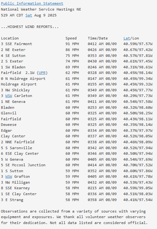
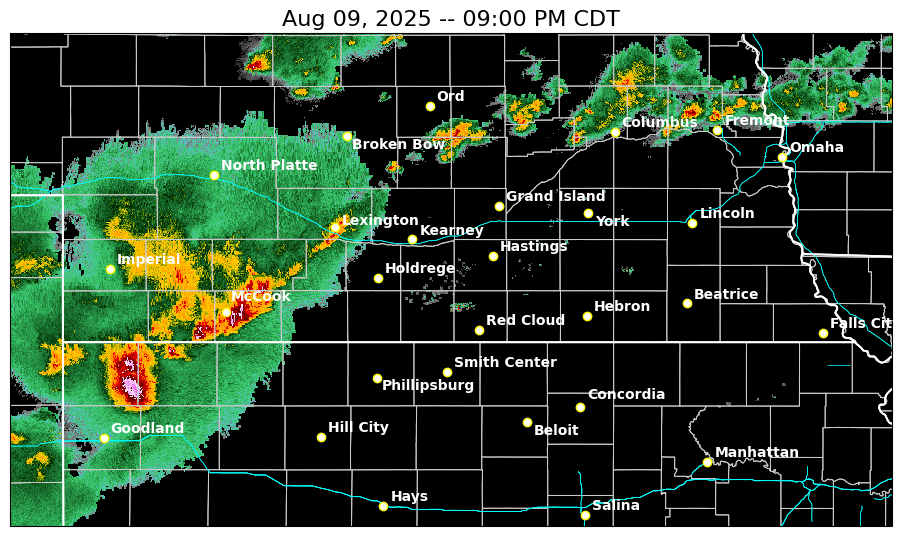
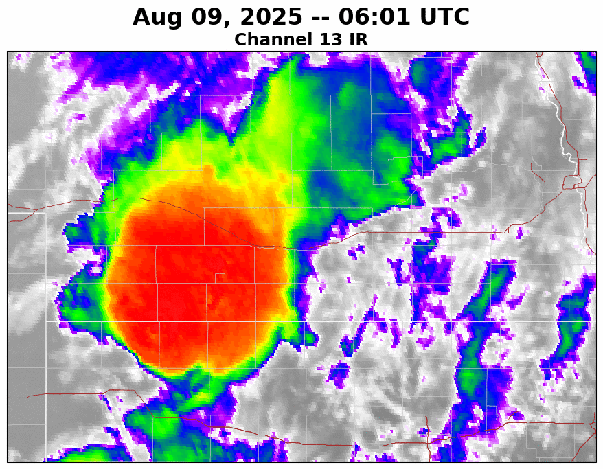
Two separate damaging wind events struck the southern half of our south central NE/north central KS forecast area during the late overnight and early morning hours of August 8-9th (Fri night-Sat AM) and August 9-10th (Sat night-Sun AM). Both events produced peak measured wind gusts of 90+ MPH! Widespread tree and power line damage resulted in significant power outages, some of which lasted for more than a day. Agricultural impacts were also significant in some spots. While hail was NOT a significant threat from either round of storms, even relatively small hail (dime to quarter size), combined with the strong winds, was enough to strip crops in some locations. Other impacts include overturned pivots and pushed over corn, which may complicate fall harvest. Both thunderstorm complexes were supported by seasonably strong wind shear (especially in the lowest 10,000ft) and instability, and "overperformed" forecast expectations in both scope and intensity. |
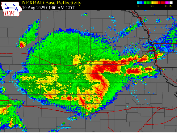 Clicking on the above image will take you to a radar loop running through both events. The loops starts at 11:30 PM August 8th and ends at 8 AM August 10th. |
Photos
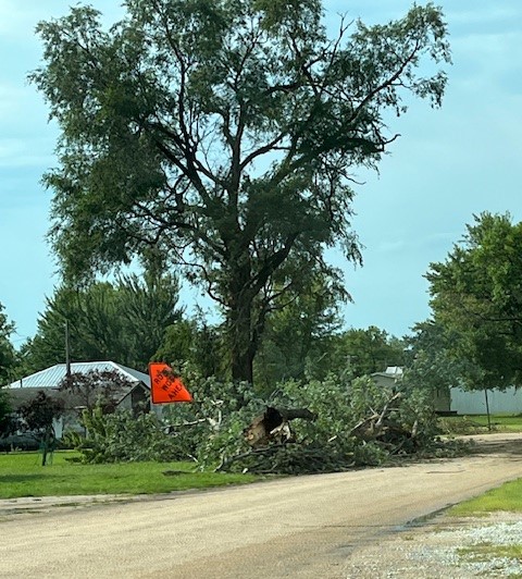
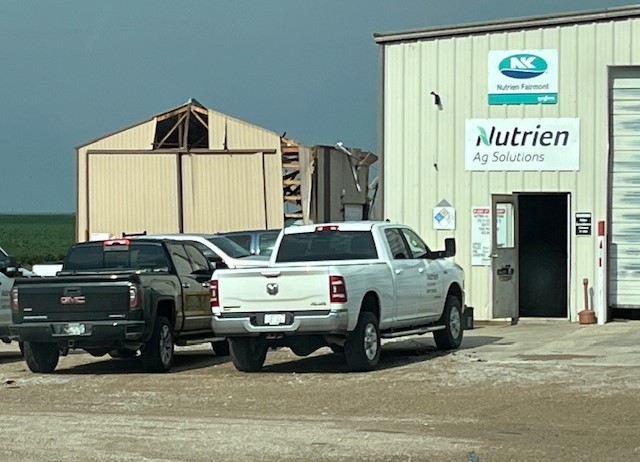
Round #1 - August 8-9 (Fri night-Sat AM)
 |
 |
 |
 |
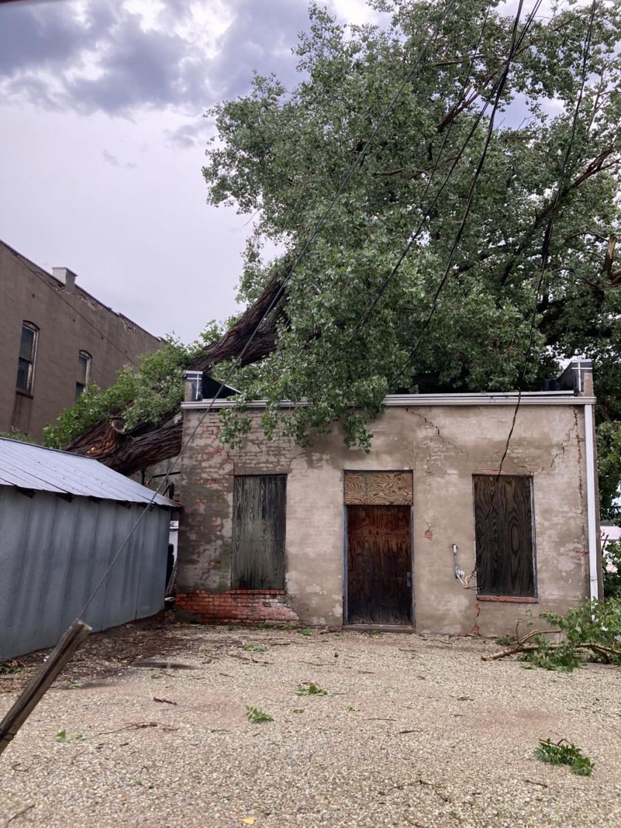
| Fairmont, NE (Jeremy Wesely) |
Fairmont, NE (Jeremy Wesely) |
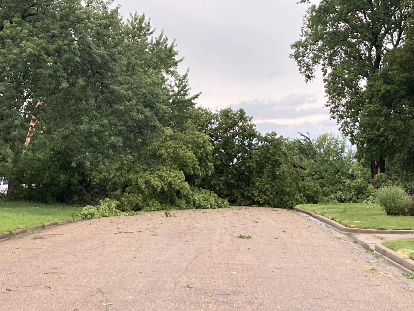
Grafton, NE (Jeremy Wesely) |
Grafton, NE (Jeremy Wesely) |
 |
 |
 |
 |
| Fairmont, NE (Tim Jones) |
Blue Hill, NE (Alex Buschow) |
Power Line Over Highway 6 West of Fairmont (Fillmore County Sheriff's Office) |
Overturned Semi on Highway 81 North of Fairmont (Fillmore County Sheriff's Office) |
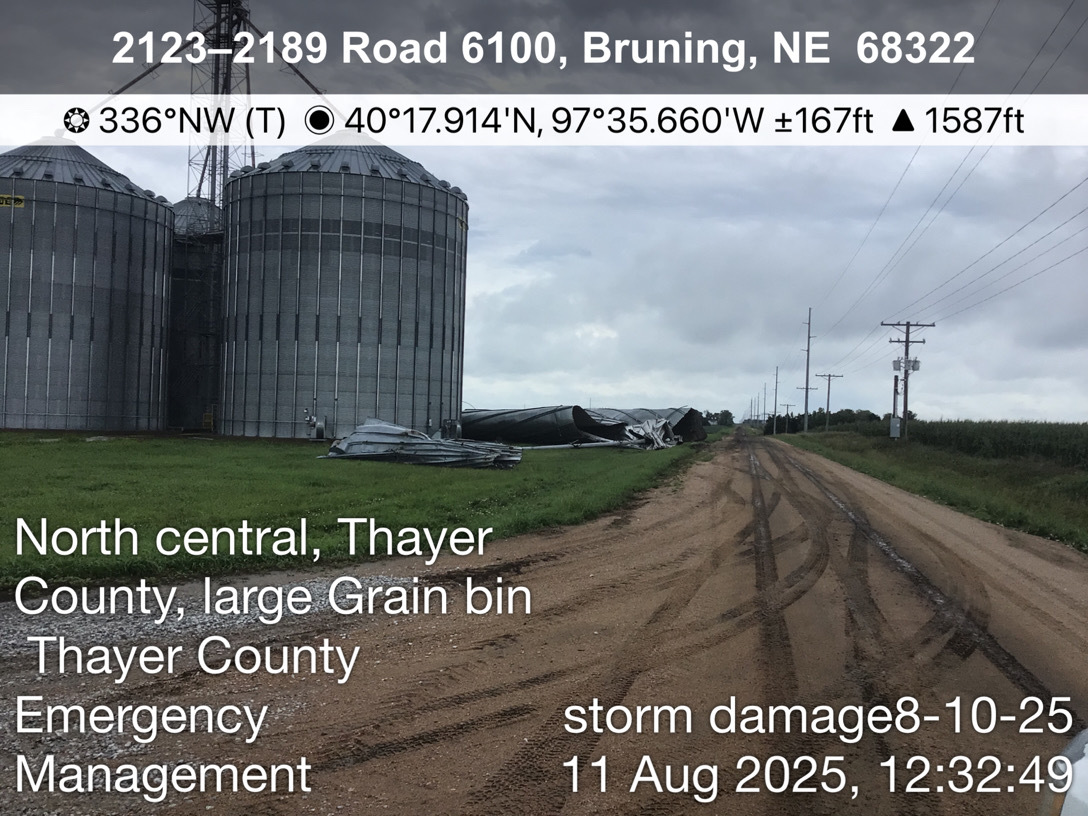
Round #2 - August 9-10 (Sat night-Sun AM)
 |
 |
 |
.jpg) |
| Bruning, NE (Taylor Kanost) |
Deshler, NE (Thayer Co EM) |
NC Thayer County (Thayer Co EM) |
NE Thayer County (Thayer Co EM) |
 |
 |
 |
 |
| Nelson, NE (Nelson Facebook Page) |
Nelson, NE (Nelson Facebook Page) |
Nelson, NE (Nelson Facebook Page) |
Nelson, NE (Nelson Facebook Page) |
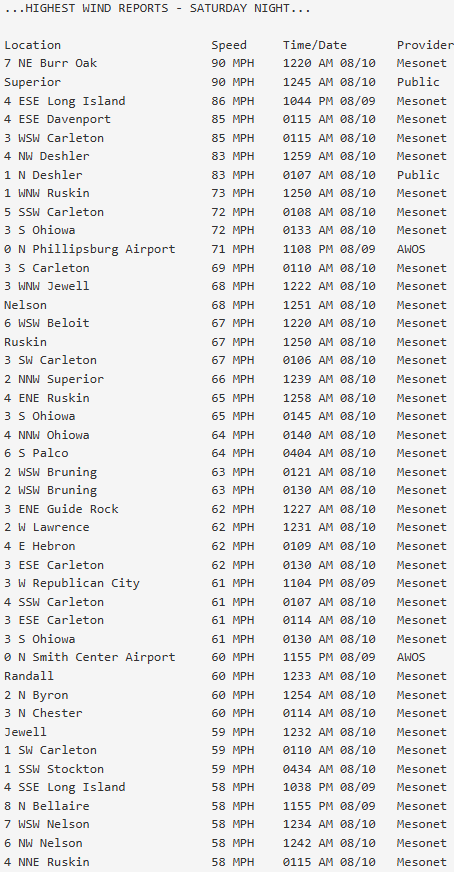
Storm Reports
 |
 |
 |
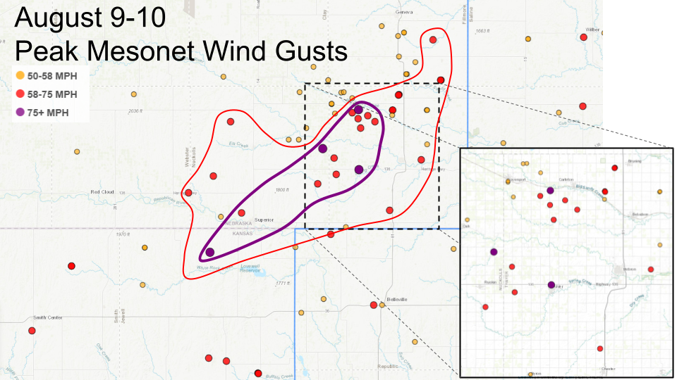 |
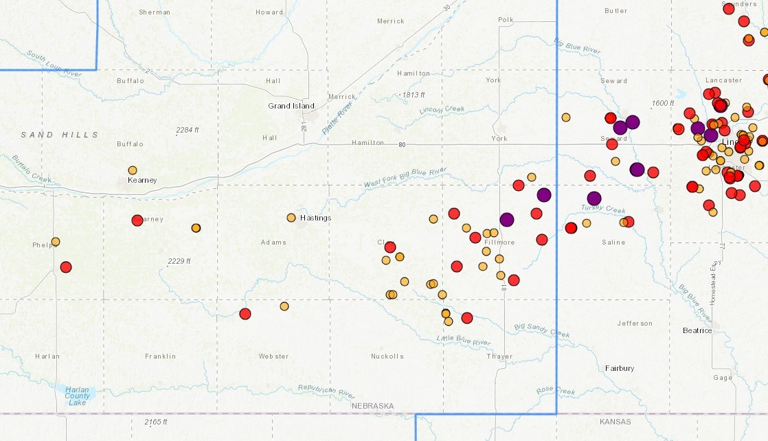
| August 8-9 Peak Wind Gusts | August 8-9 Peak Wind Gusts Map | August 9-10 Peak Wind Gusts | August 9-10 Peak Wind Gusts Map |
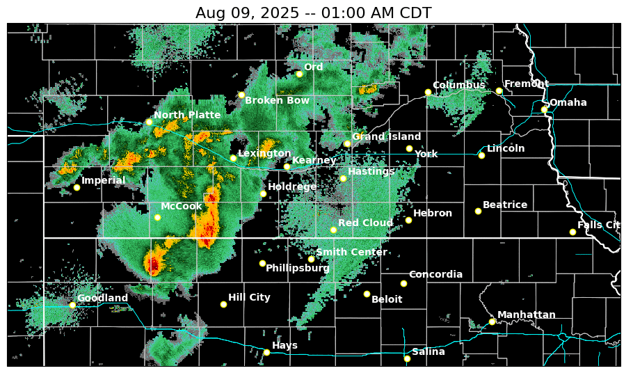
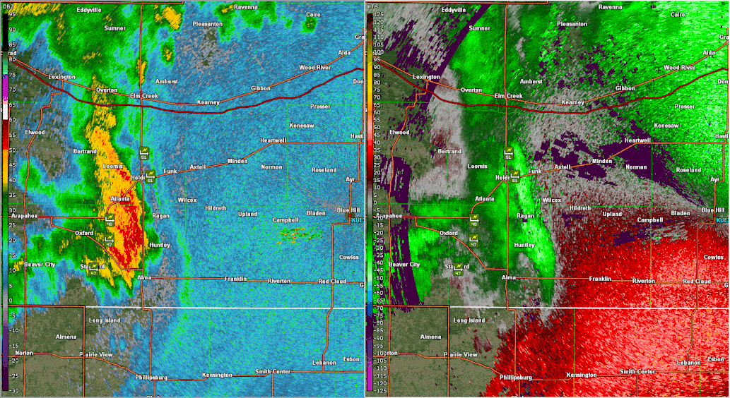
Radar
 |
 |
 |
 |
| August 8-9 Composite Radar (1st round) |
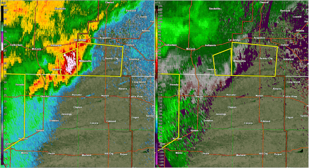
August 8-9 Reflectivity & Velocity (1st round) |
August 9-10 Composite Radar (2nd round) |
August 9-10 Reflectivity & Velocity (2nd round) |
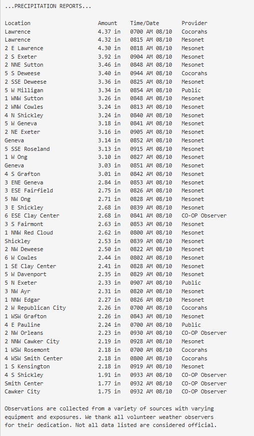
Rain Reports
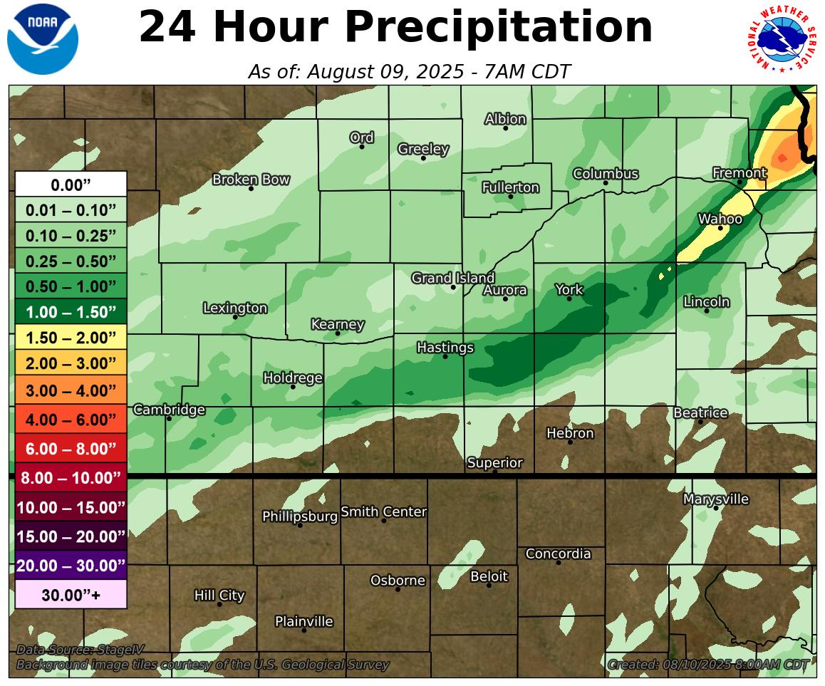
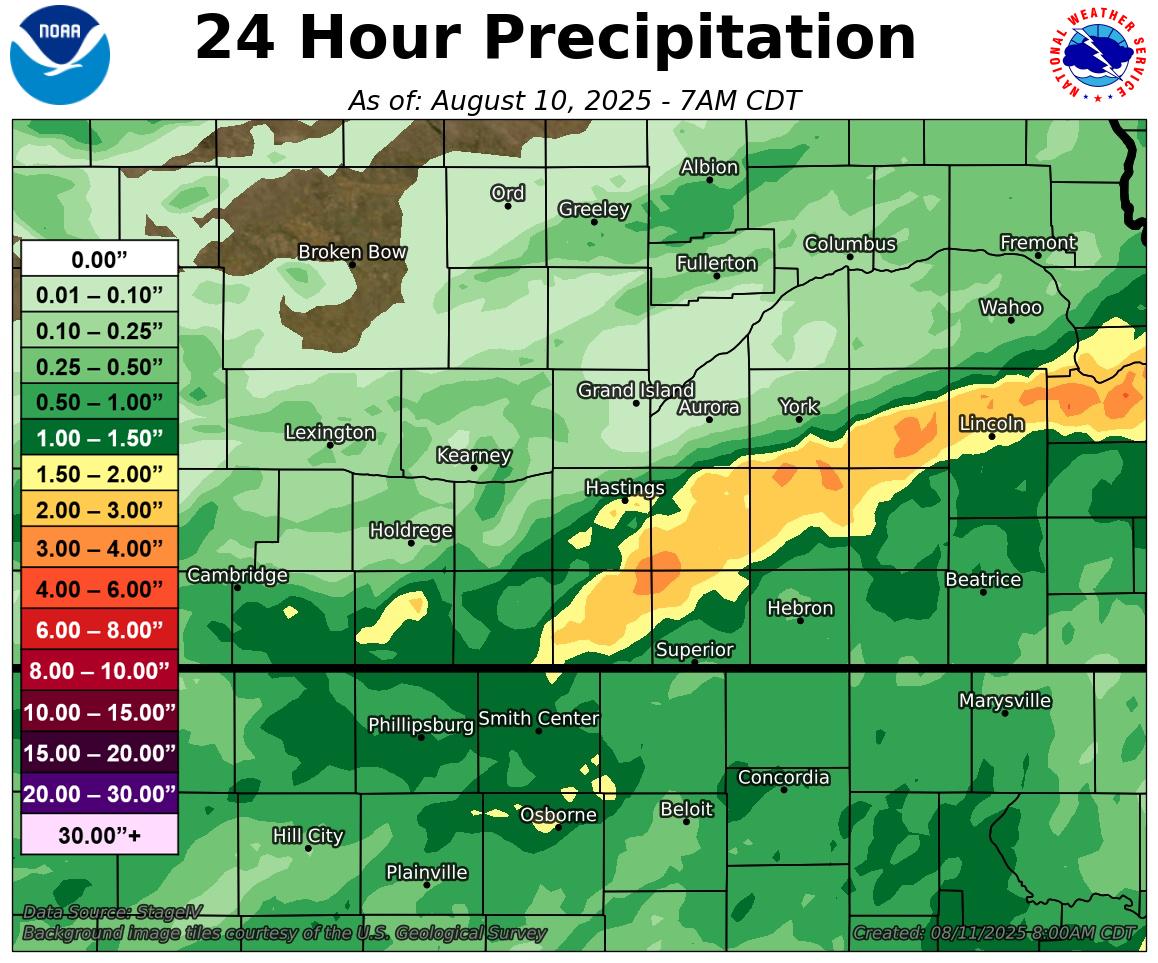
3-day rain totals of 4-4.5" were reported in portions of York and Fillmore Counties, with overall heaviest rain rates occurring with the second round of thunderstorms late on August 9th into the early morning hours of August 10th. Rain amounts remained lighter over the northwest half of the area.
 |
 |
 |
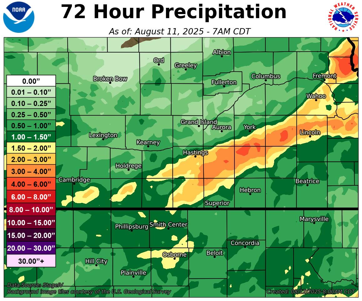 |
| August 8-9 24-Hour Precip Map (1st round) | August 9-10 24-Hour Precip Map (2nd round) | August 9-10 Rain Reports Table | August 8-10 72-Hour Precip Map (3-day rain totals) |
Satellite
 |
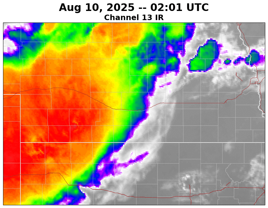 |
| August 8-9 IR Satellite | August 9-10 IR Satellite |
Environment
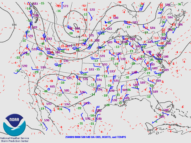
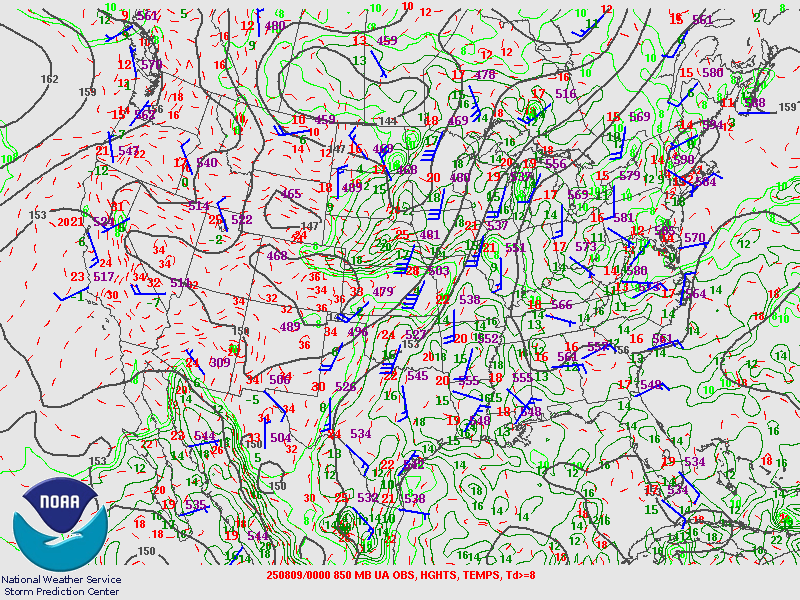
A seasonably-strong upper level trough moved across the northern U.S. and pushed a cold front southward into the central Plains during the evening hours of Friday, August 8th. Moisture pooling along the slowing boundary, along with steep mid level lapse rates, resulted in a reservoir of strong to extreme instability, even during the late evening and overnight hours. Backed northeasterly low level flow behind the front, combined with seasonably strong southwest to west mid-level flow, resulted in strong shear, particularly in the lowest 10,000ft. The timing of the first round of severe-wind-producing storms was somewhat unusual (though not unheard of) as the strongest winds occurred in the 2-5 AM time frame.
 |
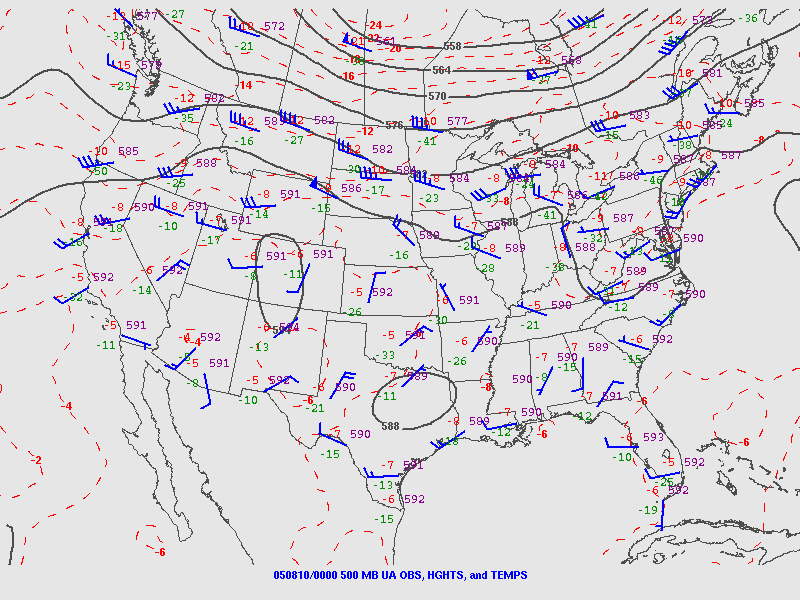 |
| 500mb Upper Air Map At 00z on August 9th | 500mb Upper Air Map At 00z on August 10th |
 |
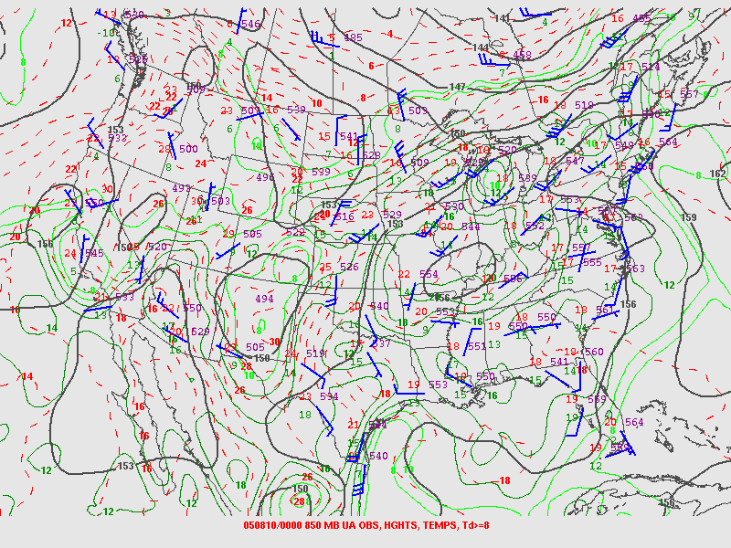 |
| 850mb Upper Air Map At 00z on August 9th | 850mb Upper Air Map At 00z on August 10th |
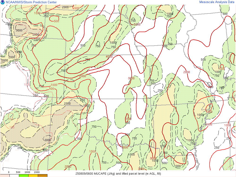
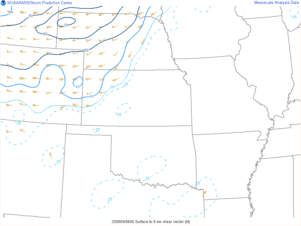
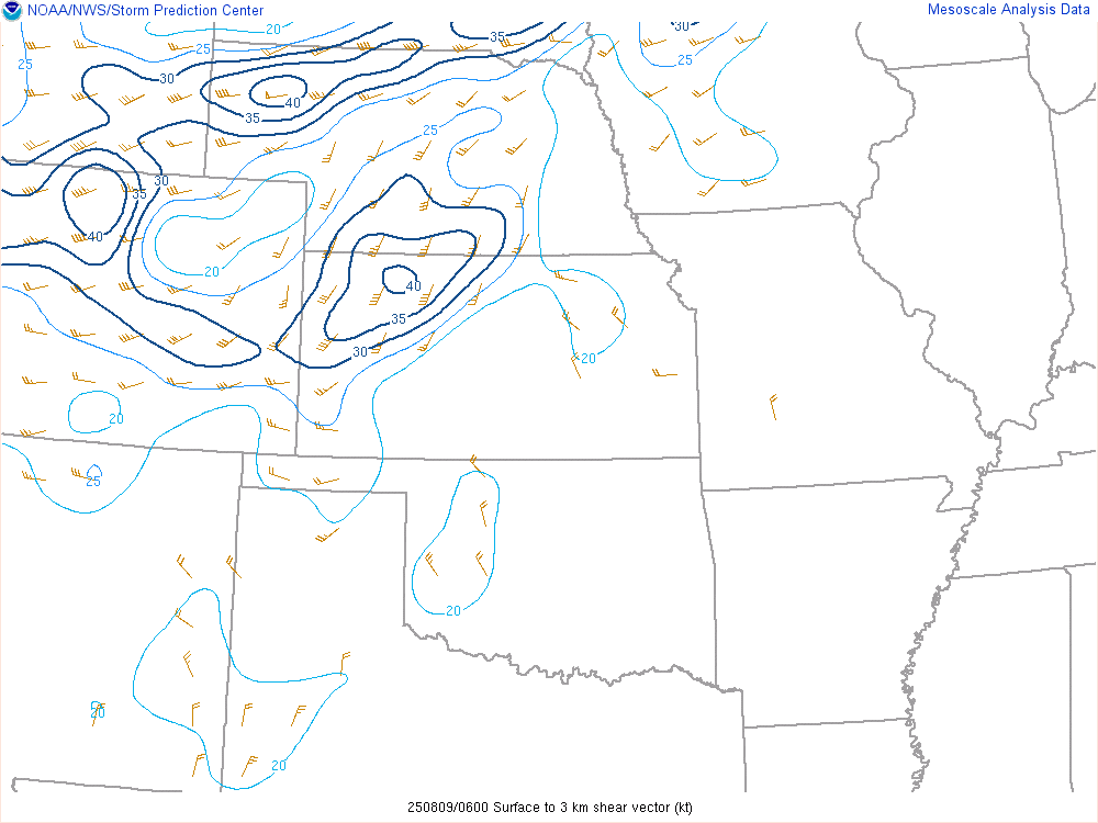
Near-storm environment of round one (late overnight of August 8th into early morning hours of August 9th)
 |
 |
 |
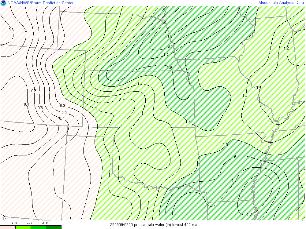 |
| Most Unstable CAPE at 06z on August 9th | 0-6km Shear at 06z on August 9th | 0-3km Shear at 06z on August 9th | Precipitable Water at 06z on August 9th |
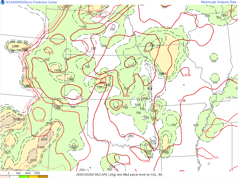
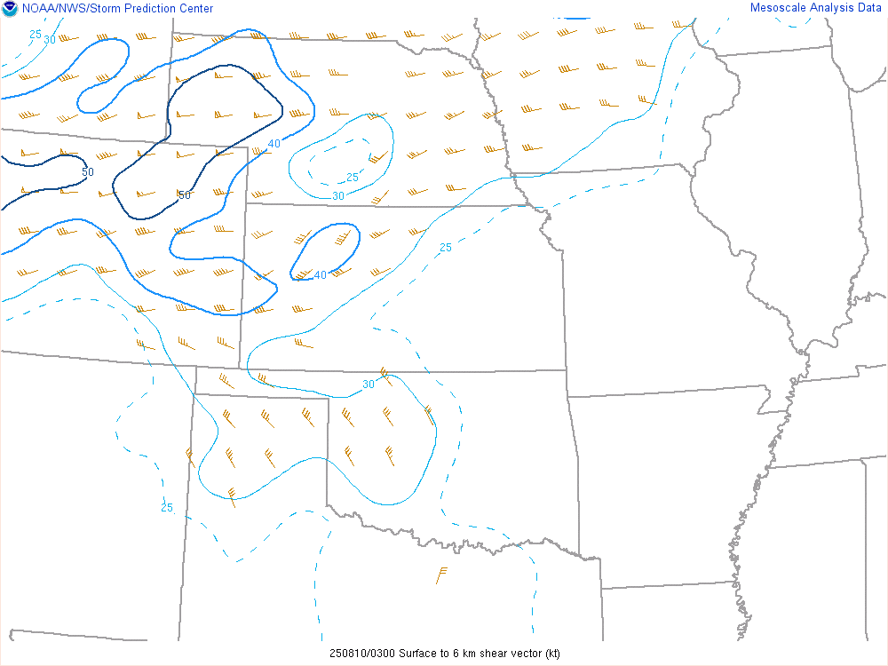
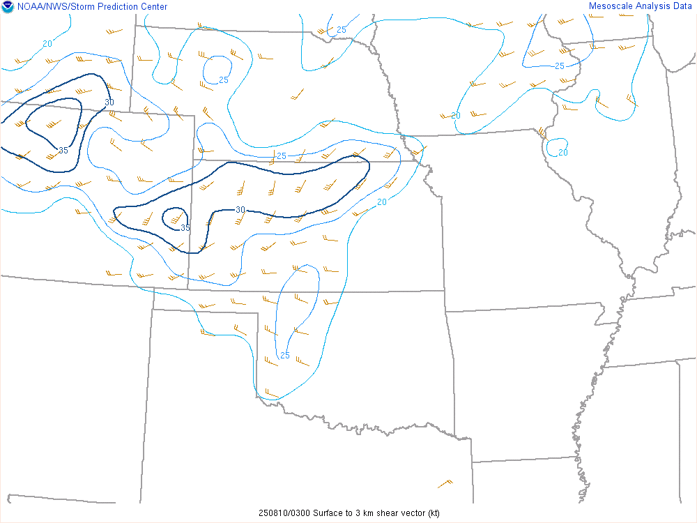
Near-storm environment of round two (late evening of August 9th into early morning hours of August 10th.
 |
 |
 |
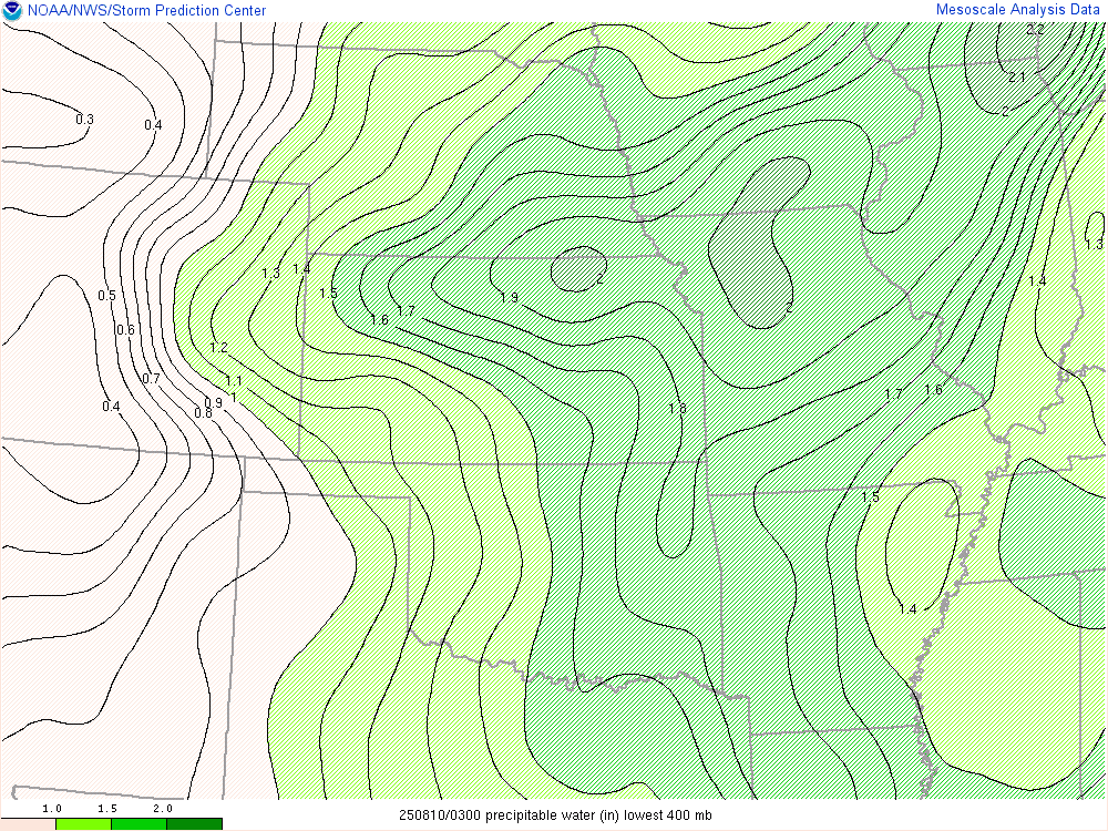 |
| Most Unstable CAPE at 03z on August 10th | 0-6km Shear at 03z on August 10th | 0-6km Shear at 03z on August 10th | Precipitable Water at 03z on August 10th |
 |
Media use of NWS Web News Stories is encouraged! Please acknowledge the NWS as the source of any news information accessed from this site. |
|

