
Life-threatening and locally catastrophic flash and urban flooding is expected across portions of south-central Texas through early Friday, with significant river flooding and rapid rises on small streams, arroyos, and typically dry washes expected. A significant heat wave continues for the Rockies, Northern Plains, and Great Lakes into the Mid-Atlantic, peaking in intensity through midweek. Read More >
Overview
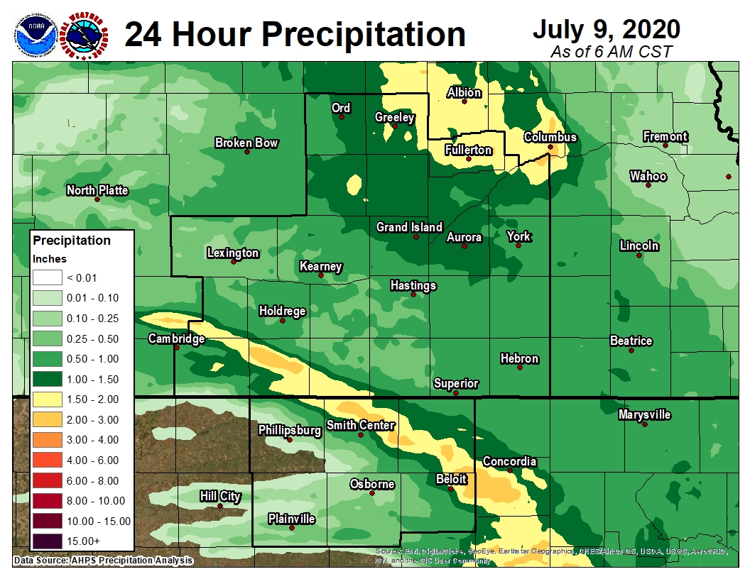
| During the evening of Wednesday, July 8th, thunderstorms first developed well north and west of the NWS Hastings coverage area, along a cold front and surface trough focused within northern and western Nebraska. Individual storms eventually developed into a line of storms that then charged south and east across the heart of central/south central Nebraska and north central Kansas. These severe storms entered the NWS Hastings area after 10pm and lasted well into the early morning hours of Thursday, July 9th. These storms produced significant and widespread straight-line wind damage with numerous reports of 60 to 70 mph wind gusts. Trees, tree limbs, crops and power lines were impacted, along with a handful of structures (such as grain bins). Many communities were impacted with brief power outages. There was also some isolated hail up to golf ball size (in Furnas County), but hail was definitely not the "main story" of the night. Additionally a narrow line of storms trained over the same locations in our southern coverage area, producing a band of up to 2-3" of rain that did cause brief flooding in Mitchell County, KS. | 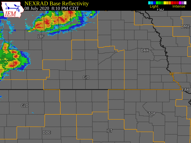 |
Wind & Hail:
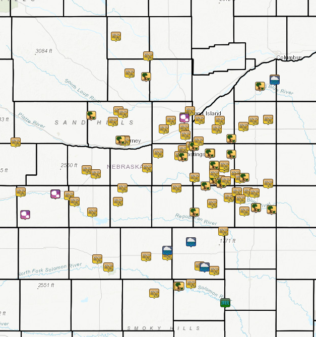
Widespread wind damage was reported across much of the area, with numerous observations measured between 60-70+ mph. Hail was also reported, but was much less widespread across the area. (Click Map of LSRs to see details)
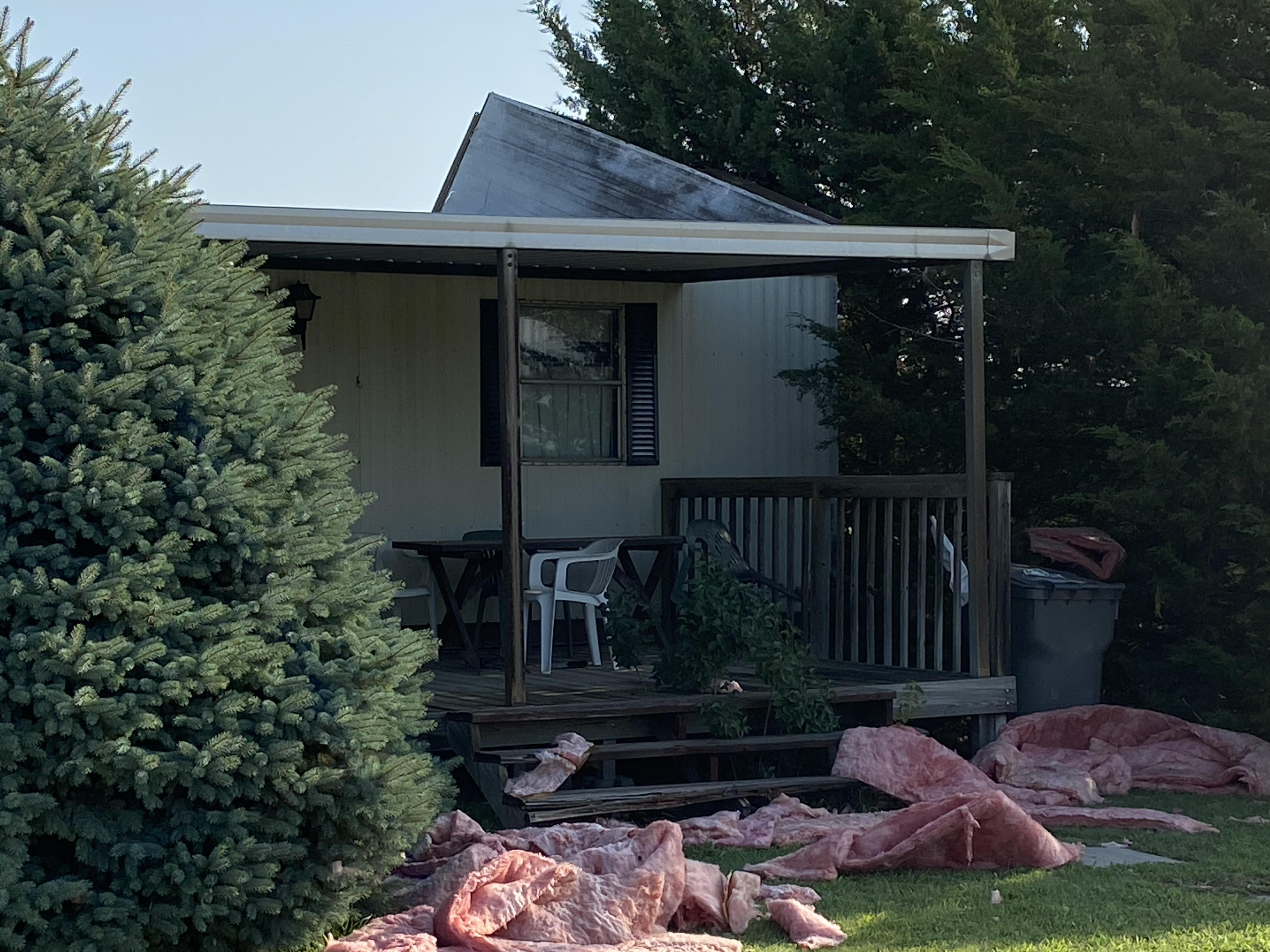
Wind Damage
Shelly%20Wragge_tree%20damageGI.jpg) |
 |
Eric%20Klein_tree%20down%20GI%20(2).jpg) |
Danielle%20Brianne%20Emmons_tree%20damage%20Shickley.jpg) |
| Tree Damage in Grand Island Picture Courtesy of Shelly Wragge |
Outbuilding Damage in Shickley Picture Courtesy of Fillmore County EM |
Tree Damage in Grand Island Picture Courtesy of Eric Klein |
Tree Damage in Shickley Picture Courtesy of Danielle Brianne Emmons |
 |
MikeSchardt_CropDamage_Carleton.jpg) |
SarahModlin_Hebron_Tree%20damage.jpg) |
Clay%20County%20EMA_tree%20down%20in%20Trumbull.jpg) |
| Mobile Home Damage in Cawker City, KS Picture Courtesy of Mitchell County EM |
Crop Damage Picture Courtesy of Mike Schardt |
Tree Damage in Hebron Picture Courtesy of Sarah Modlin |
Tree Damage in Trumbull Picture Courtesy of Clay County EM |
Hail
PrairySky_Hail_Wilsonville_FurnasCounty.jpg) |
|||
| Large hail in Wilsonville NE (photo courtesy of Prairy Sky) |
Highest Wind Reports
Public Information Statement
National Weather Service Hastings NE
1117 AM CDT Thu Jul 9 2020

...HIGHEST WIND REPORTS...

Location                     Speed     Time/Date       Provider
Carleton                     75 MPH    1224 AM 07/09   Mesonet
3 SSW Aurora                 73 MPH    1151 PM 07/08   Mesonet
4 E Pauline                  72 MPH    1151 PM 07/08   Mesonet
Grand Island Airport         71 MPH    1134 PM 07/08   ASOS
6 N Riverdale                70 MPH    1103 PM 07/08   Trained Spotter
4 N Doniphan                 70 MPH    1140 PM 07/08   Trained Spotter
1 ESE Doniphan               70 MPH    1147 PM 07/08   Public
4 NE Trumbull                70 MPH    1147 PM 07/08   Fire Dept/Rescue
6 ESE Clay Center            70 MPH    1205 AM 07/09   CO-OP Observer
5 S Saronville               70 MPH    1206 AM 07/09   Trained Spotter
2 NNE Cambridge              69 MPH    0945 PM 07/08   Mesonet
3 ESE Carleton               69 MPH    1226 AM 07/09   Mesonet
York Airport                 68 MPH    1215 AM 07/09   AWOS
Hastings Airport             67 MPH    1148 PM 07/08   ASOS
4 E Pauline                  66 MPH    1146 PM 07/08   Mesonet
Harvard                      66 MPH    1203 AM 07/09   Mesonet
3 ENE Edgar                  66 MPH    1215 AM 07/09   Mesonet
2 W Shickley                 66 MPH    1215 AM 07/09   Mesonet
1 W Trumbull                 65 MPH    1142 PM 07/08   Mesonet
Waco                         65 MPH    1223 AM 07/09   Public
3 E Loomis                   64 MPH    1032 PM 07/08   Mesonet
2 NNE Norman                 64 MPH    1121 PM 07/08   Public
3 WNW Alda                   64 MPH    1135 PM 07/08   Public
Waco                         64 MPH    1214 AM 07/09   Mesonet
3 S Clay Center              63 MPH    1158 PM 07/08   Trained Spotter
1 SSE Davenport              63 MPH    1217 AM 07/09   Public
2 NNW Alma                   62 MPH    1033 PM 07/08   Mesonet
1 WSW Blue Hill              62 MPH    1133 PM 07/08   Public
2 N Edgar                    61 MPH    1203 AM 07/09   Mesonet
4 NNE Ong                    61 MPH    1214 AM 07/09   Mesonet
5 SW Scotia                  60 MPH    1030 PM 07/08   Emergency Mngr
Loup City                    60 MPH    1112 PM 07/08   Emergency Mngr
Kenesaw                      60 MPH    1125 PM 07/08   Public
4 SSW Hansen                 60 MPH    1140 PM 07/08   NWS Employee
Wood River                   60 MPH    1140 PM 07/08   Broadcast Media
Phillips                     60 MPH    1149 PM 07/08   Emergency Mngr
Nelson                       60 MPH    1152 PM 07/08   Emergency Mngr
Burr Oak                     60 MPH    1200 AM 07/09   CO-OP Observer
3 NE Shelby                  60 MPH    1205 AM 07/09   Public
3 ENE Fairfield              60 MPH    1207 AM 07/09   Trained Spotter
Deshler                      60 MPH    1227 AM 07/09   Fire Dept/Rescue
6 SSE Davenport              60 MPH    1230 AM 07/09   Mesonet
4 ENE Kearney                59 MPH    1110 PM 07/08   Public
Aurora Airport               59 MPH    1155 PM 07/08   AWOS
Smith Center Airport         59 MPH    1159 PM 07/08   AWOS
1 NE Oak                     59 MPH    1208 AM 07/09   Mesonet
3 SSE Bradshaw               59 MPH    1210 AM 07/09   Public
3 S Ohiowa                   59 MPH    1229 AM 07/09   Mesonet
1 N Oxford                   58 MPH    1008 PM 07/08   Mesonet
Phillipsburg Airport         58 MPH    1110 PM 07/08   AWOS
5 ENE Webber                 58 MPH    1159 PM 07/08   Mesonet
Randall                      58 MPH    1229 AM 07/09   Public
Hildreth                     56 MPH    1057 PM 07/08   Mesonet
Cawker City                  56 MPH    1205 AM 07/09   Mesonet
3 WNW Jewell                 55 MPH    1210 AM 07/09   Mesonet
Holdrege Airport             54 MPH    1035 PM 07/08   AWOS
Kearney Airport              54 MPH    1110 PM 07/08   AWOS

Observations are collected from a variety of sources with varying
equipment and exposures. We thank all volunteer weather observers
for their dedication. Not all data listed are considered official.

$$
Rain Reports
 |
Media use of NWS Web News Stories is encouraged! Please acknowledge the NWS as the source of any news information accessed from this site. |
|

