
A significant heat wave continues for the Rockies, Northern Plains, and Great Lakes into the Mid-Atlantic, peaking in intensity through midweek and lingering across parts of the Northern Plains and Midwest until this weekend. Excessive rainfall my bring life-threatening and locally catastrophic flash and urban flooding across portions of southwestern Texas through early Friday. Read More >
Overview
|
Thunderstorms produced widespread heavy rain across north central Kansas into southern Nebraska the evening of September 3rd and with rain continuing through the overnight hours on September 4th, 2016. Rainfall of 3 to 6 inches were common with the greatest amounts occurring in the Plainville, KS area and city rain gauge reports ranged from 6 inches to 6.5 inches. Some of the highest measured rainfall amounts include:
|
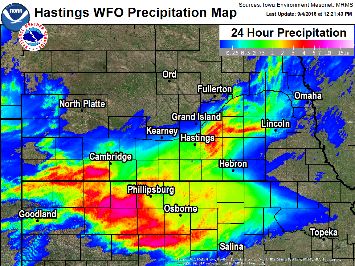 Rainfall from the evening of September 3rd through the morning on September 4th, 2016. |
Hydrographs
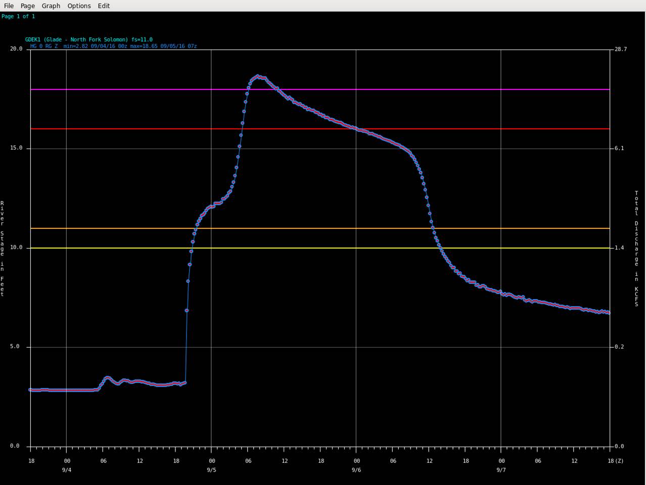
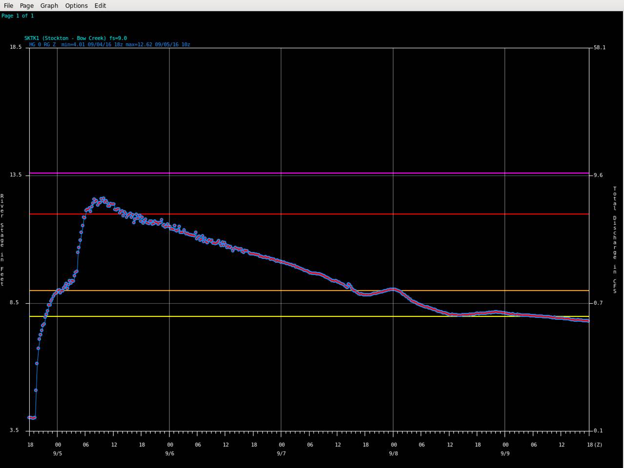
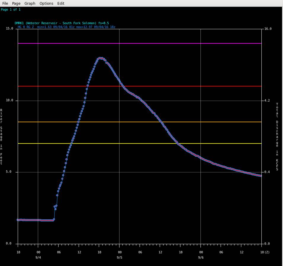
Several rivers experienced rises in river levels and flooded. Below are images showing how the rivers reacted to the heavy rain upstream. The gauge along the North Fork of the Solomon River near Glade, KS actually recorded a new record crest of 18.65 feet at 2:45 a.m. the morning of Monday, Sept. 5th.
The orange horizontal line represents that river's "Minor" flood stage, the red line is "Moderate" flood stage and the purple line is "Major" flood stage.
 |
 |
 |
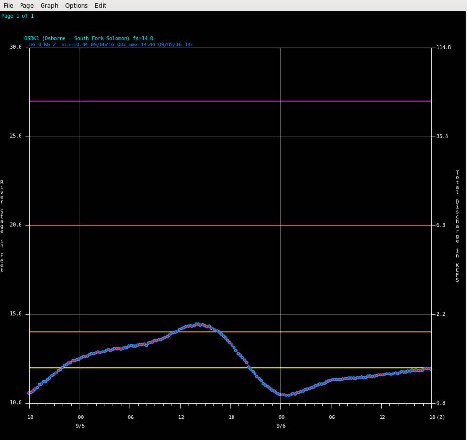 |
| North Fork of the Solomon River near Glade, KS | Bow Creek north of Stockton, KS | South Fork of the Solomon River near Damar, KS | South Fork of the Solomon River near Osborne, KS |
Photos From The Area
 |
 |
 |
 |
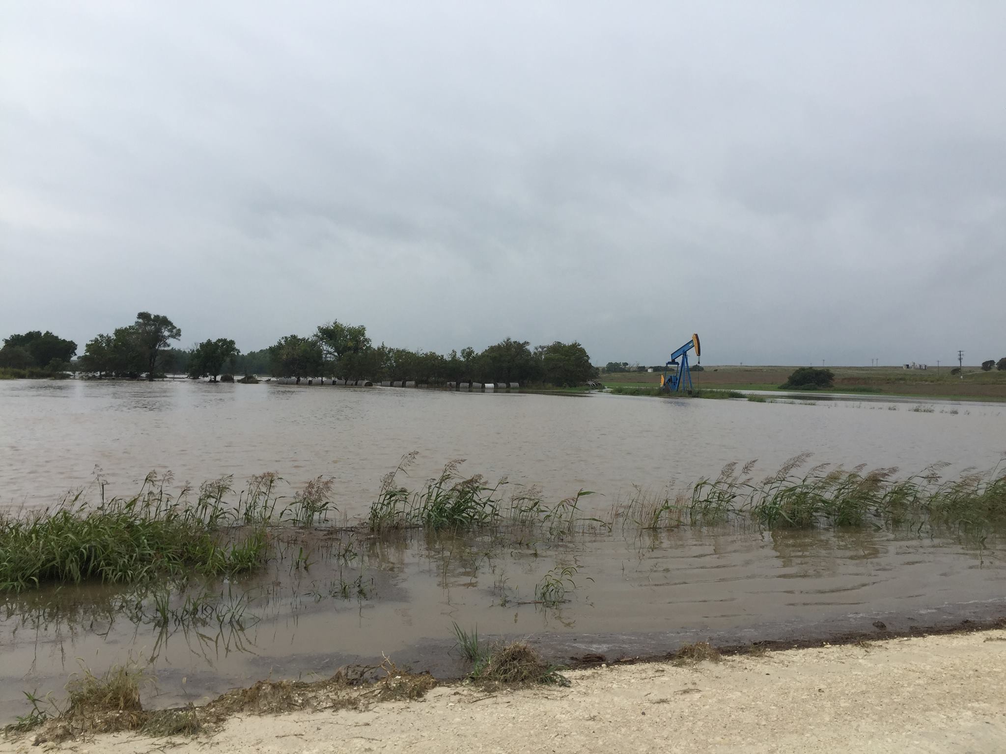
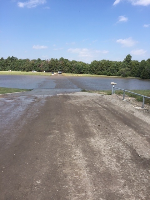
| Flooded field in Rooks County north of Plainville, KS Photo by Elizabeth Stamper. |
Elm Creek flooding 7 miles north of Plainville, KS Photo by Elizabeth Stamper |
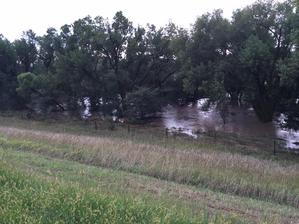
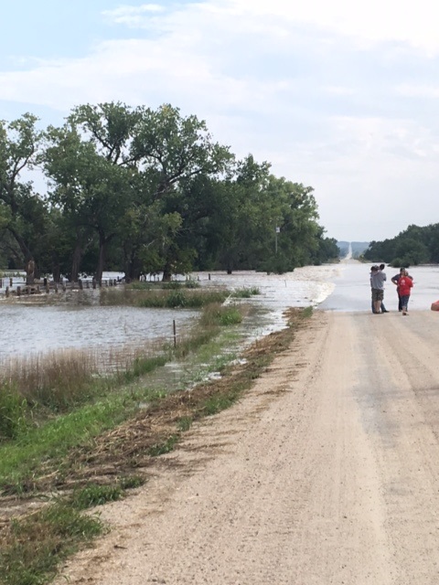
Deer Creek flooding near Stuttgart, KS Photo by Amy Stephen |
Deer Creek flooding near Stuttgart, KS Photo by Amy Stephen |
 |
 |
 |
 |
| Spillway St at Plainville Lake in Rooks County, KS. Photo by Butch Post |
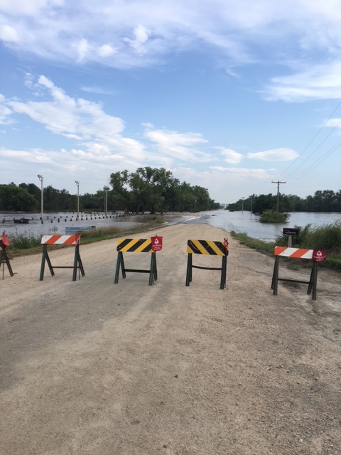
Barricaded roads near Speed, KS Photo by Deb Hayes |
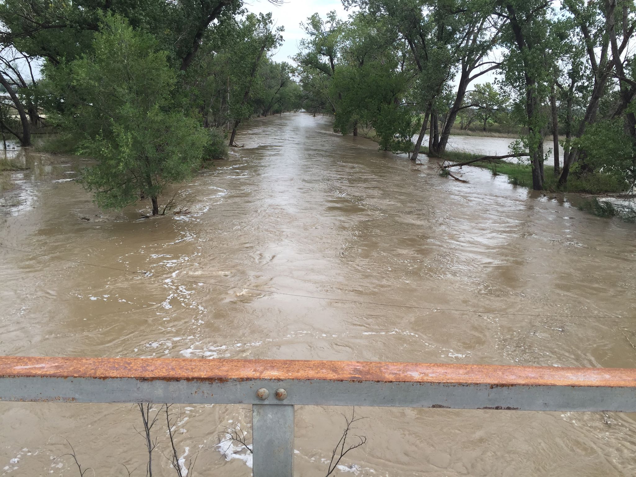
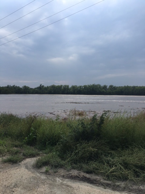
Flooding along the North Fork of the Solomon River south of Speed, KS Photo by Deb Hayes |
Flooding south of Speed, KS Photo by Deb Hayes |
 |
Media use of NWS Web News Stories is encouraged! Please acknowledge the NWS as the source of any news information accessed from this site. |
|

