Dangerous heat expands across the Desert Southwest, Plains, Mississippi Valley and Midwest. Critical fire weather for portions of the Intermountain West. Risk for severe thunderstorms and flash flooding across the Upper Midwest/Great Lakes, Ohio Valley, and portions of the mid-Atlantic. Active monsoonal moisture fuels thunderstorms over the Southwest. Hurricane Fausto in the Pacific, should weaken Read More >
|
The May 22nd, 2004 Tornado Outbreak |
May 22, 2004 was one of the worst severe weather outbreaks that affected south central and eastern Nebraska during the afternoon and evening hours. In south central Nebraska, no less than 17 different tornadoes rolled across the area, and the devastating Hallam, NE tornado also occurred in eastern Nebraska on this day. The tornadoes in south central Nebraska damaged dozens of homes and a few were completely destroyed. In addition, over 250 center irrigation pivots were affected and hundreds of power poles were snapped, resulting in many miles of downed electrical line. Large hail and strong straight line winds (up to 80 mph) also wreaked havoc on the region. In the end, property damage of over 17 million dollars, and about 5 million dollars in crop damage was reported. In todays numbers, the total damage across south central Nebraska totaled nearly 30 million dollars.
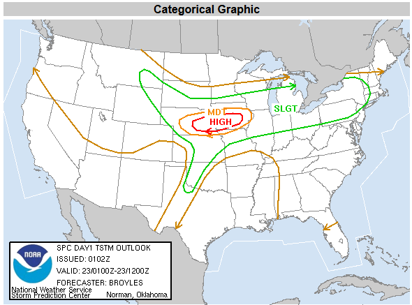 |
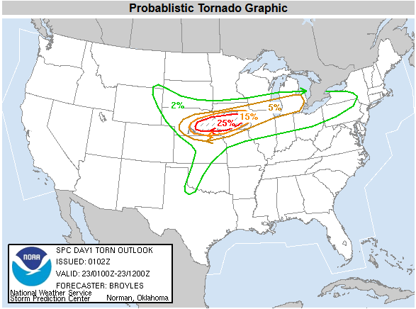
SPC Categorical Outlook for Severe weather to the left SPC Probalistic Outlook for Tornados to the right |
 |
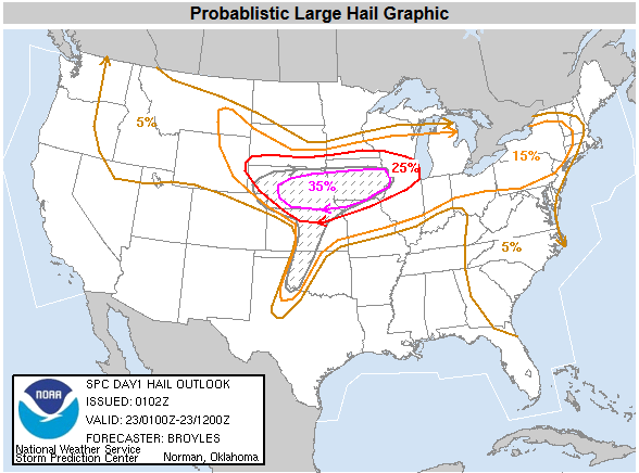 |
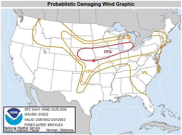
SPC Probablistic Outlook for Large Hail to the left SPC Probablistic Outlook for Damaging Wind to the right |
 |
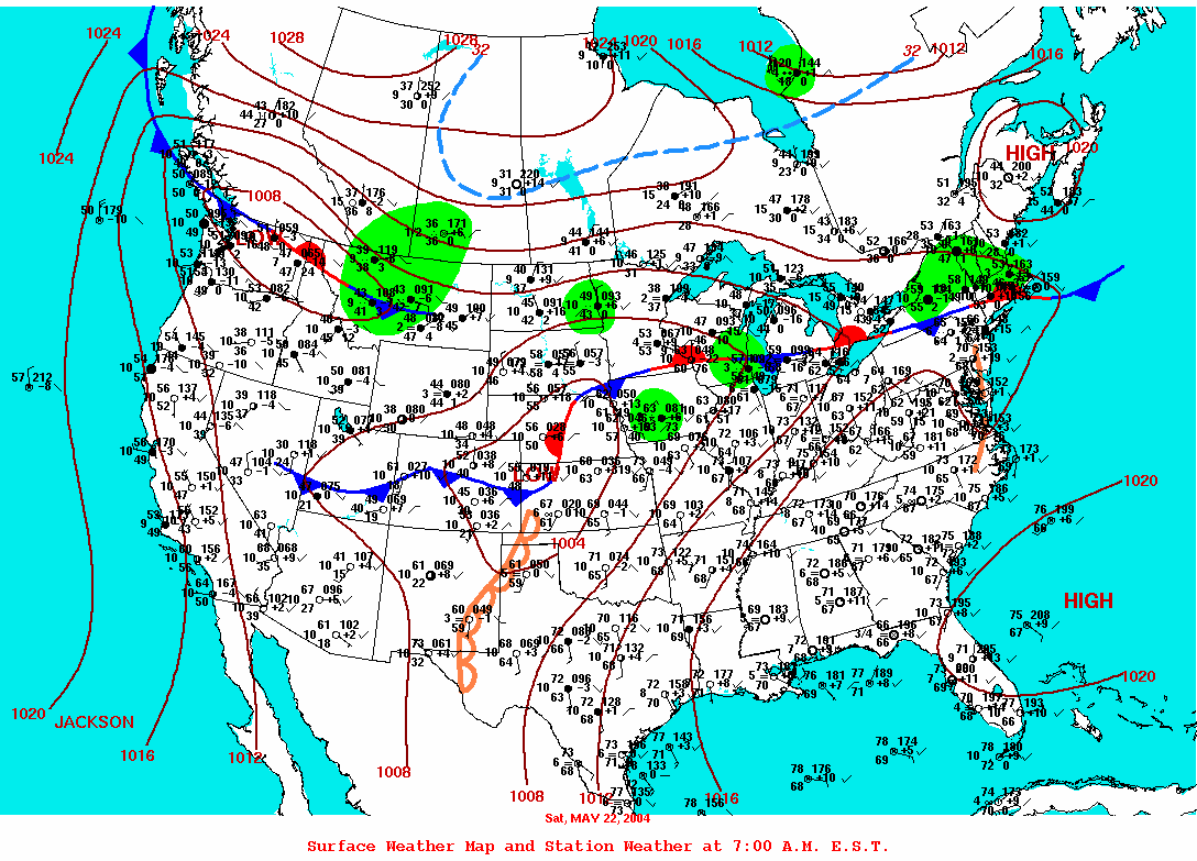
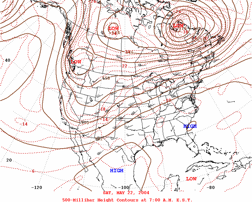
Contributing to the high probabilities for severe weather was the atmospheric set up on May 22nd, 2004. The 7 AM EST surface map below shows a dry line across western Kansas, a stationary warm frontal boundary draped across south central Nebraska, and a cold front to the west which was expected to charge eastward later that day. In the upper levels of the atmosphere, the 500 mb analysis below (also valid at 7 AM EST) depicts a large trough of low pressure across the intermountain west, with a low diving southward across the pacific Northwest, and an upper level perturbation near the four corners region.
 |
 |
|
Surface Analysis from 7 AM EST May 22nd, 2004. |
500 mb Analysis from 7 AM EST May 22nd, 2004 |
Synopsis for the Day
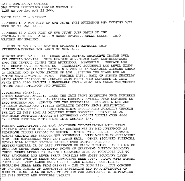
During the early morning hours of May 22nd, 2004, an upper level trough across the intermountain west was positioned to shift eastward as an upper level low across the pacific Northwest was diving south. At the same time, an upper level wave embedded in this trough was forecast to emerge into the plains during the afternoon hours. Ahead of this disturbance, a dry line was positioned across western Kansas with a cold front expected to blast across the region later in the day. With very good deep layer shear and instability across the region, this dryline was expected to be the focus of covection initiation later in the day, with the overall potential for severe weather on the high side - especially across portions of Nebraska where a moderate risk for severe weather had been forecast by the Storm Prediction Center (SPC) in Norman, Oklahoma at 7 am CDT. This risk was later upgraded to a high risk for severe weather as the event was unfolding.
|
Convective Outlook from SPC issued at 1135 AM CDT (click to enlarge) |
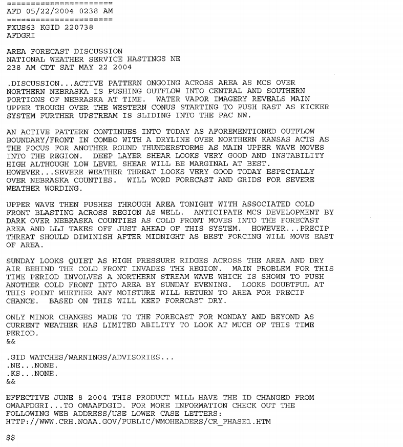
Area Forecast Discussion issued by the NWS in Hastings, NE at 238 AM CDT (click to enlarge) |
 |
 |
|
Mesoscale Discussion from SPC issued at 302 PM CDT (click to enlarge) |
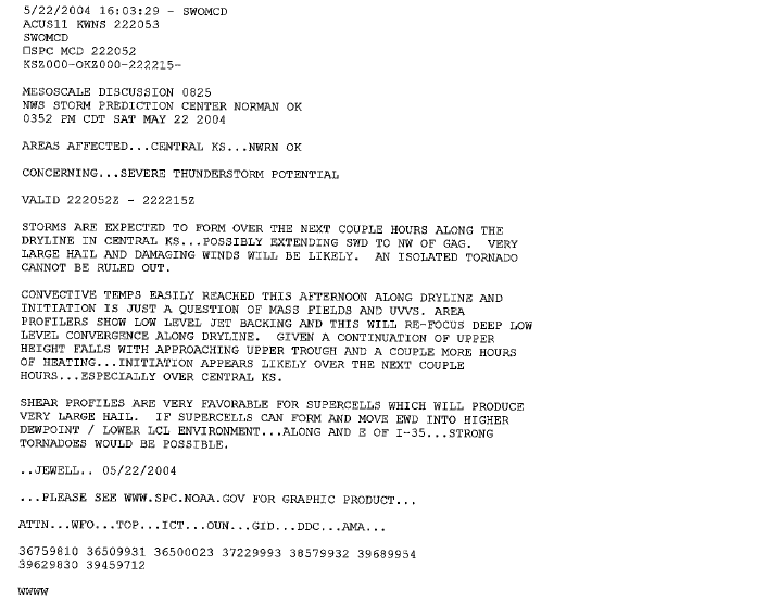
Mesoscale Discussion from SPC issued at 352 PM CDT (click to enlarge) |
 |
 |
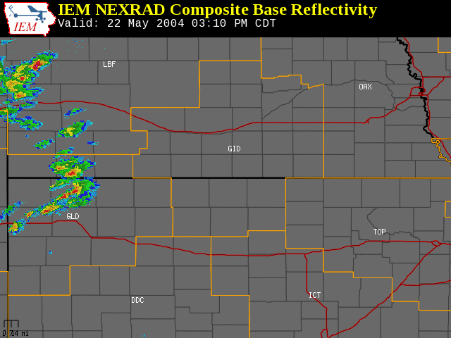 |
Radar loop Image (Central CONUS) from 5:02 PM CDT Saturday May 22nd, 2004 (click on image to enlarge). |
Tornado Video: May 22, 2004
The tornado that was reported across Furnas County (near Beaver City) that afternoon was caught on video. This tornado was eventually rated an F1 on the Fujita scale.
(click on each image to view video)
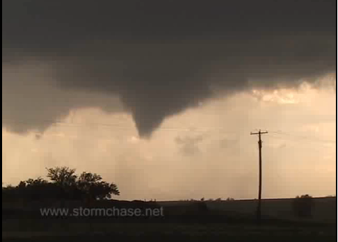

Video of tornado near Beaver City, NE.(Video courtesy of Roger Hill)
Video of tornado in Furnas County, NE. (Video courtesy of Linda Kitchen and Kathy Velasquez)
 |
The Result: At least 17 Tornadoes were reported across the local area
May 22nd, 2004
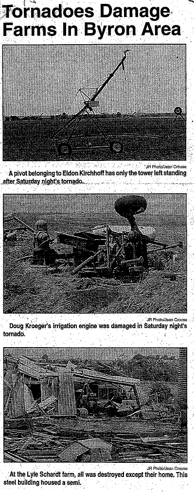
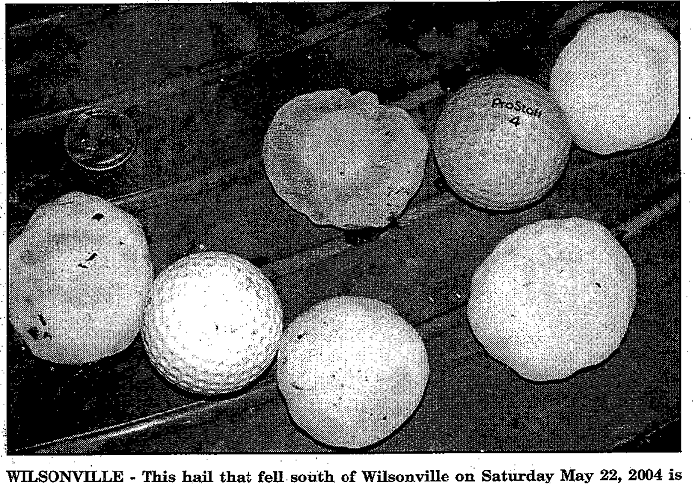
Damage Photos from May 22, 2004
The F2s:
Highlights of the "Belvidere/Bruning Tornado":
Highlights of the "Spring Ranch/Clay Center Tornado":
The F1s:
Highlights of the "Bruning/Ohiowa Tornado":
Highlights of the "Beaver City/Hollinger Tornado":
Highlights of the "Ayr/Pauline Tornado":
Highlights of the "Fairfield Tornado":
Highlights of the "Ohiowa Tornado":
Highlights of the "Byron/Deshler Tornado":
Additional tornadoes (the F0s):
There were nine additional F0 tornadoes which occurred across south central Nebraska:
 |
 |
|
Hebron Journal Register |
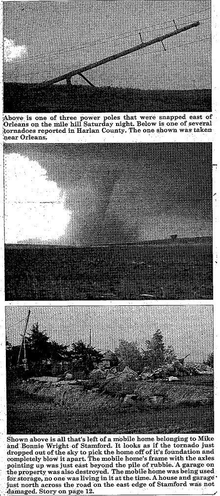
Harlan County Journal |
 |
 |
|
Cambridge Clarion |
Kearney Hub |
 |
 |
 |
|
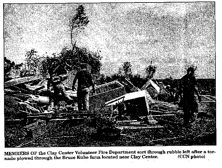
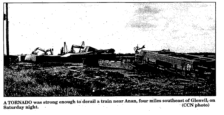
Clay County News |
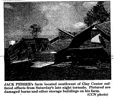
Clay County News |
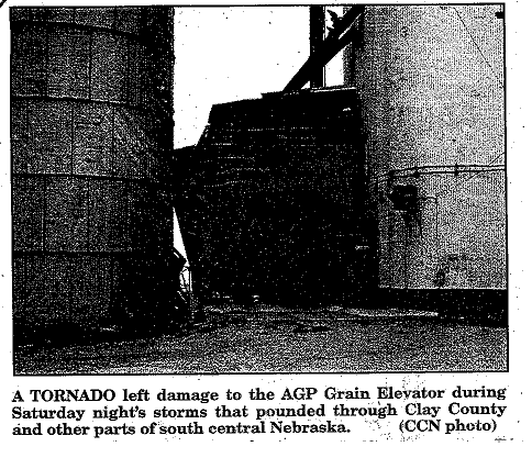
Clay County News |
 |
 |
 |
|
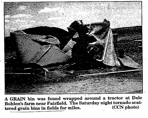
Clay County News |
Clay County News |
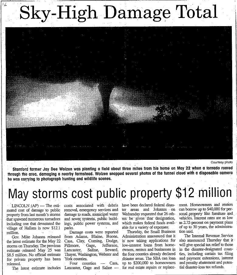
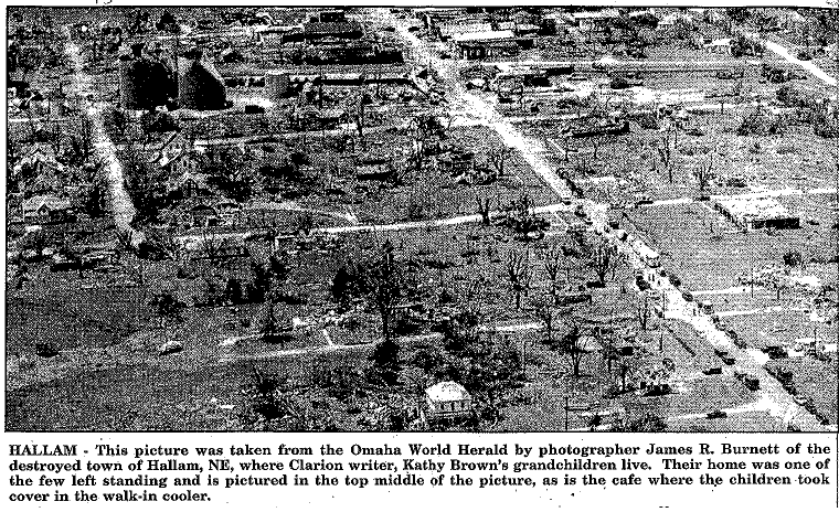
Omaha World Herald Photo |
Acknowledgements
The National Weather Service in Hastings would like to thank all those who contributed to this article. The newspaper clippings are from local office archives provided to the NWS by a clipping service.
|
|
This page was composed by the staff at the National Weather Service in Hastings, Nebraska. |  |